facebook
Image showing that the PDF download is in progress... PDF download in progress

Please wait...

Image showing a pink decorative paint splat
Image showing a green decorative paint splat
reviews buttonReviews view map buttonMap
view 3d map button3D Map
directions take me there buttonDirections
Save
PDF
Gpx File

Currimundi Lake: Short Paddle

Currimundi Lake: Short Paddle
Currimundi
canoe icon canoe icon black
Trail type
difficulty icon
Skill Level
2.7km
Length
direction icon direction icon black
Circuit

Ideal for entry-level paddlers, or those short on time – a peaceful paddle, viewing native trees along Currimundi Creek to the lake entrance and back.

SUITABLILITY
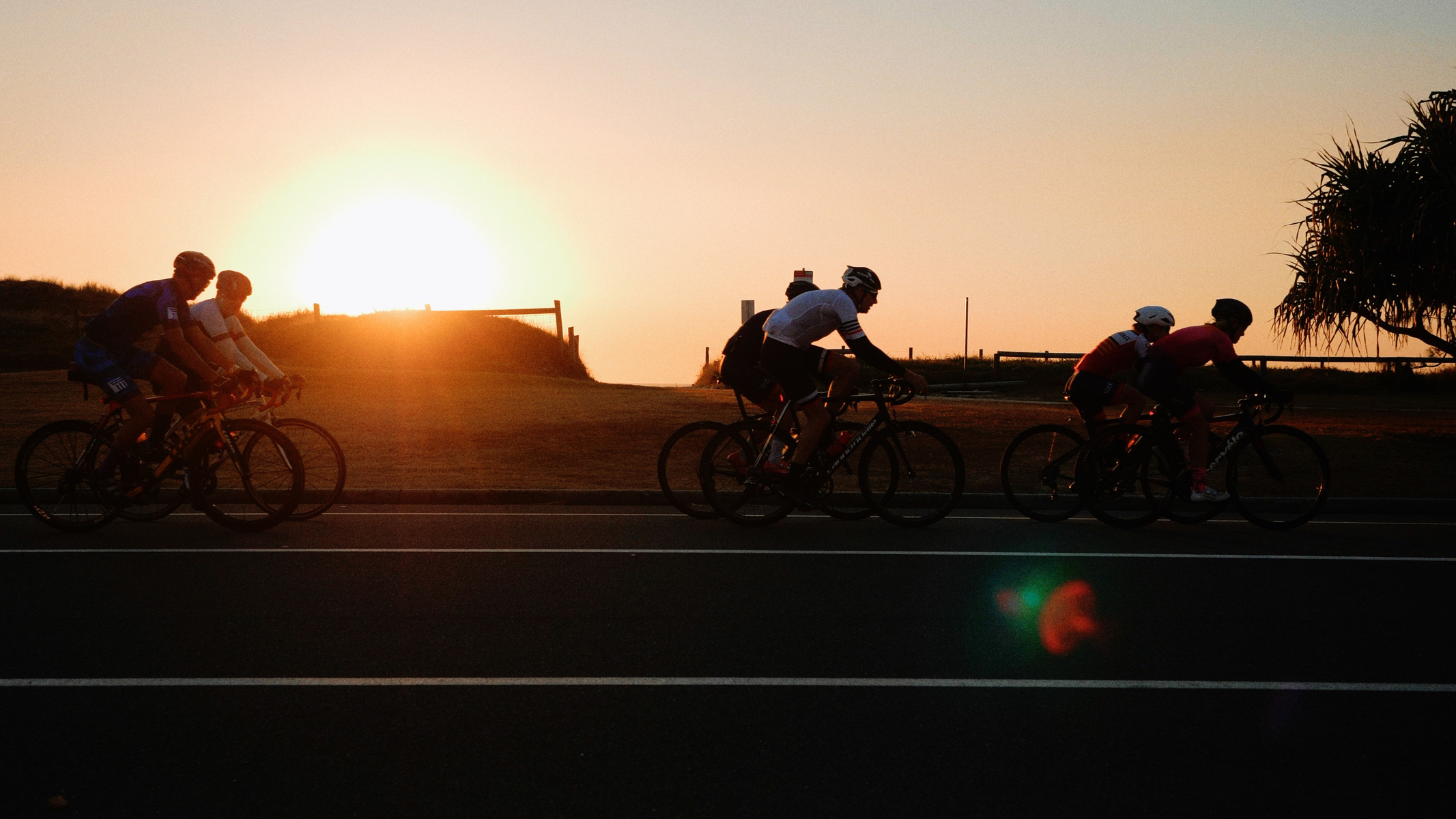
An easy paddle suitable for beginners and families.

HIGHLIGHTS
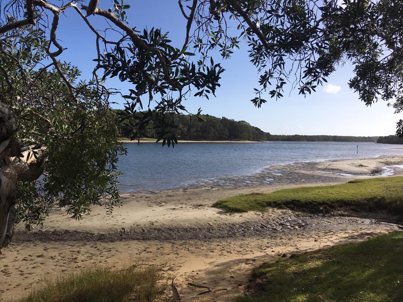
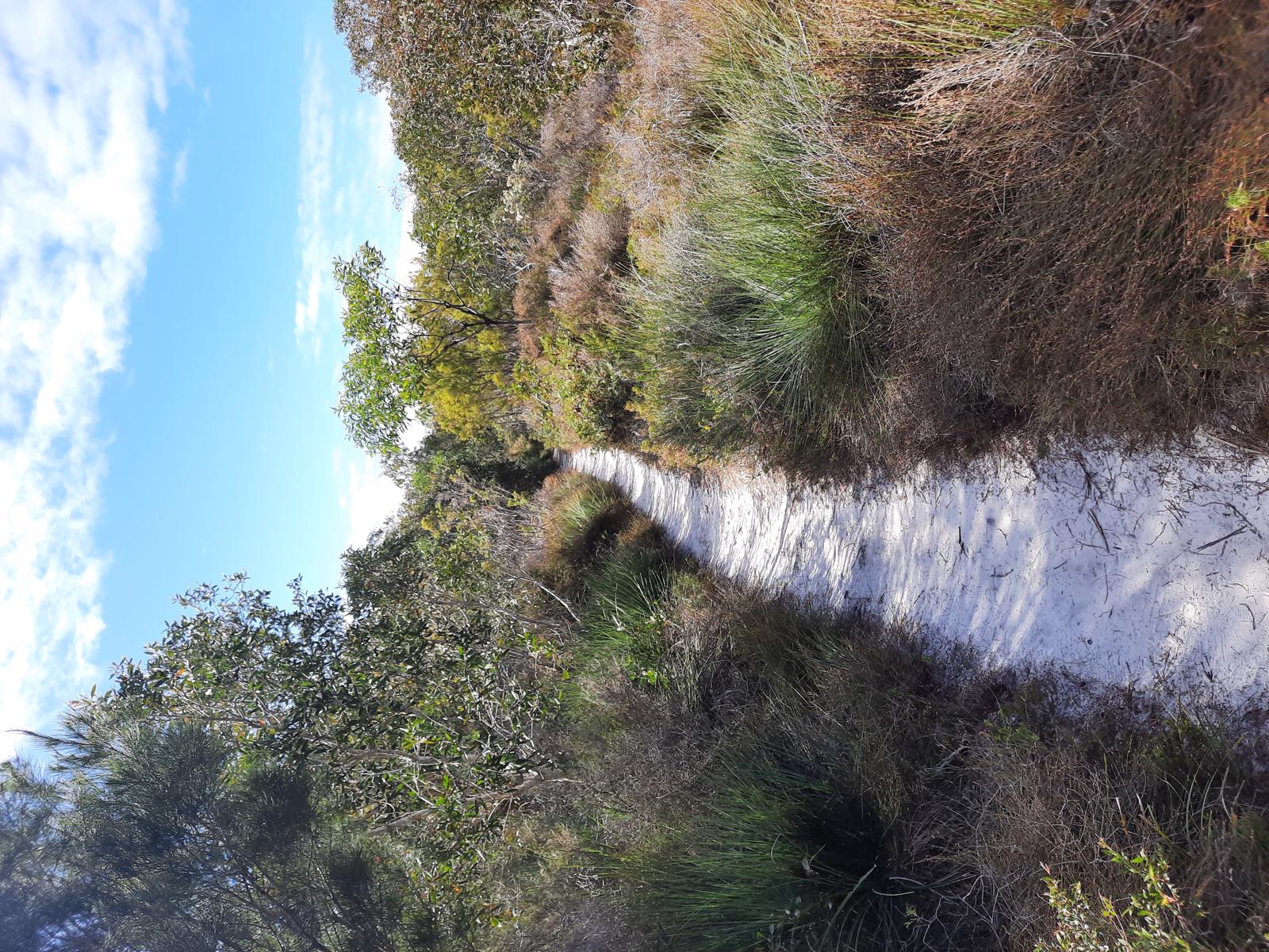
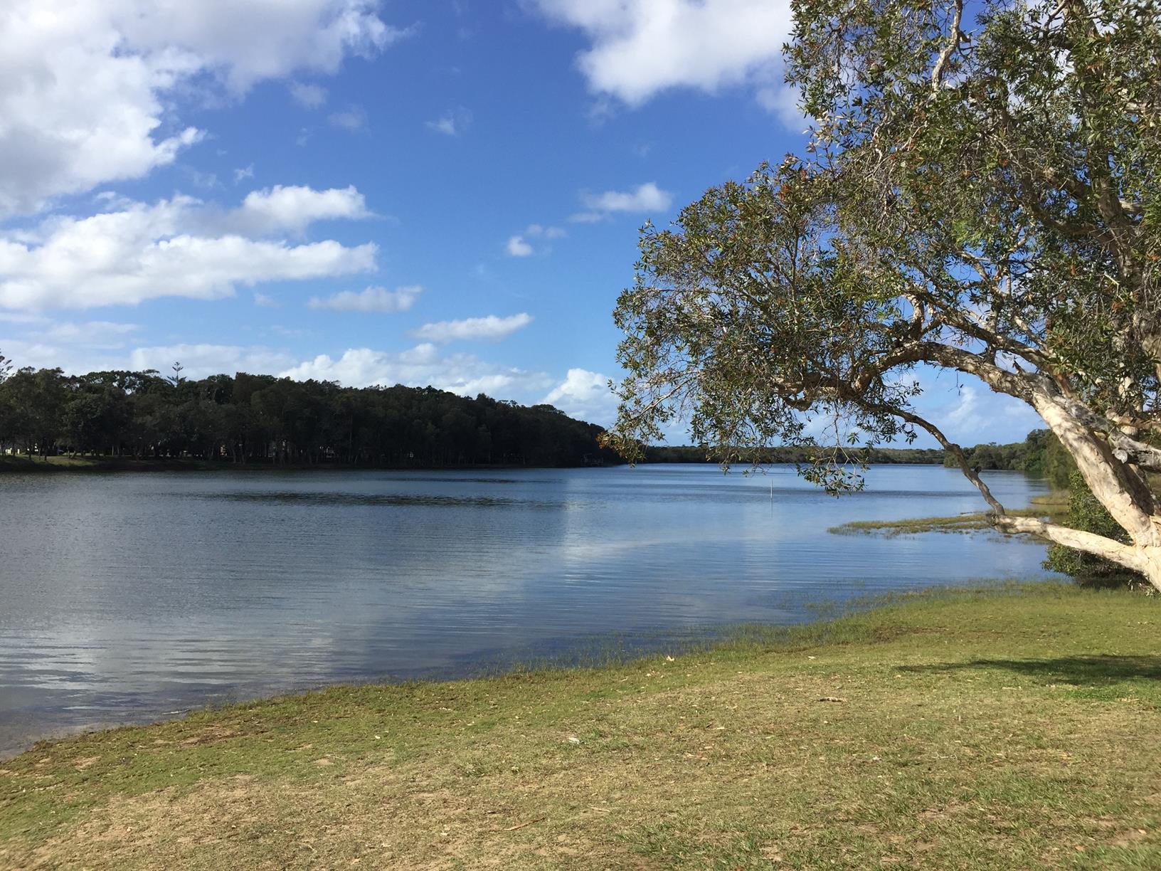
Perfect for the whole family, the safe, sheltered waters of Currimundi Lake are ideal for canoe, kayak or paddleboard adventures and are very easy to navigate. Currimundi Lake has an approximate full 6km canoe/paddle circuit but for those wanting a short paddle simply head downstream to the Lake entrance. The calm lake is usually protected from the wind and offers a safe, clean paddle experience. The paddle is quite narrow until the lake.

Look out for a range of native flora including the Pink Bloodwood, Coastal and Wallum Banksia, Black She-oak, Broad-leaf Paperback, the Apple Berry Vine and the vibrant cerise flowers of the Purple Tongue. If you’re lucky you might see some Glossy-black Cockatoos in the She-oaks, honeyeaters in the Banksias or the Royal Spoonbill and White faced Heron’s out at the Lagoon. There are also canoe resting points along the way.

At Kitethrills, 1 Watson Street, Currimundi, you can hire SUPs, single and double kayaks and kitesurf equipment. They also have great espressos.

AFTERWARDS
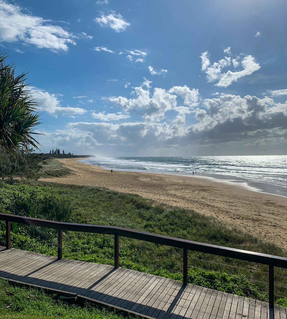
Why not enjoy a BBQ or picnic in one of the many park facilities on the Lake foreshore? You can also enjoy the Currimundi trail network’s coastal pathways by bike or walking. At the Lake entrance there is a large area of sand perfect for families, especially young children or you can enjoy the surf at the patrolled Currimundi Beach.

HOW TO GET THERE
Drive along Nicklin Way to Currimundi Lake from the north or south.

South side: The marked route shows launching from the south side.
Turn right into Gannawarra Street from Nicklin Way, left into Lara Street and left into Gamban Esplande. This will take you to the spot marked on the map where it is often easier to find a park due to it being further away from the beach than Frank McIvor Park (just along Westaway Parade) which also has parking and a canoe launching area.

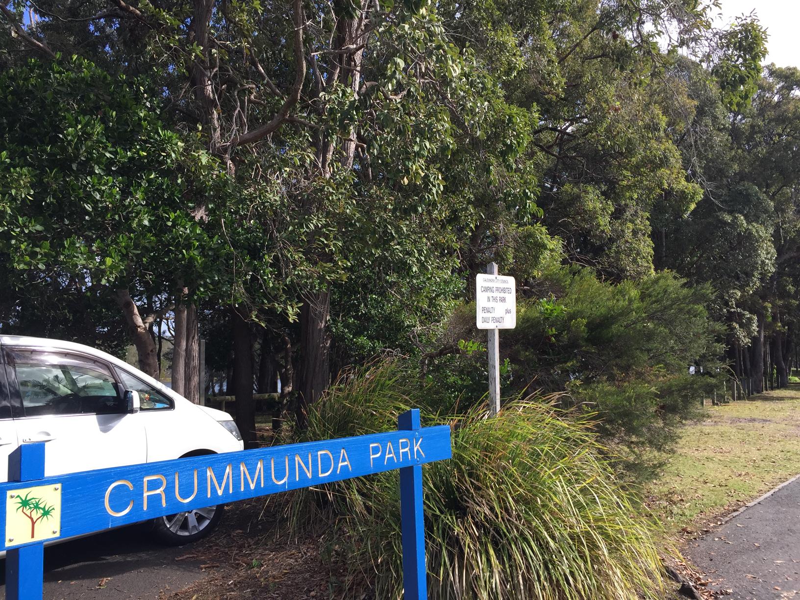
On the northside you can launch your boat at either:

Noel Burns Park
Turn right into Piringa Street from Nicklin Way, left into Pimpala Street and right into Mulloka Esplanade. The canoe launching area is at the end of Mulloka Esplanade.

Crummunda Park
Turn right into Gayandi Street from Nicklin Way, right into Mandara Drive and left into Coongarra Esplanade. The parking area and canoe launching area is at the junction of Coongarra Esplanade and Bareki Street.

Paddle downstream towards the Lake entrance/Currimundi Beach. Return to your designated launch point.

glossary button
Glossary
  • Icon showing this activity is suitable for wheelchairsSuitable for wheelchairs
  • Icon showing this activity is suitable for walkingSuitable for walking
  • Icon showing this activity is suitable for recreational cyclingSuitable for recreational cycling
  • Icon showing this activity is suitable for mountain bikingSuitable for mountain biking
  • Icon showing this activity is suitable for horse ridingSuitable for horse riding
  • Icon showing this activity is suitable for kayakingSuitable for kayaking
  • Icon showing this activity has drinking water availableDrinking water available
  • Icon showing this activity does not have drinking water availableNo drinking water available
  • Icon showing this activity has a barbeque on siteBarbeque on site
  • Icon showing this activity has a picnic table on sitePicnic table on site
  • Icon showing this activity has toilets on siteToilets on site
  • Icon showing fires are permitted at this activityFires permitted
  • Icon showing fires are prohibited at this activityFires prohibited
  • Icon showing camping is permitted at this activityCamping permitted
  • Icon showing camping is prohibited at this activityCamping prohibited
  • suitable for kayaking suitable for kayaking Suitable for kayaking
  • No drinking water available No drinking water available No drinking water available
  • Fires prohibited Fires prohibited Fires prohibited
  • Camping prohibited Camping prohibited Camping prohibited
Write a review

Be the first to review this trail.

hazard icon

IN AN EMERGENCY DIAL '000'.

Always Adventure Safely!

  • Always follow any local signage, it contains key information and conditions can change at any time.
  • Use the trails with consideration for your abilities, be prepared for the adventure ahead:
    • Be aware of the weather conditions, found here: http://www.bom.gov.au/qld/.
    • Always wear appropriate clothing, focus on good footwear.
    • Always bring more water than you think you will need.
    • Be Sun Safe!
    • Always let someone know where you are going that isn’t going with you.
  • Just getting started try this site for good useful information: https://www.trailhiking.com.au/hike-safety/
  • Sunshine Coast Council does it’s best to maintain current information but things can change so always be aware that a trail may not be as listed in this guide, and report and issues via our feedback link.

Sunshine Coast Council

For any issues with this experience please contact:

Sunshine Coast Council via 07 5475 7272 or via e-mail: adventure@sunshinecoast.qld.gov.au

Nearby Trails

Trail Image for Currimundi Lake: Full Paddle
Intermediate

Currimundi Lake: Full Paddle

Birtinya
canoeing icon
Trail type
difficulty icon
Skill Level

5.6km

Length
direction icon
One-way
Trail Image for Currimundi Lake: ‘Loop the Lake’
Easy

Currimundi Lake: ‘Loop the Lake’

Currimundi
walking icon cycling icon
Trail type
difficulty icon
Skill Level

4.3km

Length
direction icon
One-way
Trail Image for Currimundi Lake (Kathleen McArthur) Conservation Park
Intermediate

Currimundi Lake (Kathleen McArthur) Conservation Park

Wurtulla
walking icon
Trail type
difficulty icon
Skill Level

4.1km

Length
direction icon
Circuit
Trail Image for Coastal Pathway: Dicky Beach to Currimundi Lake
Easy

Coastal Pathway: Dicky Beach to Currimundi Lake

Currimundi
walking icon cycling icon
Trail type
difficulty icon
Skill Level

1.7km

Length
direction icon
One-way
Trail Image for Road Cycle Route: Pt. Cartwright to Moffat Beach
Difficult

Road Cycle Route: Pt. Cartwright to Moffat Beach

Aroona
walking icon cycling icon
Trail type
difficulty icon
Skill Level

30.6km

Length
direction icon
One-way

Share this trail

This action requires a login.
To continue, click on Login/Signup below.

Photo uploaded successfully, thank you.

Feedback / Suggest an Adventure

If you have any feedback on the site or any of the trails, please drop us a short email.

Have we missed something? Do you have an adventure to suggest? Fill in the suggestion form to let us know about it.