facebook
Image showing that the PDF download is in progress... PDF download in progress

Please wait...

Image showing a pink decorative paint splat
Image showing a green decorative paint splat
upload photo button
reviews buttonReviews view map buttonMap
view 3d map button3D Map
directions take me there buttonDirections
Save
PDF
Gpx File

Maroochy Regional Bushland Botanic Garden: Whipbird walk

Maroochy Regional Bushland Botanic Garden: Whipbird walk
Tanawha
walking icon walking icon black
Trail type
difficulty icon
Skill Level
0.6km
Length
direction icon direction icon black
Circuit

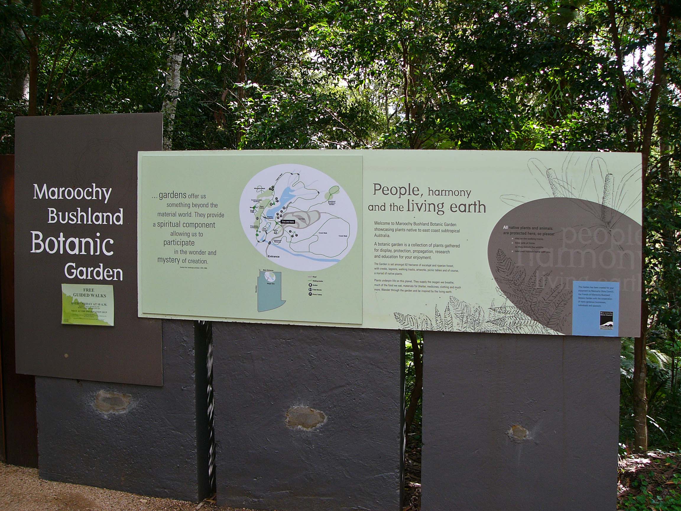
The Maroochy Regional Bushland Botanic Garden is located in Tanawha on the Sunshine Coast. The garden showcases plants native to the Sunshine Coast region.
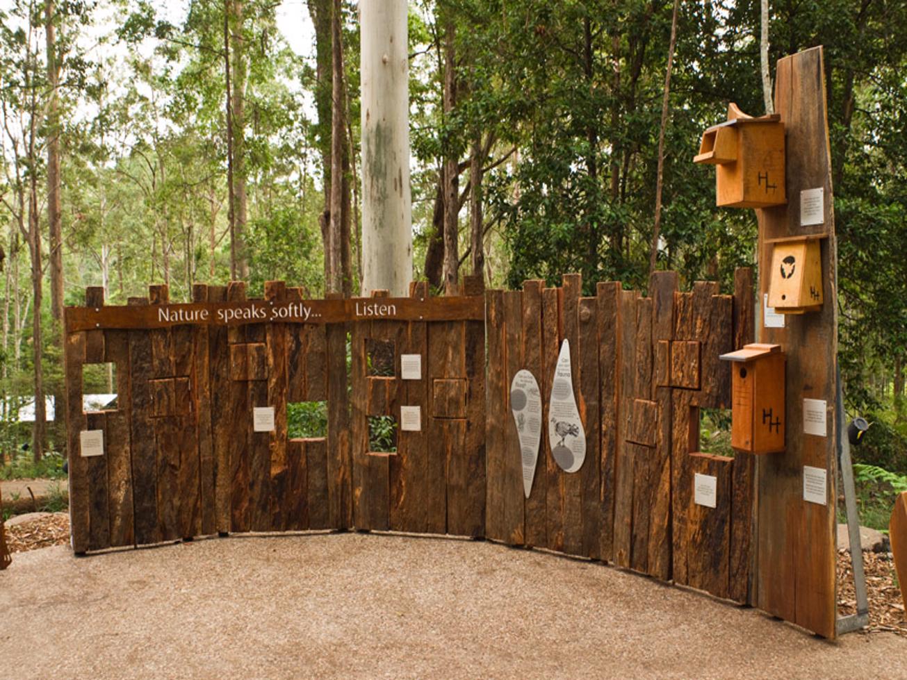
The magnificent 82 hectare garden supports native plants and wildlife, and has a magic and spirit that affect all who visit. The garden includes a mix of eucalypt open forest and creek-side rainforest, featuring lagoons, rocky and palm filled gullies, and the headwaters of Mountain Creek

SUITABILITY
Suitable for walkers out to see a range of native bush in a small area with great supporting facilities and information. Great place to take young kids for an exploration of the natural world.

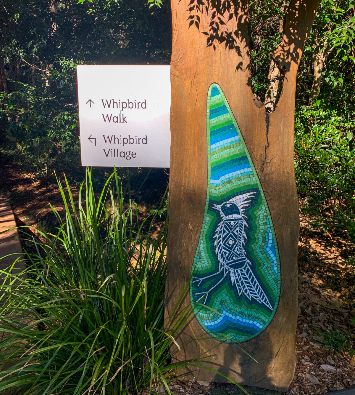
WHIPBIRD WALK HIGHLIGHTS
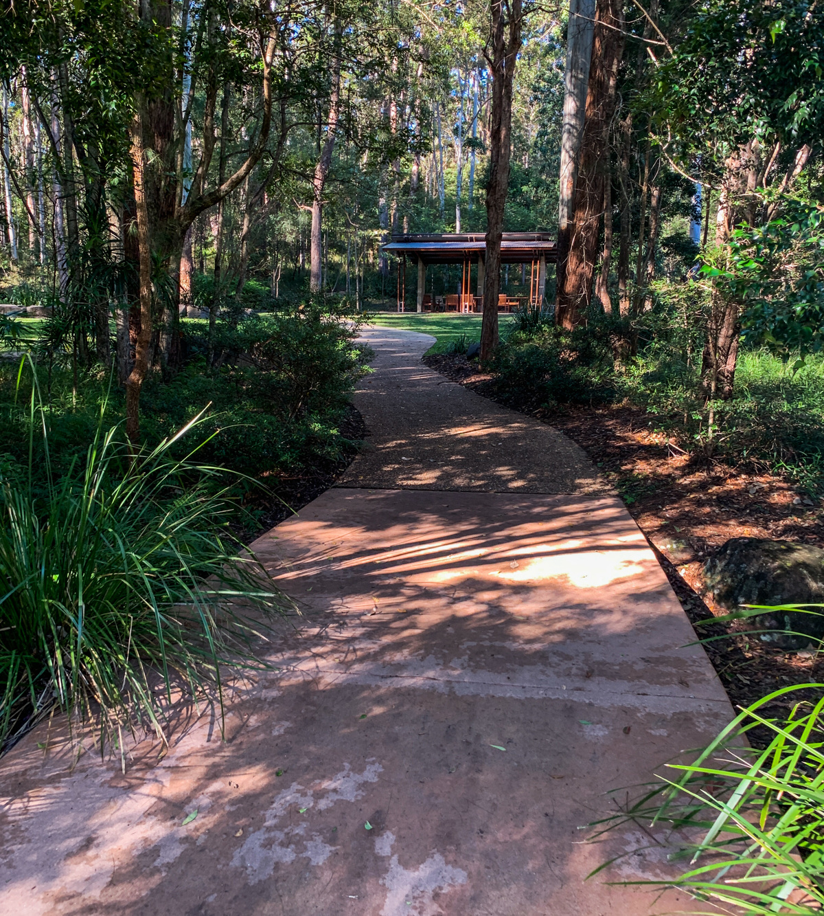
Natural rough track; flat to moderate incline walk.

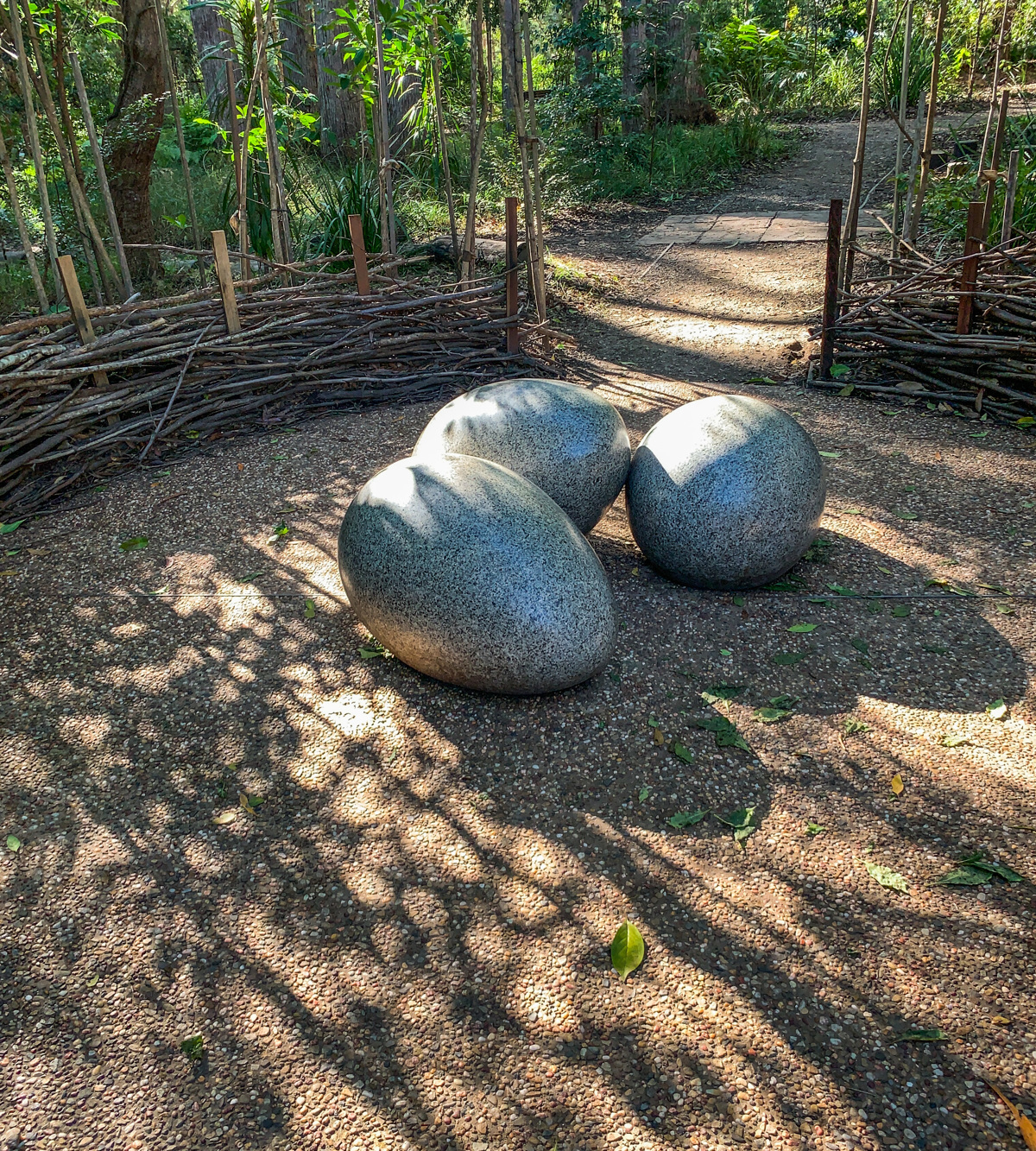
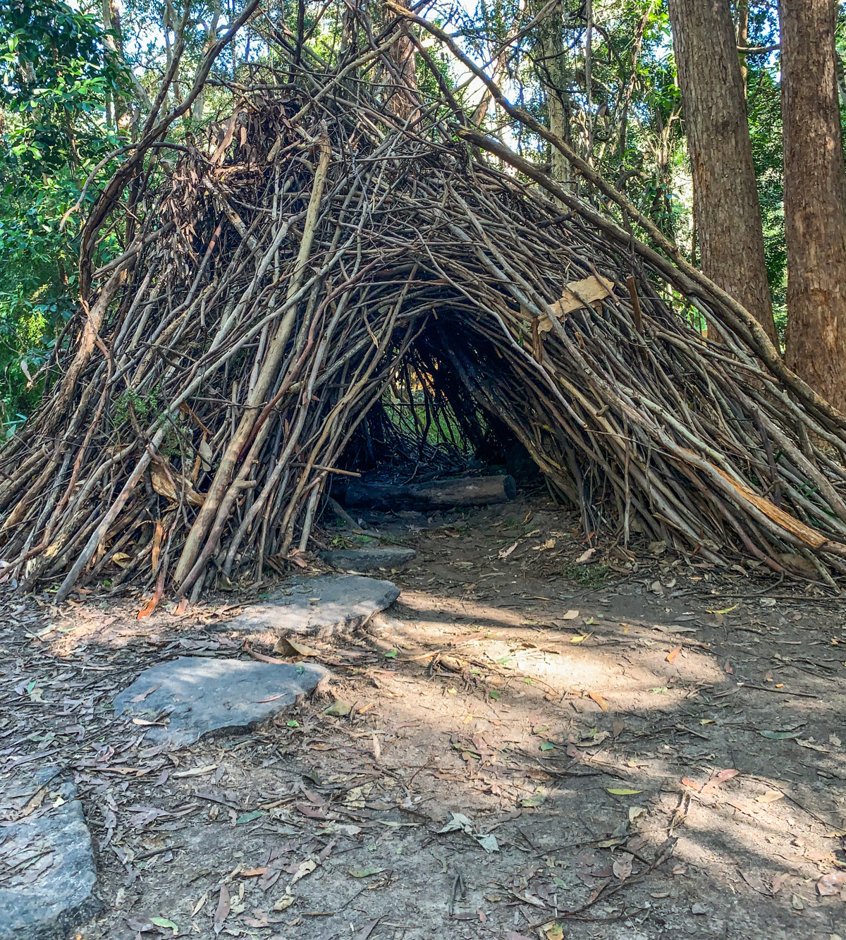
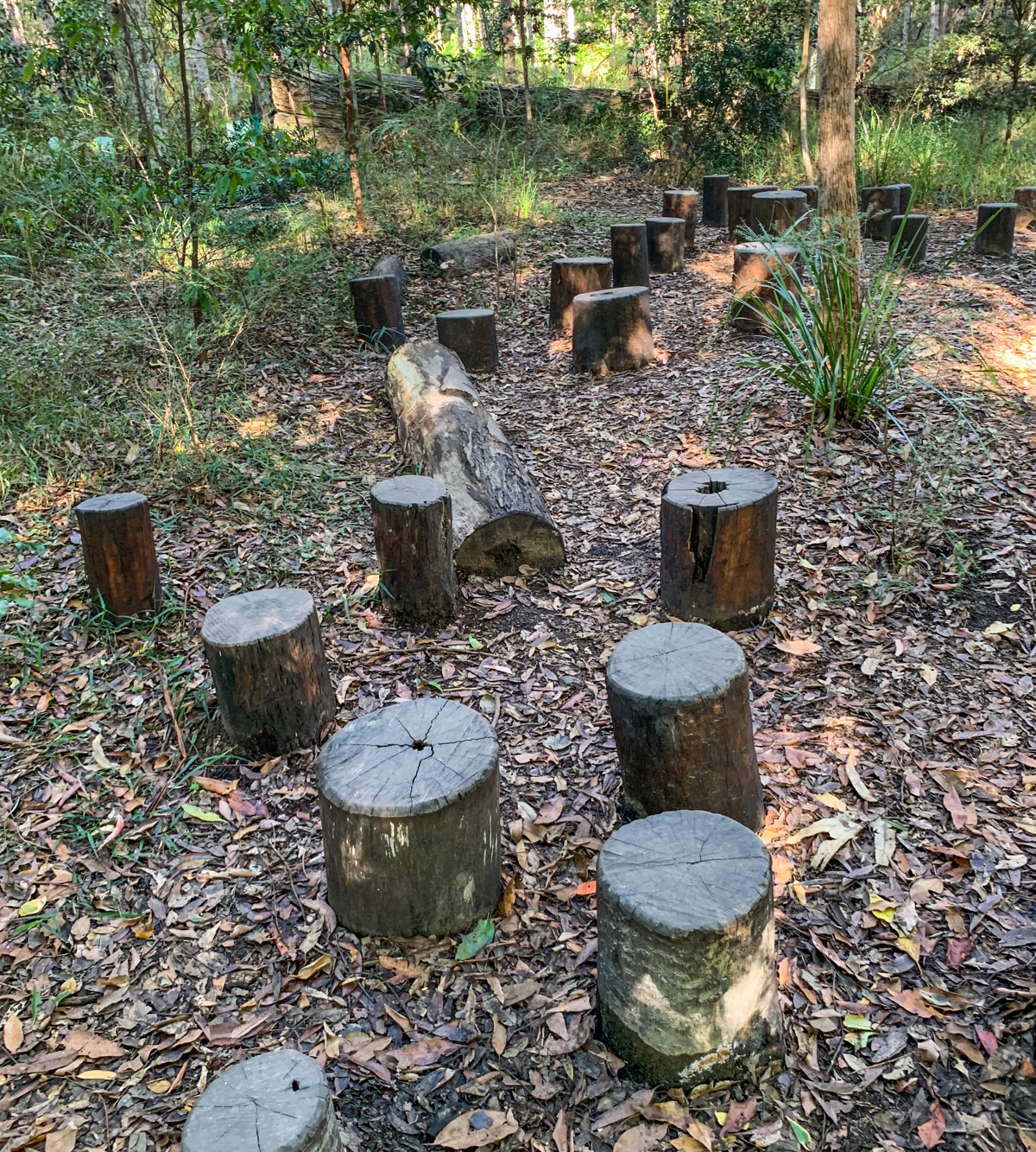
A safe haven where children can discover a wealth of hidden secrets. From giant spiders to exotic butterflies this children’s adventure walk is home to many fantasy creatures.

AFTERWARDS
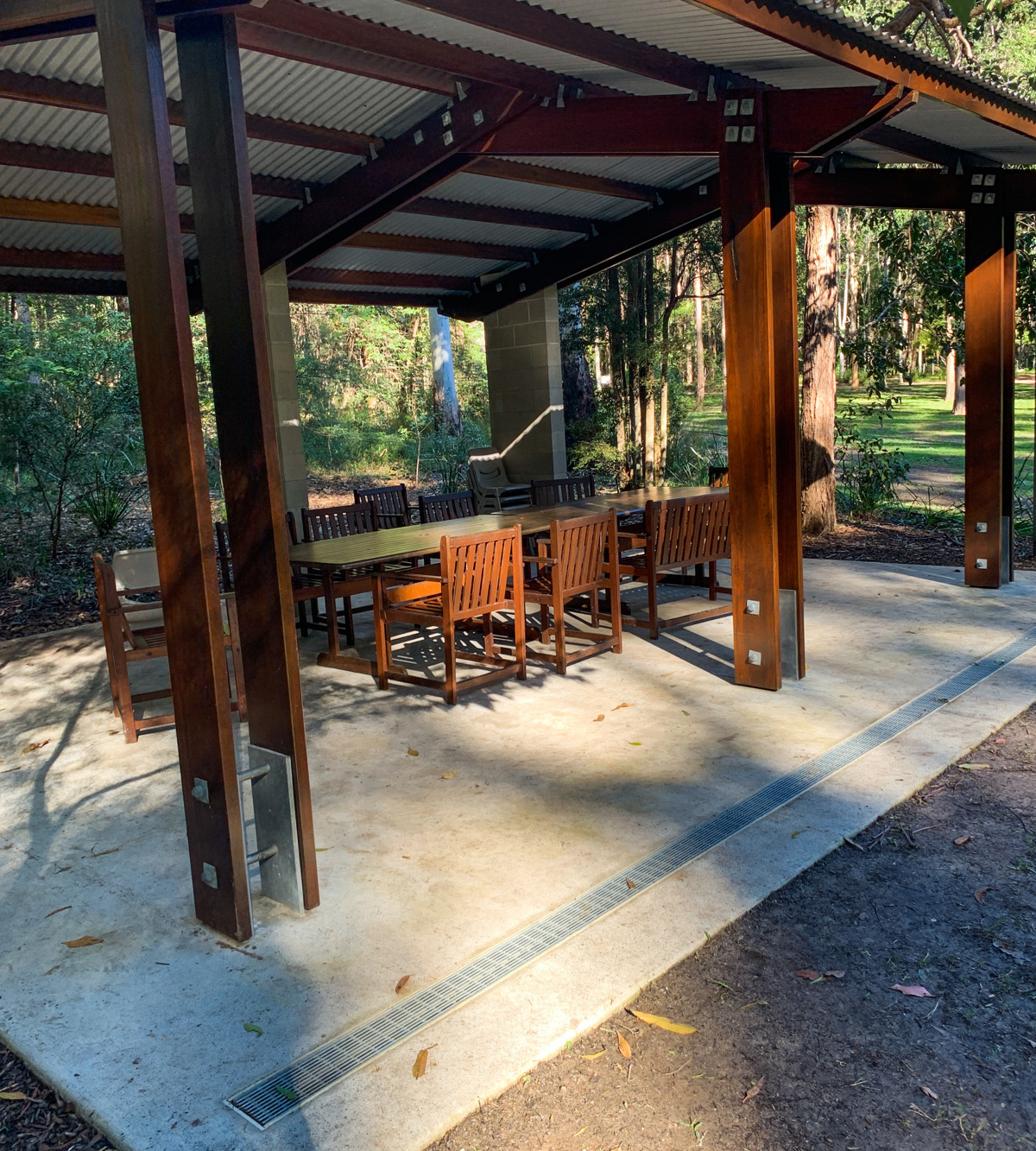
Grab a coffee and a bite to eat at Compass Café, or BYO picnic and enjoy one of the many spots to have lunch. Once done here it’s a short hop up the hill to Buderim and all the views and activities that town offers.

HOW TO GET THERE
To the starting point: Traveling on the Bruce Highway (M1) take the exit onto the Sunshine Motorway. Take the Tanawha Tourist exit off of the Sunshine Motorway. You then turn onto Main Creek Road and take the turn onto Radbourne then Palm Creek Roads. The gardens are a left turn off of Palm Creek Rd on the same turn as the golf club.

Just follow the signs and you will get there!

Google can get you lost on this one!

To the end point: The end point is the same as your starting point.

glossary button
Glossary
  • Icon showing this activity is suitable for wheelchairsSuitable for wheelchairs
  • Icon showing this activity is suitable for walkingSuitable for walking
  • Icon showing this activity is suitable for recreational cyclingSuitable for recreational cycling
  • Icon showing this activity is suitable for mountain bikingSuitable for mountain biking
  • Icon showing this activity is suitable for horse ridingSuitable for horse riding
  • Icon showing this activity is suitable for kayakingSuitable for kayaking
  • Icon showing this activity has drinking water availableDrinking water available
  • Icon showing this activity does not have drinking water availableNo drinking water available
  • Icon showing this activity has a barbeque on siteBarbeque on site
  • Icon showing this activity has a picnic table on sitePicnic table on site
  • Icon showing this activity has toilets on siteToilets on site
  • Icon showing fires are permitted at this activityFires permitted
  • Icon showing fires are prohibited at this activityFires prohibited
  • Icon showing camping is permitted at this activityCamping permitted
  • Icon showing camping is prohibited at this activityCamping prohibited
  • Suitable for walking Suitable for walking black lines Suitable for walking
  • Drinking water available Drinking water available Drinking water available
  • Picnic table on site Picnic table on site Picnic table on site
  • toilets on site toilets on site Toilets on site
  • Fires prohibited Fires prohibited Fires prohibited
  • Camping prohibited Camping prohibited Camping prohibited
Write a review

Be the first to review this trail.

hazard icon

IN AN EMERGENCY DIAL '000'.

Always Adventure Safely!

  • Always follow any local signage, it contains key information and conditions can change at any time.
  • Use the trails with consideration for your abilities, be prepared for the adventure ahead:
    • Be aware of the weather conditions, found here: http://www.bom.gov.au/qld/.
    • Always wear appropriate clothing, focus on good footwear.
    • Always bring more water than you think you will need.
    • Be Sun Safe!
    • Always let someone know where you are going that isn’t going with you.
  • Just getting started try this site for good useful information: https://www.trailhiking.com.au/hike-safety/
  • Sunshine Coast Council does it’s best to maintain current information but things can change so always be aware that a trail may not be as listed in this guide, and report and issues via our feedback link.

Sunshine Coast Council

For any issues with this experience please contact:

Sunshine Coast Council via 07 5475 7272 or via e-mail: adventure@sunshinecoast.qld.gov.au

Nearby Trails

Trail Image for Maroochy Regional Bushland Botanic Garden: Lagoon walk
Easy

Maroochy Regional Bushland Botanic Garden: Lagoon walk

Tanawha
walking icon
Trail type
difficulty icon
Skill Level

1.3km

Length
direction icon
Circuit
Trail Image for Maroochy Regional Bushland Botanic Garden: Fern Glade walk
Easy

Maroochy Regional Bushland Botanic Garden: Fern Glade walk

Tanawha
walking icon
Trail type
difficulty icon
Skill Level

0.5km

Length
direction icon
Circuit
Trail Image for Maroochy Regional Bushland Botanic Garden: Sculpture Garden walk
Easy

Maroochy Regional Bushland Botanic Garden: Sculpture Garden walk

Tanawha
walking icon
Trail type
difficulty icon
Skill Level

0.7km

Length
direction icon
Circuit
Trail Image for Maroochy Regional Bushland Botanic Garden: Mossy Log Walk
Easy

Maroochy Regional Bushland Botanic Garden: Mossy Log Walk

Tanawha
walking icon
Trail type
difficulty icon
Skill Level

0.1km

Length
direction icon
One-way
Trail Image for Maroochy Regional Bushland Botanic Garden: Ephemeral Wetland Walk
Easy

Maroochy Regional Bushland Botanic Garden: Ephemeral Wetland Walk

Tanawha
walking icon
Trail type
difficulty icon
Skill Level

0.4km

Length
direction icon
Circuit

Share this trail

This action requires a login.
To continue, click on Login/Signup below.

Photo uploaded successfully, thank you.

Feedback / Suggest an Adventure

If you have any feedback on the site or any of the trails, please drop us a short email.

Have we missed something? Do you have an adventure to suggest? Fill in the suggestion form to let us know about it.