
Maroochy River Canoe Trail: Ashtons Wharf to Lift Bridge
A river paddle along the patchwork of sugar cane and small crop farms in the upper Maroochy river estuary.
SUITABLILITY
Suitable for all levels of paddlers from beginner to experienced.
Highlights
Paddle downstream along the Maroochy River from Ashtons Wharf to the Heritage listed Lift Bridge. Alongside the upper estuary, there are fields of sugarcane and other small crops. These farms occupy the floodplains that were once a mixture of eucalypt forest, paperbark forest and sub-tropical rainforest. Parts of the river can be quite exposed along the banks whereas others will have native woodland. This paddle can be wind affected. Expect to see a variety of birdlife such as cormorants, darters and more – hopefully you won’t be disappointed!
The Tramway Lift Bridge over Maroochy River is a heritage-listed railway bridge at Store Road, Nambour. Built in 1921, it was added to the Queensland Heritage Register in 2005.
Afterwards
Accessing Maroochy River from the Yandina side provides the opportunity to do many adventures in this area. Top of the list would be climbing Mt Ninderry which is accessed off Ninderry Road at Yandina.
Popular tourist destination the Ginger Factory is also located in Yandina and has splendid ginger gardens on display as well as Buderim Ginger products for sale.
If you’re up for some finer fare, you can dine at the famous The Spirit House Thai restaurant. Further up the road is Eumundi, home of the Wednesday and Saturday morning Eumundi Markets, eclectic cafes and pub grub.
How to get there
To the starting point: Ashtons Wharf is located at the end of Ashtons Wharf Road via Apps Road. Apps Road can be found on the southern side of Yandina Coolum Road between Ocean Vista Drive and Wants Road. There is a good ramp to put in.
To the end point:
The end point is where you started as it is not possible to put in or out at Lift Bridge, but you can go on land right to lift bridge.
About this place
- Suitable for kayaking
- Walking track grade
- Grade 3
- A formed track with some obstacles, up to 20km. Expect short steep sections and plenty of steps. Some walking experience helps.
Graded on the Queensland Parks walking track scale. Walk with care(opens in a new tab)
- Managed by
- Sunshine Coast Council
To report damage, a hazard or another problem with the trail:
Safety
Hazards on this trail
If it gets windy
In an emergency, call 000. Always adventure safely!
- Always follow any local signage, it contains key information and conditions can change at any time.
- Use the trails with consideration for your abilities, be prepared for the adventure ahead:
- Be aware of the weather conditions, found here: Bureau of Meteorology — Queensland(opens in a new tab)
- Always wear appropriate clothing, focus on good footwear.
- Always bring more water than you think you will need.
- Be Sun Safe!
- Always let someone know where you are going that isn't going with you.
- Just getting started try this site for good useful information: Trail Hiking Australia — hike safety(opens in a new tab)
- Sunshine Coast Council does its best to keep this information current, but things change, so be aware that a trail may not be as listed here.
Reviews
No reviews yet. Be the first to share your experience of this trail.
Nearby trails
- Walking
- Cycling
Dunethin Rock Explore
Maroochy River
Easy2.0 kmCircuit
4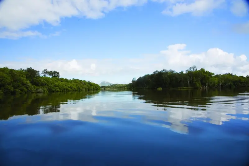
- Walking
- Mountain Biking
- Horse Riding
Parklands Conservation Park - Rocky Creek Circuit
Parklands
Difficult5.4 kmCircuitDogs prohibited

Your Adventure Starts Here
Save favourites, plan trips, earn badges and share your trail photos with the community — free, in seconds.
Always free · Sign up in seconds
Printed from Adventure Sunshine Coast · https://adventure.sunshinecoast.qld.gov.au/trails/39631/maroochy-river-canoe-trail-ashtons-wharf-to-lift-bridge
Always check current conditions and closures before you set out.