facebook
Image showing that the PDF download is in progress... PDF download in progress

Please wait...

Image showing a pink decorative paint splat
Image showing a green decorative paint splat
upload photo button
reviews buttonReviews view map buttonMap
view 3d map button3D Map
directions take me there buttonDirections
Save
PDF
Gpx File

Wild Horse Mountain Lookout

Wild Horse Mountain Lookout
Coochin Creek
walking icon walking icon black
Trail type
difficulty icon
Skill Level
0.8km
One-way Length
direction icon direction icon black
One-way

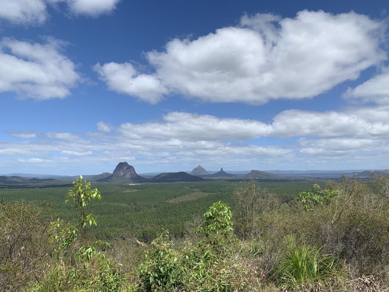
A short steep walk for 360º degree uninterrupted views of the Glass House Mountains to your west, uninterrupted views of the Sunshine Coast

SUITABILITY
Suitable for reasonably fit walkers or slower walkers wanting to take their time.

HIGHLIGHTS
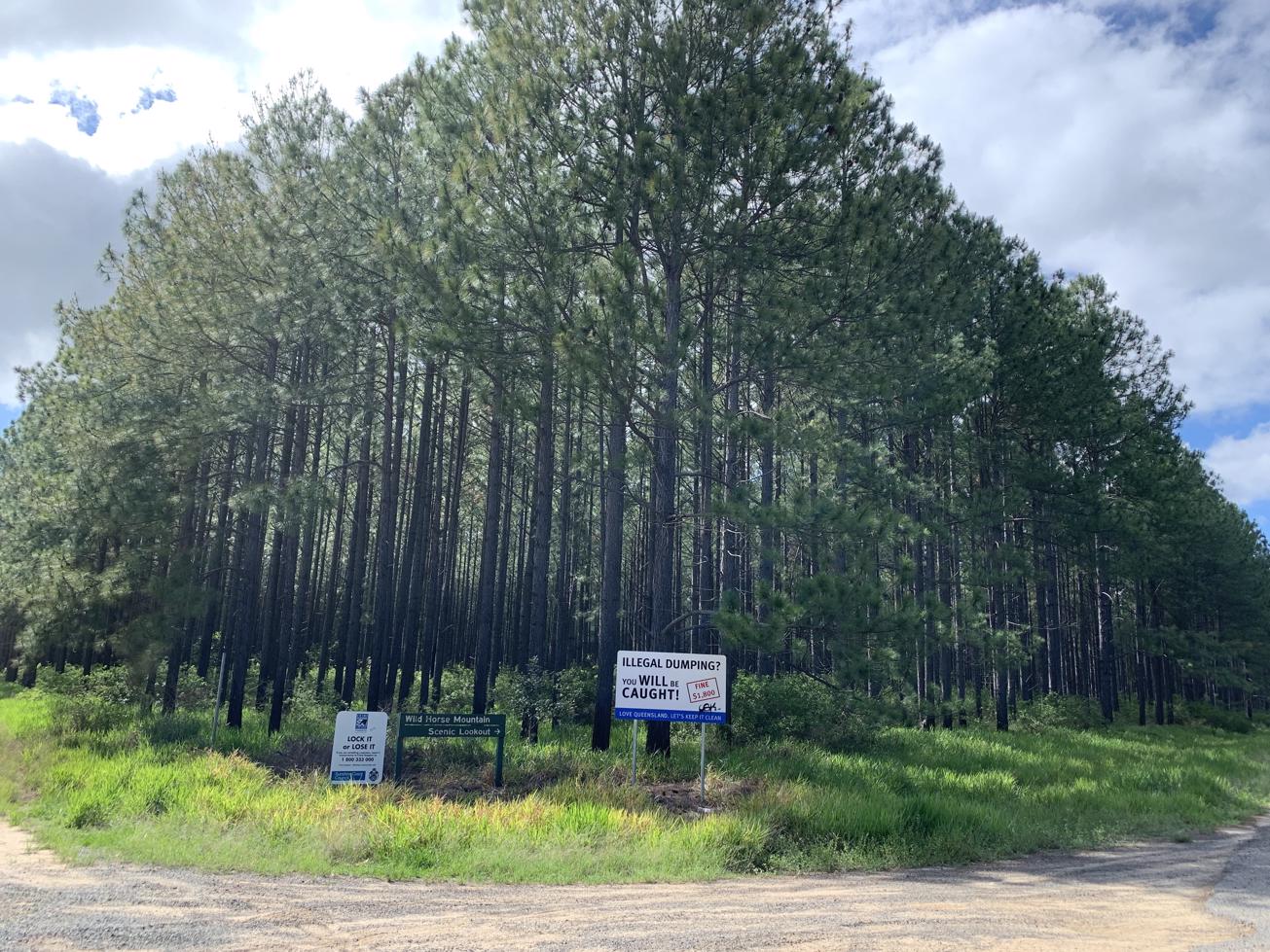
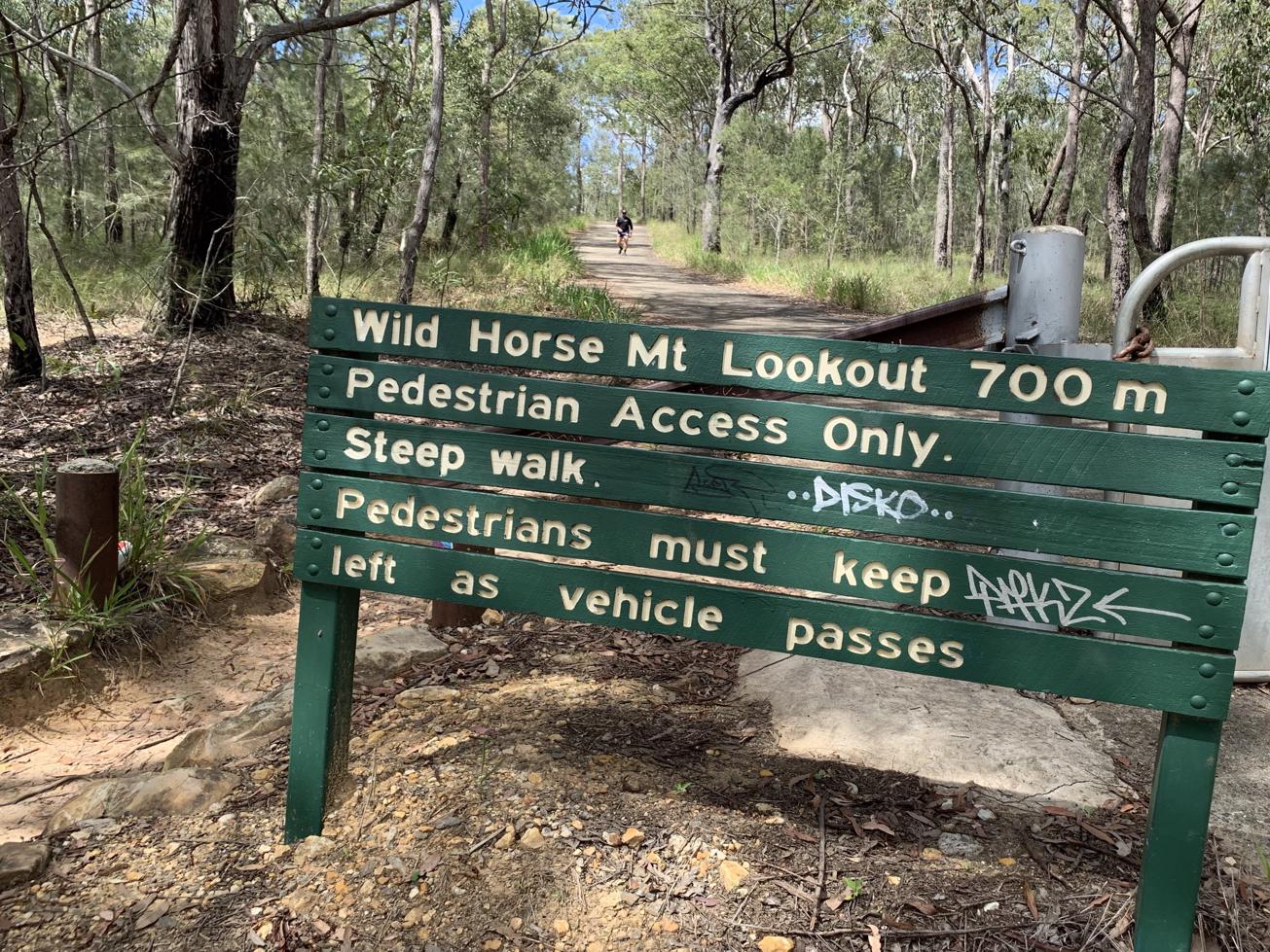
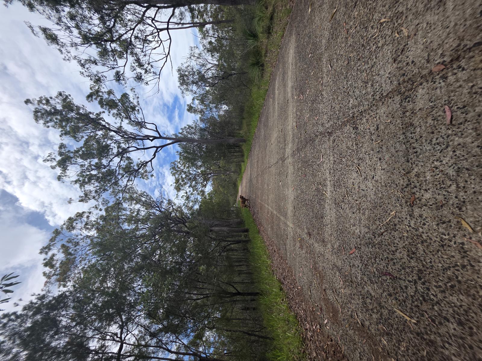
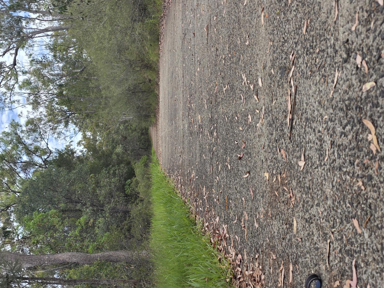
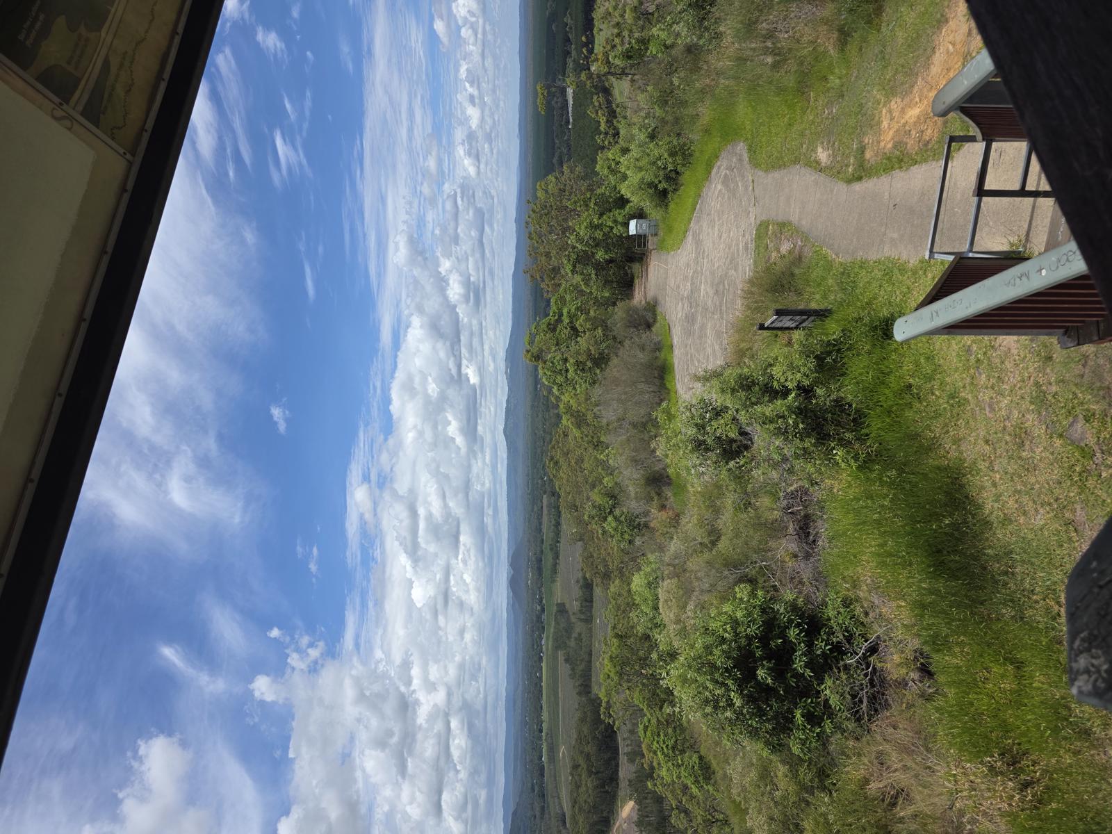
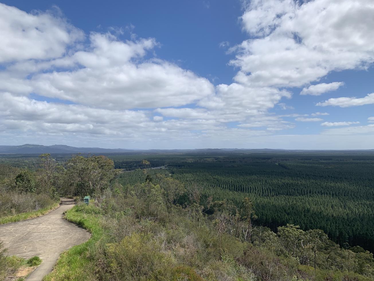
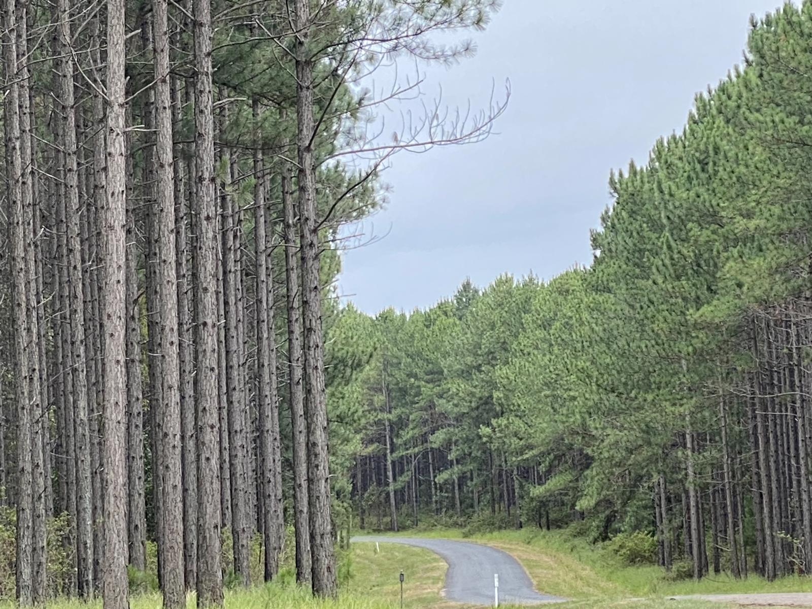
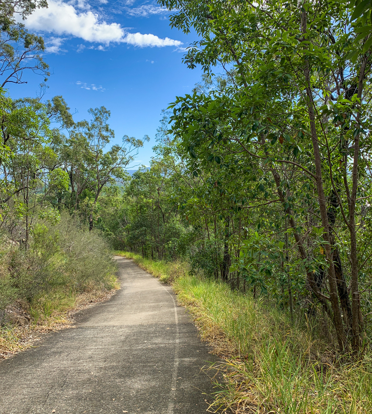
The Wild Horse Mountain lookout is in Beerburrum State Forest, east of the Bruce Highway/M1. This walk starts at the southern end of the car park up the cement road, and all the way up to the top, approximately 700m one way.

You’ll walk past casuarinas, grass trees and eucalypts. On your way you might be lucky to see kookaburras, wagtails and dragonflies.

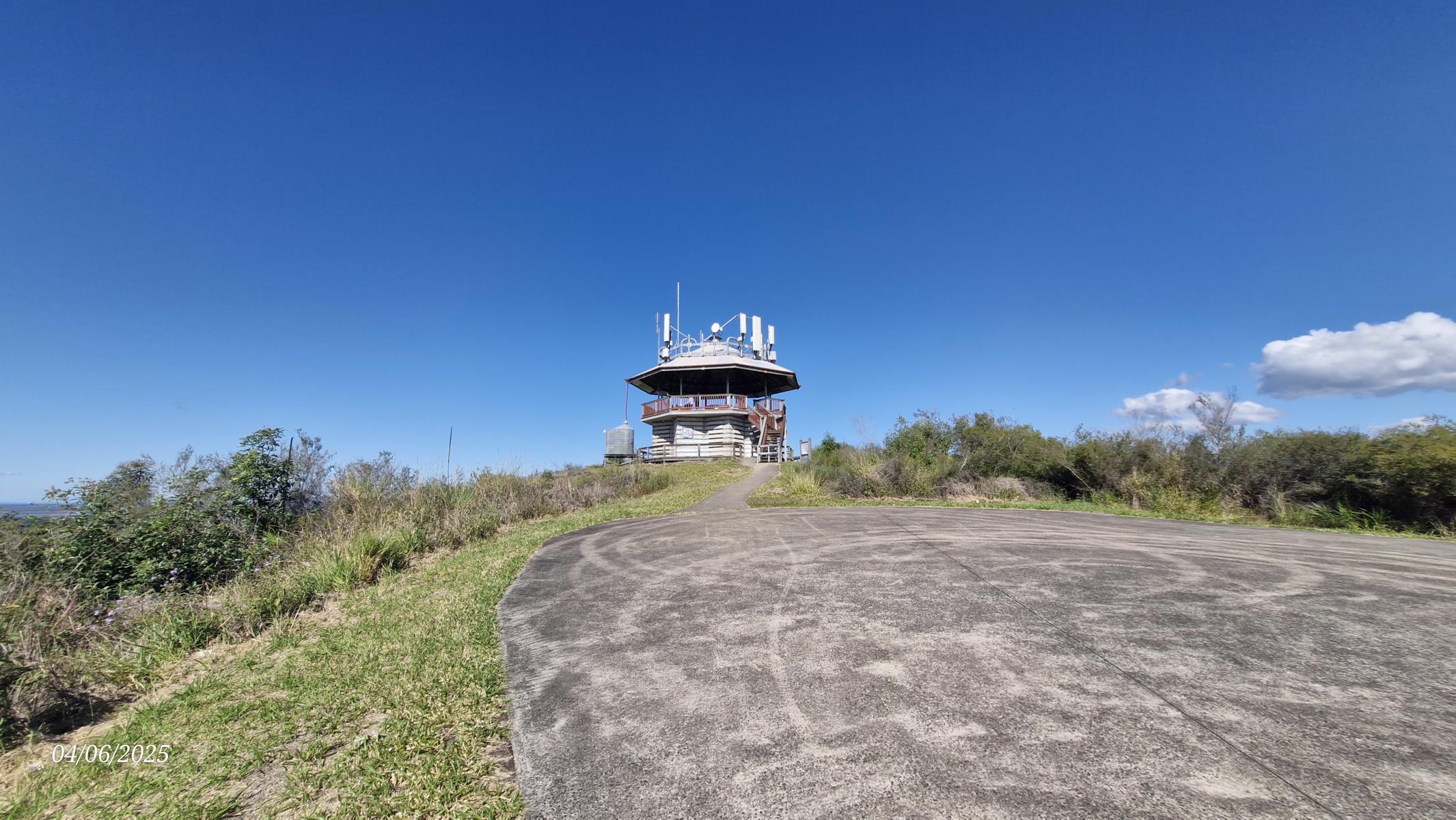
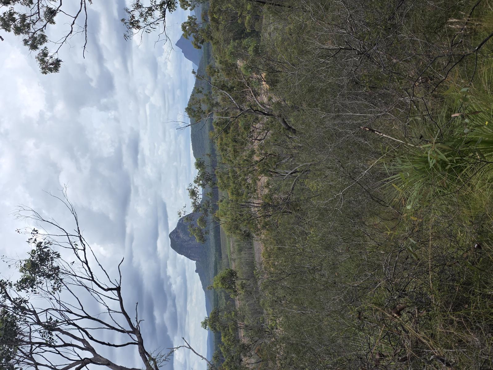
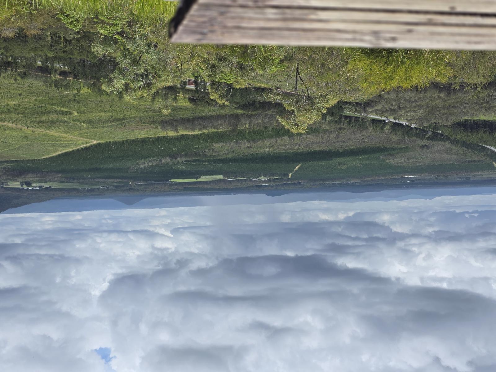
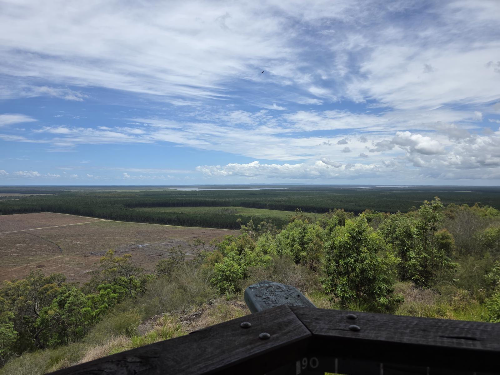
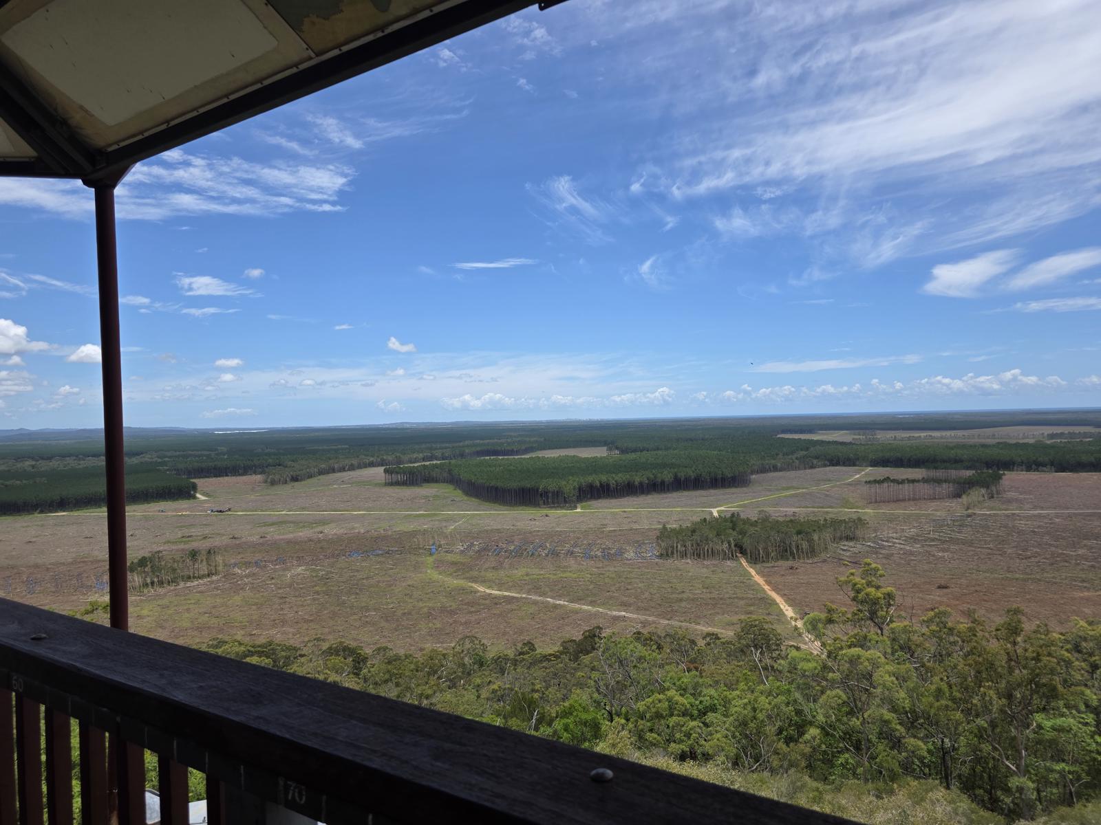
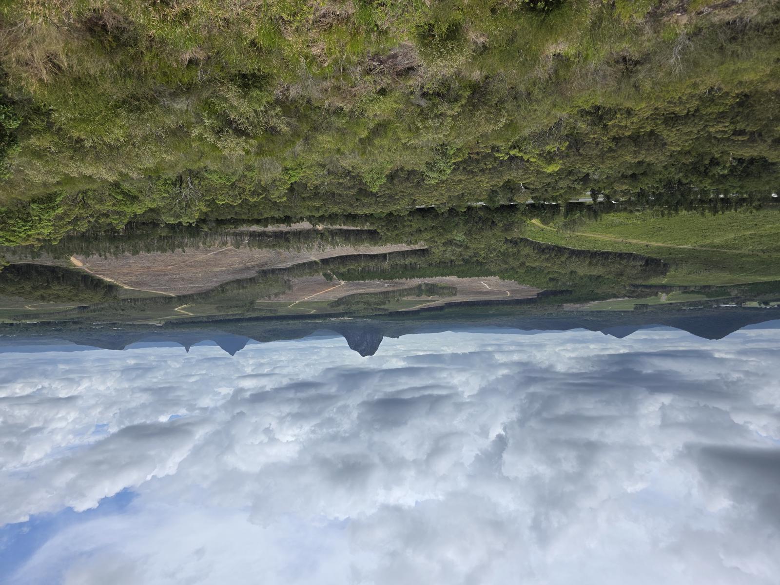
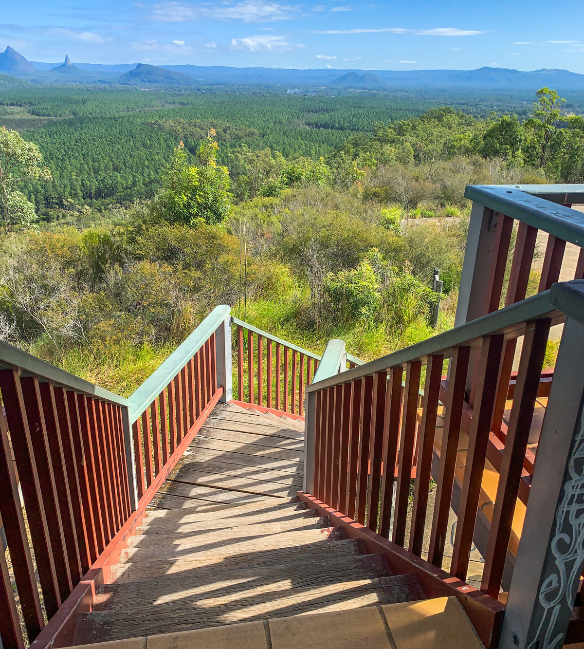
While a reasonably steep climb of 123m elevation, there is shade and generous seating at the top in the fire tower rotunda, which is operated in partnership with the fire monitoring site on Mt Beerburrum.

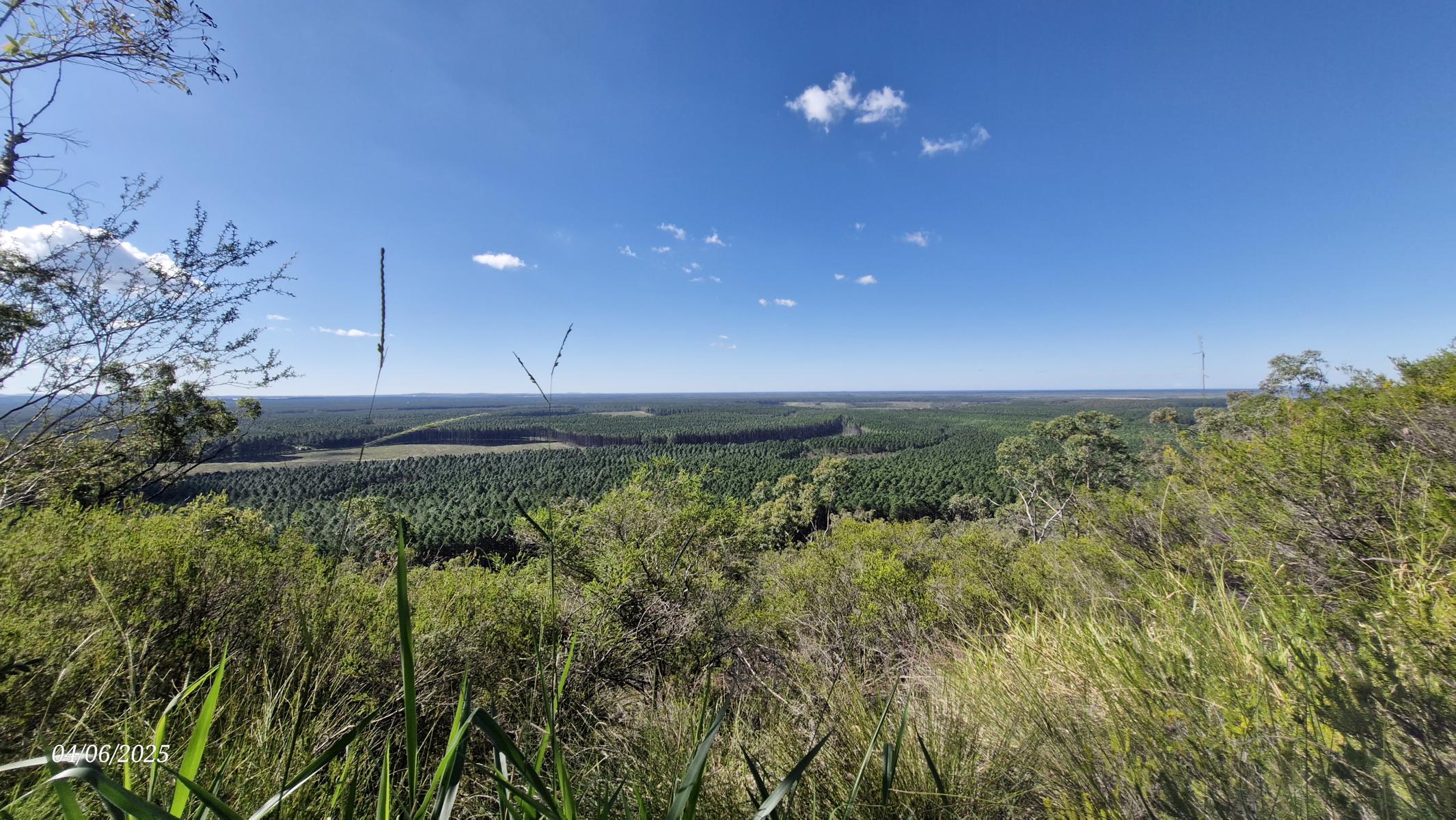
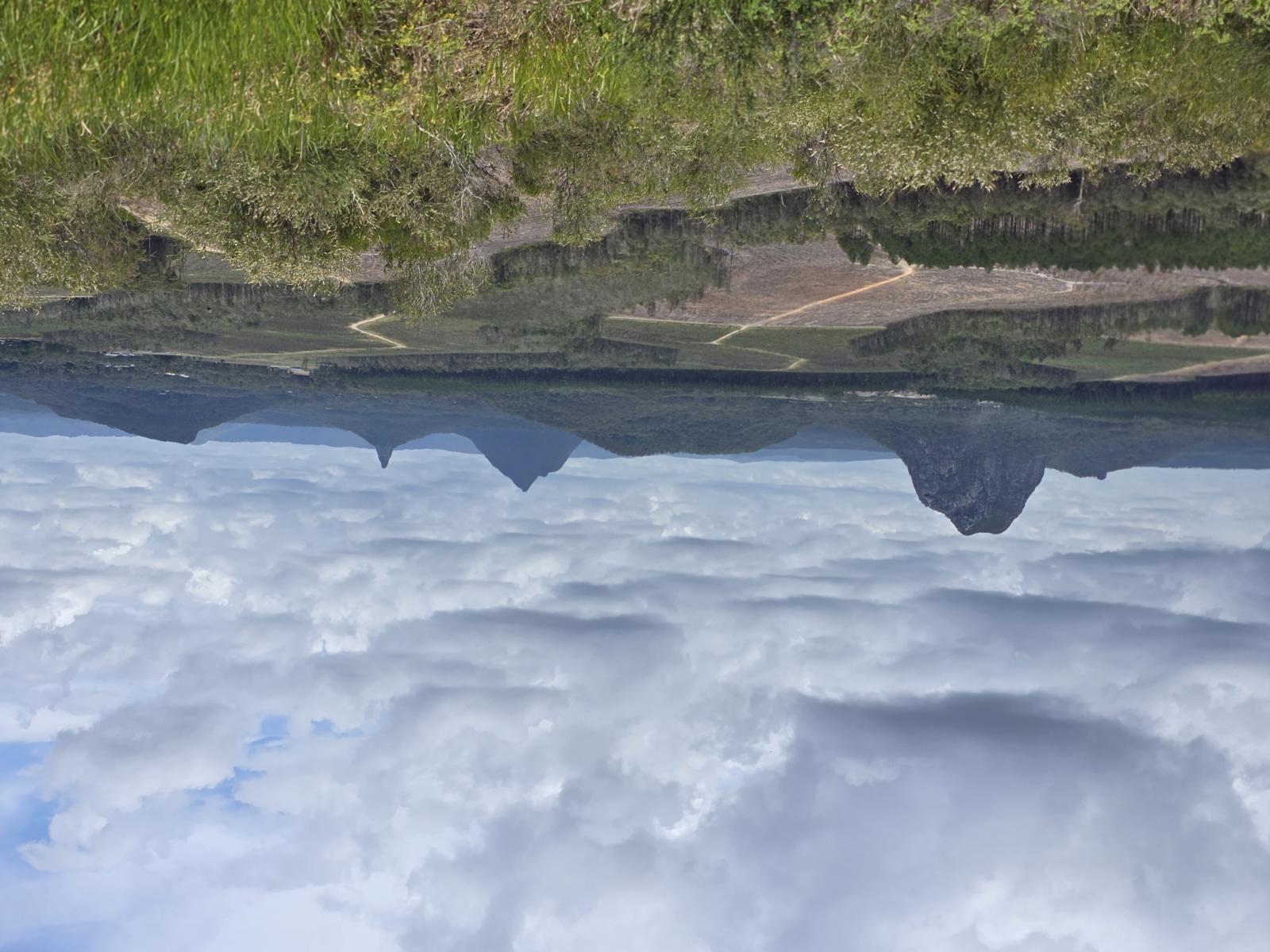
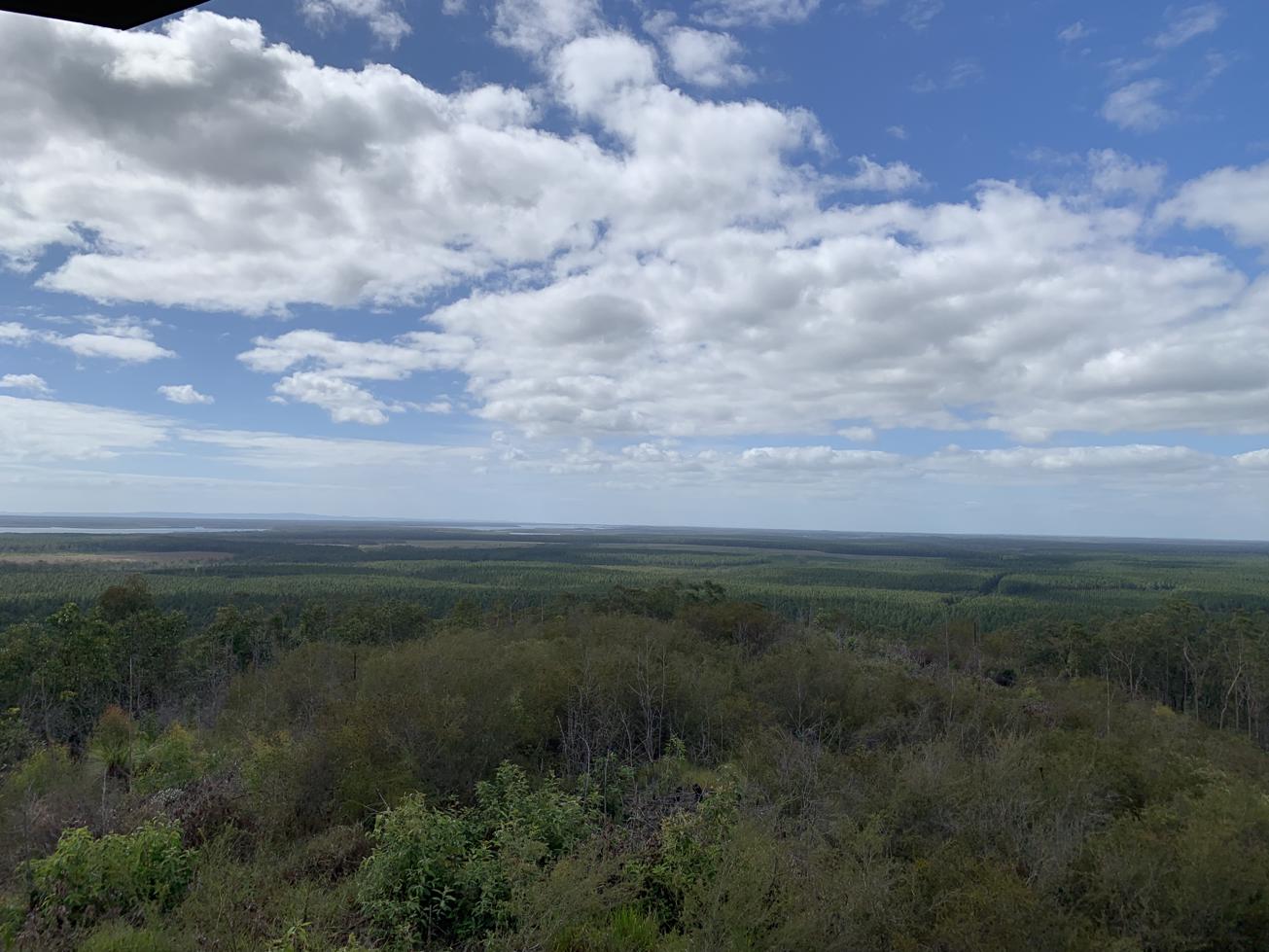
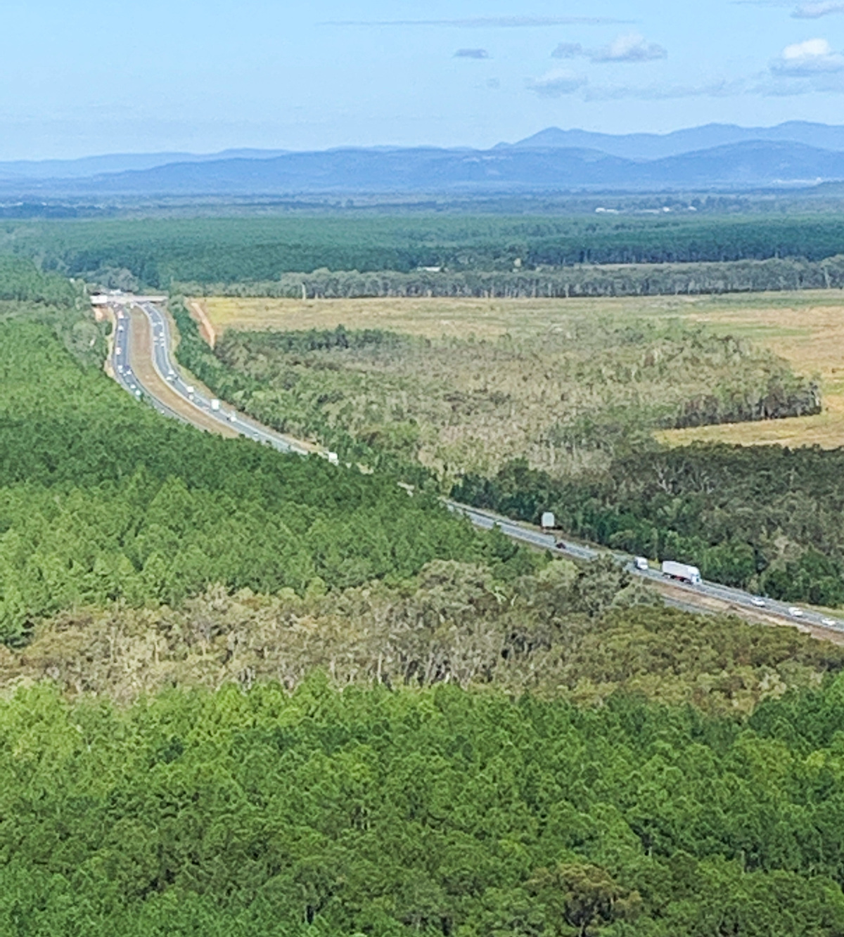
From the tower you can see Brisbane to the south, as well as Pumicestone Passage and Coochin Creek. There are coastal plains to take in, numerous pine forestry plantations, and the various Glass House Mountains to the west and. Northwards you can also spot Mount Coolum and Mount Cooroora.

Look up while you are in the tower to read the information boards which describes the peaks you are looking at.

AFTERWARDS

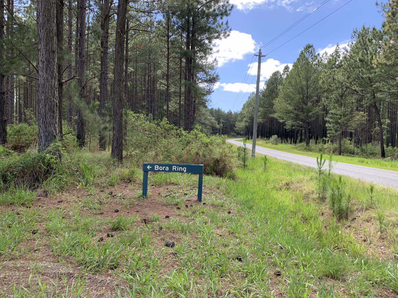
From this location you are close to an Aboriginal Bora Ring which is on the western end of Johnston Road before you get to Crittendon Road. It is signposted, so look for the signs to your right just after a forestry section.

If you’re after a bite to eat just back down at WILD Horse Mountains services area there are lots on offer for a quick pit stop including Beefys, Subway, golden arches and healthier options.

HOW TO GET THERE
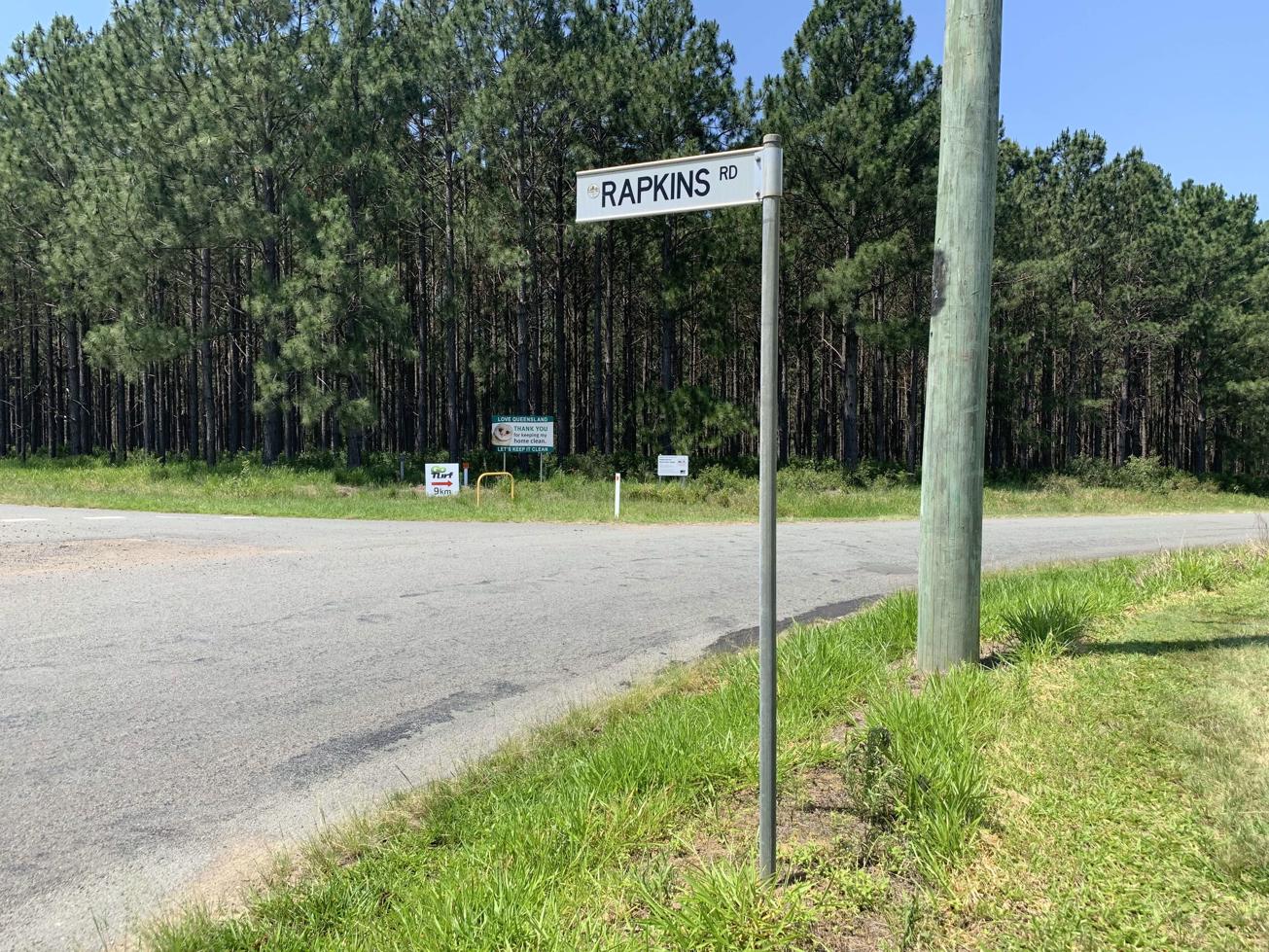
To the starting point: Travelling on the M1 look for the Johnston Road turn-off that is signed Wild Horse Mountain Summit Lookout exit and Exit 171. (This is also the McDonalds / Beefy’s Pies exit.)

It’s located approximately halfway between Caloundra and Caboolture.

At the turn-off head East on Johnston Road and then take the first road to your right to Wild Horse Mountain. It is well sign-posted. Follow this road to the end to the car park. Before you leave your car, make sure your vehicle is locked and any valuables are taken with you. Sadly, vehicles do get broken into here from time to time.

The end point: This is an up and back route. The end point is the same as your starting point.

glossary button
Glossary
  • Icon showing this activity is suitable for wheelchairsSuitable for wheelchairs
  • Icon showing this activity is suitable for walkingSuitable for walking
  • Icon showing this activity is suitable for recreational cyclingSuitable for recreational cycling
  • Icon showing this activity is suitable for mountain bikingSuitable for mountain biking
  • Icon showing this activity is suitable for horse ridingSuitable for horse riding
  • Icon showing this activity is suitable for kayakingSuitable for kayaking
  • Icon showing this activity has drinking water availableDrinking water available
  • Icon showing this activity does not have drinking water availableNo drinking water available
  • Icon showing this activity has a barbeque on siteBarbeque on site
  • Icon showing this activity has a picnic table on sitePicnic table on site
  • Icon showing this activity has toilets on siteToilets on site
  • Icon showing fires are permitted at this activityFires permitted
  • Icon showing fires are prohibited at this activityFires prohibited
  • Icon showing camping is permitted at this activityCamping permitted
  • Icon showing camping is prohibited at this activityCamping prohibited
  • Suitable for walking Suitable for walking black lines Suitable for walking
  • No drinking water available No drinking water available No drinking water available
  • Fires prohibited Fires prohibited Fires prohibited
  • Camping prohibited Camping prohibited Camping prohibited
Write a review

Review Date: 28/05/2019

Steep but so very worth it! Although one of the shorter walks, do not under estimate this beauty; you do need a certain level of fitness. The effort is so worth it at the top with spectacular views and the beautiful shade.

Reviewed By: Jessica

Review Date: 25/05/2019

Best sunset view of the Glasshouse Mountains. Steep but short little walk up a concrete road. On top is a really nice large covered viewing area. Well worth a quick detour on sunset

Reviewed By: Nathan

Review Date: 29/11/2018

This lookout offers some of the best views of the Glass House Mountains on the coast. A short walk up the steep paved path takes you to the fire watch tower - well worth it, especially at sunset.

Reviewed By: Christopher

Review Date: 29/11/2018

The description for this trail on the website is spot on. The climb is very steep, even though it's relatively short it still requires a degree of fitness - be prepared to carry young children. The view at the top of the Glass House Mountains is wonderful and the rotunda offers shade after the hike up.

Reviewed By: Kellie

hazard icon

IN AN EMERGENCY DIAL '000'.

Always Adventure Safely!

  • Always follow any local signage, it contains key information and conditions can change at any time.
  • Use the trails with consideration for your abilities, be prepared for the adventure ahead:
    • Be aware of the weather conditions, found here: http://www.bom.gov.au/qld/.
    • Always wear appropriate clothing, focus on good footwear.
    • Always bring more water than you think you will need.
    • Be Sun Safe!
    • Always let someone know where you are going that isn’t going with you.
  • Just getting started try this site for good useful information: https://www.trailhiking.com.au/hike-safety/
  • Sunshine Coast Council does it’s best to maintain current information but things can change so always be aware that a trail may not be as listed in this guide, and report and issues via our feedback link.

Nearby Trails

Trail Image for Rapkins Road Trail (West of M1)
Difficult

Rapkins Road Trail (West of M1)

Beerburrum
walking icon mountain biking icon horse riding icon
Trail type
difficulty icon
Skill Level

8.0km

Length
direction icon
Circuit
Trail Image for Ramms Road Trail (East of M1)
Difficult

Ramms Road Trail (East of M1)

Beerburrum
walking icon mountain biking icon horse riding icon
Trail type
difficulty icon
Skill Level

16.9km

Length
direction icon
Circuit
Trail Image for Beerwah State Forest: Bora Ring
Easy

Beerwah State Forest: Bora Ring

Glass House Mountains
walking icon
Trail type
difficulty icon
Skill Level

0.2km

Length
direction icon
Circuit
Trail Image for Glass House Mountains National Park: Soldier Settlers Loop
Intermediate

Glass House Mountains National Park: Soldier Settlers Loop

Beerburrum
walking icon mountain biking icon
Trail type
difficulty icon
Skill Level

8.5km

Length
direction icon
Circuit
Trail Image for Glass House Mountains National Park: Mathew Flinders Park to Jack Ferris Lookout
Easy

Glass House Mountains National Park: Mathew Flinders Park to Jack Ferris Lookout

Beerburrum
walking icon
Trail type
difficulty icon
Skill Level

4.4km

Length
direction icon
One-way

Share this trail

This action requires a login.
To continue, click on Login/Signup below.

Photo uploaded successfully, thank you.

Feedback / Suggest an Adventure

If you have any feedback on the site or any of the trails, please drop us a short email.

Have we missed something? Do you have an adventure to suggest? Fill in the suggestion form to let us know about it.