facebook
Image showing that the PDF download is in progress... PDF download in progress

Please wait...

Image showing a pink decorative paint splat
Image showing a green decorative paint splat
upload photo button
reviews buttonReviews view map buttonMap
view 3d map button3D Map
directions take me there buttonDirections
Save
PDF
Gpx File

Peregian Springs: The Avenue Park to Waterville Way Park

Peregian Springs: The Avenue Park to Waterville Way Park
Peregian Springs
walking icon walking icon black
Trail type
difficulty icon
Skill Level
1.4km
Length
direction icon direction icon black
Circuit

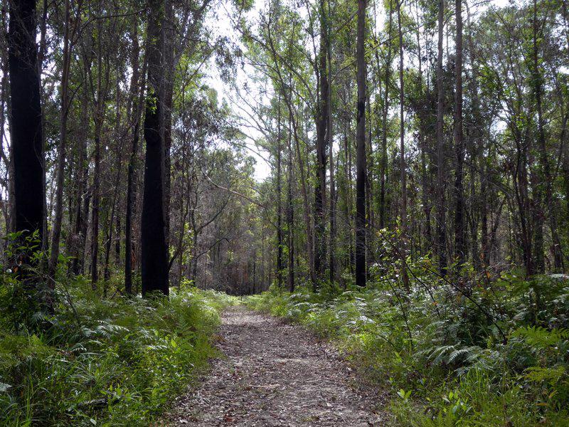
An easy walk amongst beautiful parklands along the fringe of Peregian Springs

SUITABILITY
This walk is suitable for families including prams.
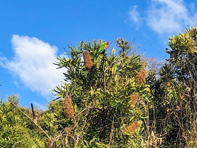
HIGHLIGHTS
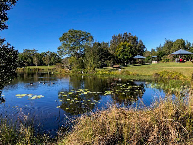
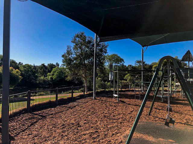
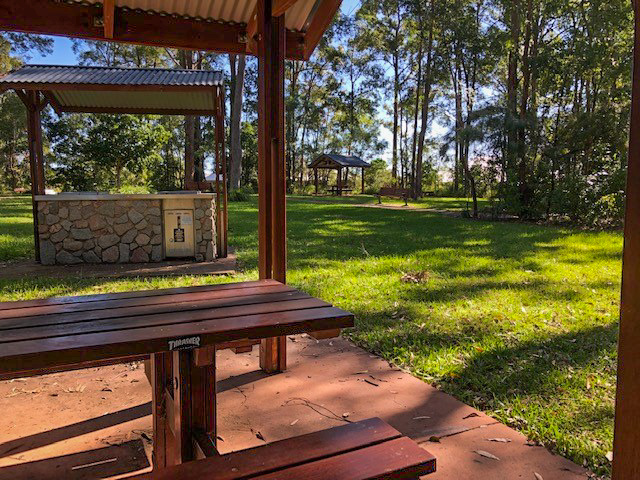
The Avenue Park is a perfect spot to begin this walk and features a range of amenities including toilets, BBQ facilities and drinking water. Pack a picnic and let the kids run around the open green spaces or test their skills on the updated playground equipment.
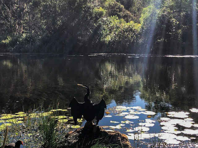
The park also features a range of beautiful birdlife amongst the water lily covered pond. Several bridges complete the path surrounding the duck pond.
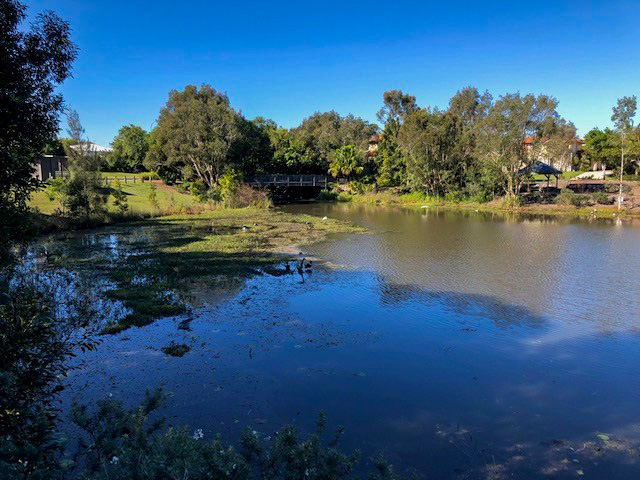
The walk takes you along the fringe of Peregian Springs, past another lake and the Waterville Way Park is the turning point. This quiet suburban green wedge includes picnic benches or plenty of green, shaded spaces to relax prior to the return leg.

AFTERWARDS
Peregian Springs Village is perfect to swing by for a post walk coffee or bite to eat at one of the many cafes or restaurants.

HOW TO GET THERE
To Start: When arriving via Emu Mountain Rd or Sunshine Coast Motorway, take the Peregian Springs Drv turnoff. Then turn left at The Avenue – the starting point is approximately 1km on your right.
To End: The end point is the same as the start point.

glossary button
Glossary
  • Icon showing this activity is suitable for wheelchairsSuitable for wheelchairs
  • Icon showing this activity is suitable for walkingSuitable for walking
  • Icon showing this activity is suitable for recreational cyclingSuitable for recreational cycling
  • Icon showing this activity is suitable for mountain bikingSuitable for mountain biking
  • Icon showing this activity is suitable for horse ridingSuitable for horse riding
  • Icon showing this activity is suitable for kayakingSuitable for kayaking
  • Icon showing this activity has drinking water availableDrinking water available
  • Icon showing this activity does not have drinking water availableNo drinking water available
  • Icon showing this activity has a barbeque on siteBarbeque on site
  • Icon showing this activity has a picnic table on sitePicnic table on site
  • Icon showing this activity has toilets on siteToilets on site
  • Icon showing fires are permitted at this activityFires permitted
  • Icon showing fires are prohibited at this activityFires prohibited
  • Icon showing camping is permitted at this activityCamping permitted
  • Icon showing camping is prohibited at this activityCamping prohibited
  • Suitable for walking Suitable for walking black lines Suitable for walking
  • Drinking water available Drinking water available Drinking water available
  • barbeque on site barbeque on site Barbeque on site
  • Picnic table on site Picnic table on site Picnic table on site
  • Fires prohibited Fires prohibited Fires prohibited
  • Camping prohibited Camping prohibited Camping prohibited
Write a review

Be the first to review this trail.

hazard icon

IN AN EMERGENCY DIAL '000'.

Always Adventure Safely!

  • Always follow any local signage, it contains key information and conditions can change at any time.
  • Use the trails with consideration for your abilities, be prepared for the adventure ahead:
    • Be aware of the weather conditions, found here: http://www.bom.gov.au/qld/.
    • Always wear appropriate clothing, focus on good footwear.
    • Always bring more water than you think you will need.
    • Be Sun Safe!
    • Always let someone know where you are going that isn’t going with you.
  • Just getting started try this site for good useful information: https://www.trailhiking.com.au/hike-safety/
  • Sunshine Coast Council does it’s best to maintain current information but things can change so always be aware that a trail may not be as listed in this guide, and report and issues via our feedback link.

Sunshine Coast Council

For any issues with this experience please contact:

Sunshine Coast Council via 07 5475 7272 or via e-mail: adventure@sunshinecoast.qld.gov.au

Nearby Trails

Trail Image for Road Cycle Route: Twin Waters Loop
Difficult

Road Cycle Route: Twin Waters Loop

Bli Bli
walking icon cycling icon
Trail type
difficulty icon
Skill Level

73.8km

Length
direction icon
Circuit
Trail Image for Doonan Creek: North Bushland Loop
Easy

Doonan Creek: North Bushland Loop

Peregian Springs
walking icon mountain biking icon
Trail type
difficulty icon
Skill Level

1.7km

Length
direction icon
Circuit
Trail Image for Peregian Breeze Park to Peregian Beach
null

Peregian Breeze Park to Peregian Beach

Peregian Beach
walking icon
Trail type
difficulty icon
Skill Level

2.8km

Length
direction icon
One-way
Trail Image for Noosa National Park: Emu Mountain
Difficult

Noosa National Park: Emu Mountain

Coolum Beach
walking icon
Trail type
difficulty icon
Skill Level

1.4km

Length
direction icon
One-way
Trail Image for Peregian Beach: National Park Fringe Walk
Easy

Peregian Beach: National Park Fringe Walk

walking icon
Trail type
difficulty icon
Skill Level

3.5km

Length
direction icon
Circuit

Share this trail

This action requires a login.
To continue, click on Login/Signup below.

Photo uploaded successfully, thank you.

Feedback / Suggest an Adventure

If you have any feedback on the site or any of the trails, please drop us a short email.

Have we missed something? Do you have an adventure to suggest? Fill in the suggestion form to let us know about it.