facebook
Image showing that the PDF download is in progress... PDF download in progress

Please wait...

Image showing a pink decorative paint splat
Image showing a green decorative paint splat
upload photo button
reviews buttonReviews view map buttonMap
view 3d map button3D Map
directions take me there buttonDirections
Save
PDF
Gpx File

Maroochy Waters Canal to Chambers Island Paddle

Maroochy Waters Canal to Chambers Island Paddle
Maroochydore
canoe icon canoe icon black
Trail type
difficulty icon
Skill Level
2.7km
One-way Length
direction icon direction icon black
One-way

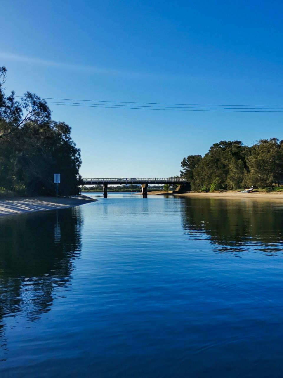
A 2km watery journey through the canals of Maroochy Waters to the shores of Picnic Point and Chambers Island.

SUITABILITY
Due to the protected waters of the canal, this short paddle is suitable for beginner paddlers in kayaks or on paddle boards. Depending on energy levels, the paddle is either straight out along the main canal or can be lengthened by detouring into the canal tributaries.

HIGHLIGHTS
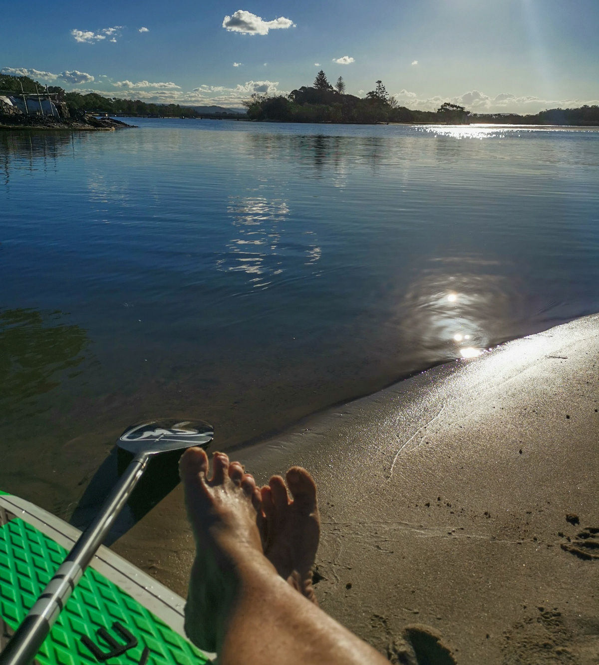
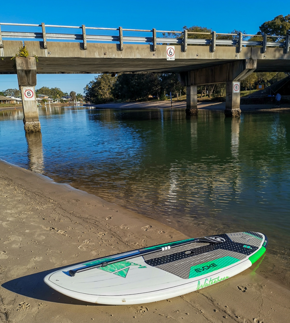
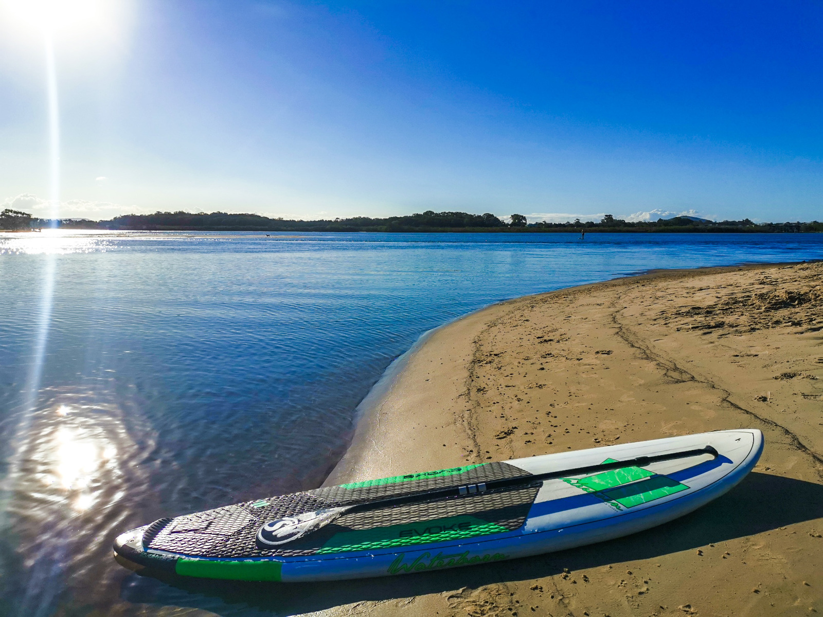
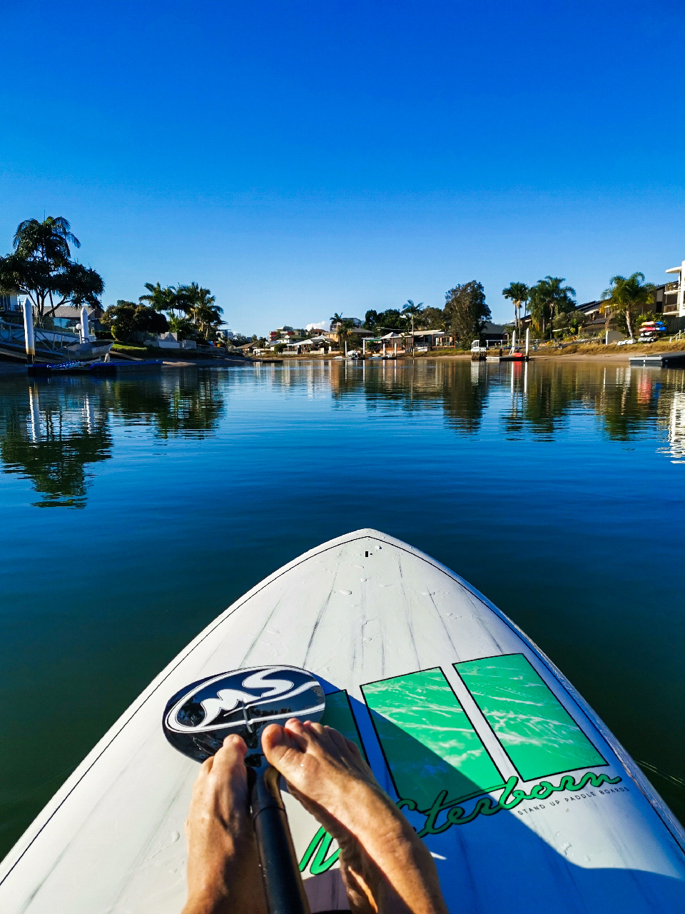
This relaxing paddle can be enjoyed without the effects of strong currents and winds encountered outside the canals. You’ll also be impressed by the stunning canal homes that line the waterfront as you head out towards Chambers Island.
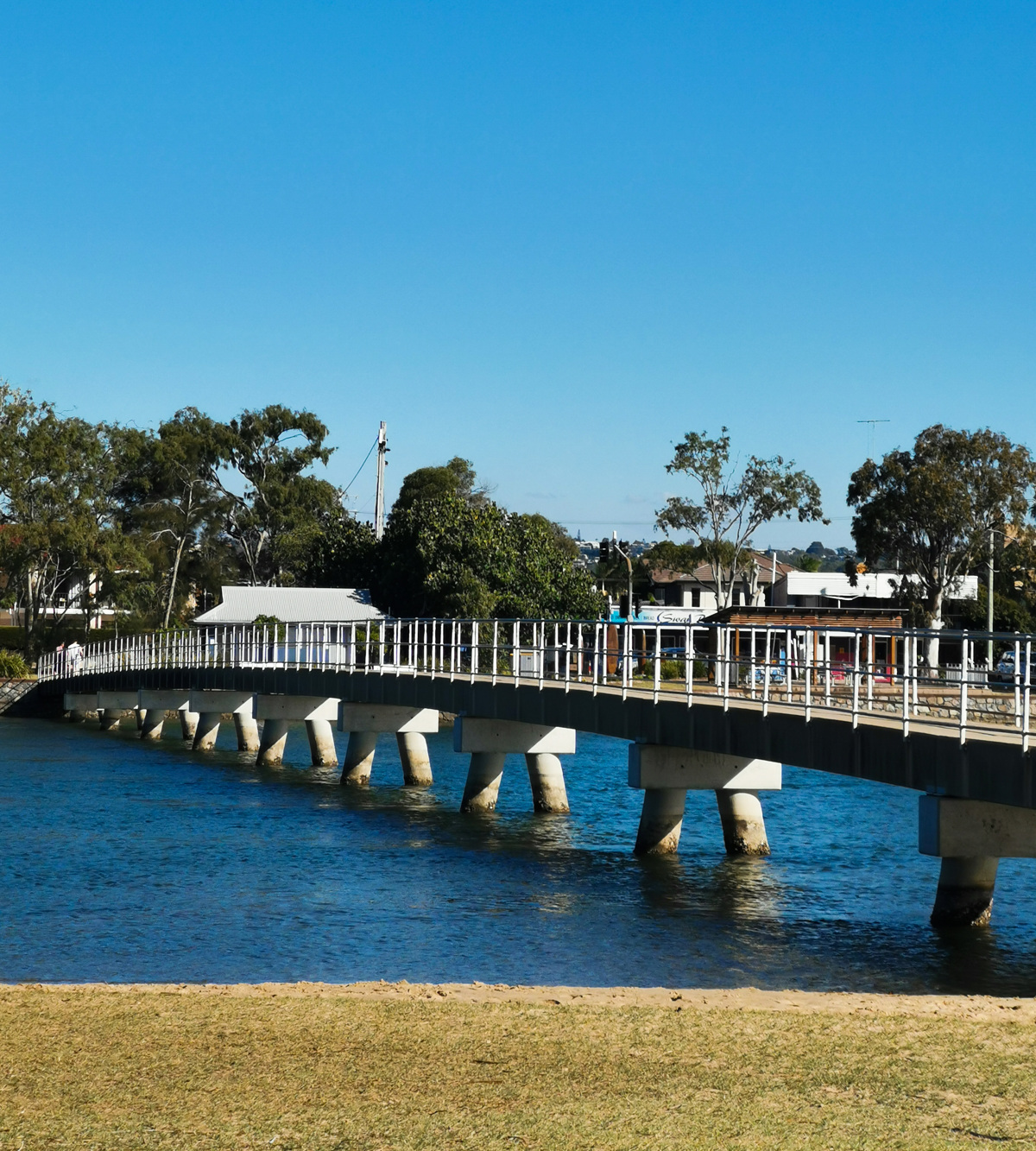
There’s opportunities to take smaller side canals and pull up onto small grassy parks but the best spots for a break are along the shores of the canal either side of the bridge on Bradman Avenue. This section is also great for a cooling swim.

AFTERWARDS
If you are feeling like a longer paddle then scoot around Chambers Island or head either west into the inland section of the Maroochy River or east towards Picnic Point and Cotton Tree. This more exposed section of the river is best navigated with the tides.

HOW TO GET THERE
To the starting point: Park at the jetty on Maroochy Waters Drive to unload. This area has plenty of parking and is not as busy as Picnic Point.

To the end point: The end point is the same as the starting point.

glossary button
Glossary
  • Icon showing this activity is suitable for wheelchairsSuitable for wheelchairs
  • Icon showing this activity is suitable for walkingSuitable for walking
  • Icon showing this activity is suitable for recreational cyclingSuitable for recreational cycling
  • Icon showing this activity is suitable for mountain bikingSuitable for mountain biking
  • Icon showing this activity is suitable for horse ridingSuitable for horse riding
  • Icon showing this activity is suitable for kayakingSuitable for kayaking
  • Icon showing this activity has drinking water availableDrinking water available
  • Icon showing this activity does not have drinking water availableNo drinking water available
  • Icon showing this activity has a barbeque on siteBarbeque on site
  • Icon showing this activity has a picnic table on sitePicnic table on site
  • Icon showing this activity has toilets on siteToilets on site
  • Icon showing fires are permitted at this activityFires permitted
  • Icon showing fires are prohibited at this activityFires prohibited
  • Icon showing camping is permitted at this activityCamping permitted
  • Icon showing camping is prohibited at this activityCamping prohibited
  • suitable for kayaking suitable for kayaking Suitable for kayaking
  • Drinking water available Drinking water available Drinking water available
  • toilets on site toilets on site Toilets on site
  • Fires prohibited Fires prohibited Fires prohibited
  • Camping prohibited Camping prohibited Camping prohibited
Write a review

Be the first to review this trail.

hazard icon

IN AN EMERGENCY DIAL '000'.

Always Adventure Safely!

  • Always follow any local signage, it contains key information and conditions can change at any time.
  • Use the trails with consideration for your abilities, be prepared for the adventure ahead:
    • Be aware of the weather conditions, found here: http://www.bom.gov.au/qld/.
    • Always wear appropriate clothing, focus on good footwear.
    • Always bring more water than you think you will need.
    • Be Sun Safe!
    • Always let someone know where you are going that isn’t going with you.
  • Just getting started try this site for good useful information: https://www.trailhiking.com.au/hike-safety/
  • Sunshine Coast Council does it’s best to maintain current information but things can change so always be aware that a trail may not be as listed in this guide, and report and issues via our feedback link.

Sunshine Coast Council

For any issues with this experience please contact:

Sunshine Coast Council via 07 5475 7272 or via e-mail: adventure@sunshinecoast.qld.gov.au

Nearby Trails

Trail Image for Chambers Island Explore
Easy

Chambers Island Explore

Maroochydore
canoeing icon
Trail type
difficulty icon
Skill Level

1.3km

Length
direction icon
Circuit
Trail Image for Road Cycle Route: SCC Big Loop
Difficult

Road Cycle Route: SCC Big Loop

Alexandra Headland
walking icon cycling icon
Trail type
difficulty icon
Skill Level

180.6km

Length
direction icon
Circuit
Trail Image for Road Cycle Route: Mooloolaba to Coolum
Difficult

Road Cycle Route: Mooloolaba to Coolum

Alexandra Headland
walking icon cycling icon
Trail type
difficulty icon
Skill Level

51.6km

Length
direction icon
One-way
Trail Image for Road Cycle Route: Maroochydore Flat Road Loop
Difficult

Road Cycle Route: Maroochydore Flat Road Loop

Alexandra Headland
walking icon cycling icon
Trail type
difficulty icon
Skill Level

38.9km

Length
direction icon
Circuit
Trail Image for Road Cycle Route: Mooloolaba to Mudjimba
Difficult

Road Cycle Route: Mooloolaba to Mudjimba

Alexandra Headland
walking icon cycling icon
Trail type
difficulty icon
Skill Level

31.4km

Length
direction icon
One-way

Share this trail

This action requires a login.
To continue, click on Login/Signup below.

Photo uploaded successfully, thank you.

Feedback / Suggest an Adventure

If you have any feedback on the site or any of the trails, please drop us a short email.

Have we missed something? Do you have an adventure to suggest? Fill in the suggestion form to let us know about it.