facebook
Image showing that the PDF download is in progress... PDF download in progress

Please wait...

Image showing a pink decorative paint splat
Image showing a green decorative paint splat
upload photo button
reviews buttonReviews view map buttonMap
view 3d map button3D Map
directions take me there buttonDirections
Save
PDF
Gpx File

Ben Bennett Bushland Park

Ben Bennett Bushland Park
Caloundra
walking icon walking icon black
Trail type
difficulty icon
Skill Level
1.5km
Length
direction icon direction icon black
Circuit

Enjoy pathways and vegetation variety through this 21 hectare bush reserve in central Caloundra.

SUITABILITY
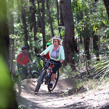
Suitable for walkers out to see a range of native bush types in a small area.

HIGHLIGHTS
This hidden gem is so close to town yet feels like a natural bushland track. Perfect for those who like to leave the car at home as it's a five to ten minute walk from many Caloundra residents.

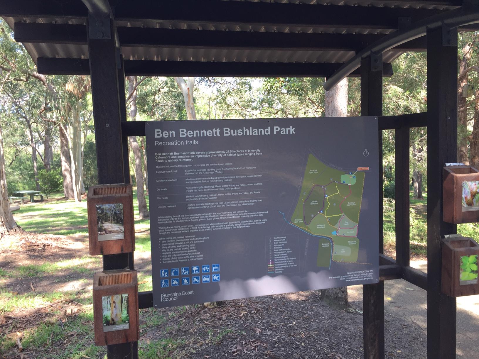
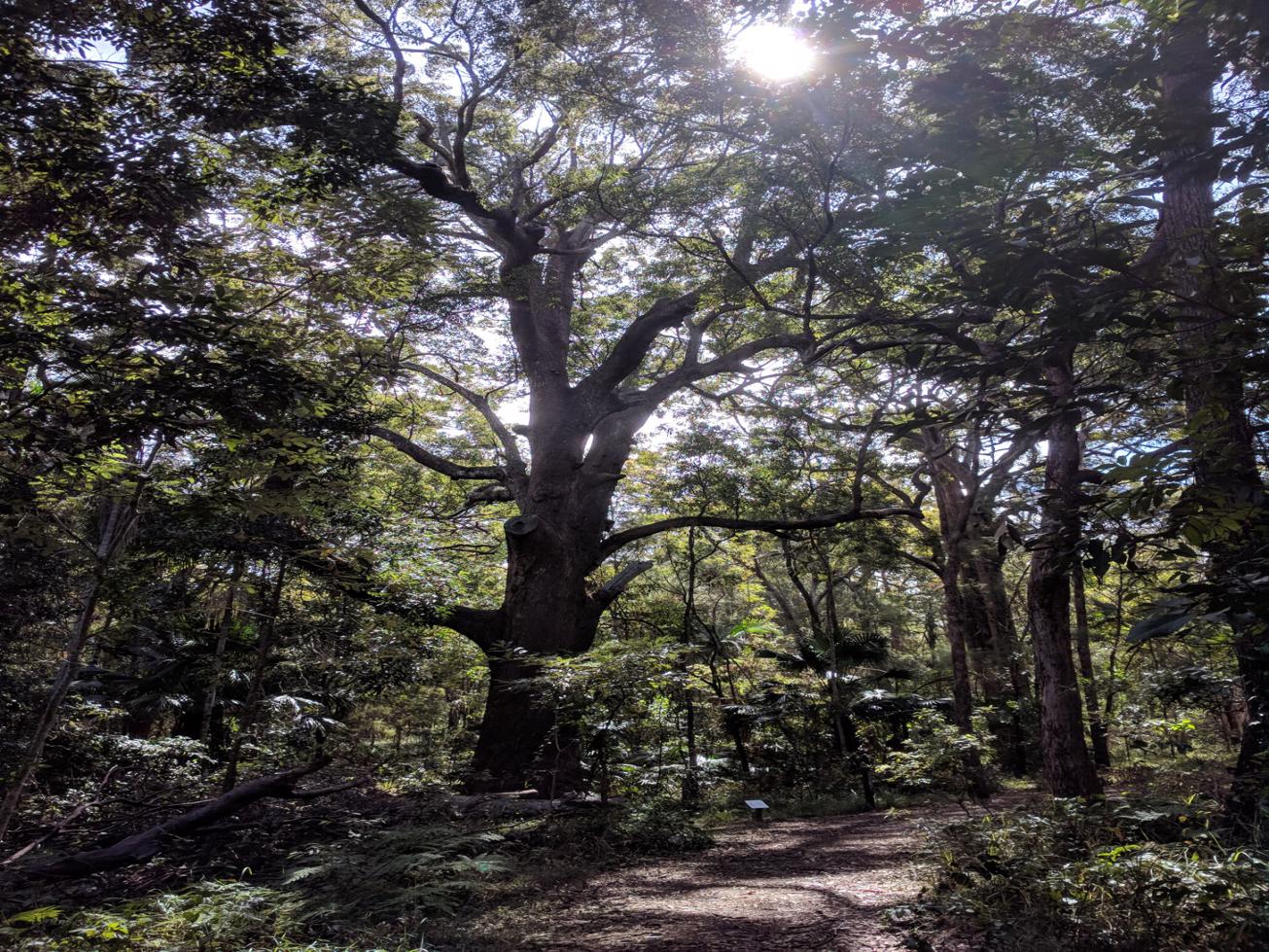
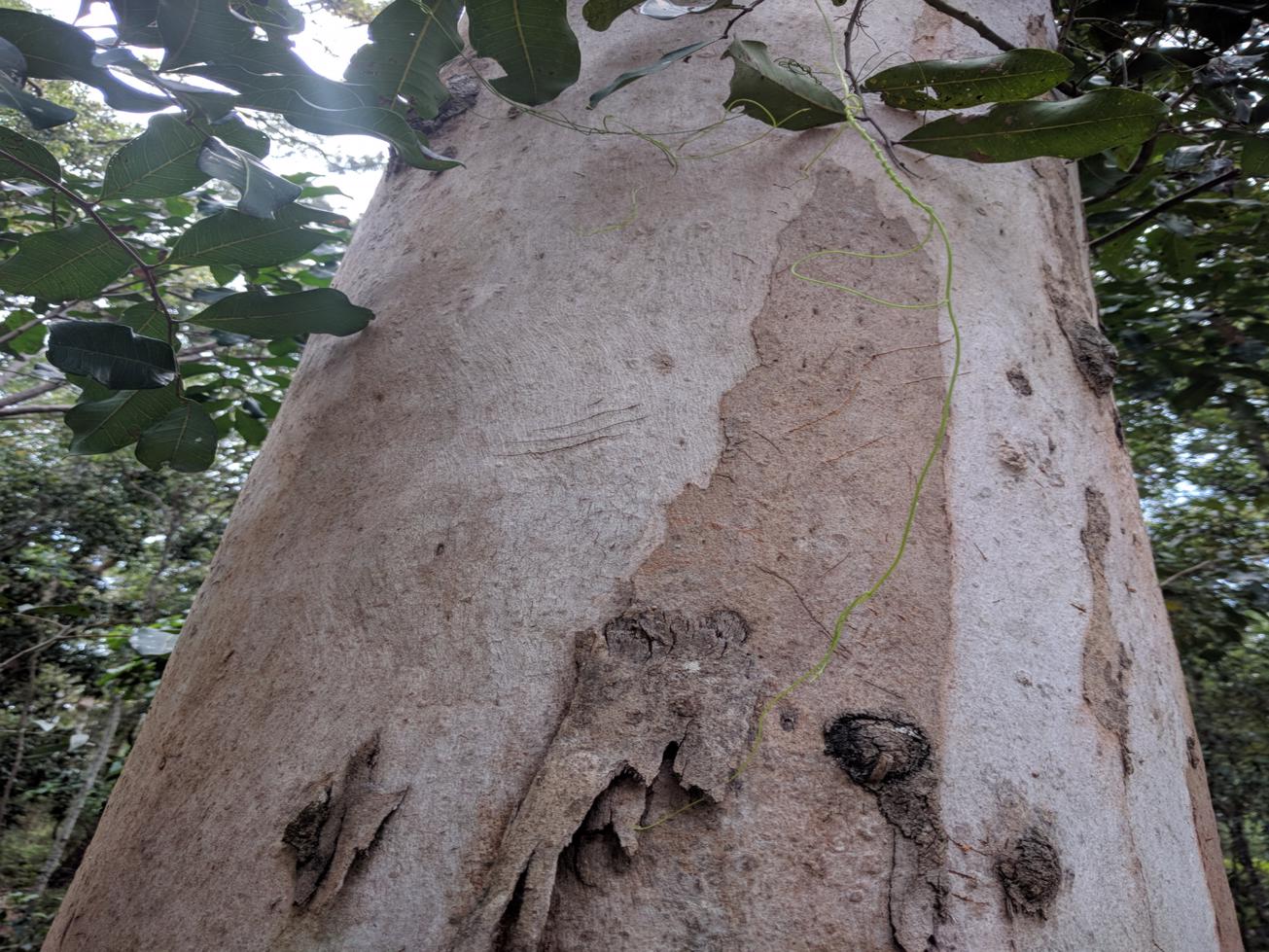
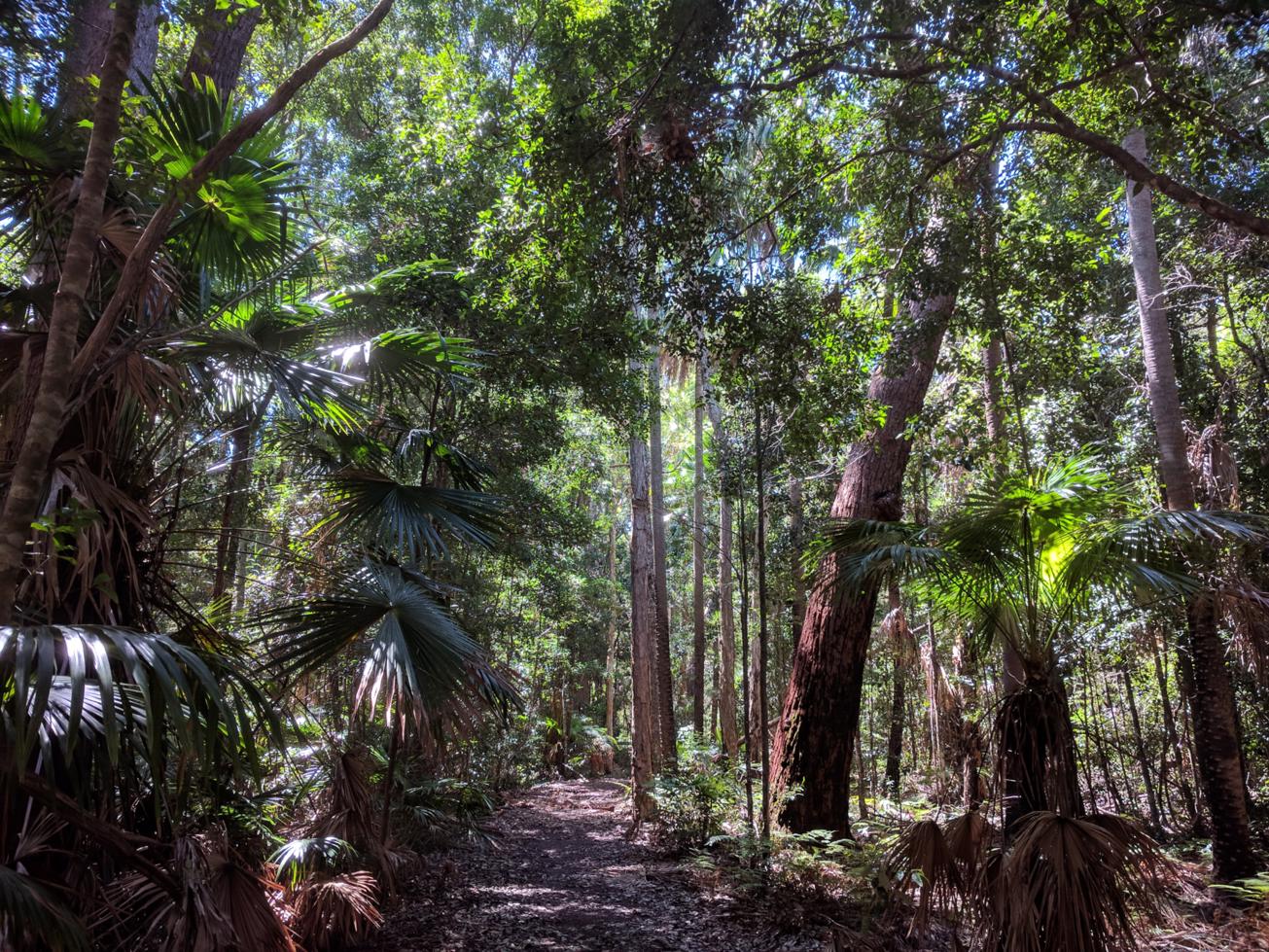
There are about a dozen interesting trails through the park ranging from 800m to 1100m return. (See maps at the Queen St entrance.) Start with the perimeter loop through several different vegetation zones. The Middle third is a rich rainforest. Other flora you'll encounter include: eucalyptus Melaleuca woodland, paperbarks, dry and wet heath, giant Tallowwood and Bribie Island Pines.

The park is a great place for bird watching and because of the botanical species in the park, it’s part of the Sunshine Coast Wildflower Festival held each August.

Note: During summer some of the lower tracks may be underwater.

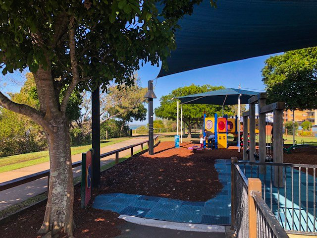
All in all, this is a very family friendly and central piece of peacefulness with toilets, electric BBQ, tables and huts, medium grassed area and bitumen parking.

AFTERWARDS
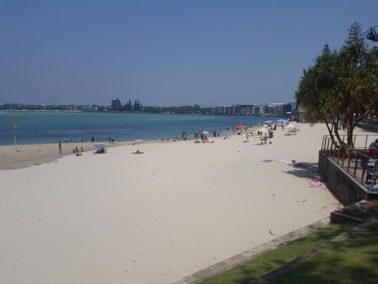
Head to Kings Beach for a swim or the The Esplanade at Caloundra for refreshments – both locations are close by and part of the Sunshine Coast Coastal Pathway, which you can walk or cycle.

HOW TO GET THERE
To the starting point: Ben Bennett Bushland Park (Also referred to as Botanical Park) is located just east of Nicklin Way. (But not accessible form Nicklin Way.) You need to access it from Queen Street. On the left hand side as you are going up the hill, just past Caloundra High School there is a sign for Ben Bennett Bushland Park. There you will see bitumen parking spaces and an information board.

To the end point: The end point is the same as your starting point. You can go in and back or do a larger circuit going via suburban roads and streets, coming out on Arthur Street or West Terrace.

glossary button
Glossary
  • Icon showing this activity is suitable for wheelchairsSuitable for wheelchairs
  • Icon showing this activity is suitable for walkingSuitable for walking
  • Icon showing this activity is suitable for recreational cyclingSuitable for recreational cycling
  • Icon showing this activity is suitable for mountain bikingSuitable for mountain biking
  • Icon showing this activity is suitable for horse ridingSuitable for horse riding
  • Icon showing this activity is suitable for kayakingSuitable for kayaking
  • Icon showing this activity has drinking water availableDrinking water available
  • Icon showing this activity does not have drinking water availableNo drinking water available
  • Icon showing this activity has a barbeque on siteBarbeque on site
  • Icon showing this activity has a picnic table on sitePicnic table on site
  • Icon showing this activity has toilets on siteToilets on site
  • Icon showing fires are permitted at this activityFires permitted
  • Icon showing fires are prohibited at this activityFires prohibited
  • Icon showing camping is permitted at this activityCamping permitted
  • Icon showing camping is prohibited at this activityCamping prohibited
  • Suitable for walking Suitable for walking black lines Suitable for walking
  • No drinking water available No drinking water available No drinking water available
  • Fires prohibited Fires prohibited Fires prohibited
  • Camping prohibited Camping prohibited Camping prohibited
Write a review

Review Date: 30/11/2018

So much to see in this beautiful reserve - heaps of birdlife, almost guaranteed to see lace monitors and if you are walking through in late autumn/early winter you can hear wallum froglets calling in the wetland. Easy walking and a great way to get some exercise and reconnect with nature.

Reviewed By: Julie

Review Date: 28/11/2018

Great, easy walk. The wide trails were perfect for walking my dog. Make sure you pick-up a brochure at the trail head to learn more about the species in the park.

Reviewed By: Wendy

Review Date: 14/11/2018

Tranquil and rewarding tracks so close to the Caloundra CBD with bench seats to sit, close your eyes and zone out for a moment or two. There is an abundance of birdlife and butterflies, evidence of koalas, (tree scratchings) and goannas patrolling their territory. Undoubtably, the star of the show is the Giant Tallowwood that somehow survived the logging period and sets an imposing figure despite the imperfect posture. Maybe this posture was the reason this tree survived. I am lucky enough to work within walking distance of Ben Bennett Park. What a bonus to be able to have this gem to reinvigorate me several times a week. The trees regularly solve problems for me without me even asking them. Defo’ worth a visit.

Reviewed By: John

hazard icon

IN AN EMERGENCY DIAL '000'.

Always Adventure Safely!

  • Always follow any local signage, it contains key information and conditions can change at any time.
  • Use the trails with consideration for your abilities, be prepared for the adventure ahead:
    • Be aware of the weather conditions, found here: http://www.bom.gov.au/qld/.
    • Always wear appropriate clothing, focus on good footwear.
    • Always bring more water than you think you will need.
    • Be Sun Safe!
    • Always let someone know where you are going that isn’t going with you.
  • Just getting started try this site for good useful information: https://www.trailhiking.com.au/hike-safety/
  • Sunshine Coast Council does it’s best to maintain current information but things can change so always be aware that a trail may not be as listed in this guide, and report and issues via our feedback link.

Sunshine Coast Council

For any issues with this experience please contact:

Sunshine Coast Council via 07 5475 7272 or via e-mail: adventure@sunshinecoast.qld.gov.au

Nearby Trails

Trail Image for Sugar Bag Mountain Bike Trails: Beginners Loop
Easy

Sugar Bag Mountain Bike Trails: Beginners Loop

Caloundra West
mountain biking icon
Trail type
difficulty icon
Skill Level

6.4km

Length
direction icon
Circuit
Trail Image for Sugar Bag Mountain Bike Trails: Pump Track
Intermediate

Sugar Bag Mountain Bike Trails: Pump Track

walking icon cycling icon mountain biking icon
Trail type
difficulty icon
Skill Level

0.2km

Length
direction icon
Circuit
Trail Image for Coastal Pathway: Bulcock Beach to Kings Beach
Easy

Coastal Pathway: Bulcock Beach to Kings Beach

Caloundra
walking icon cycling icon
Trail type
difficulty icon
Skill Level

1.8km

Length
direction icon
One-way
Trail Image for Coastal Pathway: Golden Beach Esplanade
Easy

Coastal Pathway: Golden Beach Esplanade

Golden Beach
walking icon cycling icon
Trail type
difficulty icon
Skill Level

5.1km

Length
direction icon
Circuit
Trail Image for Road Cycle Route: Pt. Cartwright to Moffat Beach
Difficult

Road Cycle Route: Pt. Cartwright to Moffat Beach

Aroona
walking icon cycling icon
Trail type
difficulty icon
Skill Level

30.6km

Length
direction icon
One-way

Share this trail

This action requires a login.
To continue, click on Login/Signup below.

Photo uploaded successfully, thank you.

Feedback / Suggest an Adventure

If you have any feedback on the site or any of the trails, please drop us a short email.

Have we missed something? Do you have an adventure to suggest? Fill in the suggestion form to let us know about it.