facebook
Image showing that the PDF download is in progress... PDF download in progress

Please wait...

Image showing a pink decorative paint splat
Image showing a green decorative paint splat
upload photo button
reviews buttonReviews view map buttonMap
view 3d map button3D Map
directions take me there buttonDirections
Save
PDF
Gpx File

Buderim Forest Park: River Walk

Buderim Forest Park: River Walk
Buderim
walking icon walking icon black
Trail type
difficulty icon
Skill Level
0.8km
One-way Length
direction icon direction icon black
One-way

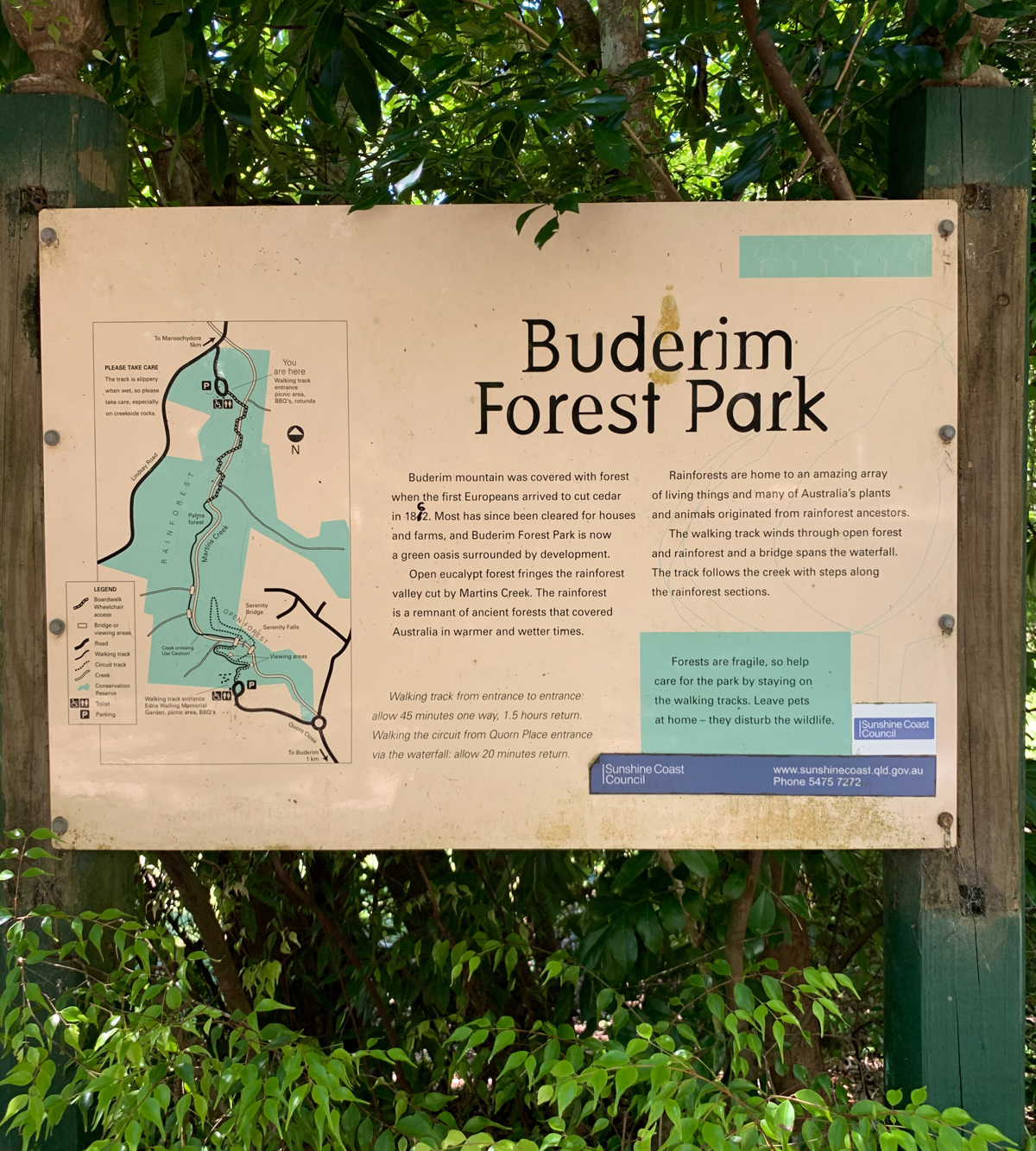
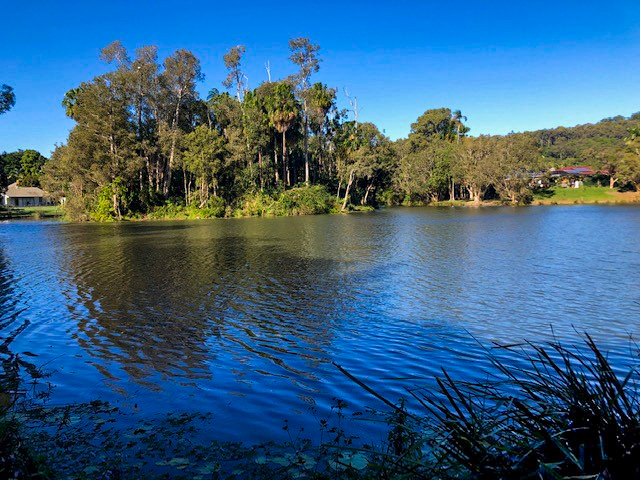
A delightful walk through dense and cool rainforest in the lower section of this 45 hectare reserve on the northern side of Buderim.

SUITABILITY
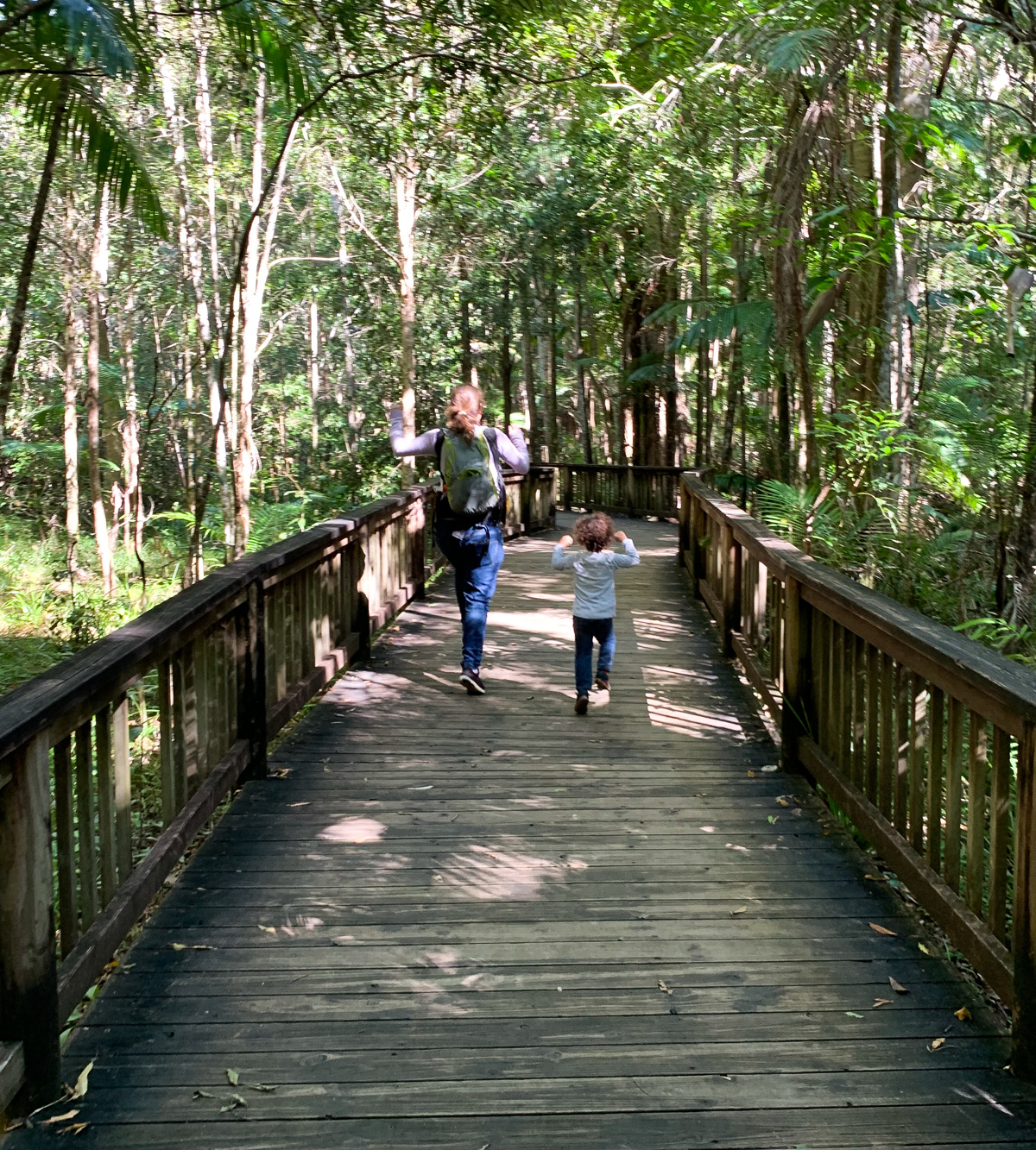
Suitable for all ages. Prams and wheelchair accessible.
HIGHLIGHTS
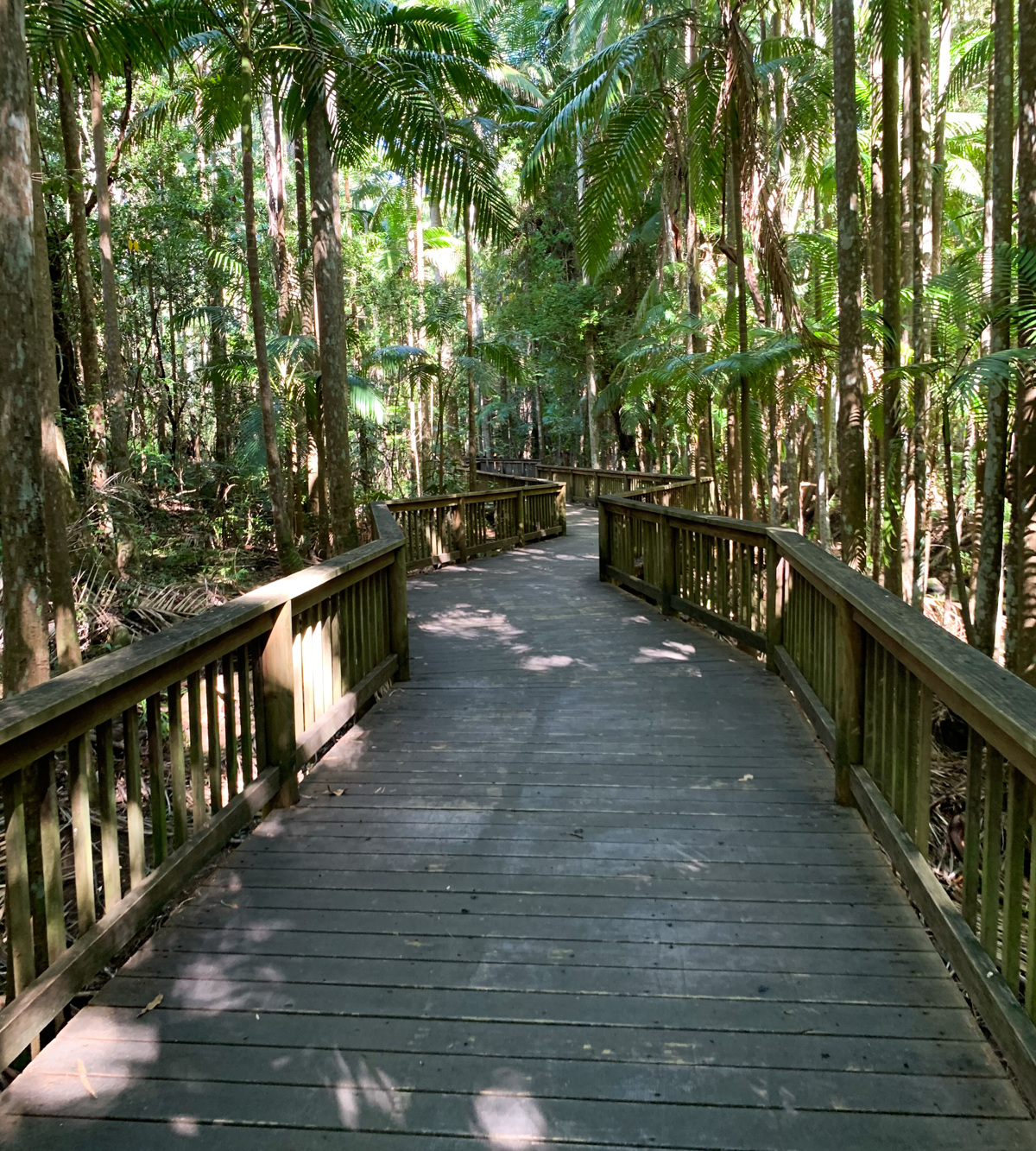
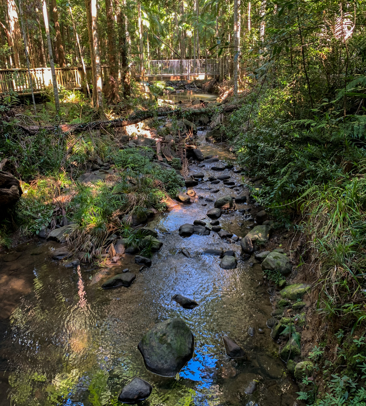
This is an accessible option for the whole family to enjoy. The boardwalk takes you on a journey through the shaded forest, criss-crossing Martins Creek at several spots. The ambience of the dense rainforest and trickling sound of water instantly calms the mind.
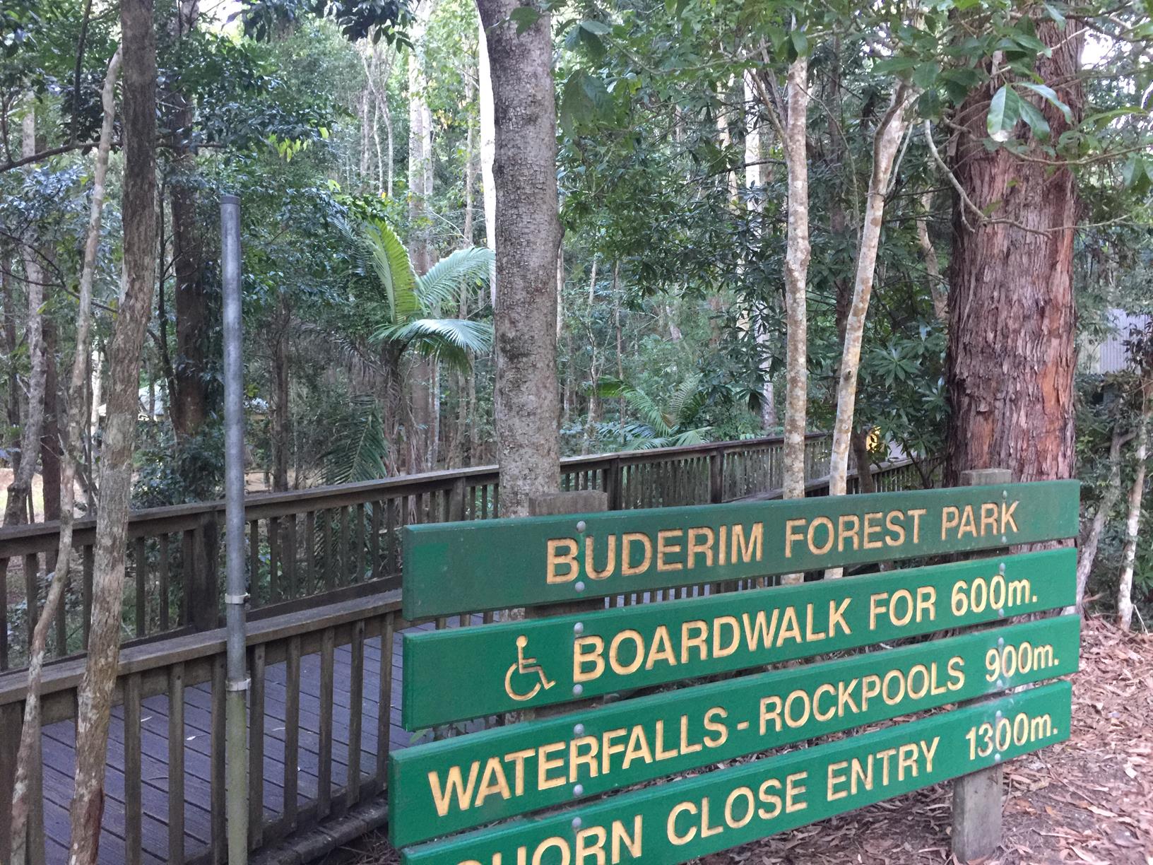
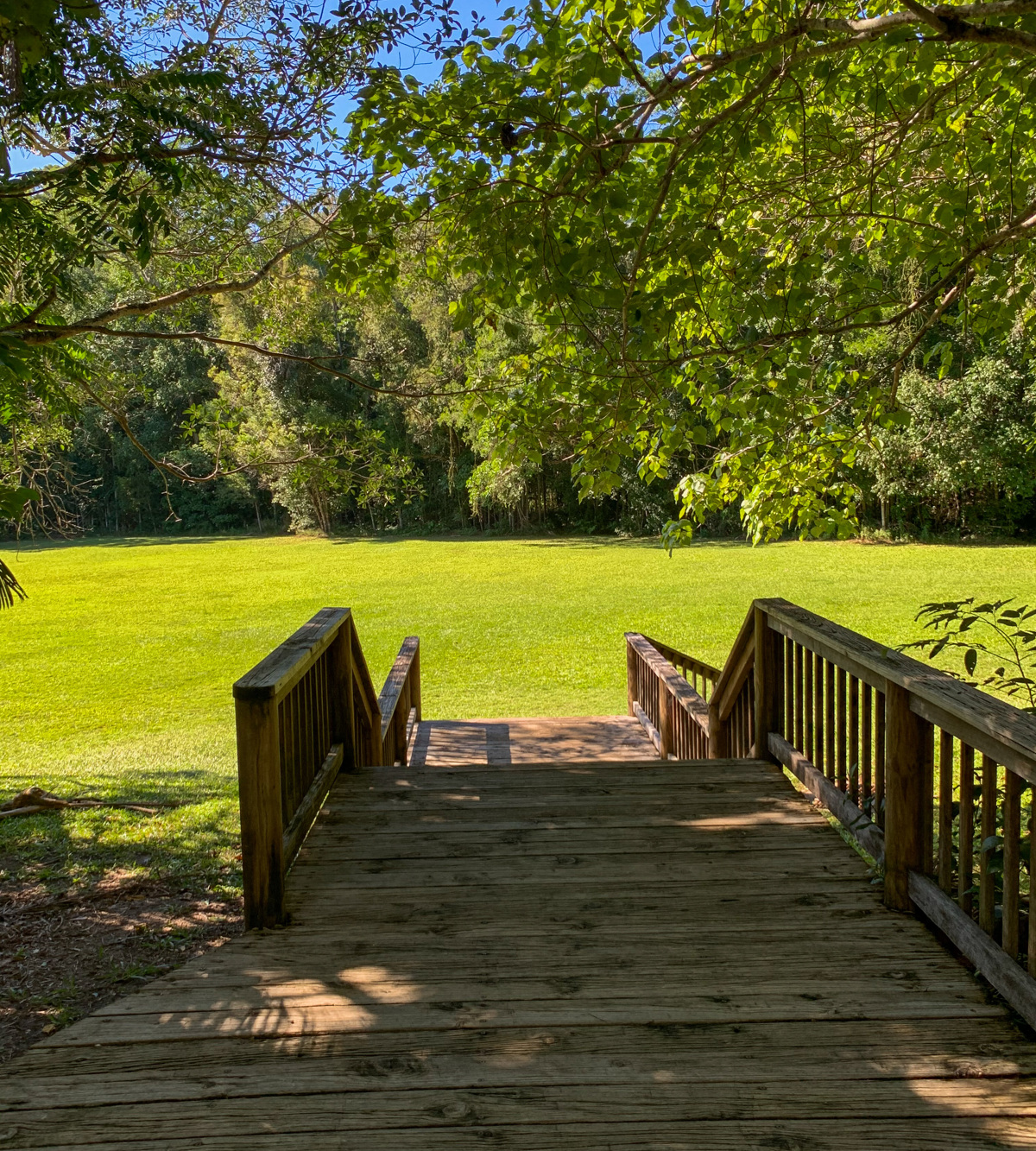
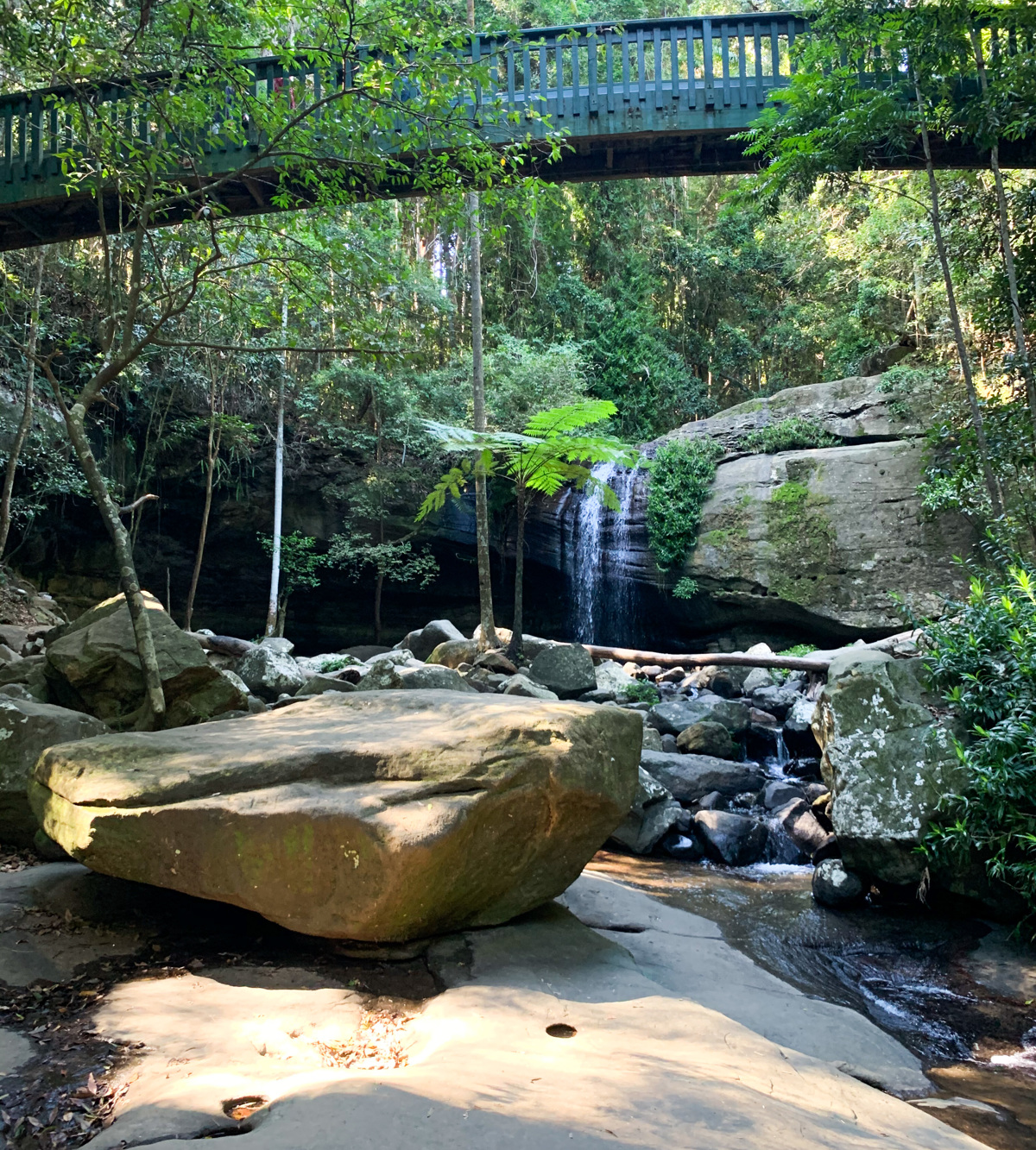
When the boardwalk ends you can join a rough trail that takes you up to Serenity Bridge and Buderim Falls. From here you can retrace your steps or add on the hillier Forest Loop circuit before returning to the Harry’s Road end, where there is a large lawn area to lounge, run or play on.
Enjoy this lush rainforest of ferns, trees, vines. Take a deep breath and listen to the tinkling creek and the birds singing.


AFTERWARDS
For the more energetic, the track links into Buderim Forest Falls, which is a lovely natural experience.
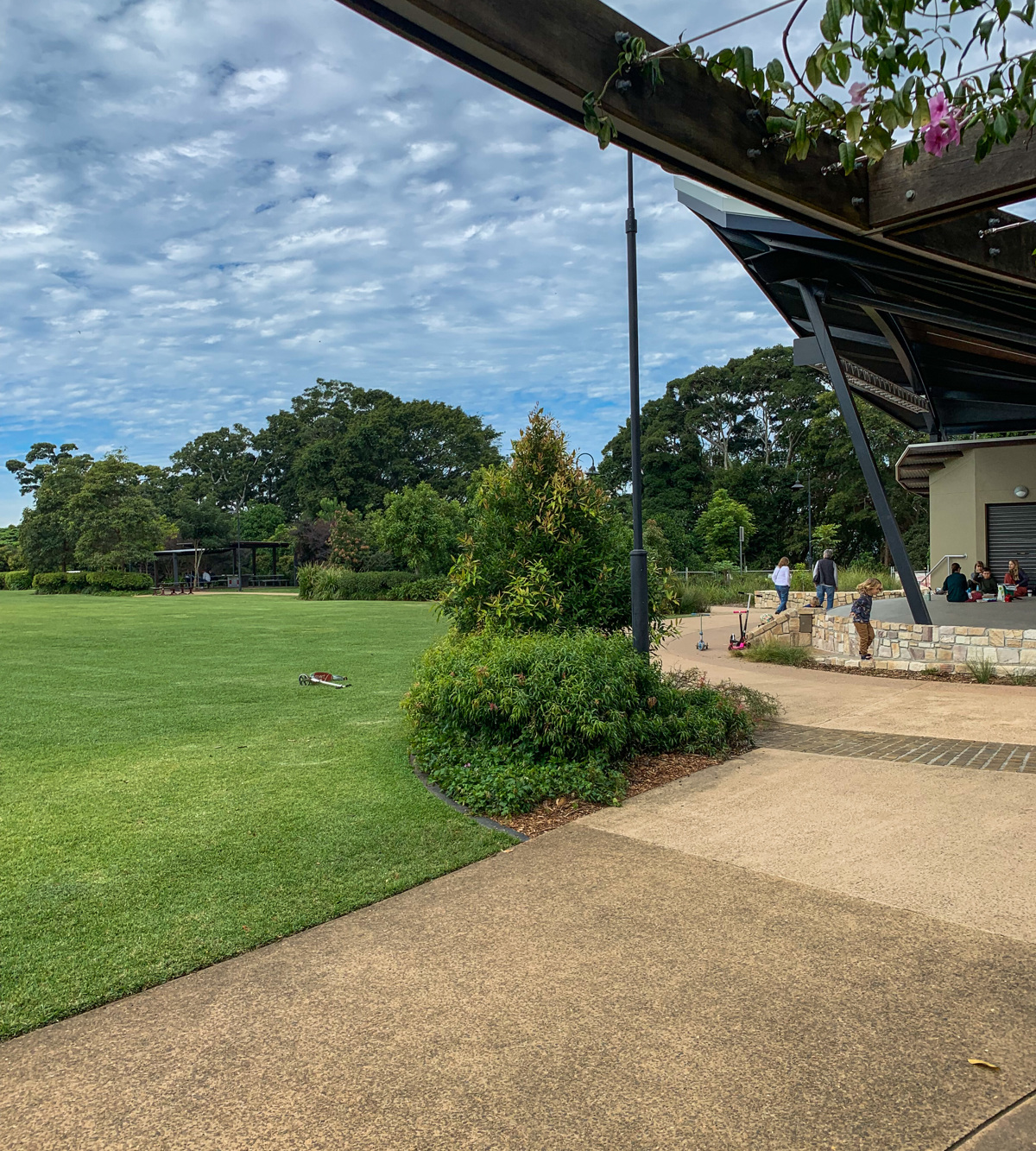
There are picnic grounds, BBQ facilities and tables available at both ends of the walk. From the top end, Buderim township is less than 1 km away with an array of cafes. At the bottom end is Harry’s Restaurant and there are shops just out on Jones Road.

HOW TO GET THERE
To the starting point: Make your way to Buderim as the walk is close by and only 5 kms from Maroochydore. There are two entry points to this reserve, both off Lindsay Road. The lower entry (to the River Walk) is via Harry’s Lane off Lindsay Road (off the lower end of Jones Road).
The upper entry point is via Quorn Close, which runs off Lindsay Road at the top of Buderim. It is closest to the waterfalls and takes you on the Forest Loop walk which intercepts the River Walk at Serenity Bridge.
To the end point: The end point is the same as your starting point. From the lower entry you can go in and back or make a circuit of it by going uphill and doing the Forest Loop.
From the top end you can just do the forest loop or go down and back to the other entrance. Alternatively, if you do a car drop off you can walk one way and do a shuttle round at the end.

glossary button
Glossary
  • Icon showing this activity is suitable for wheelchairsSuitable for wheelchairs
  • Icon showing this activity is suitable for walkingSuitable for walking
  • Icon showing this activity is suitable for recreational cyclingSuitable for recreational cycling
  • Icon showing this activity is suitable for mountain bikingSuitable for mountain biking
  • Icon showing this activity is suitable for horse ridingSuitable for horse riding
  • Icon showing this activity is suitable for kayakingSuitable for kayaking
  • Icon showing this activity has drinking water availableDrinking water available
  • Icon showing this activity does not have drinking water availableNo drinking water available
  • Icon showing this activity has a barbeque on siteBarbeque on site
  • Icon showing this activity has a picnic table on sitePicnic table on site
  • Icon showing this activity has toilets on siteToilets on site
  • Icon showing fires are permitted at this activityFires permitted
  • Icon showing fires are prohibited at this activityFires prohibited
  • Icon showing camping is permitted at this activityCamping permitted
  • Icon showing camping is prohibited at this activityCamping prohibited
  • Suitable for walking Suitable for walking black lines Suitable for walking
  • No drinking water available No drinking water available No drinking water available
  • barbeque on site barbeque on site Barbeque on site
  • Picnic table on site Picnic table on site Picnic table on site
  • toilets on site toilets on site Toilets on site
  • Fires prohibited Fires prohibited Fires prohibited
  • Camping prohibited Camping prohibited Camping prohibited
Write a review

Review Date: 01/05/2019

Nice easy boardwalk stroll through the trees along side the creek. informative signs and easy parking with oval to kick the ball and toilet facilities. It continues into a dirt trail up to the waterhole and waterfall and into Buderim if you follow it all the way. The kids will love this one too

Reviewed By: Cat

Review Date: 03/12/2018

A beautiful walk and, as a Buderim local, it is close and has easy access for me to get some time in nature. The boardwalk, set alongside the running creek is delightful, and the surrounding vegetation provides excellent shade and interesting rainforest. Of course the waterhole is the jewel!

Reviewed By: Martina

Review Date: 30/11/2018

Great track with great paths and infrastructure. Beautiful lush green bush, nice to escape the summer heat with a waterfall swim. Just remember to bring insect repellent!

Reviewed By: Marcia

Review Date: 26/11/2018

This is one of my favourite walks. It is a beautiful nature walk mostly long a boardwalk and then on to a little dirt track that takes you to the rock pools and waterfalls - a perfect way to cool off at the end.

Reviewed By: Carissa

Review Date: 26/11/2018

From the Harry's Ln car park the boardwalk offers a relaxed and immersive bush-rainforest experience suitable for all ages and abilities. A little sanctuary for native plants and animals not far from the centre of Buderim.

Reviewed By: Krstyna

Review Date: 26/11/2018

A really beautiful walk for everyone - the boardwalk is nice and wide, and criss-crosses back and forth over a rocky stream. The birdlife is abundant under the green tropical canopy. Once you get to the end of the boardwalk you can chose to continue 10mins to the waterfalls on a broken track.

Reviewed By: Bronwyn

Review Date: 20/11/2018

A walk with public toilets is always handy. This is a great spot to escape the heat in summer.

Reviewed By: Hetti

Review Date: 01/11/2018

Its a nice relaxing walk along a creek bed. Great for prams etc as it's a wide wood boardwalk with rails. As with all these areas, when it gets dark and wet...watch out for mozzies.

Reviewed By: Paul

hazard icon

IN AN EMERGENCY DIAL '000'.

Always Adventure Safely!

  • Always follow any local signage, it contains key information and conditions can change at any time.
  • Use the trails with consideration for your abilities, be prepared for the adventure ahead:
    • Be aware of the weather conditions, found here: http://www.bom.gov.au/qld/.
    • Always wear appropriate clothing, focus on good footwear.
    • Always bring more water than you think you will need.
    • Be Sun Safe!
    • Always let someone know where you are going that isn’t going with you.
  • Just getting started try this site for good useful information: https://www.trailhiking.com.au/hike-safety/
  • Sunshine Coast Council does it’s best to maintain current information but things can change so always be aware that a trail may not be as listed in this guide, and report and issues via our feedback link.

Sunshine Coast Council

For any issues with this experience please contact:

Sunshine Coast Council via 07 5475 7272 or via e-mail: adventure@sunshinecoast.qld.gov.au

Nearby Trails

Trail Image for Buderim Forest Park: Falls Loop
Easy

Buderim Forest Park: Falls Loop

Buderim
walking icon
Trail type
difficulty icon
Skill Level

0.8km

Length
direction icon
Circuit
Trail Image for Buderim Walks: Serenity Falls Walk
Easy

Buderim Walks: Serenity Falls Walk

Buderim
walking icon
Trail type
difficulty icon
Skill Level

2.0km

Length
direction icon
One-way
Trail Image for Buderim Walks: Town Loop
Easy

Buderim Walks: Town Loop

Buderim
walking icon
Trail type
difficulty icon
Skill Level

3.7km

Length
direction icon
Circuit
Trail Image for Buderim Village Park
Easy

Buderim Village Park

Buderim
walking icon
Trail type
difficulty icon
Skill Level

0.4km

Length
direction icon
Circuit
Trail Image for North Buderim Lake Circuit
Easy

North Buderim Lake Circuit

Buderim
walking icon cycling icon
Trail type
difficulty icon
Skill Level

2.3km

Length
direction icon
Circuit

Share this trail

This action requires a login.
To continue, click on Login/Signup below.

Photo uploaded successfully, thank you.

Feedback / Suggest an Adventure

If you have any feedback on the site or any of the trails, please drop us a short email.

Have we missed something? Do you have an adventure to suggest? Fill in the suggestion form to let us know about it.