facebook
Image showing that the PDF download is in progress... PDF download in progress

Please wait...

Image showing a pink decorative paint splat
Image showing a green decorative paint splat
upload photo button

NOTE: This adventure is in Glass House Mountains National Park for current Queensland Parks and Wildlife Service parks information, maps and essential park alerts click here

reviews buttonReviews view map buttonMap
view 3d map button3D Map
directions take me there buttonDirections
Save
PDF
Gpx File

Glass House Mountains National Park: Mt. Ngungun Summit

Glass House Mountains National Park: Mt. Ngungun Summit
Glass House Mountains
walking icon walking icon black
Trail type
difficulty icon
Skill Level
1.6km
One-way Length
direction icon direction icon black
One-way

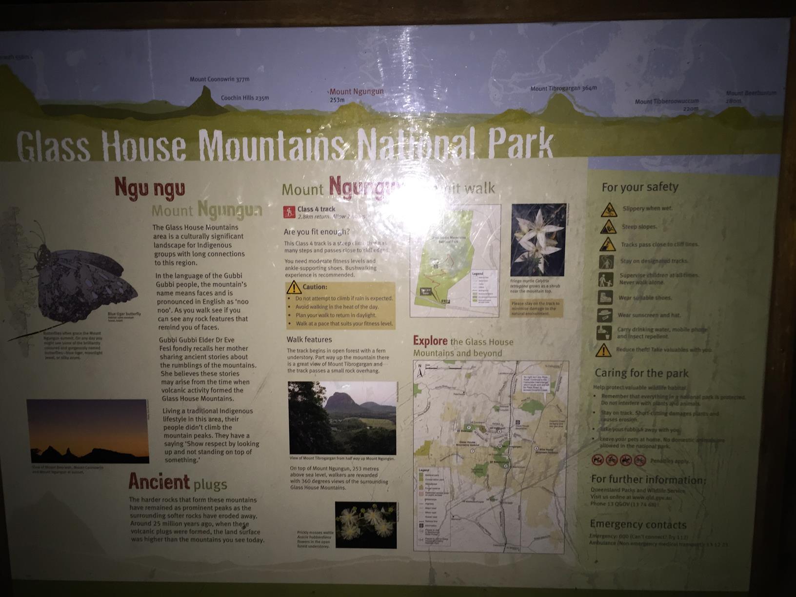
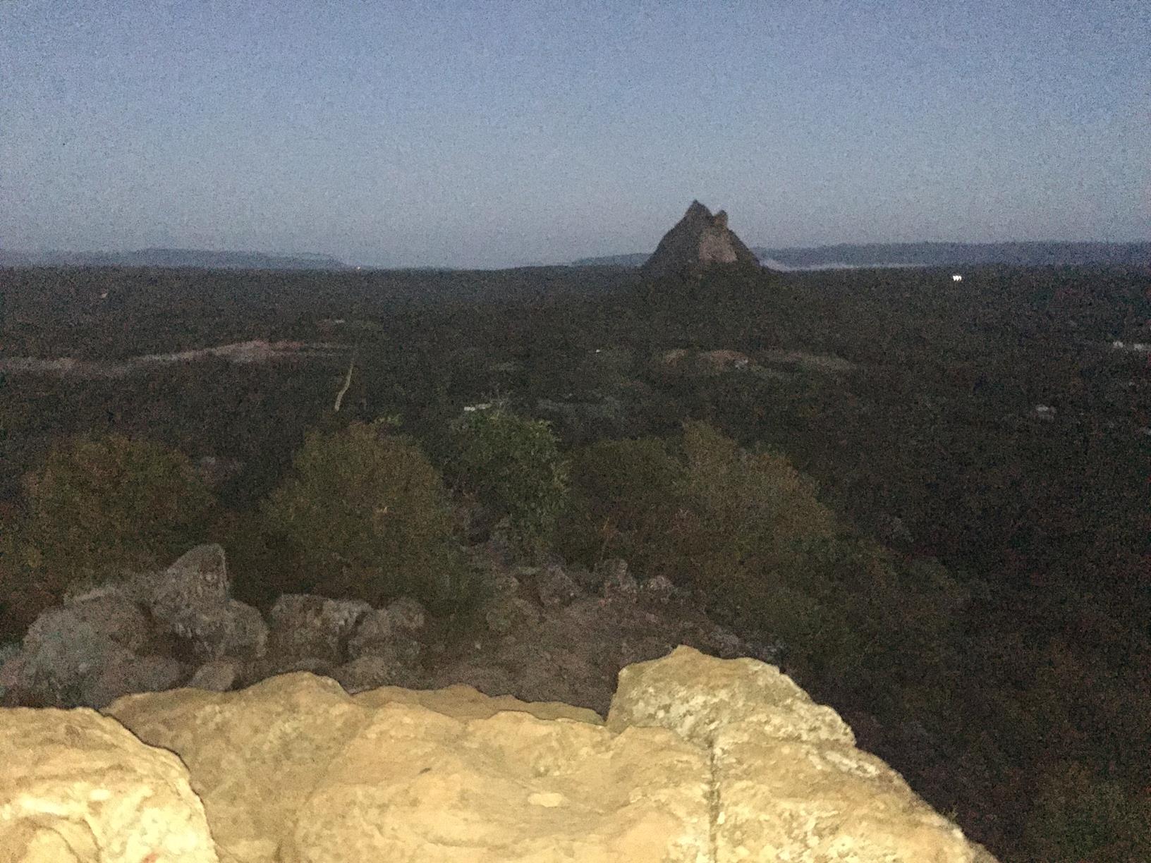
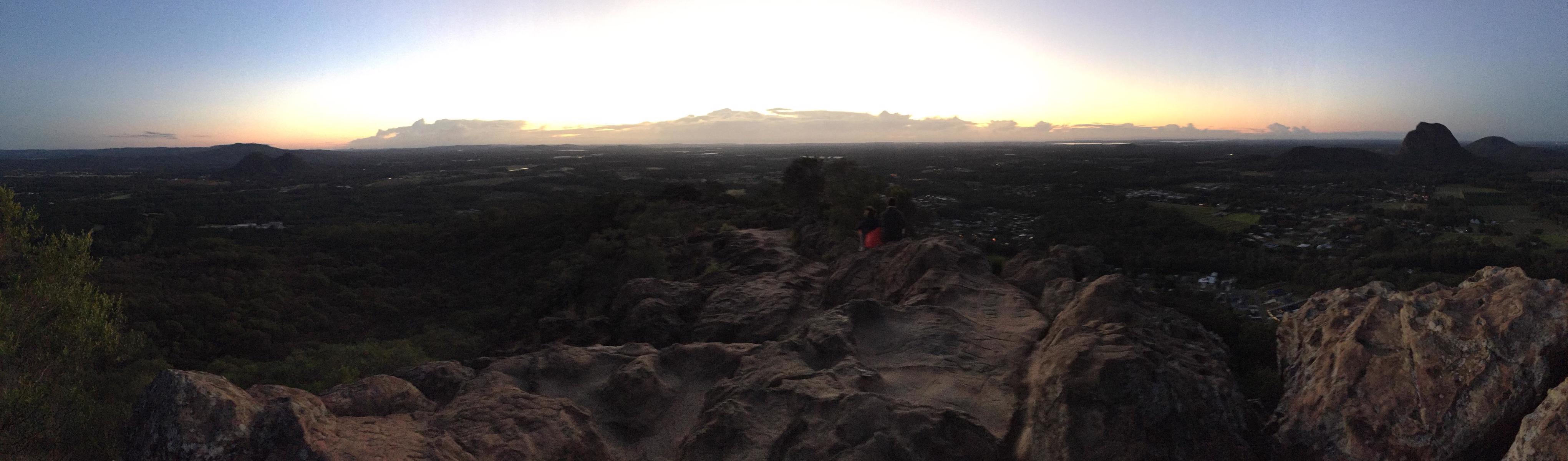
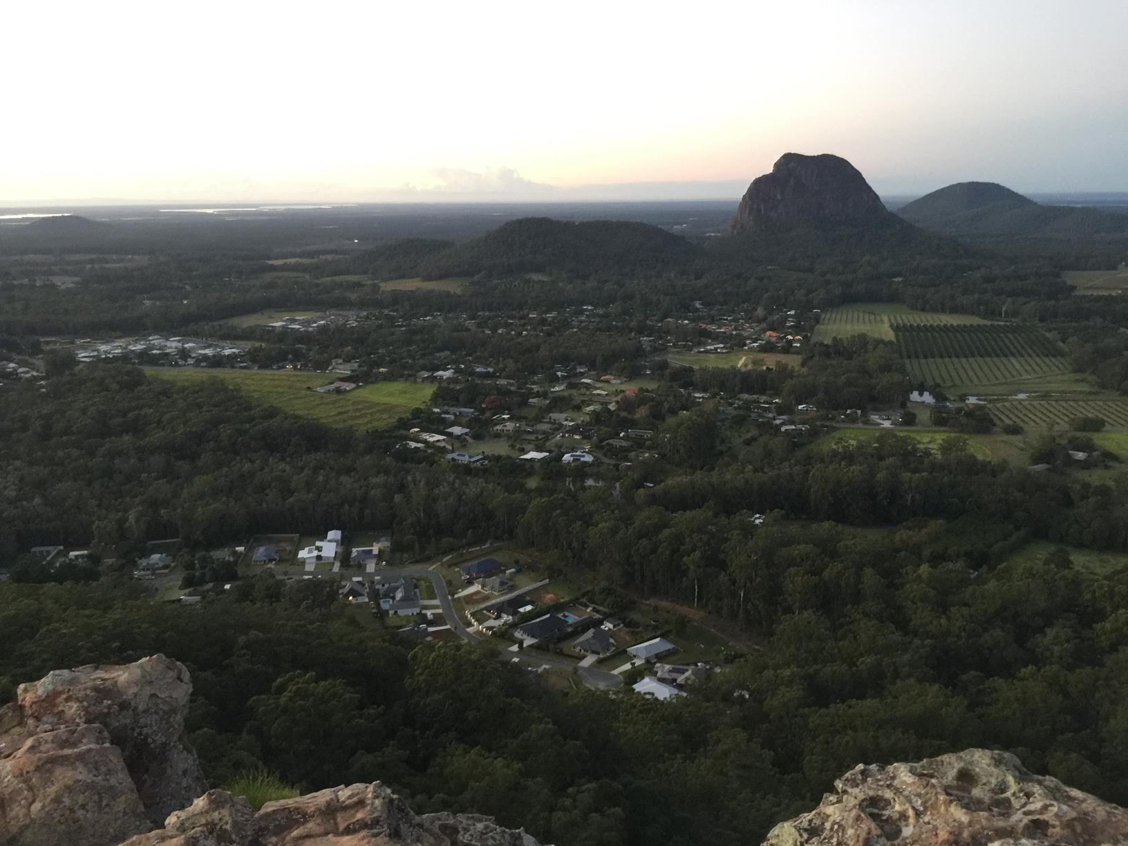
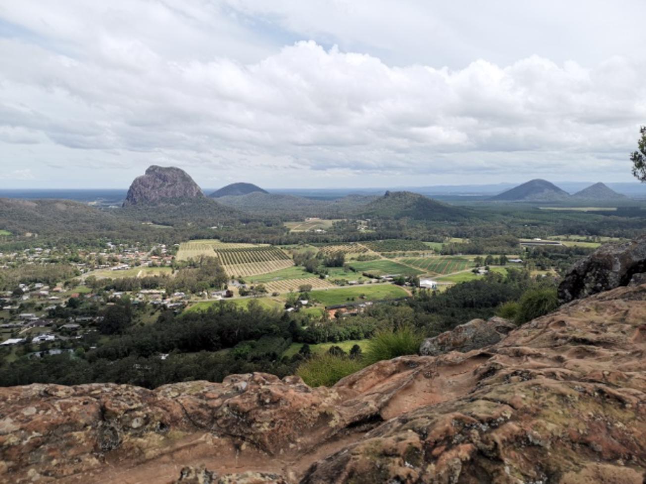
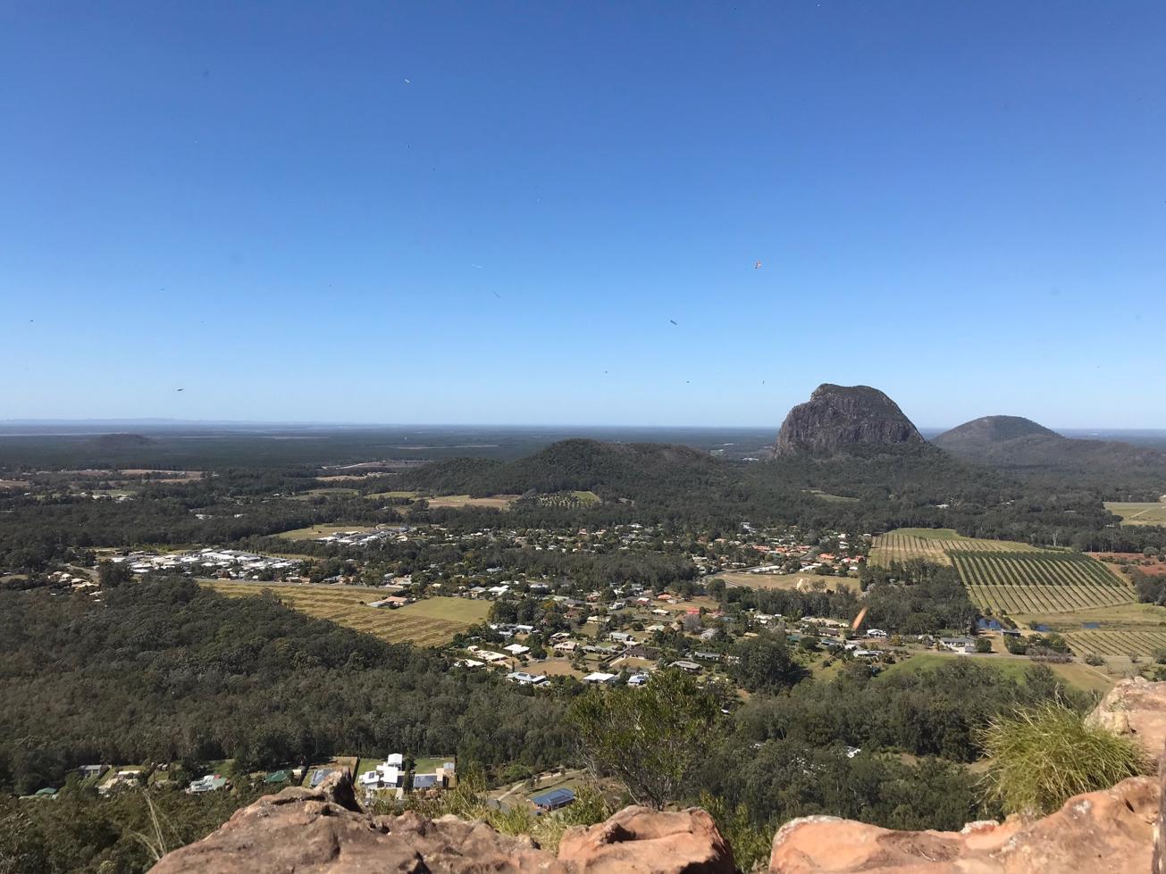
Climb Mount Ngungun, the best place to view the taller mountains of the scenic Glass House range.

SUITABILITY
Suitable for walkers, easily accessible and manageable for young kids.

HIGHLIGHTS
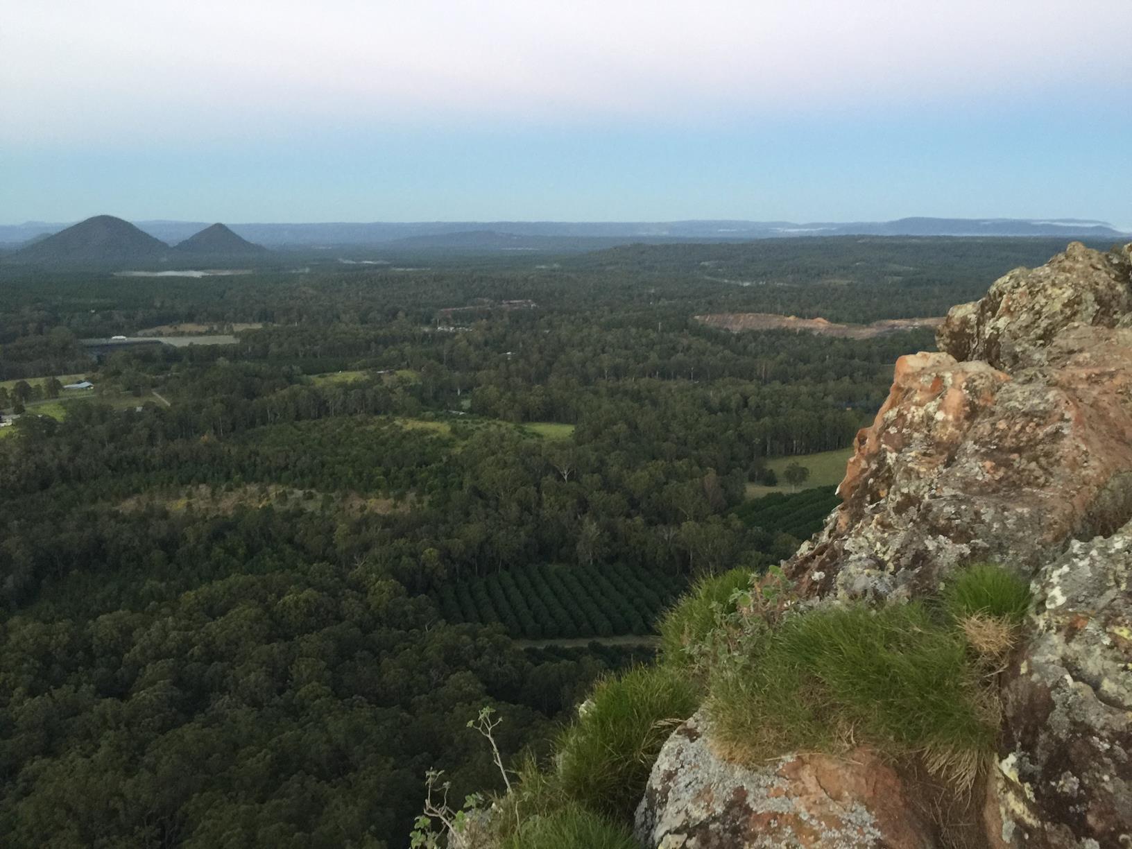
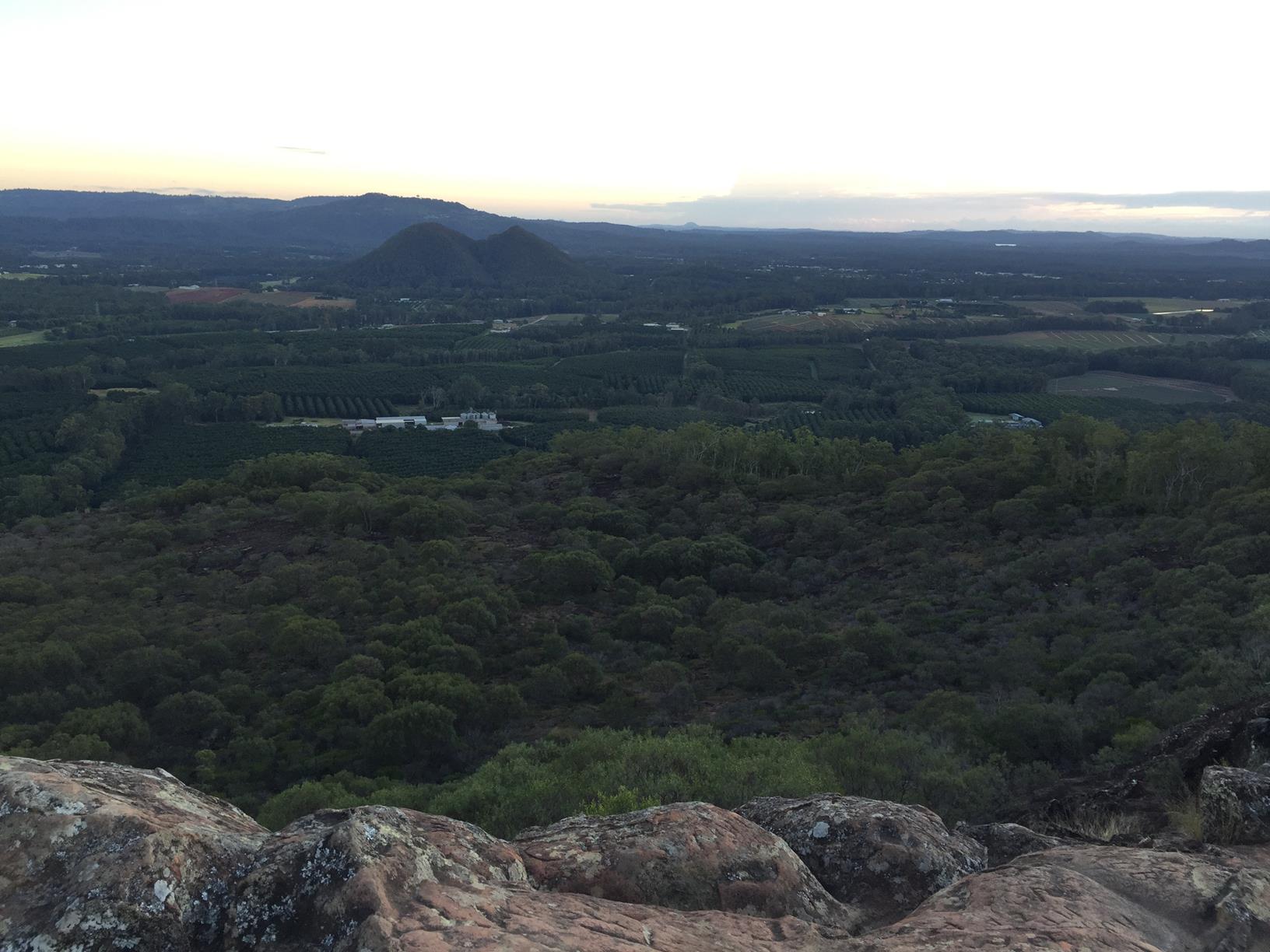
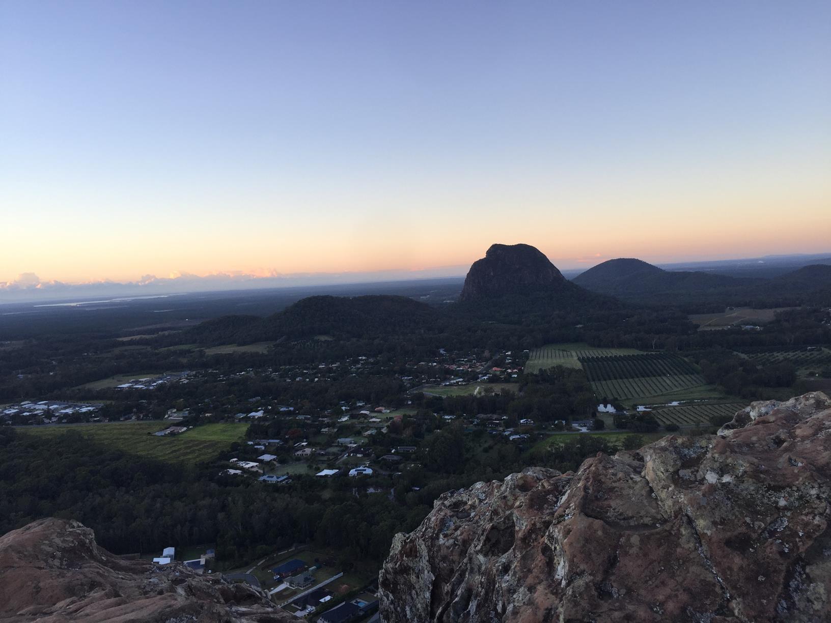
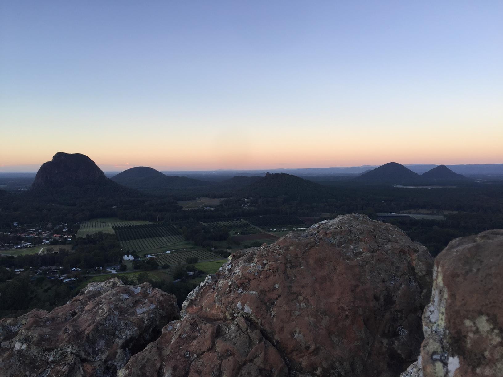
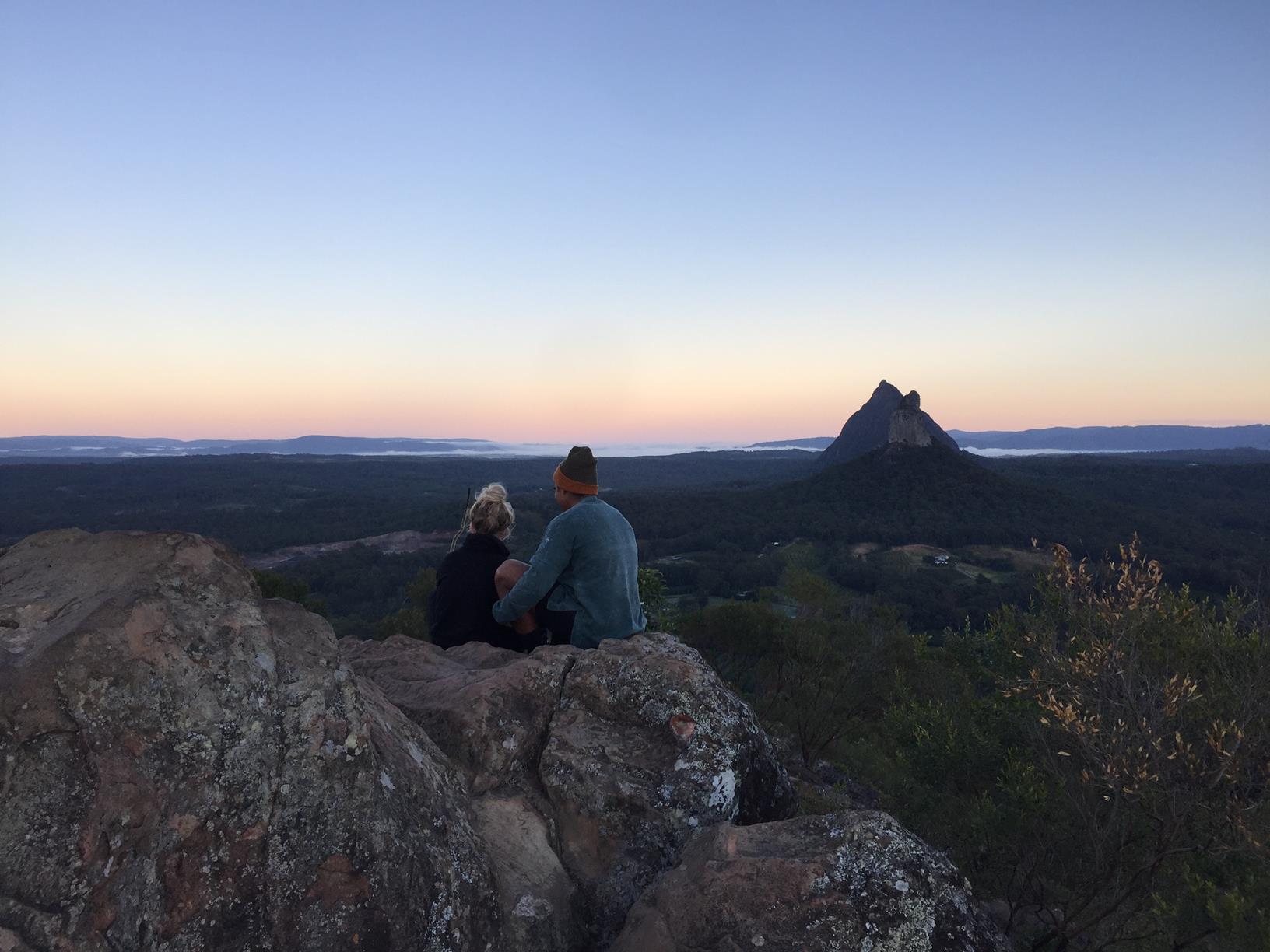
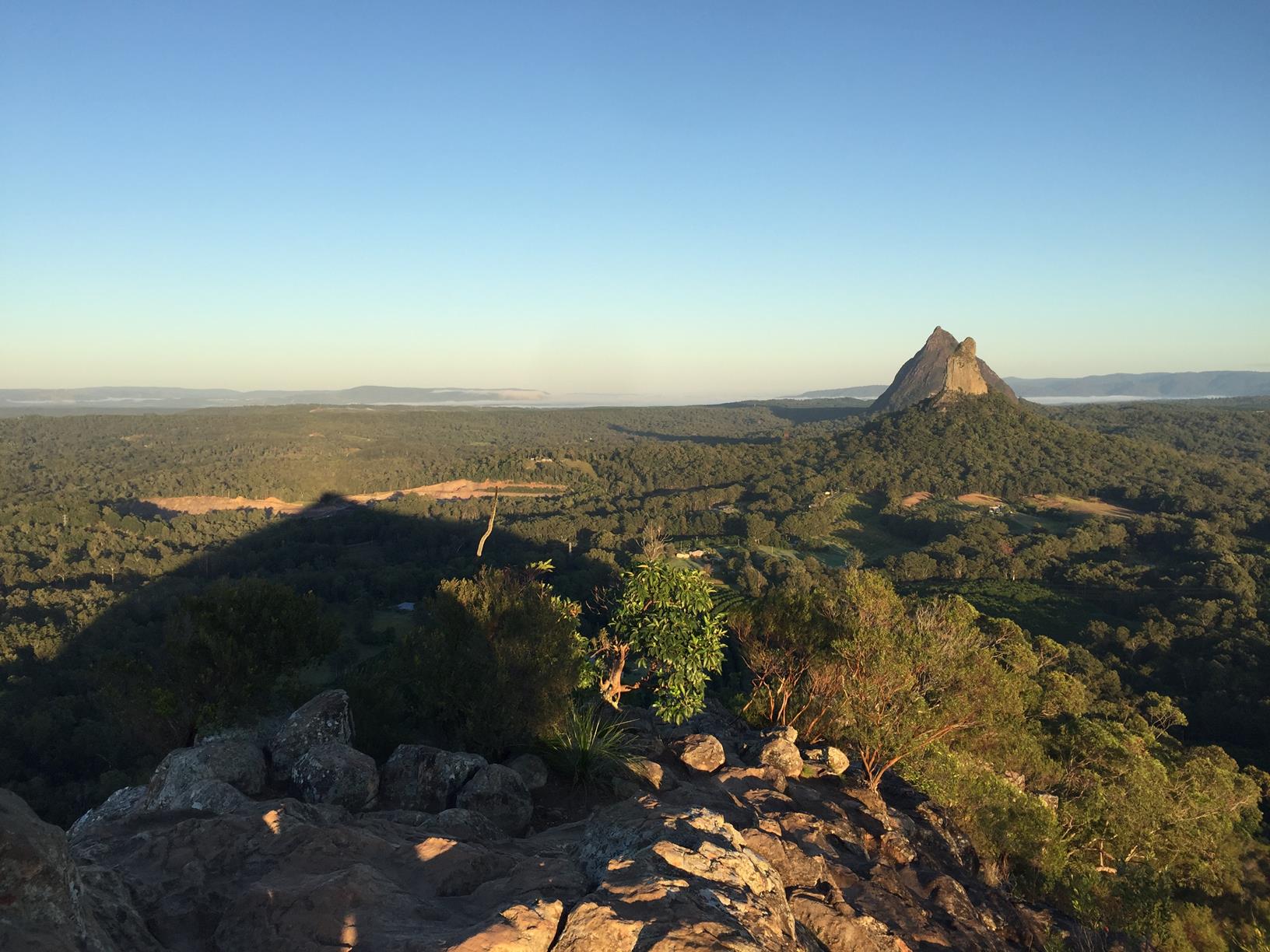
If you do only one of the famous Glass House Mountains, this is the one. It’s the closest one to Glasshouse township and also the most bang for buck.

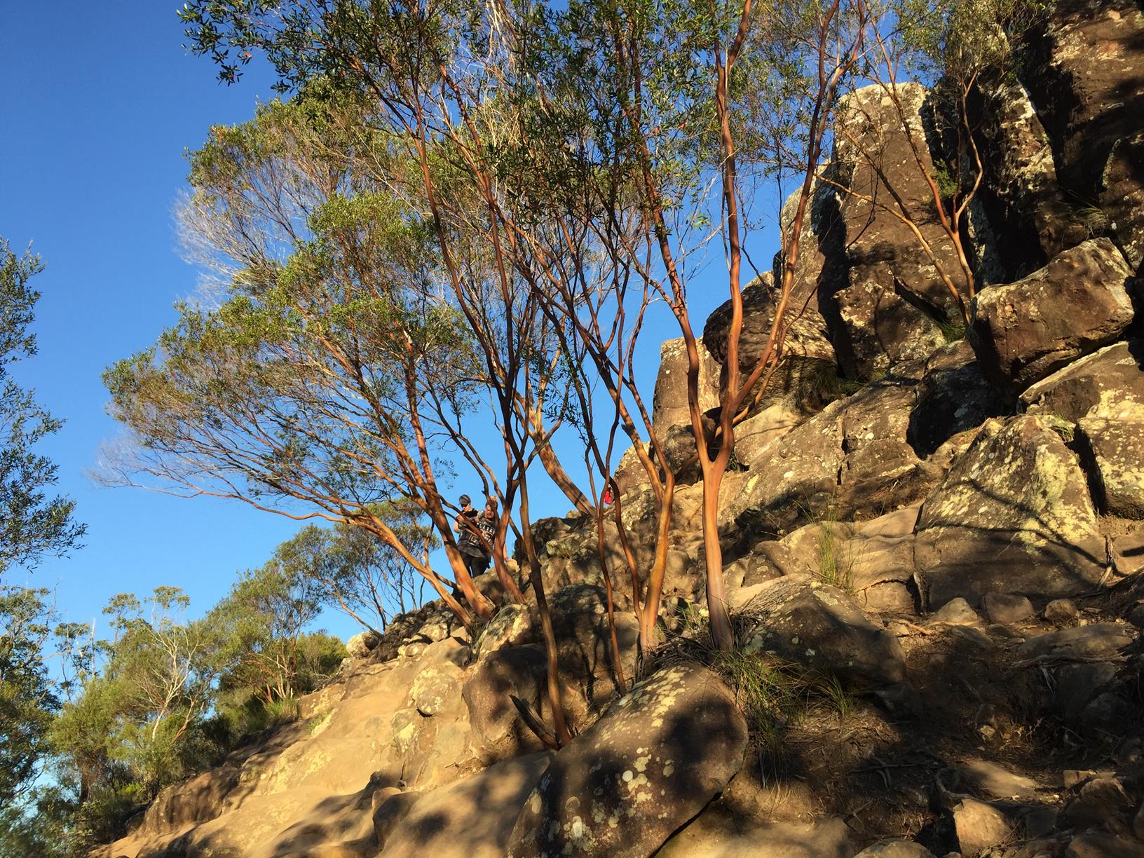
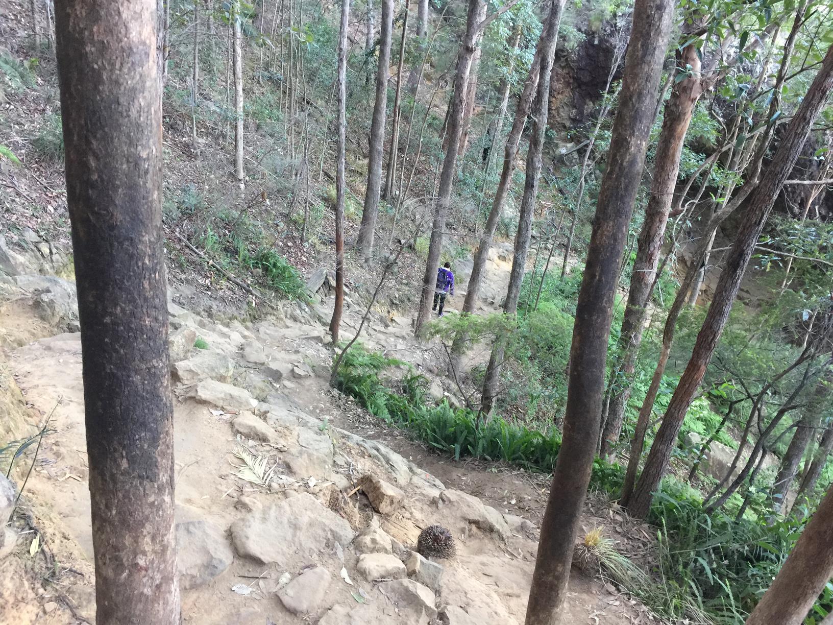
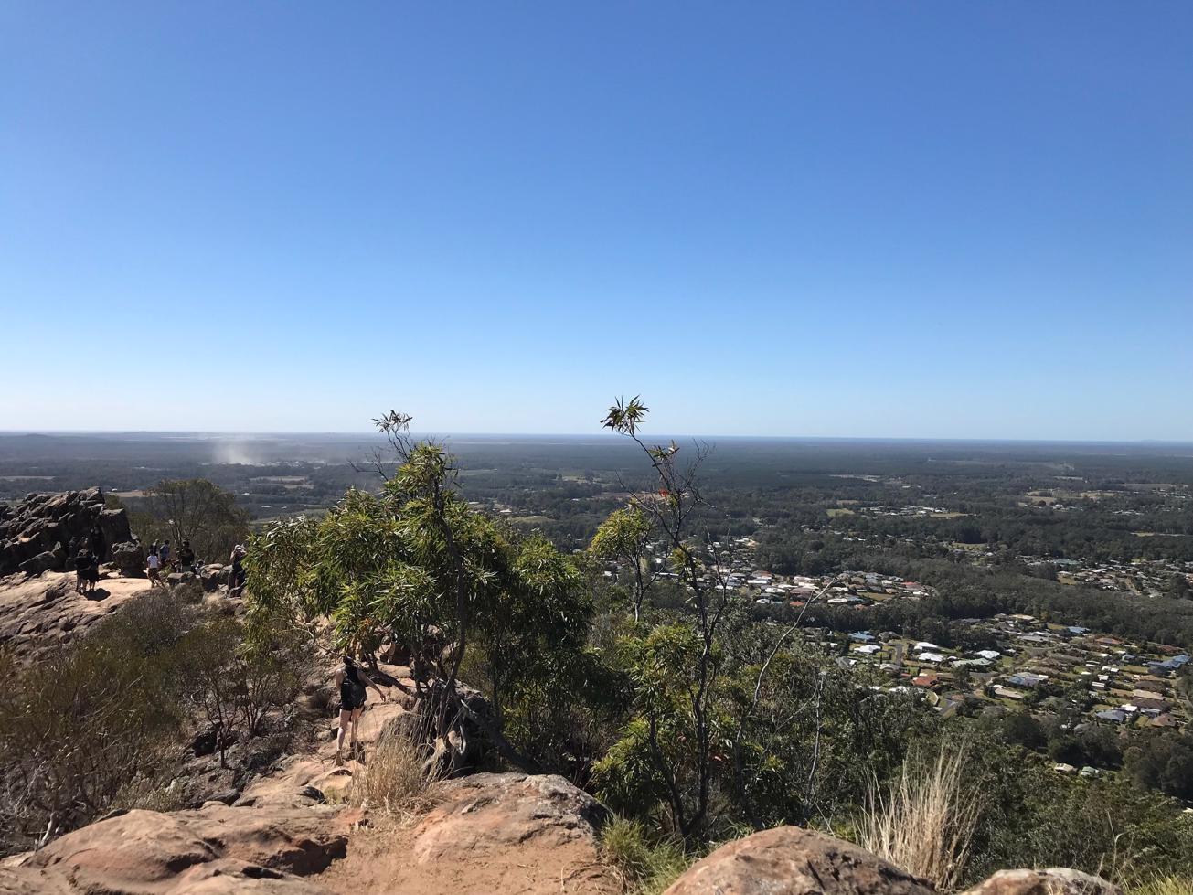
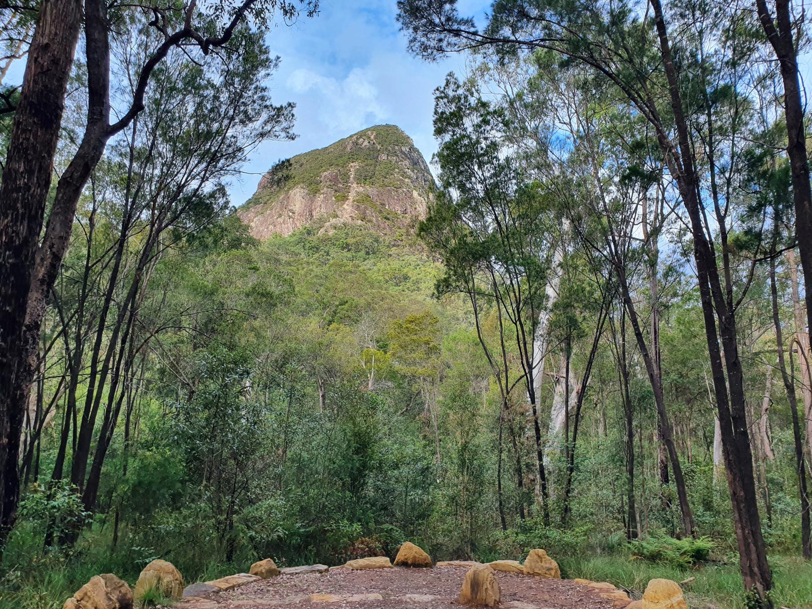
The 2.8km return trek begins easily in open forest before starting to steepen and throw in some steps. About half way you pass ‘lovers cave’ so named after an Aboriginal legend.

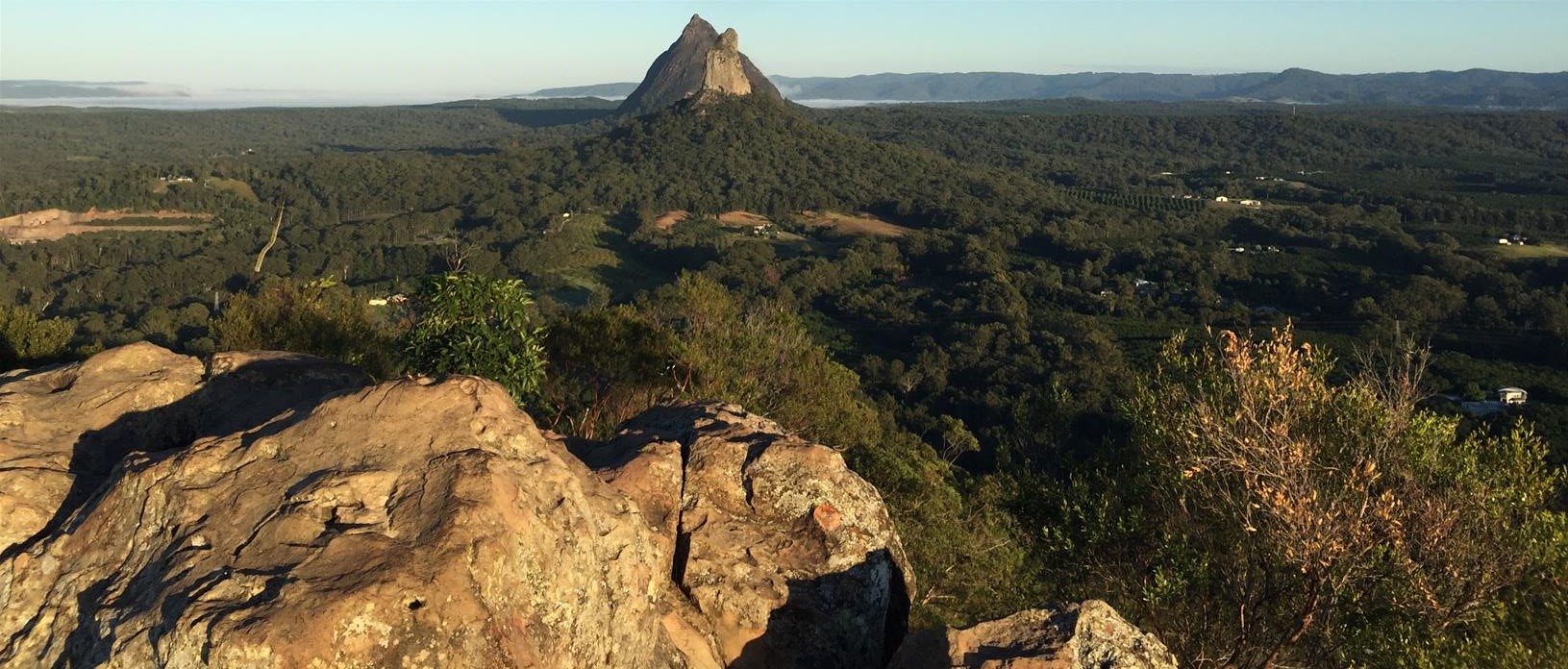
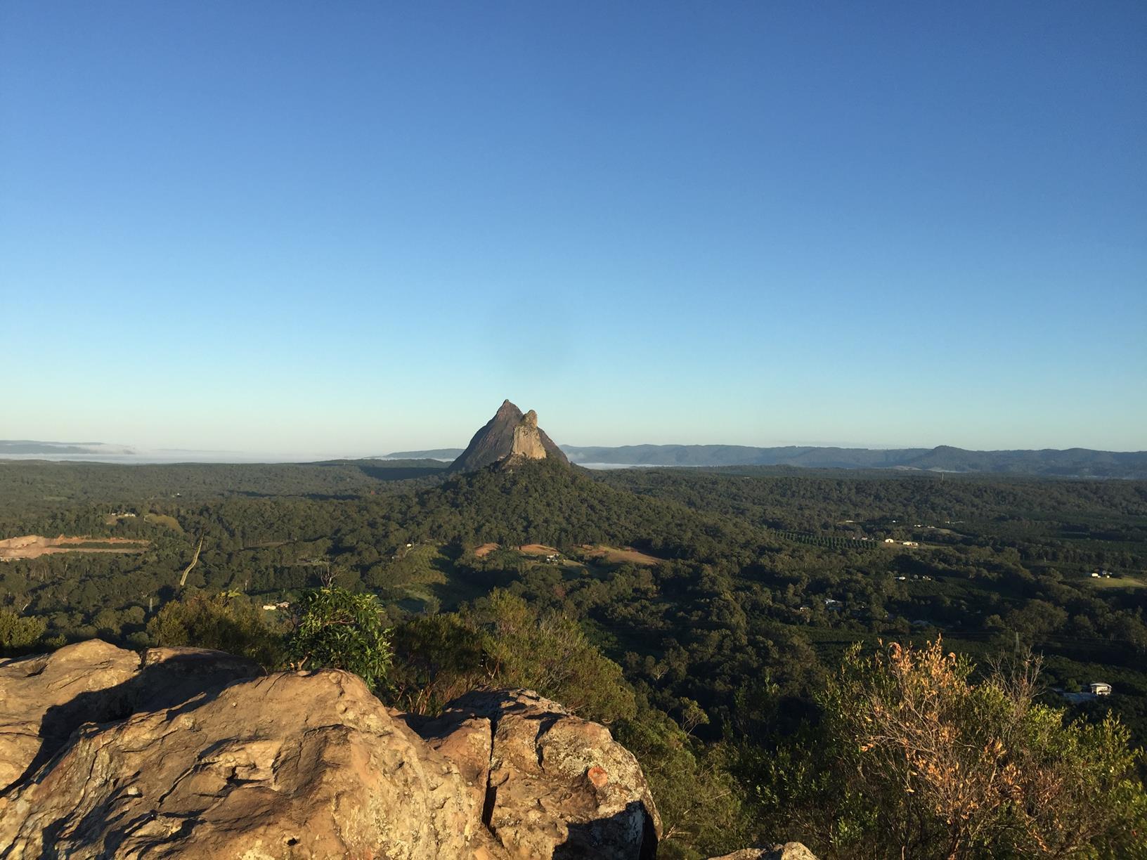
From there it gets trickier but before you know it you pop out next to a large leaning monolith, and have a long rocky ridgeline to explore.

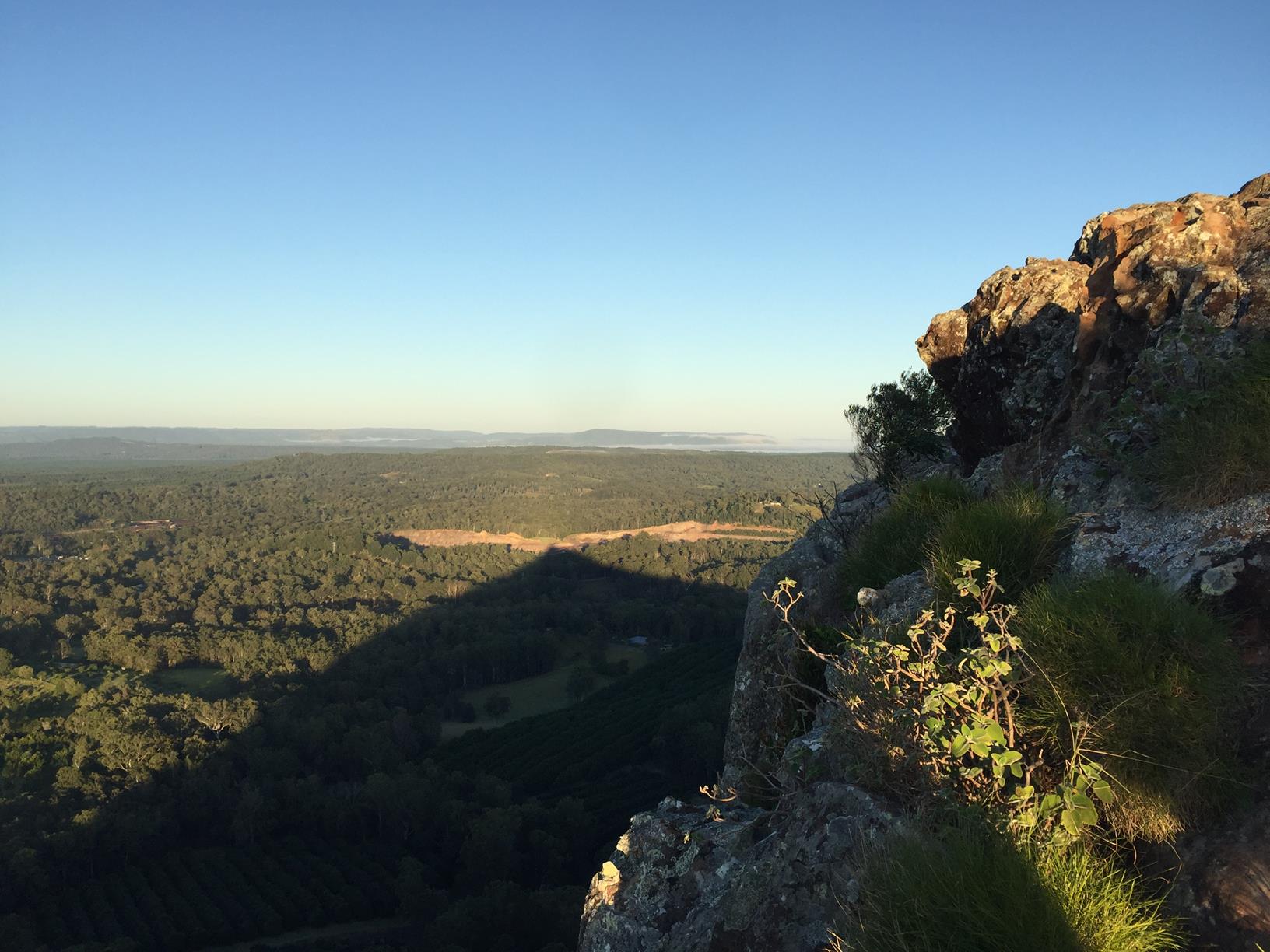
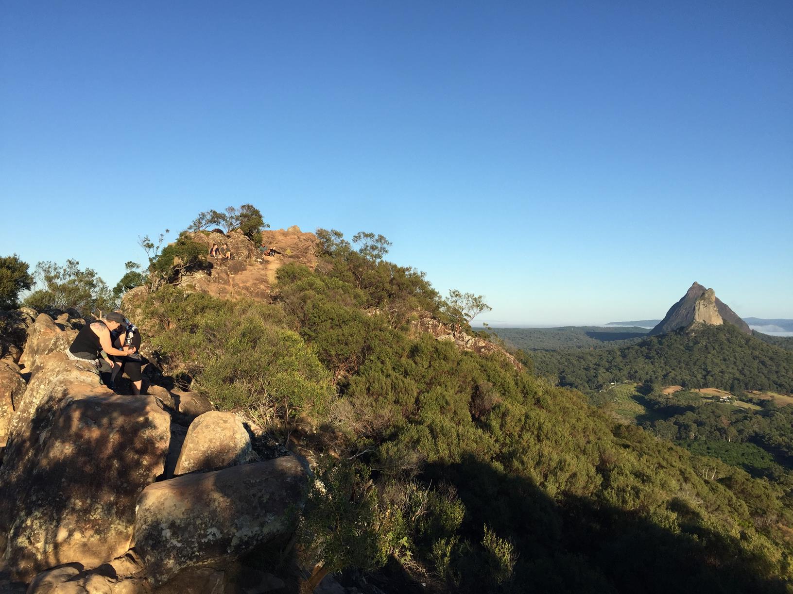
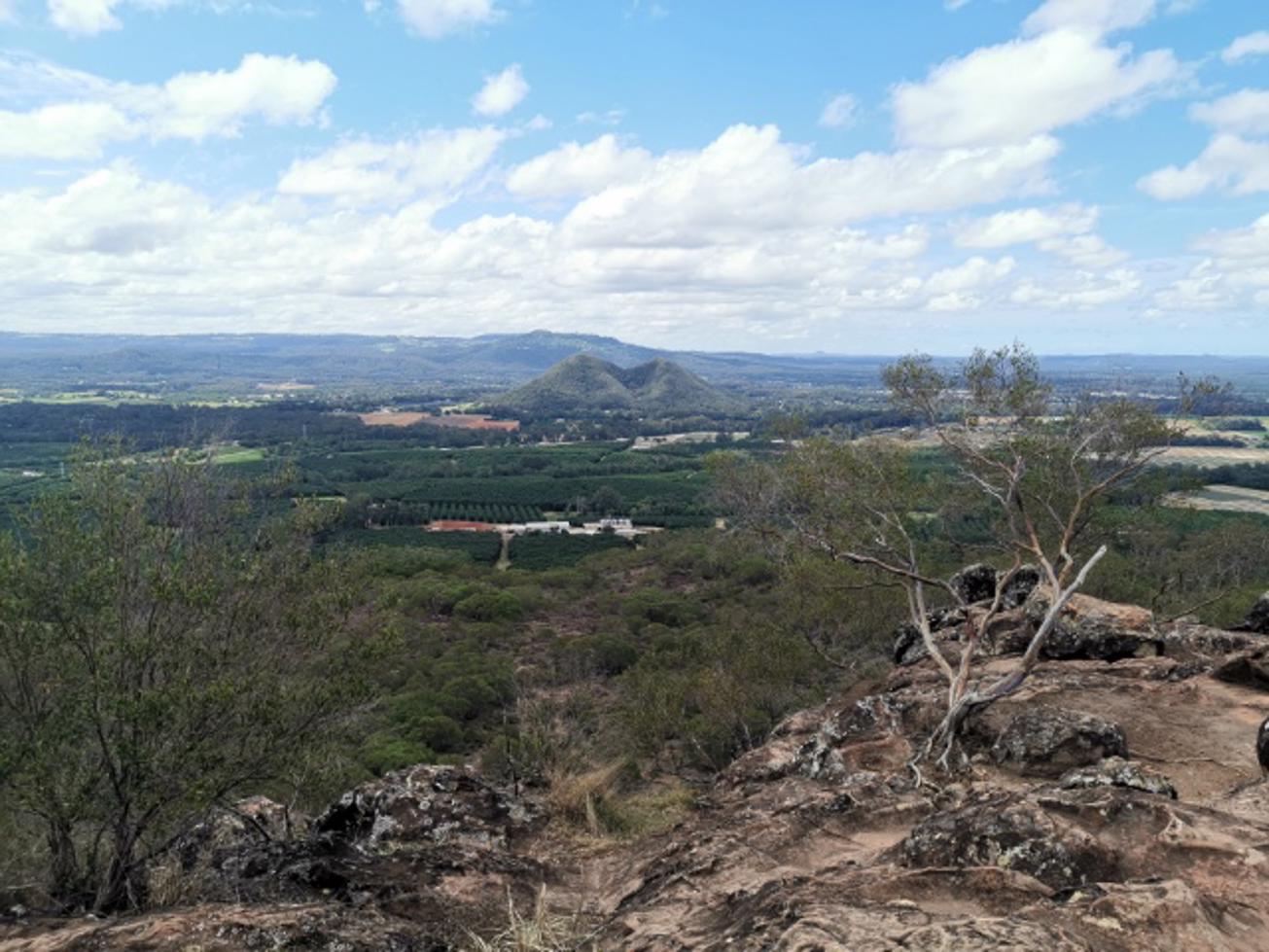
At the peak there are 360 degree panoramic views of the entire region. And best of all there are no manmade incursions up there unlike some of the other Sunshine Coast peaks. Supervise kids carefully, take your camera.

AFTERWARDS
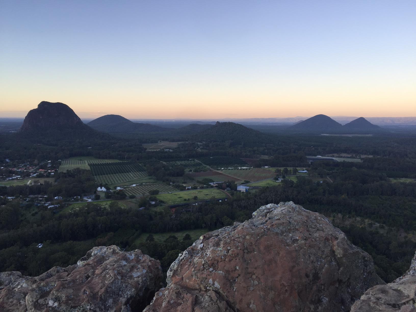
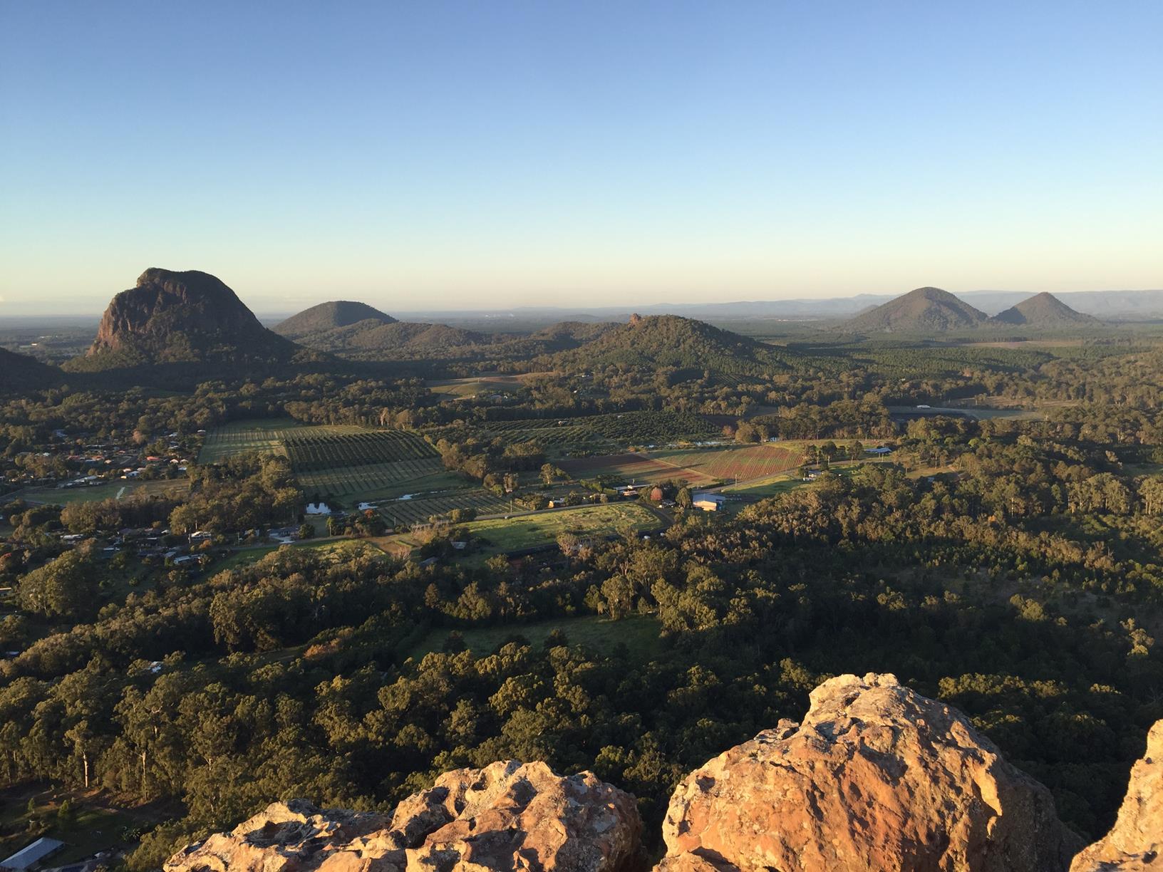
The smallest of the Glass House Mountains is Wild Horse Mountain, north of Ngungun. It’s well worth a visit because its east of the M1, providing a wonderful panorama of most of the Glass House peaks. There’s a large carpark near the base, providing an easy walk for most people.

HOW TO GET THERE
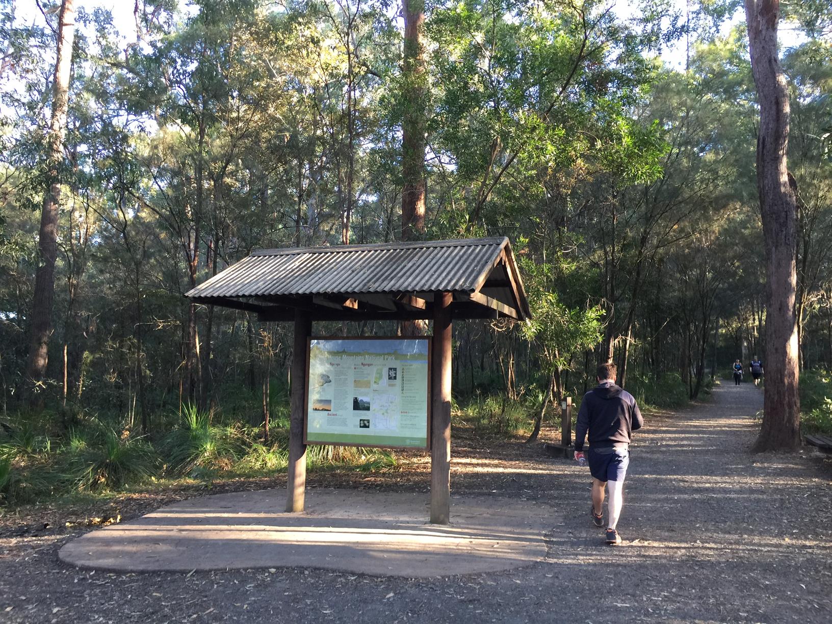
To the starting point: Head to the township of Glass House Mountains off Steve Irwin Way (off M1). Turn into Reed Street. Follow it around to the left. It quickly runs into Bruce Parade and Burgess St which turns into Coonowrin Street. Turn right into Fullertons Road and the car park to Mt Ngungun will be along on your right (about 3km from the Info Centre). The walk starts from the carpark.

To the end point: The end point is the same as your starting point.

glossary button
Glossary
  • Icon showing this activity is suitable for wheelchairsSuitable for wheelchairs
  • Icon showing this activity is suitable for walkingSuitable for walking
  • Icon showing this activity is suitable for recreational cyclingSuitable for recreational cycling
  • Icon showing this activity is suitable for mountain bikingSuitable for mountain biking
  • Icon showing this activity is suitable for horse ridingSuitable for horse riding
  • Icon showing this activity is suitable for kayakingSuitable for kayaking
  • Icon showing this activity has drinking water availableDrinking water available
  • Icon showing this activity does not have drinking water availableNo drinking water available
  • Icon showing this activity has a barbeque on siteBarbeque on site
  • Icon showing this activity has a picnic table on sitePicnic table on site
  • Icon showing this activity has toilets on siteToilets on site
  • Icon showing fires are permitted at this activityFires permitted
  • Icon showing fires are prohibited at this activityFires prohibited
  • Icon showing camping is permitted at this activityCamping permitted
  • Icon showing camping is prohibited at this activityCamping prohibited
  • Suitable for walking Suitable for walking black lines Suitable for walking
  • Drinking water available Drinking water available Drinking water available
  • Fires prohibited Fires prohibited Fires prohibited
  • Camping prohibited Camping prohibited Camping prohibited
Write a review

Review Date: 31/03/2019

This is a fantastic short but steep walk to the summit, suitable for children, however, there are some steep cliffs up the top. Once you get to the top you are rewarded by incredible 360 degree views. It's really worth the walk. Be early though as it's incredibly popular, it can get crowded!

Reviewed By: Christine

Review Date: 30/11/2018

Great walk that offers a short but steep hike up with good views of the other Glass House Mountains as a reward. Often extremely busy during peak times. Recommended to visit for sunrise

Reviewed By: Chris

Review Date: 29/11/2018

Love this climb. A great small challenge for those trying to get fit - it can be achieved. The track is clear to follow, interesting things to see on the way and the view at the top is worth the effort.

Reviewed By: Kellie

Review Date: 15/11/2018

A great walk, and really, not too much of a steep climb. Great spots to sit so you can get your breath too. The view at the top is spectacular. It's worth allowing the time to sit and chill out in the cool breeze. When you get back down, it's not so far to travel to some amazing historic sites, such as Bankfoot House which is on the way to the Glass House Lookout on Old Gympie Road - now that will really round your day!

Reviewed By: Elspeth

Review Date: 13/11/2018

Great short hike (approximately 1 hour round trip) for spectacular views, you need a reasonable level of fitness as the top half is fairly steep. It can get very busy so try to get their early to get a park. There are no facilities (toilet, water bubblers) so come prepared

Reviewed By: Kristy

Review Date: 04/11/2018

This is a great walk however gets super busy so best to get up early in the morning and climb up at around 5:30 - 6am if you can. There is a great halfway point with a 'cave' opening for kids to explore. Once you get to the top there is just beautiful 360 degree views. Bring water and also no toilet facilities. Easily can do a round trip in around 1 hour. Afterwards why not explore around the area with a trip to the local cafes, personally we love The Steaming Cup in Landsborough, haven't found better coffee anywhere else.

Reviewed By: Rebecca

Review Date: 02/11/2018

One of my go to hikes requiring beginner to intermediate fitness levels. Allow about an hour to walk this track with tree cover all the way to the top. Once you reach the summit, you'll have 360 degree views of the surrounding glasshouse mountains. Pro tip, this is a great location to watch a sunset as its goes down behind Mt Beerwah - ensure you have a phone or torch for the walk back down.

Reviewed By: Adam

hazard icon

IN AN EMERGENCY DIAL '000'.

Always Adventure Safely!

  • Always follow any local signage, it contains key information and conditions can change at any time.
  • Use the trails with consideration for your abilities, be prepared for the adventure ahead:
    • Be aware of the weather conditions, found here: http://www.bom.gov.au/qld/.
    • Always wear appropriate clothing, focus on good footwear.
    • Always bring more water than you think you will need.
    • Be Sun Safe!
    • Always let someone know where you are going that isn’t going with you.
  • Just getting started try this site for good useful information: https://www.trailhiking.com.au/hike-safety/
  • Sunshine Coast Council does it’s best to maintain current information but things can change so always be aware that a trail may not be as listed in this guide, and report and issues via our feedback link.

Qld Parks and Wildlife Service

National Parks, Conservation Parks and some State Forests are managed by Queensland Parks and Wildlife Service. Contact details are: https://www.des.qld.gov.au/contactus/

For current information on trail conditions and alerts go to https://parks.des.qld.gov.au/park-alerts/#sunshinecoast

If you think something on this web site needs to change please let us know via: adventure@sunshinecoast.qld.gov.au

Nearby Trails

Trail Image for Glass House Mountains National Park: Tibrogargan Circuit
Intermediate

Glass House Mountains National Park: Tibrogargan Circuit

Glass House Mountains
walking icon
Trail type
difficulty icon
Skill Level

4.6km

Length
direction icon
Circuit
Trail Image for Glass House Mountains National Park: Trachyte Circuit
Intermediate

Glass House Mountains National Park: Trachyte Circuit

Beerburrum
walking icon
Trail type
difficulty icon
Skill Level

6.4km

Length
direction icon
Circuit
Trail Image for Glass House Mountains National Park: Mathew Flinders Park to Jack Ferris Lookout
Easy

Glass House Mountains National Park: Mathew Flinders Park to Jack Ferris Lookout

Beerburrum
walking icon
Trail type
difficulty icon
Skill Level

4.4km

Length
direction icon
One-way
Trail Image for Glass House Mountains National Park: Soldier Settlers Loop
Intermediate

Glass House Mountains National Park: Soldier Settlers Loop

Beerburrum
walking icon mountain biking icon
Trail type
difficulty icon
Skill Level

8.5km

Length
direction icon
Circuit
Trail Image for Woodgrove Ciruit
Easy

Woodgrove Ciruit

Beerwah
walking icon cycling icon
Trail type
difficulty icon
Skill Level

2.4km

Length
direction icon
Circuit

Share this trail

This action requires a login.
To continue, click on Login/Signup below.

Photo uploaded successfully, thank you.

Feedback / Suggest an Adventure

If you have any feedback on the site or any of the trails, please drop us a short email.

Have we missed something? Do you have an adventure to suggest? Fill in the suggestion form to let us know about it.