facebook
Image showing that the PDF download is in progress... PDF download in progress

Please wait...

Image showing a pink decorative paint splat
Image showing a green decorative paint splat
upload photo button

NOTE: This adventure is in Mapleton National Park for current Queensland Parks and Wildlife Service parks information, maps and essential park alerts click here

reviews buttonReviews view map buttonMap
view 3d map button3D Map
directions take me there buttonDirections
Save
PDF
Gpx File

Mapleton National Park: Piccabeen Circuit

Mapleton National Park: Piccabeen Circuit
Gheerulla
walking icon walking icon black mountain biking icon mountain biking icon black horse riding icon horse riding icon black
Trail type
difficulty icon
Skill Level
7.6km
Length
direction icon direction icon black
Circuit

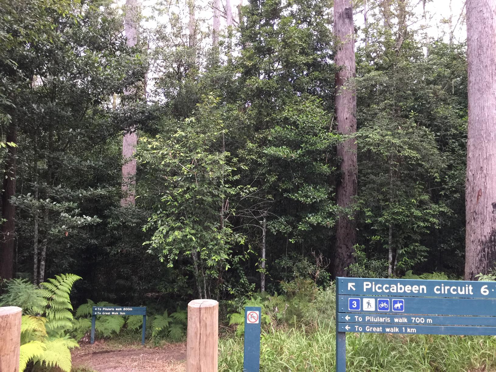
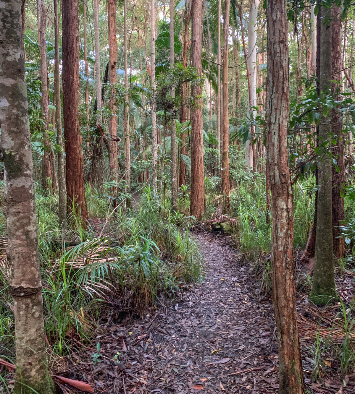
A popular trail through lush green Piccabeen palms and high range creek beds.

SUITABILITY
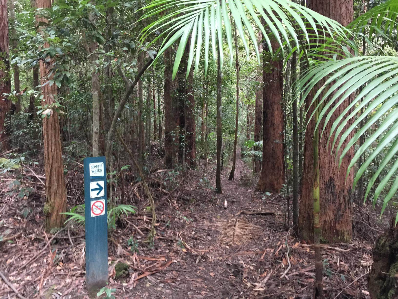
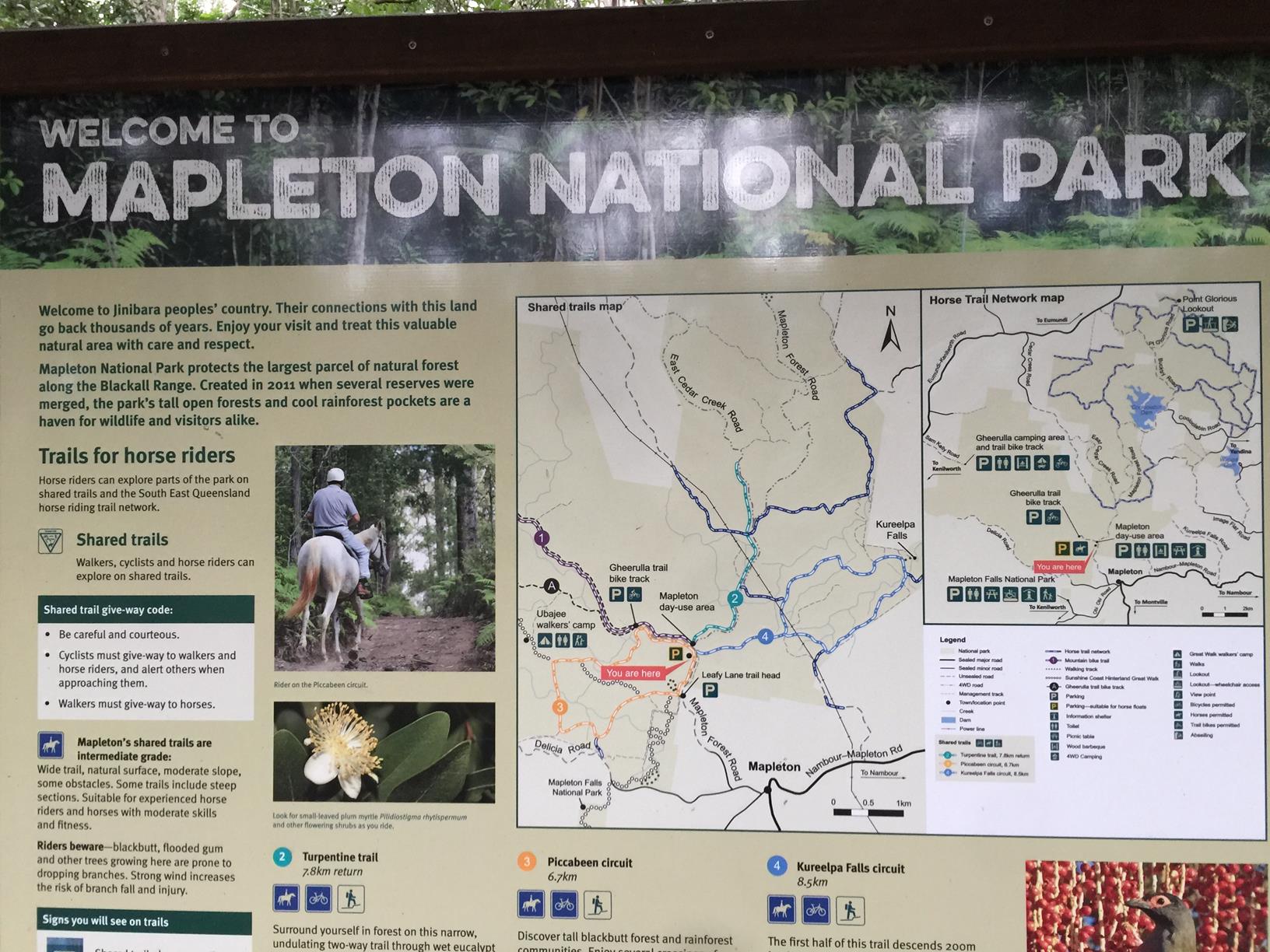
This is a shared path for walkers, horseriders and mountain bikers. At the starting point there are dedicated parks for horsefloats.

HIGHLIGHTS
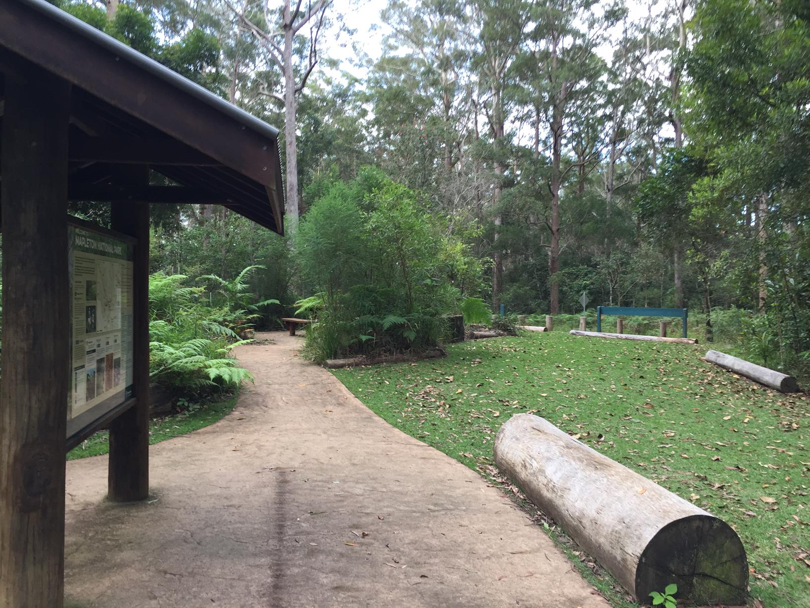
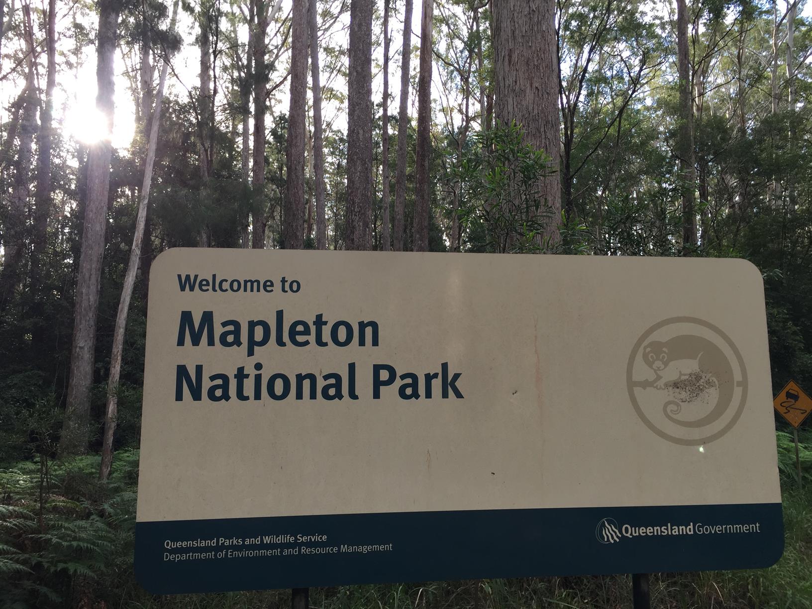
Mapleton National Park is a dream setting for nature lovers and adventures and this circuit does not disappoint. Described as a beautiful, well-cared-for, even and quiet track, it’s particularly suited for horse riders.

Along the way you’ll get to enjoy some creek crossings – wet after the rain – and you might hear one of the 32 different species of frogs that live in the park. Plus, there is the abundant bird life. Keep your eye out for the Australasian figbird, which can often be seen feeding on the red dangling piccabeen seeds.

AFTERWARDS
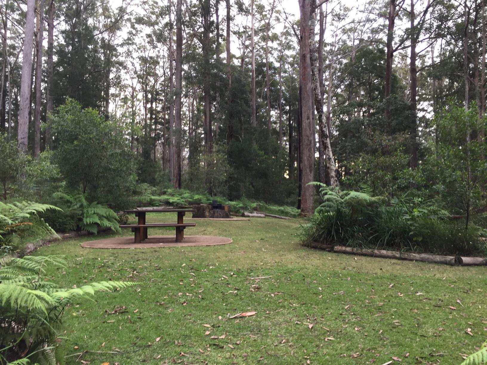
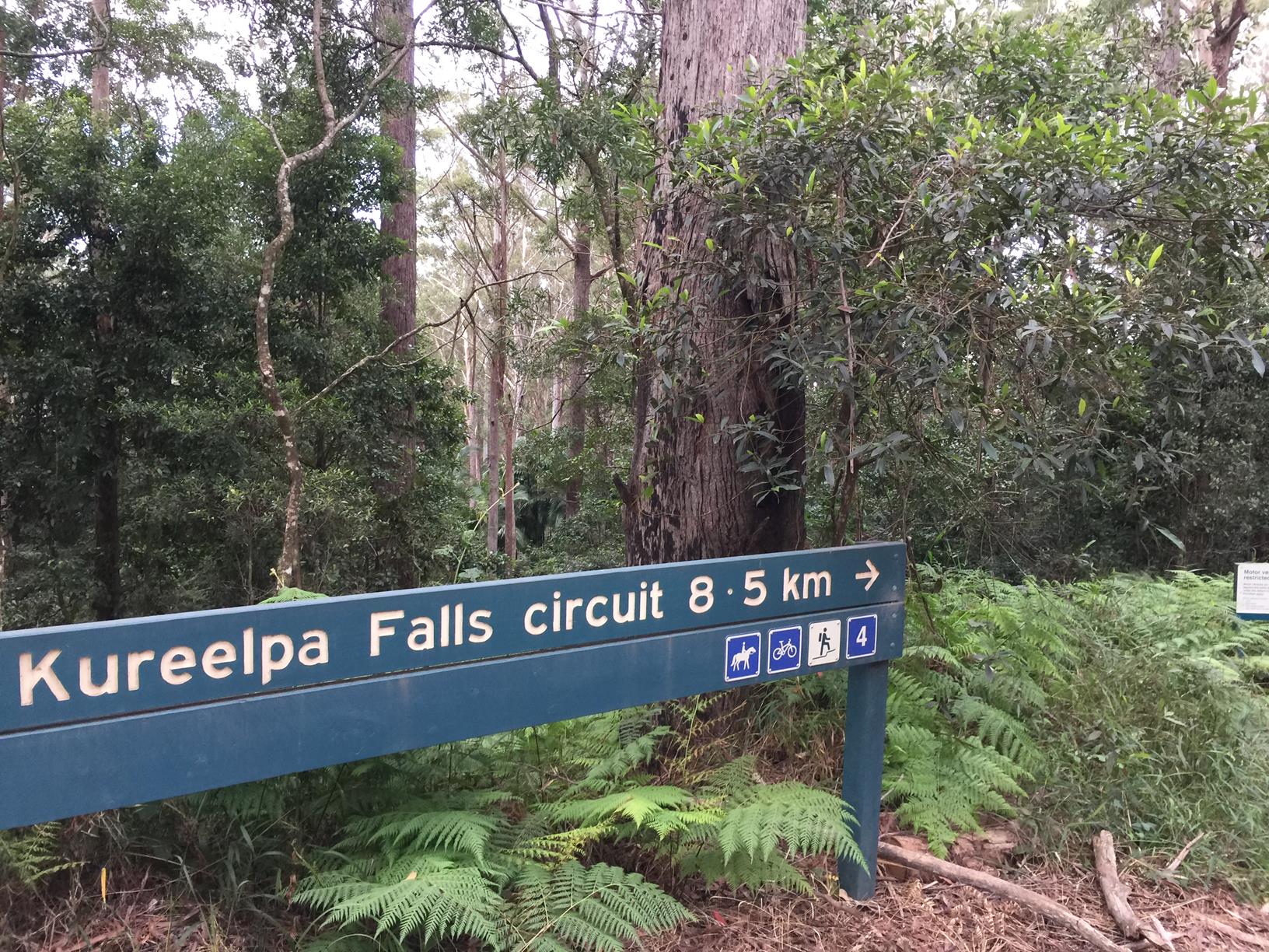
Why not head back to the Day Use Area, enjoy a relaxed lunch the head off on the Kureelpa Falls Circuit. See boulders, cascading waters, large lizards – the list goes on.

HOW TO GET THERE
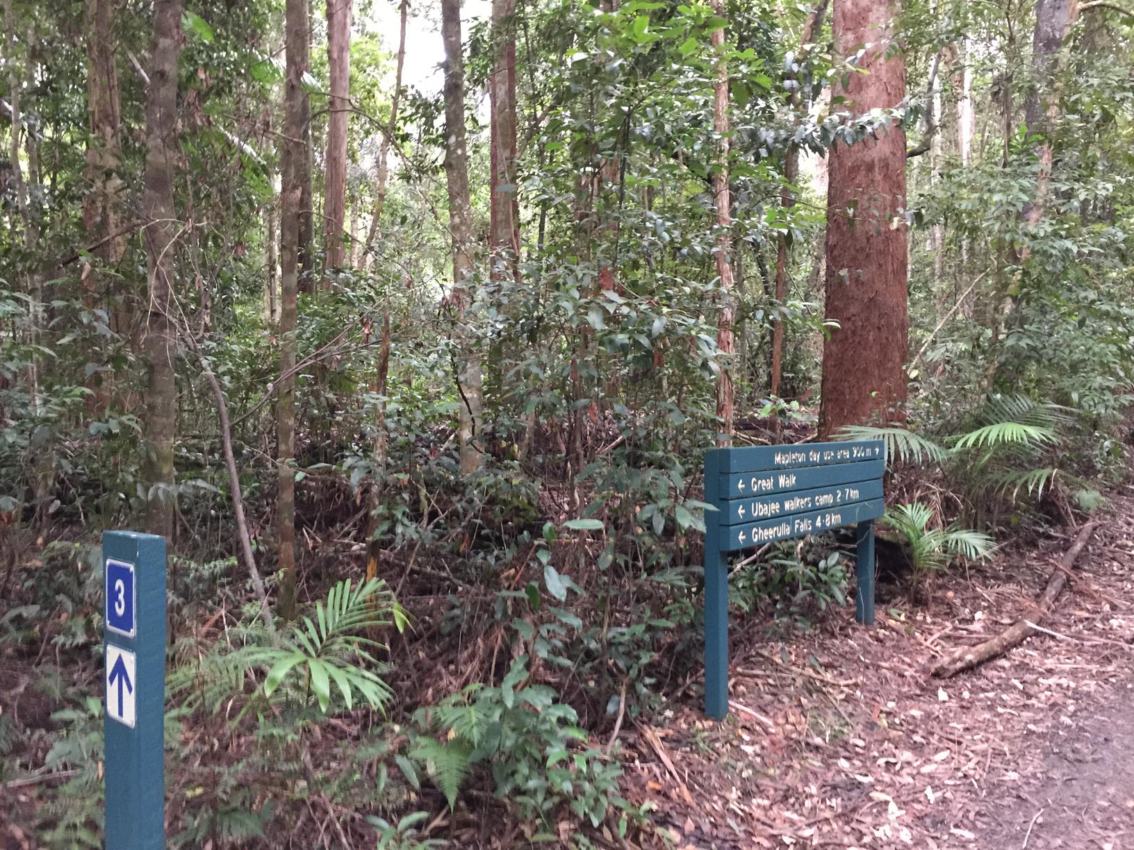
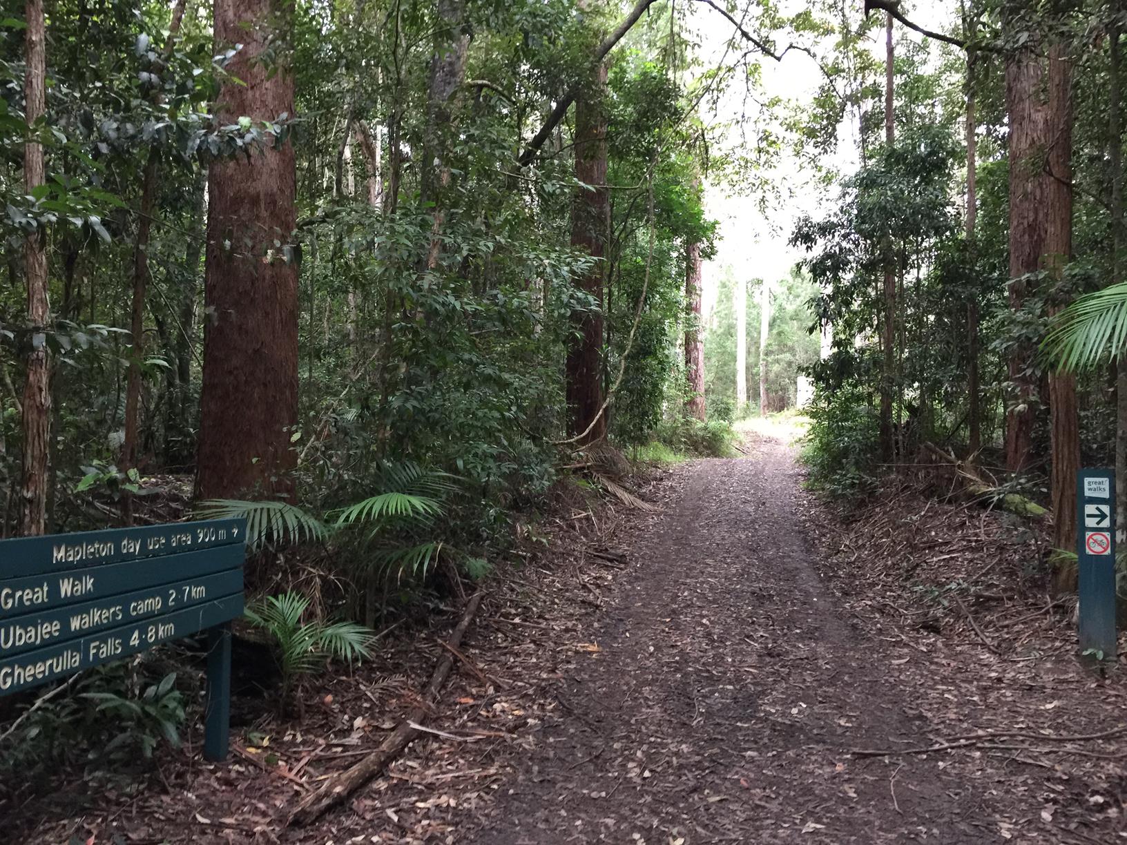
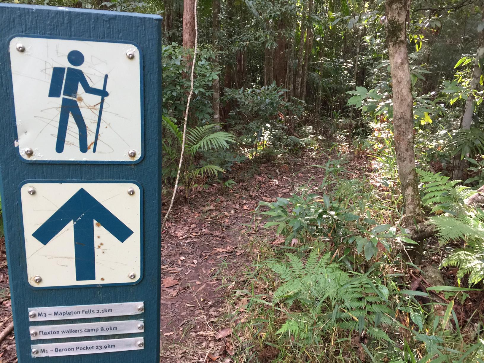
To the starting point: From Mapleton township take the Obi Obi Road and turn right into Delicia Road. Shortly thereafter turn right into Mapleton Forest Road, which is a dirt road but generally ok for 2WD vehicles.. Follow this road for about 2 km and you will come to Lookout Road on your left and then the Mapleton Day Use area, set amongst towering Blackbutts. The Piccabeen Circuit starts from here near the Leafy Lane Trail Head.

To the end point: The end point is the same as the starting point.

glossary button
Glossary
  • Icon showing this activity is suitable for wheelchairsSuitable for wheelchairs
  • Icon showing this activity is suitable for walkingSuitable for walking
  • Icon showing this activity is suitable for recreational cyclingSuitable for recreational cycling
  • Icon showing this activity is suitable for mountain bikingSuitable for mountain biking
  • Icon showing this activity is suitable for horse ridingSuitable for horse riding
  • Icon showing this activity is suitable for kayakingSuitable for kayaking
  • Icon showing this activity has drinking water availableDrinking water available
  • Icon showing this activity does not have drinking water availableNo drinking water available
  • Icon showing this activity has a barbeque on siteBarbeque on site
  • Icon showing this activity has a picnic table on sitePicnic table on site
  • Icon showing this activity has toilets on siteToilets on site
  • Icon showing fires are permitted at this activityFires permitted
  • Icon showing fires are prohibited at this activityFires prohibited
  • Icon showing camping is permitted at this activityCamping permitted
  • Icon showing camping is prohibited at this activityCamping prohibited
  • Suitable for walking Suitable for walking black lines Suitable for walking
  • Suitable for mountain biking Suitable for mountain biking Suitable for mountain biking
  • Suitable for horse riding Suitable for horse riding Suitable for horse riding
  • No drinking water available No drinking water available No drinking water available
  • Fires prohibited Fires prohibited Fires prohibited
  • Camping prohibited Camping prohibited Camping prohibited
Write a review

Be the first to review this trail.

hazard icon

IN AN EMERGENCY DIAL '000'.

Always Adventure Safely!

  • Always follow any local signage, it contains key information and conditions can change at any time.
  • Use the trails with consideration for your abilities, be prepared for the adventure ahead:
    • Be aware of the weather conditions, found here: http://www.bom.gov.au/qld/.
    • Always wear appropriate clothing, focus on good footwear.
    • Always bring more water than you think you will need.
    • Be Sun Safe!
    • Always let someone know where you are going that isn’t going with you.
  • Just getting started try this site for good useful information: https://www.trailhiking.com.au/hike-safety/
  • Sunshine Coast Council does it’s best to maintain current information but things can change so always be aware that a trail may not be as listed in this guide, and report and issues via our feedback link.

Qld Parks and Wildlife Service

National Parks, Conservation Parks and some State Forests are managed by Queensland Parks and Wildlife Service. Contact details are: https://www.des.qld.gov.au/contactus/

For current information on trail conditions and alerts go to https://parks.des.qld.gov.au/park-alerts/#sunshinecoast

If you think something on this web site needs to change please let us know via: adventure@sunshinecoast.qld.gov.au

Nearby Trails

Trail Image for Mapleton National Park: Pilularis Forest Walk
Intermediate

Mapleton National Park: Pilularis Forest Walk

Mapelton
walking icon
Trail type
difficulty icon
Skill Level

0.5km

Length
direction icon
Circuit
Trail Image for Mapleton National Park: Kureelpa Falls Circuit
Difficult

Mapleton National Park: Kureelpa Falls Circuit

Mapelton
walking icon mountain biking icon horse riding icon
Trail type
difficulty icon
Skill Level

8.7km

Length
direction icon
Circuit
Trail Image for Mapleton National Park: Gheerulla Full Loop Hike
Difficult

Mapleton National Park: Gheerulla Full Loop Hike

Gheerulla
walking icon
Trail type
difficulty icon
Skill Level

24.1km

Length
direction icon
Circuit
Trail Image for Mapleton National Park: Linda Garrett Circuit
Easy

Mapleton National Park: Linda Garrett Circuit

Gheerulla
walking icon
Trail type
difficulty icon
Skill Level

1.0km

Length
direction icon
Circuit
Trail Image for Mapleton Lilly Ponds and National Park Forest Loop
Intermediate

Mapleton Lilly Ponds and National Park Forest Loop

Gheerulla
walking icon mountain biking icon
Trail type
difficulty icon
Skill Level

0.5km

Length
direction icon
Circuit

Share this trail

This action requires a login.
To continue, click on Login/Signup below.

Photo uploaded successfully, thank you.

Feedback / Suggest an Adventure

If you have any feedback on the site or any of the trails, please drop us a short email.

Have we missed something? Do you have an adventure to suggest? Fill in the suggestion form to let us know about it.