facebook
Image showing that the PDF download is in progress... PDF download in progress

Please wait...

Image showing a pink decorative paint splat
Image showing a green decorative paint splat
upload photo button

NOTE: This adventure is in Imbil State Forest for current Queensland Parks and Wildlife Service parks information, maps and essential park alerts click here

reviews buttonReviews view map buttonMap
view 3d map button3D Map
directions take me there buttonDirections
Save
PDF
Gpx File

Imbil State Forest: Fig Tree Walk

Imbil State Forest: Fig Tree Walk
Cambroon
walking icon walking icon black
Trail type
difficulty icon
Skill Level
1.1km
Length
direction icon direction icon black
Circuit

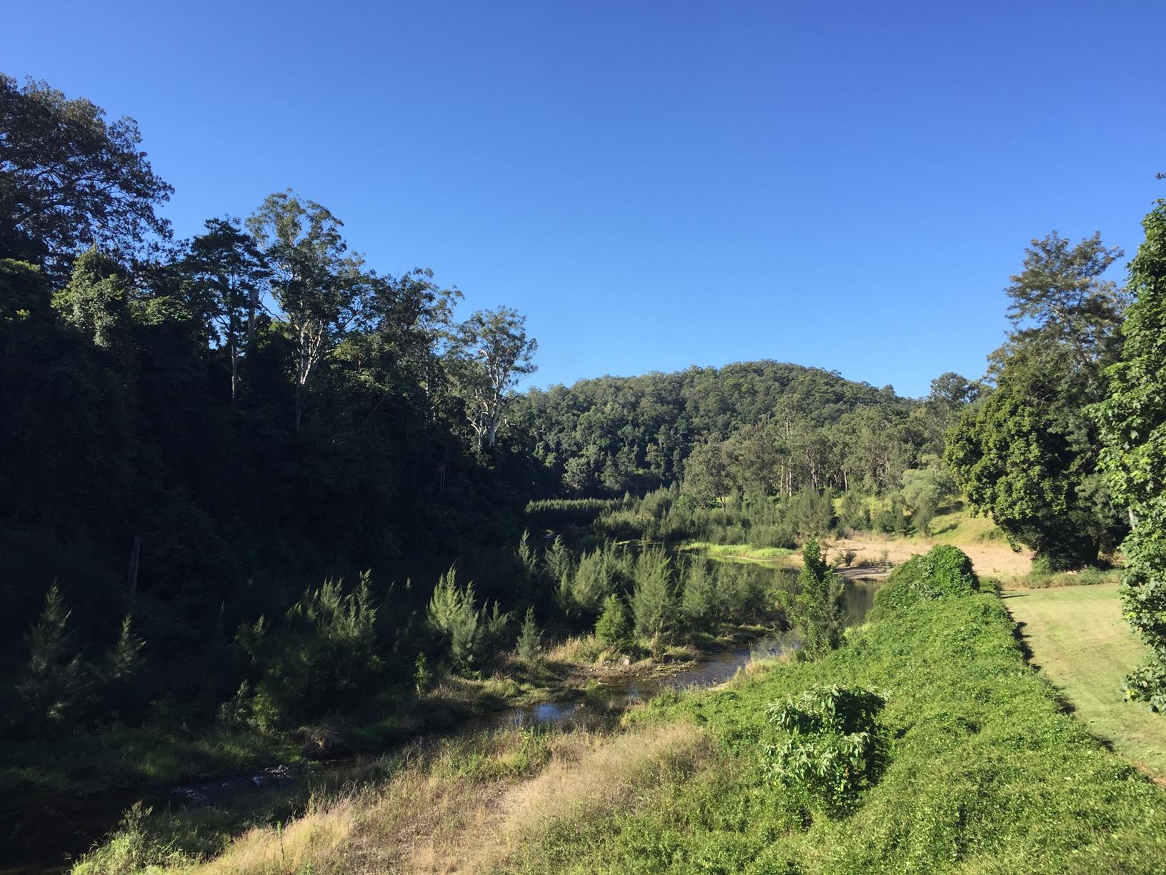
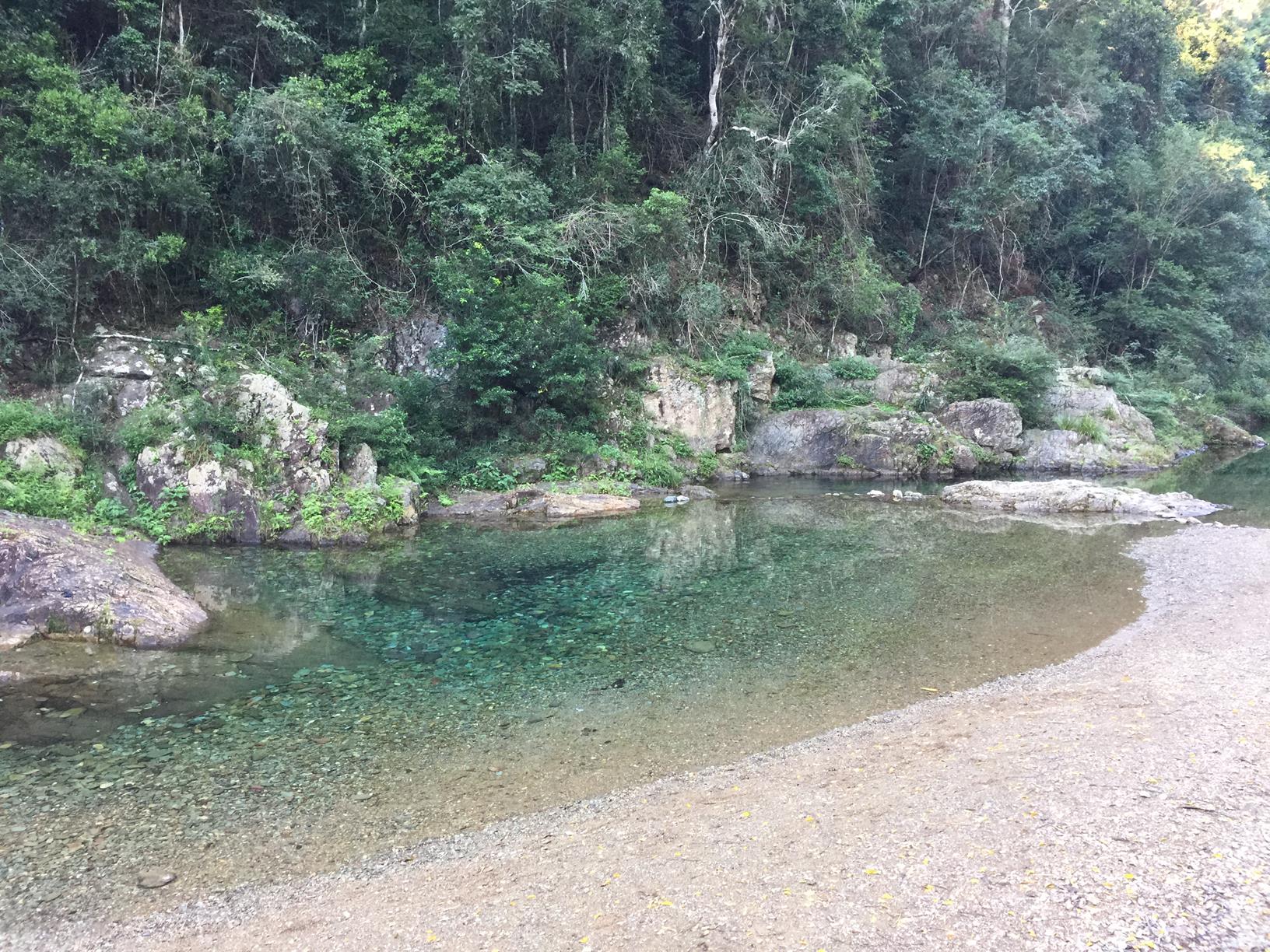
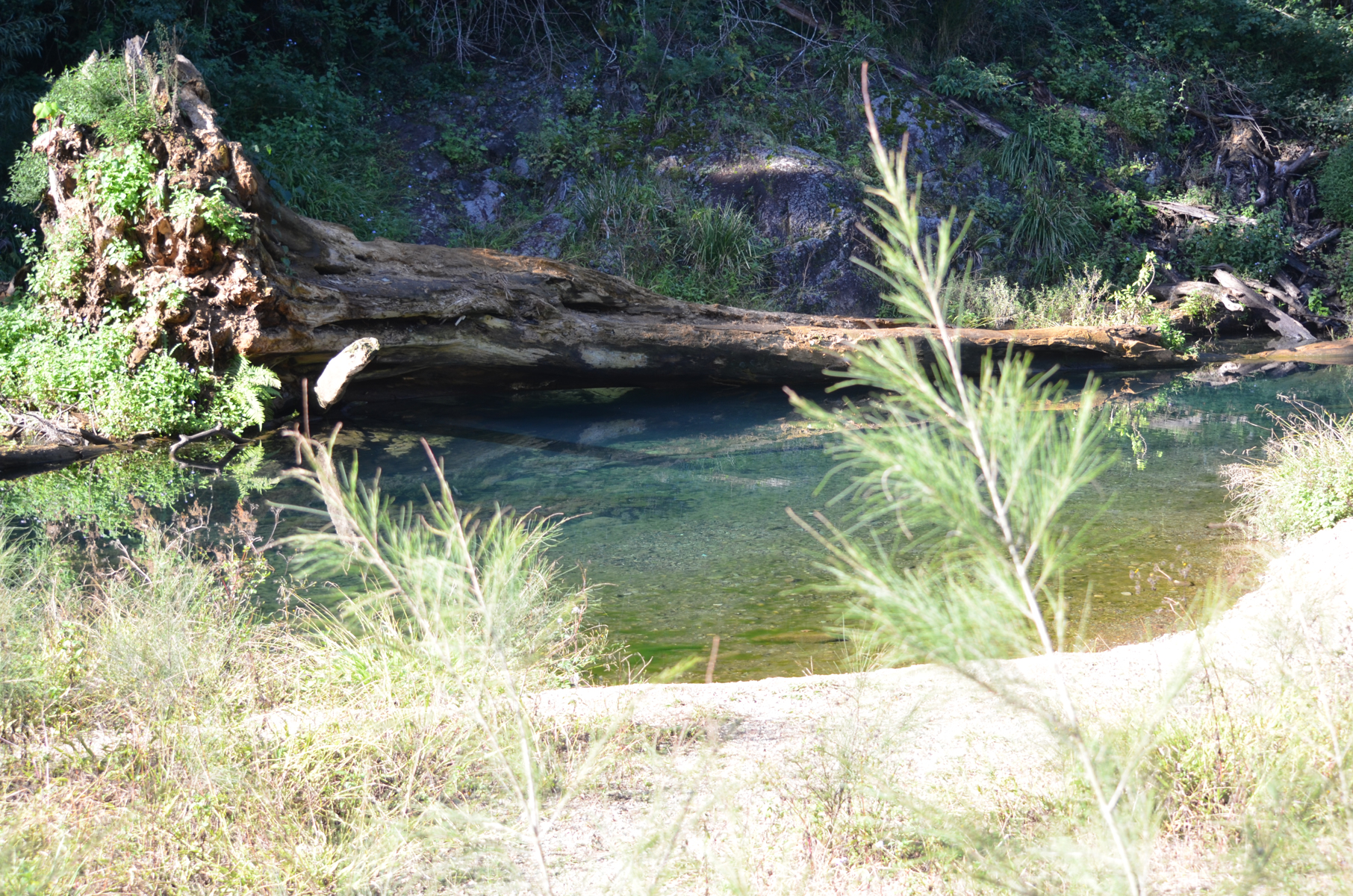
A surprising gem tucked just off the highway with both forest and creek views.

SUITABILITY
Suitable for all age groups and abilities.

HIGHLIGHTS
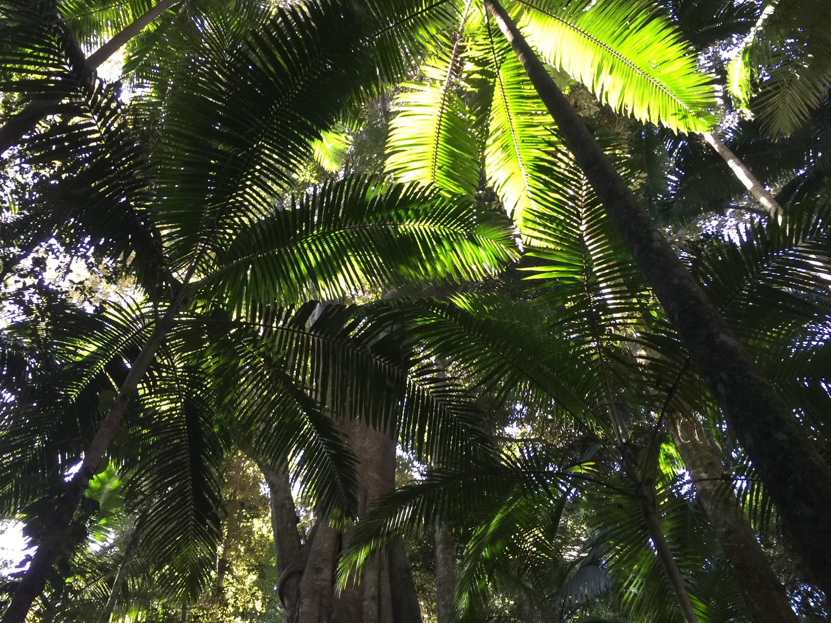
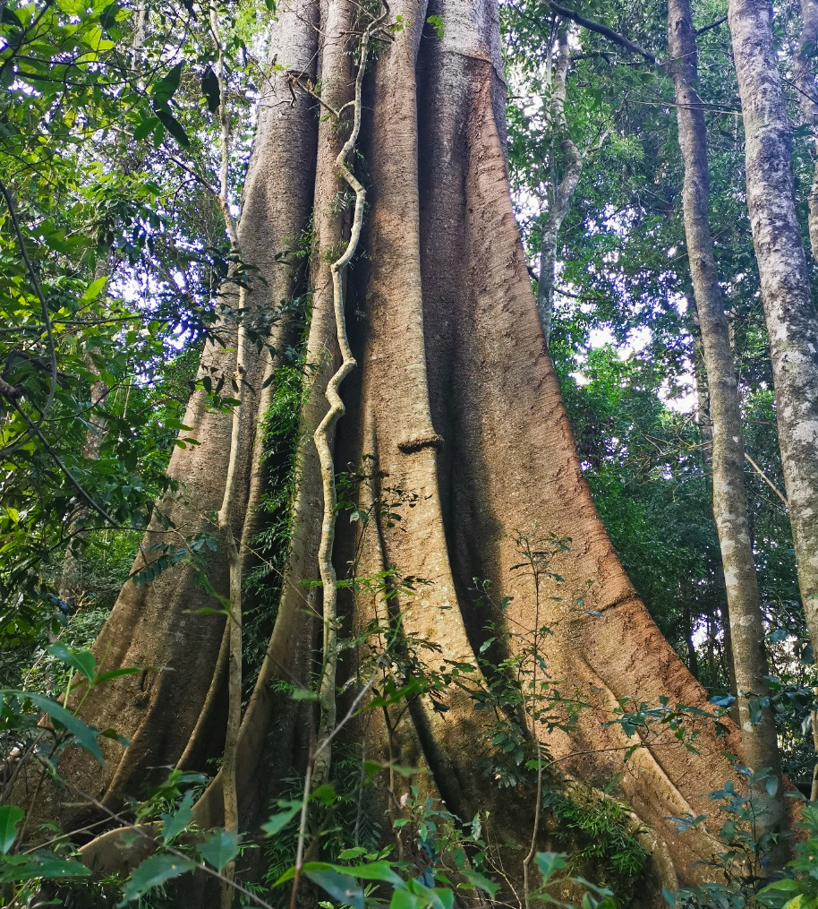
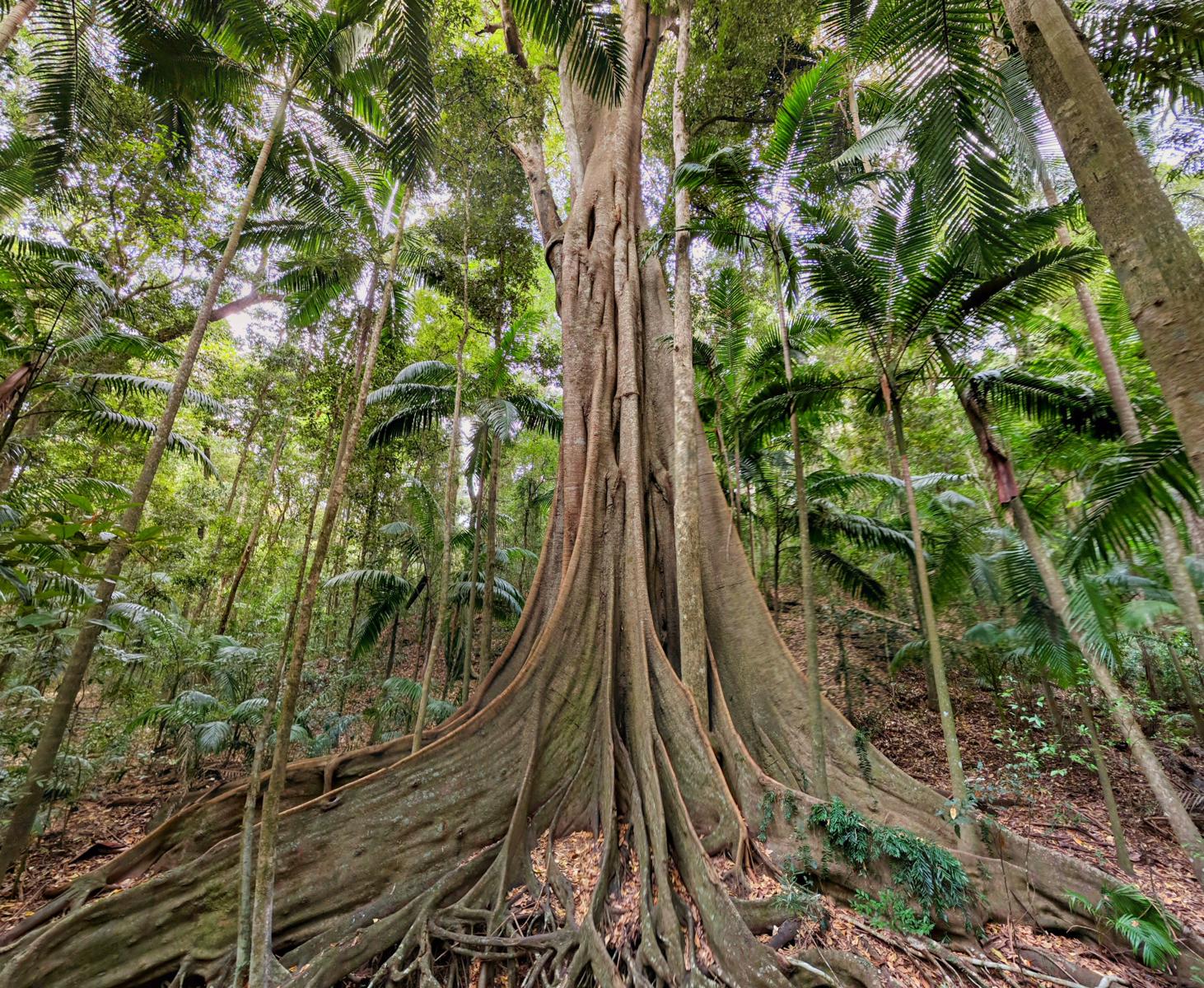
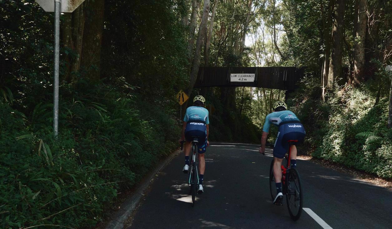
Little Yabba Park lies just south of Kenilworth on the highway towards Cambroon. Pull off on either side of the highway to access both sides of this lush, green park area. The Sunshine Coast Hinterland Poetry Trail has a spectacular ‘Buttress Root’ sculpture located in the park which is worth a look. Take a moment to read the beautiful poetry inscribed on the surface while listening to the creek ramble over rocks and the birds sing in the trees. The park straddles both sides of Maleny Kenilworth Road with an underpass connecting both sides so there’s no need to cross the highway. Amenities and a picnic area are available and access to Little Yabba Creek can be found along sections of the bank. A short walk across the bridge takes you to Fig Tree Walk, a wheelchair accessible, 1km circuit through the rainforest. In here you’ll find all manner of forest wildlife and an impressive number of Fig trees with enormous buttress roots securing them to the forest floor.

AFTERWARDS
Head into Kenilworth and sample some of the local cheese or a famous donut from the bakery. This quaint, hinterland town is worth taking a stroll around too as there are many gift shops and cafes to spend some time in.

HOW TO GET THERE
To the starting point: Take the Bruce Highway and turn off onto the Eumundi Kenilworth Road. Follow the signs to Kenilworth and drive through the town for 6km towards Cambroon on the Maleny Kenilworth Road to Little Yabba Park.
Parking is available on either side of the road. Cross the bridge to access Fig Tree Walk.

To the end point: The end point is the same as the starting point.

glossary button
Glossary
  • Icon showing this activity is suitable for wheelchairsSuitable for wheelchairs
  • Icon showing this activity is suitable for walkingSuitable for walking
  • Icon showing this activity is suitable for recreational cyclingSuitable for recreational cycling
  • Icon showing this activity is suitable for mountain bikingSuitable for mountain biking
  • Icon showing this activity is suitable for horse ridingSuitable for horse riding
  • Icon showing this activity is suitable for kayakingSuitable for kayaking
  • Icon showing this activity has drinking water availableDrinking water available
  • Icon showing this activity does not have drinking water availableNo drinking water available
  • Icon showing this activity has a barbeque on siteBarbeque on site
  • Icon showing this activity has a picnic table on sitePicnic table on site
  • Icon showing this activity has toilets on siteToilets on site
  • Icon showing fires are permitted at this activityFires permitted
  • Icon showing fires are prohibited at this activityFires prohibited
  • Icon showing camping is permitted at this activityCamping permitted
  • Icon showing camping is prohibited at this activityCamping prohibited
  • Suitable for walking Suitable for walking black lines Suitable for walking
  • No drinking water available No drinking water available No drinking water available
  • Picnic table on site Picnic table on site Picnic table on site
  • toilets on site toilets on site Toilets on site
  • Fires prohibited Fires prohibited Fires prohibited
  • Camping prohibited Camping prohibited Camping prohibited
Write a review

Review Date: 14/01/2024

This is not wheelchair accessible. The carpark is unsurfaced, the path to the start of the track is uneven and my wheels lost traction. Once entering the boardwalk it is lovely, but the uneven track between boardwalks had my wheel get caught in a rut unable to move. I started down the track from the fig tree, that was dangerously steep for a wheelchair, I decided that this track was not safe as a wheelchair user to access. A day in nature ruined.

Reviewed By: Liza

hazard icon

IN AN EMERGENCY DIAL '000'.

Always Adventure Safely!

  • Always follow any local signage, it contains key information and conditions can change at any time.
  • Use the trails with consideration for your abilities, be prepared for the adventure ahead:
    • Be aware of the weather conditions, found here: http://www.bom.gov.au/qld/.
    • Always wear appropriate clothing, focus on good footwear.
    • Always bring more water than you think you will need.
    • Be Sun Safe!
    • Always let someone know where you are going that isn’t going with you.
  • Just getting started try this site for good useful information: https://www.trailhiking.com.au/hike-safety/
  • Sunshine Coast Council does it’s best to maintain current information but things can change so always be aware that a trail may not be as listed in this guide, and report and issues via our feedback link.

Qld Parks and Wildlife Service

National Parks, Conservation Parks and some State Forests are managed by Queensland Parks and Wildlife Service. Contact details are: https://www.des.qld.gov.au/contactus/

For current information on trail conditions and alerts go to https://parks.des.qld.gov.au/park-alerts/#sunshinecoast

If you think something on this web site needs to change please let us know via: adventure@sunshinecoast.qld.gov.au

Nearby Trails

Trail Image for Road Cycle Route: Hinterland Loop
Difficult

Road Cycle Route: Hinterland Loop

Balmoral Ridge
walking icon cycling icon
Trail type
difficulty icon
Skill Level

95.8km

Length
direction icon
Circuit
Trail Image for Kenilworth Township Explore
Easy

Kenilworth Township Explore

Kenilworth
walking icon
Trail type
difficulty icon
Skill Level

1.6km

Length
direction icon
Circuit
Trail Image for Conondale National Park: Booloumba Creek & Strangler Cairn
Intermediate

Conondale National Park: Booloumba Creek & Strangler Cairn

Kenilworth
walking icon
Trail type
difficulty icon
Skill Level

2.9km

Length
direction icon
One-way
Trail Image for Conondale National Park: Booloumba Creek to Mount Allan Walk
Difficult

Conondale National Park: Booloumba Creek to Mount Allan Walk

Kenilworth
walking icon
Trail type
difficulty icon
Skill Level

6.0km

Length
direction icon
One-way
Trail Image for Conondale National Park: Conondale Range Great Walk – Full 56km Circuit
Difficult

Conondale National Park: Conondale Range Great Walk – Full 56km Circuit

Cambroon
walking icon
Trail type
difficulty icon
Skill Level

62.8km

Length
direction icon
Circuit

Share this trail

This action requires a login.
To continue, click on Login/Signup below.

Photo uploaded successfully, thank you.

Feedback / Suggest an Adventure

If you have any feedback on the site or any of the trails, please drop us a short email.

Have we missed something? Do you have an adventure to suggest? Fill in the suggestion form to let us know about it.