facebook
Image showing that the PDF download is in progress... PDF download in progress

Please wait...

Image showing a pink decorative paint splat
Image showing a green decorative paint splat
upload photo button
reviews buttonReviews view map buttonMap
view 3d map button3D Map
directions take me there buttonDirections
Save
PDF
Gpx File

Stanley River Park Circuit

Stanley River Park Circuit
Peachester
walking icon walking icon black
Trail type
difficulty icon
Skill Level
0.4km
Length
direction icon direction icon black
Circuit

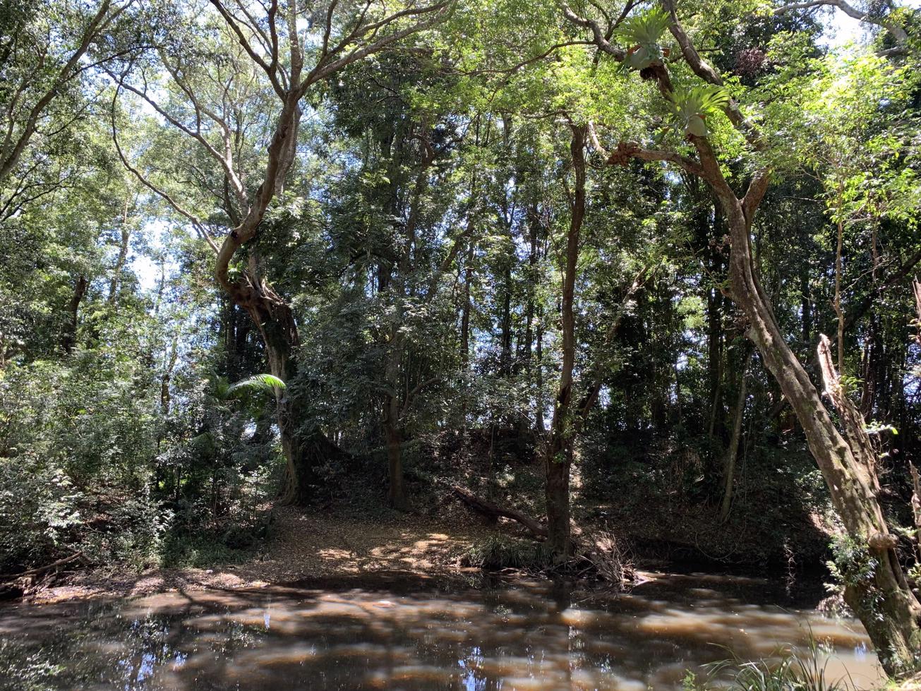
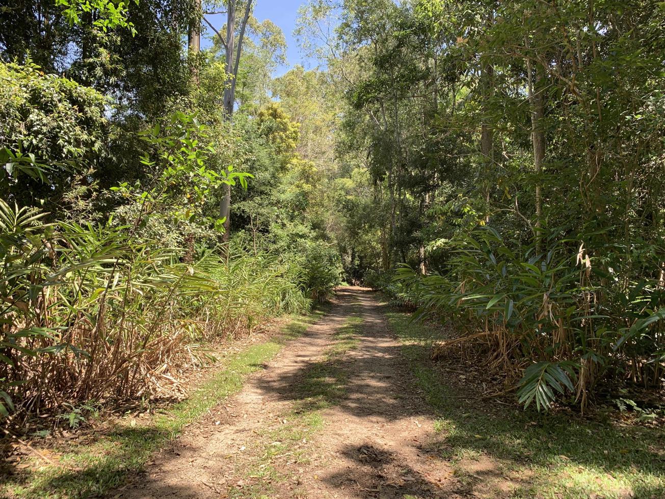
A lush green forest at the location of an important pioneering site.

SUITABILITY
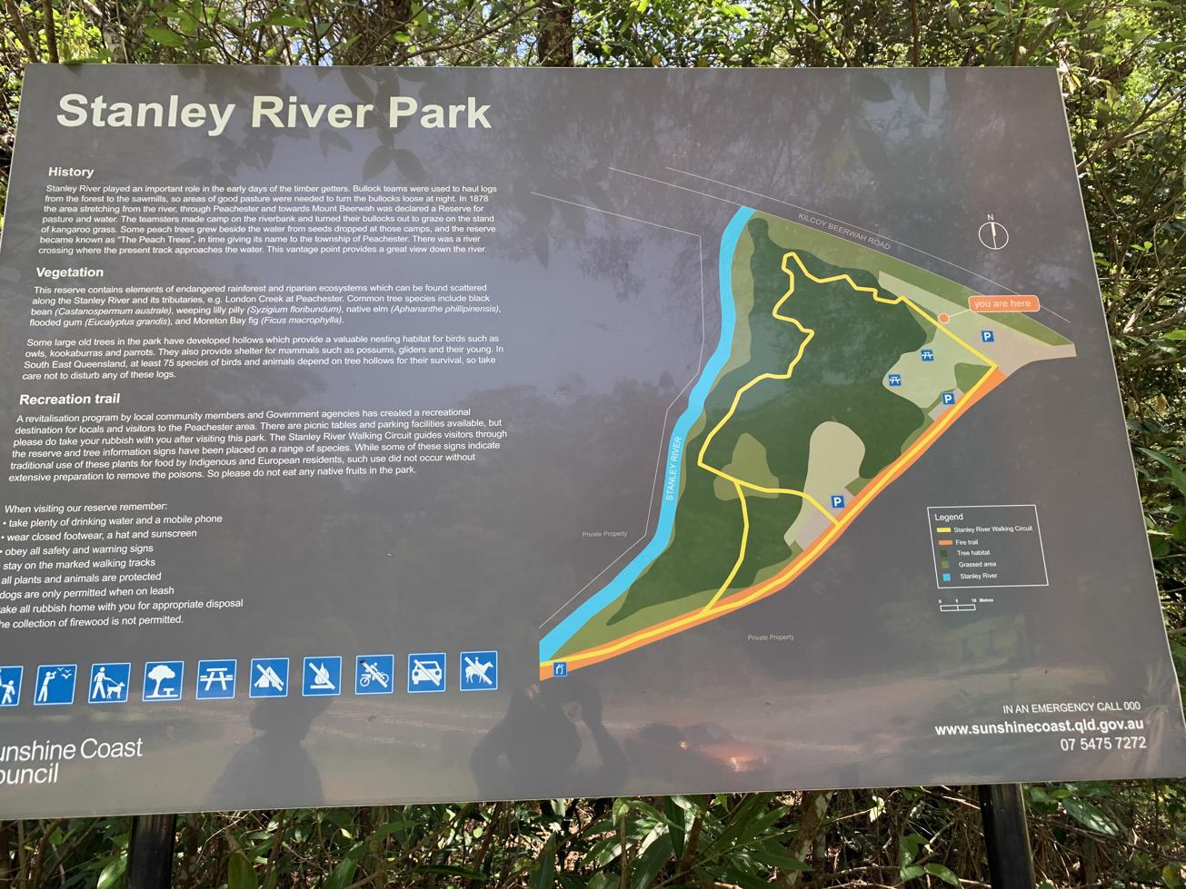
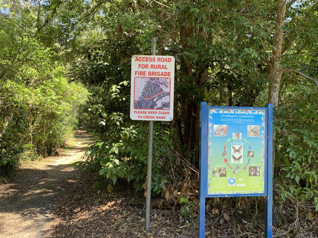
Suitable for walkers of all abilities.

HIGHLIGHTS
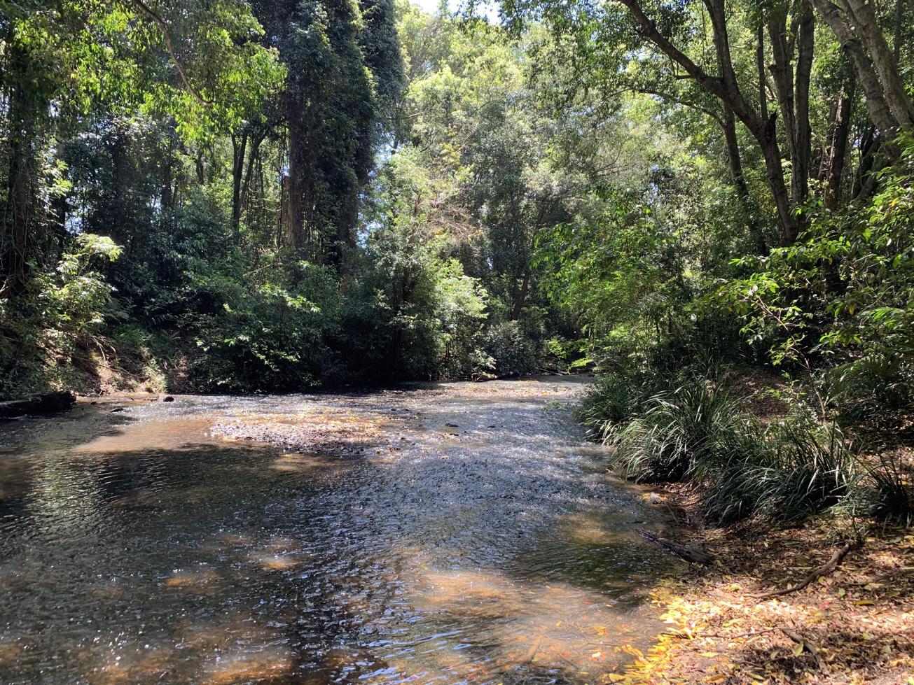
This small reserve is an interpretive forest walk with lots of signage designating different species of trees, including Blackbox. There are also large native gingers throughout. Part way round the circuit you can turn right and follow the vehicle access down to the river. Here you will see giant Strangler Figs and nice views upstream to the bridge and downstream as well.

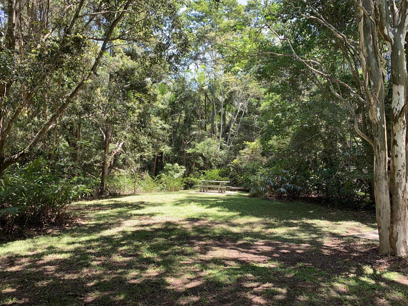
You can follow the river bank downstream on a cow trail to a sandy reach in the river before turning tail. On your way back you'll come across a pleasant grassy play come picnic as well as 2 other picnic tables.

The Stanley River is a major tributary of the Brisbane River. It extends approxmiately 35 kms westwards from south of Maleny, through Woodford to Kilcoy before veering southwards. The bridge is named after one of the pioneering families in Peachester. Elizabeth’s husband, William, ran a sawmill where the bridge is now located. The family also play an important role in growing the township of Peachester, building the Crohamhurst State School as well as many houses in the neighbourhood.

AFTERWARDS
This is a pleasant place to enjoy a picnic lunch or you could head back ito Peachester there are 2 great coffee shops to sit and relax.

For another historical adventure, from Peachester you can follow Knob Road northwards, which will eventually bring you back around into Landsborough where you can explore the Dularcha Train Tunnel either from Landsborough or Mooloolah.

HOW TO GET THERE
To the starting point: Stanley River Park is just before Eilzabeth Grigor Bridge over the Stanley River on the western side of Peachester about 1 km out of town. From Beerwah, follow the Beerwah-Kilcoy road west for about 9 km and you will arrive in Peachester. Keep going through town for another 1 km and the park is on your left. There walk starts here to your right.

To the end point: This is a mostly circular walk with the end point being your start point.

glossary button
Glossary
  • Icon showing this activity is suitable for wheelchairsSuitable for wheelchairs
  • Icon showing this activity is suitable for walkingSuitable for walking
  • Icon showing this activity is suitable for recreational cyclingSuitable for recreational cycling
  • Icon showing this activity is suitable for mountain bikingSuitable for mountain biking
  • Icon showing this activity is suitable for horse ridingSuitable for horse riding
  • Icon showing this activity is suitable for kayakingSuitable for kayaking
  • Icon showing this activity has drinking water availableDrinking water available
  • Icon showing this activity does not have drinking water availableNo drinking water available
  • Icon showing this activity has a barbeque on siteBarbeque on site
  • Icon showing this activity has a picnic table on sitePicnic table on site
  • Icon showing this activity has toilets on siteToilets on site
  • Icon showing fires are permitted at this activityFires permitted
  • Icon showing fires are prohibited at this activityFires prohibited
  • Icon showing camping is permitted at this activityCamping permitted
  • Icon showing camping is prohibited at this activityCamping prohibited
  • Suitable for walking Suitable for walking black lines Suitable for walking
  • No drinking water available No drinking water available No drinking water available
  • Picnic table on site Picnic table on site Picnic table on site
  • Fires prohibited Fires prohibited Fires prohibited
  • Camping prohibited Camping prohibited Camping prohibited
Write a review

Be the first to review this trail.

hazard icon

IN AN EMERGENCY DIAL '000'.

Always Adventure Safely!

  • Always follow any local signage, it contains key information and conditions can change at any time.
  • Use the trails with consideration for your abilities, be prepared for the adventure ahead:
    • Be aware of the weather conditions, found here: http://www.bom.gov.au/qld/.
    • Always wear appropriate clothing, focus on good footwear.
    • Always bring more water than you think you will need.
    • Be Sun Safe!
    • Always let someone know where you are going that isn’t going with you.
  • Just getting started try this site for good useful information: https://www.trailhiking.com.au/hike-safety/
  • Sunshine Coast Council does it’s best to maintain current information but things can change so always be aware that a trail may not be as listed in this guide, and report and issues via our feedback link.

Sunshine Coast Council

For any issues with this experience please contact:

Sunshine Coast Council via 07 5475 7272 or via e-mail: adventure@sunshinecoast.qld.gov.au

Nearby Trails

Trail Image for Stanley Riverbank Walk
Intermediate

Stanley Riverbank Walk

Peachester
walking icon
Trail type
difficulty icon
Skill Level

0.2km

Length
direction icon
One-way
Trail Image for Road Cycle Route: Bellthorpe Circuit
Difficult

Road Cycle Route: Bellthorpe Circuit

Bald Knob
walking icon cycling icon
Trail type
difficulty icon
Skill Level

78.4km

Length
direction icon
Circuit
Trail Image for Peachester State Forest: Long Trail
Difficult

Peachester State Forest: Long Trail

Peachester
walking icon mountain biking icon horse riding icon
Trail type
difficulty icon
Skill Level

10.4km

Length
direction icon
Circuit
Trail Image for Glass House Mountains National Park: Mt Beerwah View
Easy

Glass House Mountains National Park: Mt Beerwah View

Glass House Mountains
walking icon
Trail type
difficulty icon
Skill Level

0.2km

Length
direction icon
One-way
Trail Image for Mary Cairncross: Interpretive Boardwalk
Easy

Mary Cairncross: Interpretive Boardwalk

Maleny
walking icon
Trail type
difficulty icon
Skill Level

0.2km

Length
direction icon
Circuit

Share this trail

This action requires a login.
To continue, click on Login/Signup below.

Photo uploaded successfully, thank you.

Feedback / Suggest an Adventure

If you have any feedback on the site or any of the trails, please drop us a short email.

Have we missed something? Do you have an adventure to suggest? Fill in the suggestion form to let us know about it.