facebook
Image showing that the PDF download is in progress... PDF download in progress

Please wait...

Image showing a pink decorative paint splat
Image showing a green decorative paint splat
upload photo button

NOTE: This adventure is in Glass House Mountains National Park for current Queensland Parks and Wildlife Service parks information, maps and essential park alerts click here

reviews buttonReviews view map buttonMap
view 3d map button3D Map
directions take me there buttonDirections
Save
PDF
Gpx File

Glass House Mountains National Park: Mt Beerwah View

Glass House Mountains National Park: Mt Beerwah View
Glass House Mountains
walking icon walking icon black
Trail type
difficulty icon
Skill Level
0.2km
One-way Length
direction icon direction icon black
One-way

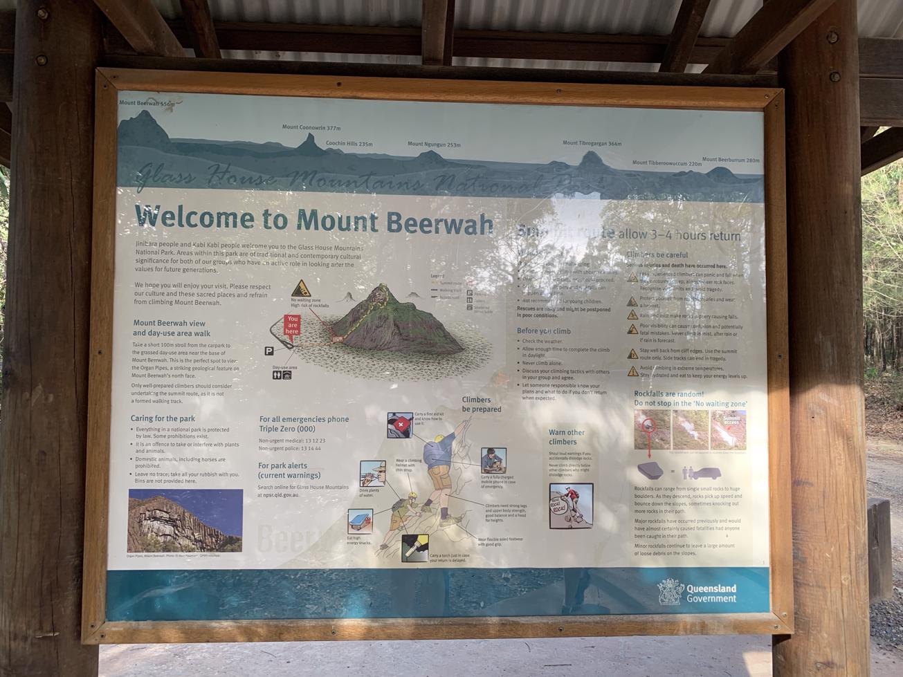
Beerwah has an easy 200m-return walk to its summit viewing and day-use area.

SUITABILITY
Suitable for walkers of all ages and abilities.

HIGHLIGHTS
Australian mountaineering legend, Michael Groom, was first inspired to climb mountains after sighting the Glass House Mountains when he was just a little boy. So, who knows where a walk to this picnic area and look-out could lead?

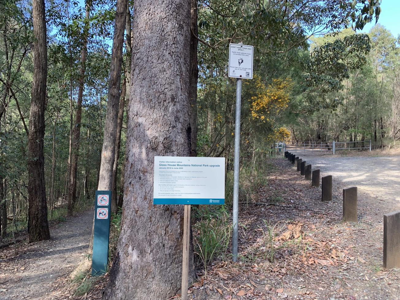
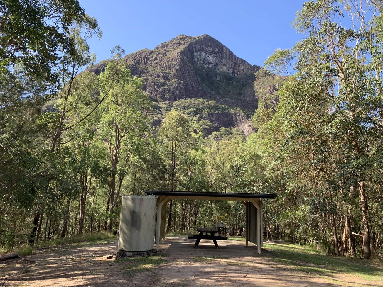
This is a short stroll through eucalypt forest to an open grassed area with tables and a picnic shelter and bush toilets. (No drinking water available but there is a tap to wash your hands.) It’s also the access route to the start of walks to Mt Beerwah summit climb and the western boundary walk.

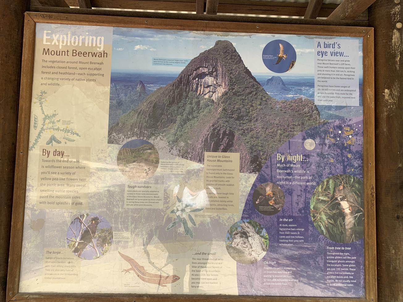
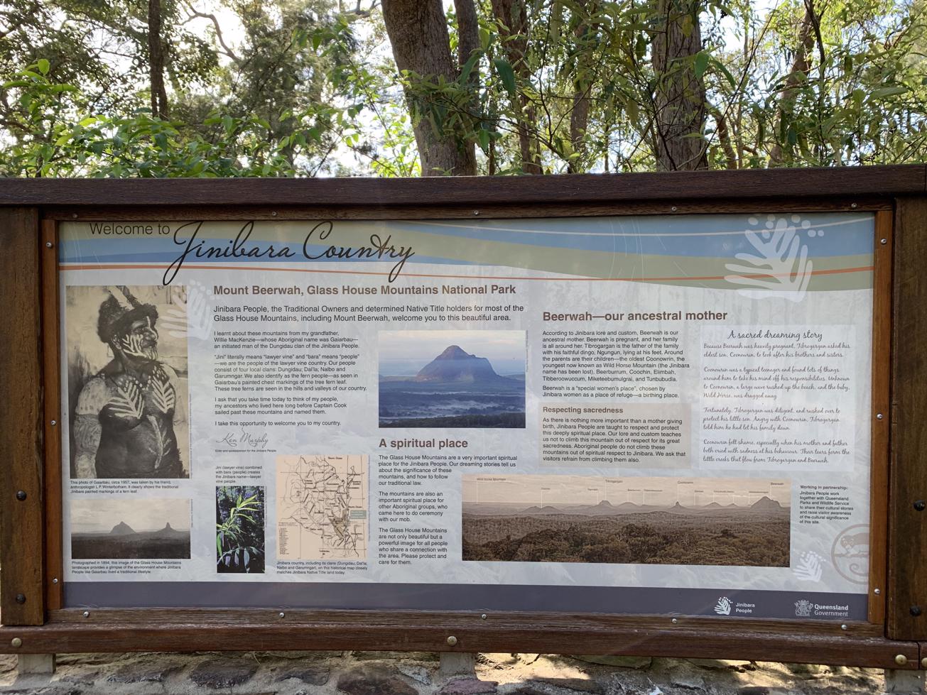
The picnic area clearing is the perfect spot to view the looming 556 m high Mount Beerwah and the Organ Pipes, a notable feature on Mount Beerwah’s north face. You can also chat to climbers returning from the summit about their epic experiences.

The day-use area has large signage panels on the mountain and the Jinibara People, native titleholders, who consider it sacred, preferring that the mountain not be climbed.

This is a place to pause and soak up the ambience and relive the awe people have felt for centuries encountering these amazing geological formations.

If you find the pathway to the picnic area too challenging there is always the parallel side trail that is easier and wider.

AFTERWARDS
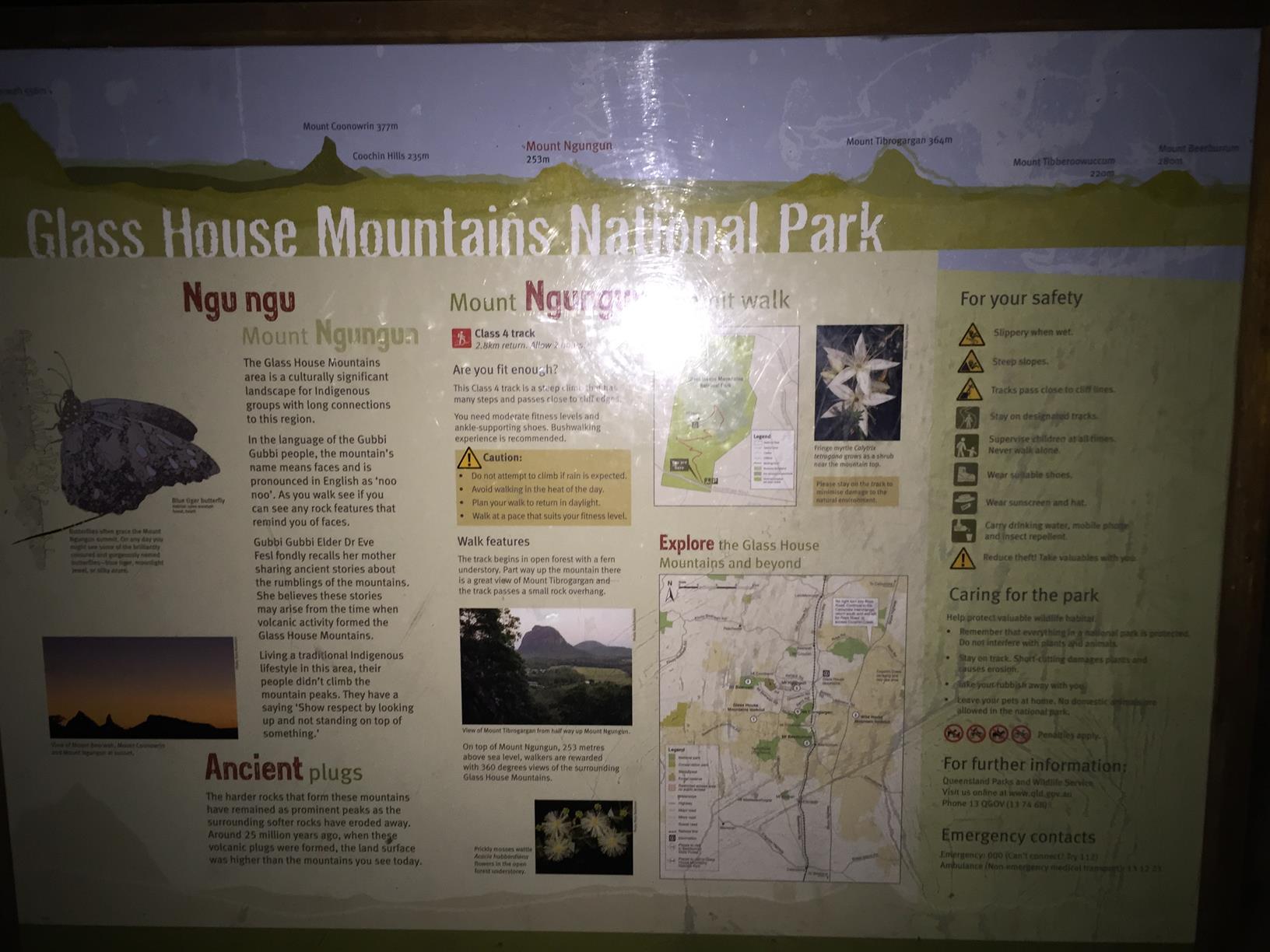
You can make a day of exploring scenic and cultural sites around the Glass House Mountains with short stops at the Bora Ring off Johston Road, an Axe Grinding Area off Old Gympie Road, Dularcha Tunnel (easily accessible from Mooloolah), The Glass House Mountains lookout and café on Glass House Woodford Road, and even the Ewen Maddock Boardwalk, north of Landsborough.

HOW TO GET THERE
To the starting point: Heading north from Brisbane on the M1 take the Steve Irwin Way and turn off at the township of Glass House Mountains. Head through town past the Info Centre (Reed St, Bruce Parade, Burgess Street and left into Coonowrin Road. Follow this road all the way till a T Junction with Old Gympie Road. Turn Left and the take the first right onto Mount Beerwah Road. Follow this road for 5 km to the carpark.

Heading South, take the Steve Irwin Turn-off (or the Johnston Road turn off and head west on it till you get to Crittendon Road. Turn Right and then Left onto Bowen Road. When it joins Steve Irwin Way, turn left and pop back up into Glass House Mountains township and follow earlier directions from there. The walks start from the Mt Beerwah carpark.

To the end point: It’s the same as your starting point.

glossary button
Glossary
  • Icon showing this activity is suitable for wheelchairsSuitable for wheelchairs
  • Icon showing this activity is suitable for walkingSuitable for walking
  • Icon showing this activity is suitable for recreational cyclingSuitable for recreational cycling
  • Icon showing this activity is suitable for mountain bikingSuitable for mountain biking
  • Icon showing this activity is suitable for horse ridingSuitable for horse riding
  • Icon showing this activity is suitable for kayakingSuitable for kayaking
  • Icon showing this activity has drinking water availableDrinking water available
  • Icon showing this activity does not have drinking water availableNo drinking water available
  • Icon showing this activity has a barbeque on siteBarbeque on site
  • Icon showing this activity has a picnic table on sitePicnic table on site
  • Icon showing this activity has toilets on siteToilets on site
  • Icon showing fires are permitted at this activityFires permitted
  • Icon showing fires are prohibited at this activityFires prohibited
  • Icon showing camping is permitted at this activityCamping permitted
  • Icon showing camping is prohibited at this activityCamping prohibited
  • Suitable for walking Suitable for walking black lines Suitable for walking
  • No drinking water available No drinking water available No drinking water available
  • Picnic table on site Picnic table on site Picnic table on site
  • toilets on site toilets on site Toilets on site
  • Fires prohibited Fires prohibited Fires prohibited
  • Camping prohibited Camping prohibited Camping prohibited
Write a review

Be the first to review this trail.

hazard icon

IN AN EMERGENCY DIAL '000'.

Always Adventure Safely!

  • Always follow any local signage, it contains key information and conditions can change at any time.
  • Use the trails with consideration for your abilities, be prepared for the adventure ahead:
    • Be aware of the weather conditions, found here: http://www.bom.gov.au/qld/.
    • Always wear appropriate clothing, focus on good footwear.
    • Always bring more water than you think you will need.
    • Be Sun Safe!
    • Always let someone know where you are going that isn’t going with you.
  • Just getting started try this site for good useful information: https://www.trailhiking.com.au/hike-safety/
  • Sunshine Coast Council does it’s best to maintain current information but things can change so always be aware that a trail may not be as listed in this guide, and report and issues via our feedback link.

Qld Parks and Wildlife Service

National Parks, Conservation Parks and some State Forests are managed by Queensland Parks and Wildlife Service. Contact details are: https://www.des.qld.gov.au/contactus/

For current information on trail conditions and alerts go to https://parks.des.qld.gov.au/park-alerts/#sunshinecoast

If you think something on this web site needs to change please let us know via: adventure@sunshinecoast.qld.gov.au

Nearby Trails

Trail Image for Peachester State Forest: Long Trail
Difficult

Peachester State Forest: Long Trail

Peachester
walking icon mountain biking icon horse riding icon
Trail type
difficulty icon
Skill Level

10.4km

Length
direction icon
Circuit
Trail Image for Glass House Mountains National Park: Mt. Ngungun Summit
Intermediate

Glass House Mountains National Park: Mt. Ngungun Summit

Glass House Mountains
walking icon
Trail type
difficulty icon
Skill Level

1.6km

Length
direction icon
One-way
Trail Image for Road Cycle Route: Bellthorpe Circuit
Difficult

Road Cycle Route: Bellthorpe Circuit

Bald Knob
walking icon cycling icon
Trail type
difficulty icon
Skill Level

78.4km

Length
direction icon
Circuit
Trail Image for Stanley Riverbank Walk
Intermediate

Stanley Riverbank Walk

Peachester
walking icon
Trail type
difficulty icon
Skill Level

0.2km

Length
direction icon
One-way
Trail Image for Stanley River Park Circuit
Easy

Stanley River Park Circuit

Peachester
walking icon
Trail type
difficulty icon
Skill Level

0.4km

Length
direction icon
Circuit

Share this trail

This action requires a login.
To continue, click on Login/Signup below.

Photo uploaded successfully, thank you.

Feedback / Suggest an Adventure

If you have any feedback on the site or any of the trails, please drop us a short email.

Have we missed something? Do you have an adventure to suggest? Fill in the suggestion form to let us know about it.