facebook
Image showing that the PDF download is in progress... PDF download in progress

Please wait...

Image showing a pink decorative paint splat
Image showing a green decorative paint splat
upload photo button
reviews buttonReviews view map buttonMap
view 3d map button3D Map
directions take me there buttonDirections
Save
PDF
Gpx File

Road Cycle Route: Bellthorpe Circuit

Road Cycle Route: Bellthorpe Circuit
Bald Knob
walking icon walking icon black cycling icon cycling icon black
Trail type
difficulty icon
Skill Level
78.4km
Length
direction icon direction icon black
Circuit

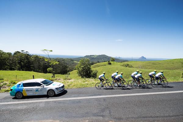
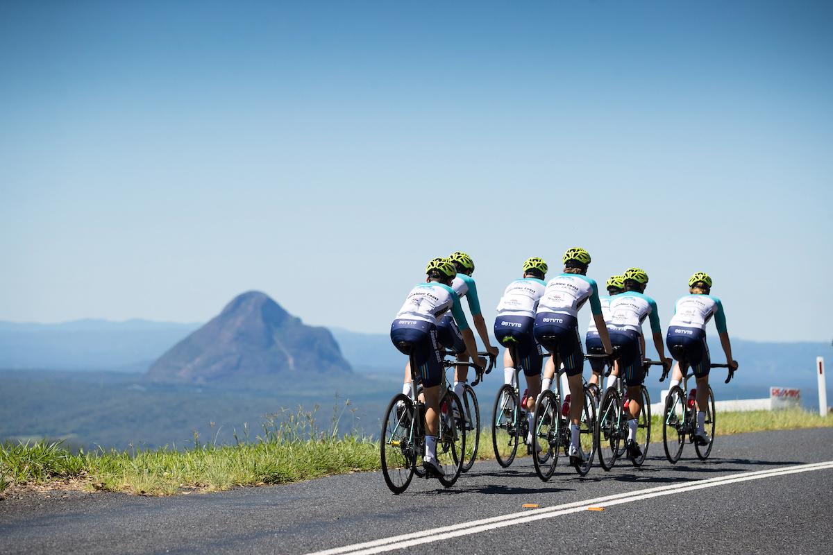
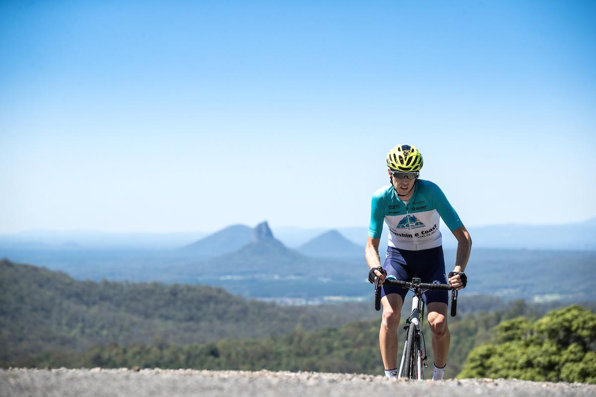
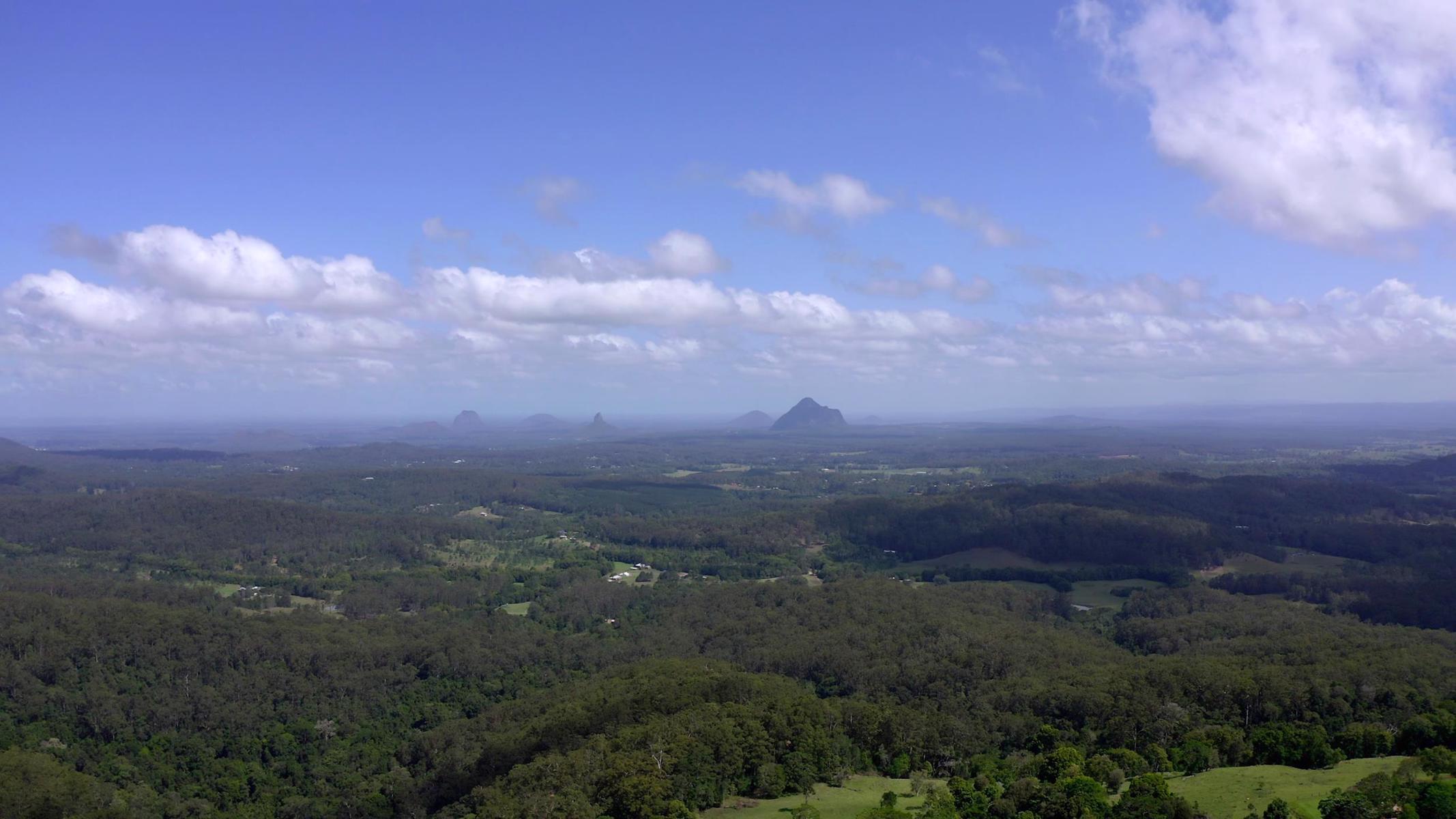
Amazing flowing climbs and views over the Glass house mountains as far as Brisbane.

SUITABILITY
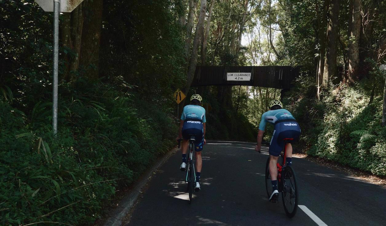
Suitable for experienced road cyclists with advanced skills riding in traffic and on rural roads with above average fitness. . Some road speeds are >60km/hr. Roads can be narrow and winding and most have narrow or no rideable shoulders. Advanced – includes 1200m of climbing.

HIGHLIGHTS
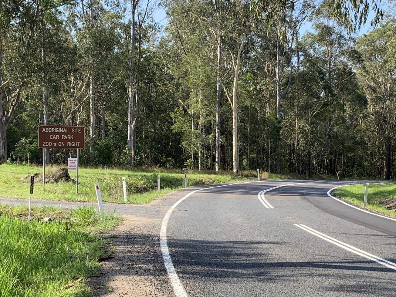
Get ready for a challenging climb on this hinterland ride. Leaving Landsborough you begin with a gentle ride to Beerwah then head onto Peachester Road as the climbing begins, gently at first and then a steep ascent through Bellthorpe National Park for unmatched views south to Glasshouse Mountains. Continue along the ridge to Maleny enjoying more stunning hinterland views. Stop in Maleny for a coffee and a snack before the downhill begins back to Landsborough through Bald Knob, with fast descents and sweeping corners. Watch for oncoming traffic on the narrow descent. This is a difficult ride with narrow winding roads but worth the challenge.

AFTERWARDS
Landsborough although small has ample cafes and restaurants to refuel you after your ride, including the historic Landsborough Hotel. Stop at Australia Zoo on your way back.

HOW TO GET THERE
Starts and finishes at Landsborough near the railway station. Plenty of parking in the area. Located on the railway, Landsborough is an easy train ride up from Brisbane or a 15 minute drive from the Sunshine Coast.

IMPORTANT: On-road cyclists should always ride with caution and be aware that conditions can change at any time. Cyclists using rural roads may encounter heavy vehicles and should be aware that roads can be narrow and undulating with varying shoulder widths. Notify someone of your intended route and be prepared with water, food and sun protection.

glossary button
Glossary
  • Icon showing this activity is suitable for wheelchairsSuitable for wheelchairs
  • Icon showing this activity is suitable for walkingSuitable for walking
  • Icon showing this activity is suitable for recreational cyclingSuitable for recreational cycling
  • Icon showing this activity is suitable for mountain bikingSuitable for mountain biking
  • Icon showing this activity is suitable for horse ridingSuitable for horse riding
  • Icon showing this activity is suitable for kayakingSuitable for kayaking
  • Icon showing this activity has drinking water availableDrinking water available
  • Icon showing this activity does not have drinking water availableNo drinking water available
  • Icon showing this activity has a barbeque on siteBarbeque on site
  • Icon showing this activity has a picnic table on sitePicnic table on site
  • Icon showing this activity has toilets on siteToilets on site
  • Icon showing fires are permitted at this activityFires permitted
  • Icon showing fires are prohibited at this activityFires prohibited
  • Icon showing camping is permitted at this activityCamping permitted
  • Icon showing camping is prohibited at this activityCamping prohibited
  • Suitable for walking Suitable for walking black lines Suitable for walking
  • Suitable for recreational cycling Suitable for recreational cycling Suitable for recreational cycling
  • No drinking water available No drinking water available No drinking water available
  • Fires prohibited Fires prohibited Fires prohibited
  • Camping prohibited Camping prohibited Camping prohibited
Write a review

Be the first to review this trail.

hazard icon

IN AN EMERGENCY DIAL '000'.

Always Adventure Safely!

  • Always follow any local signage, it contains key information and conditions can change at any time.
  • Use the trails with consideration for your abilities, be prepared for the adventure ahead:
    • Be aware of the weather conditions, found here: http://www.bom.gov.au/qld/.
    • Always wear appropriate clothing, focus on good footwear.
    • Always bring more water than you think you will need.
    • Be Sun Safe!
    • Always let someone know where you are going that isn’t going with you.
  • Just getting started try this site for good useful information: https://www.trailhiking.com.au/hike-safety/
  • Sunshine Coast Council does it’s best to maintain current information but things can change so always be aware that a trail may not be as listed in this guide, and report and issues via our feedback link.

Nearby Trails

Trail Image for Maleny Boardwalk: Platypus Walk
Easy

Maleny Boardwalk: Platypus Walk

Maleny
walking icon
Trail type
difficulty icon
Skill Level

0.8km

Length
direction icon
One-way
Trail Image for Road Cycle Route: Hinterland Loop
Difficult

Road Cycle Route: Hinterland Loop

Balmoral Ridge
walking icon cycling icon
Trail type
difficulty icon
Skill Level

95.8km

Length
direction icon
Circuit
Trail Image for Little Rocky Creek: Axe Grinding Site
Easy

Little Rocky Creek: Axe Grinding Site

Landsborough
walking icon
Trail type
difficulty icon
Skill Level

0.1km

Length
direction icon
One-way
Trail Image for Pioneer Park to Landsborough Township
null

Pioneer Park to Landsborough Township

Landsborough
walking icon cycling icon
Trail type
difficulty icon
Skill Level

1.3km

Length
direction icon
One-way
Trail Image for Maleny Trail to Reynolds Crossing
Intermediate

Maleny Trail to Reynolds Crossing

Maleny
walking icon cycling icon
Trail type
difficulty icon
Skill Level

3.6km

Length
direction icon
One-way

Share this trail

This action requires a login.
To continue, click on Login/Signup below.

Photo uploaded successfully, thank you.

Feedback / Suggest an Adventure

If you have any feedback on the site or any of the trails, please drop us a short email.

Have we missed something? Do you have an adventure to suggest? Fill in the suggestion form to let us know about it.