facebook
Image showing that the PDF download is in progress... PDF download in progress

Please wait...

Image showing a pink decorative paint splat
Image showing a green decorative paint splat
upload photo button
reviews buttonReviews view map buttonMap
view 3d map button3D Map
directions take me there buttonDirections
Save
PDF
Gpx File

Little Rocky Creek: Axe Grinding Site

Little Rocky Creek: Axe Grinding Site
Landsborough
walking icon walking icon black
Trail type
difficulty icon
Skill Level
0.1km
One-way Length
direction icon direction icon black
One-way

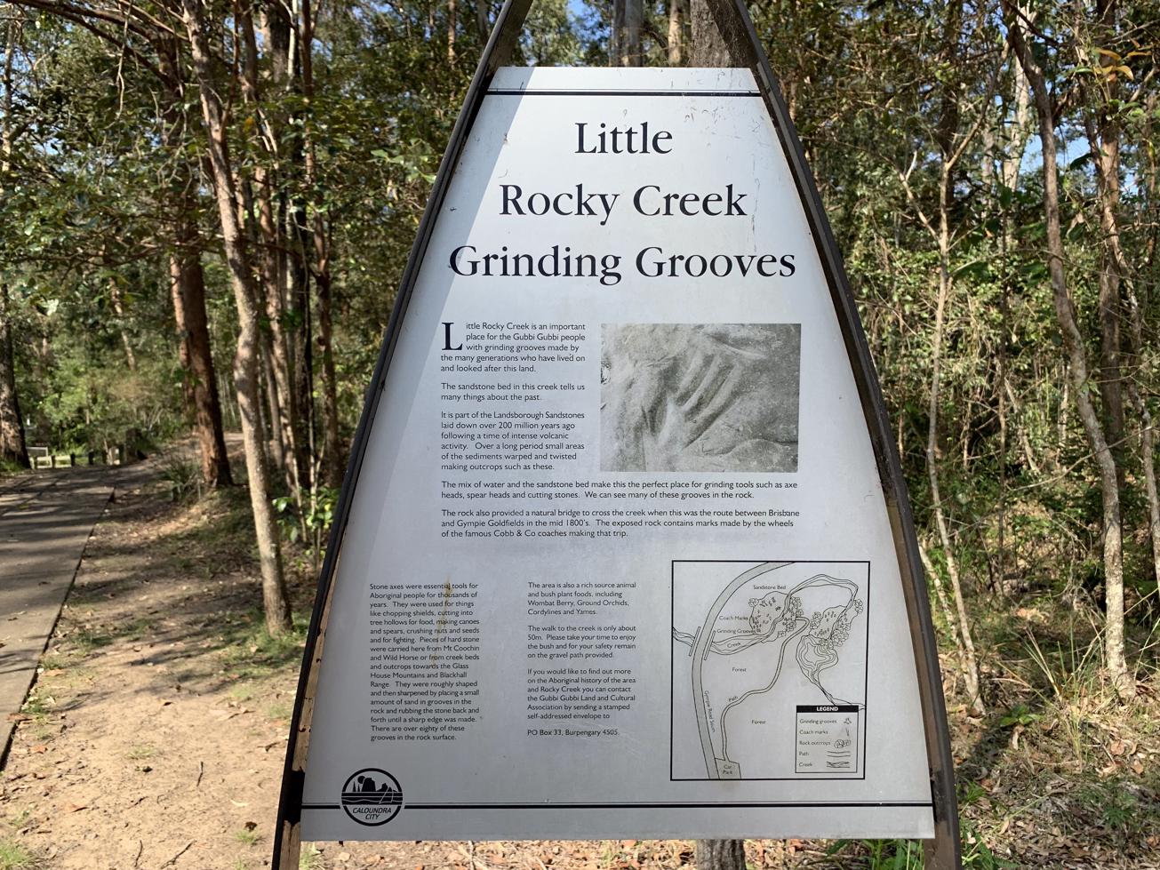
Discover a historic site, used by the First Nations people for many generations to make tools.

SUITABILITY
Suitable for all walkers and is a safe and short walk for families.

HIGHLIGHTS
This First Nations stone grinding site highlights the ingenuity of the Gubbi Gubbi people in creating the tools they needed to live and hunt.

Before you view the historical site, take time to the read the information board and understand the significant cultural importance of the area.
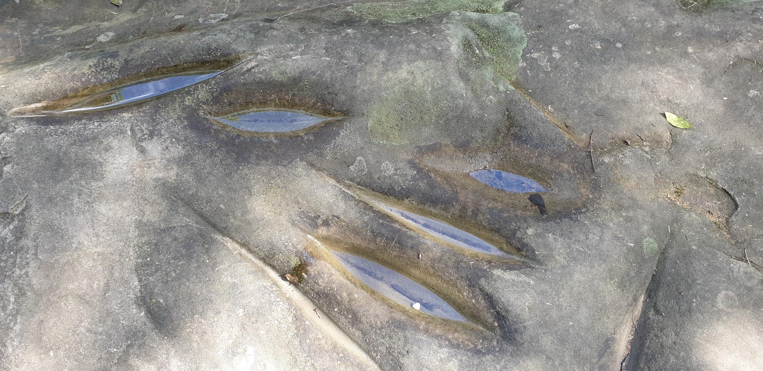
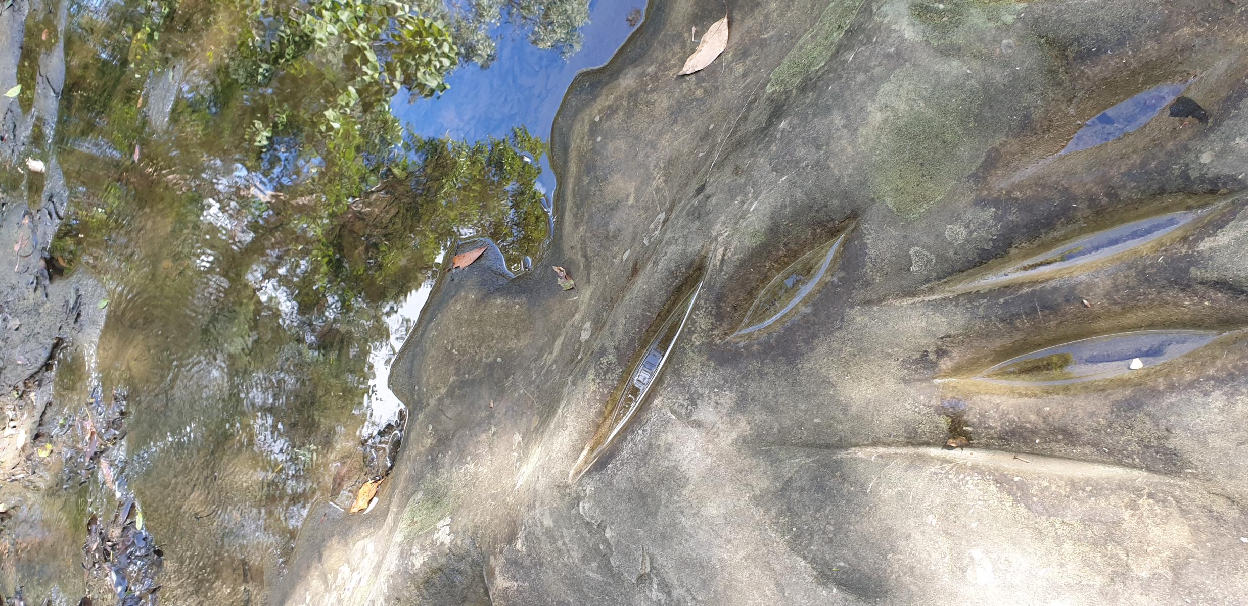
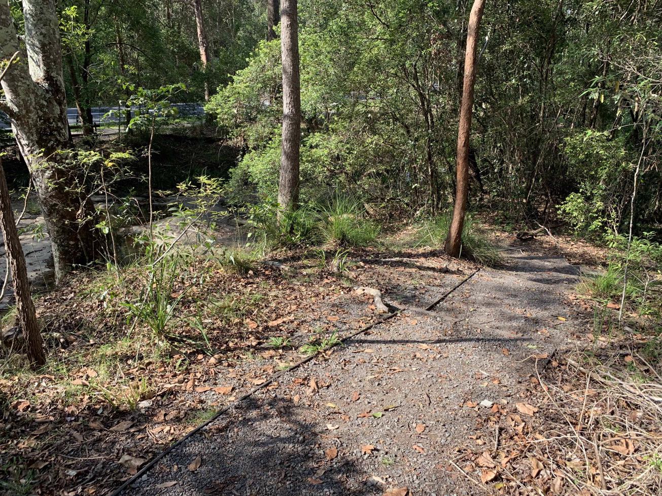
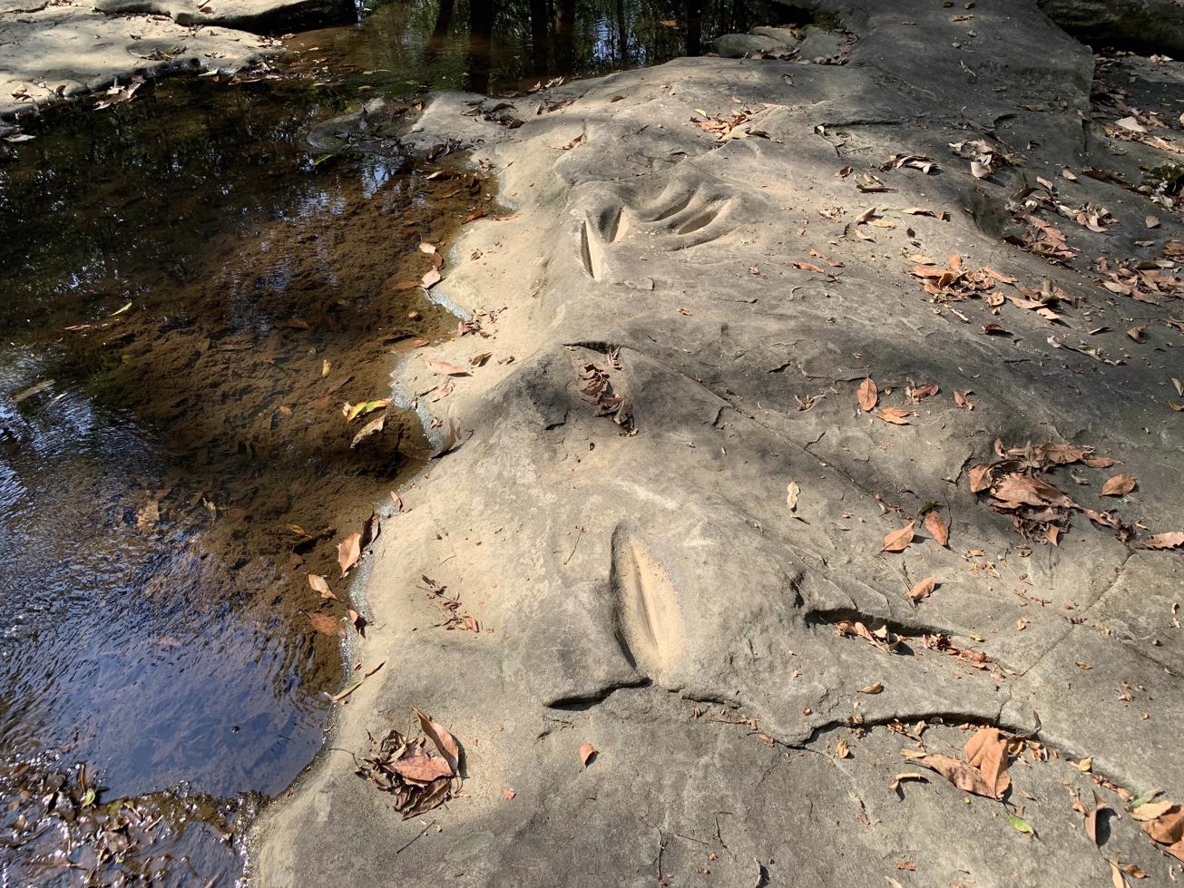
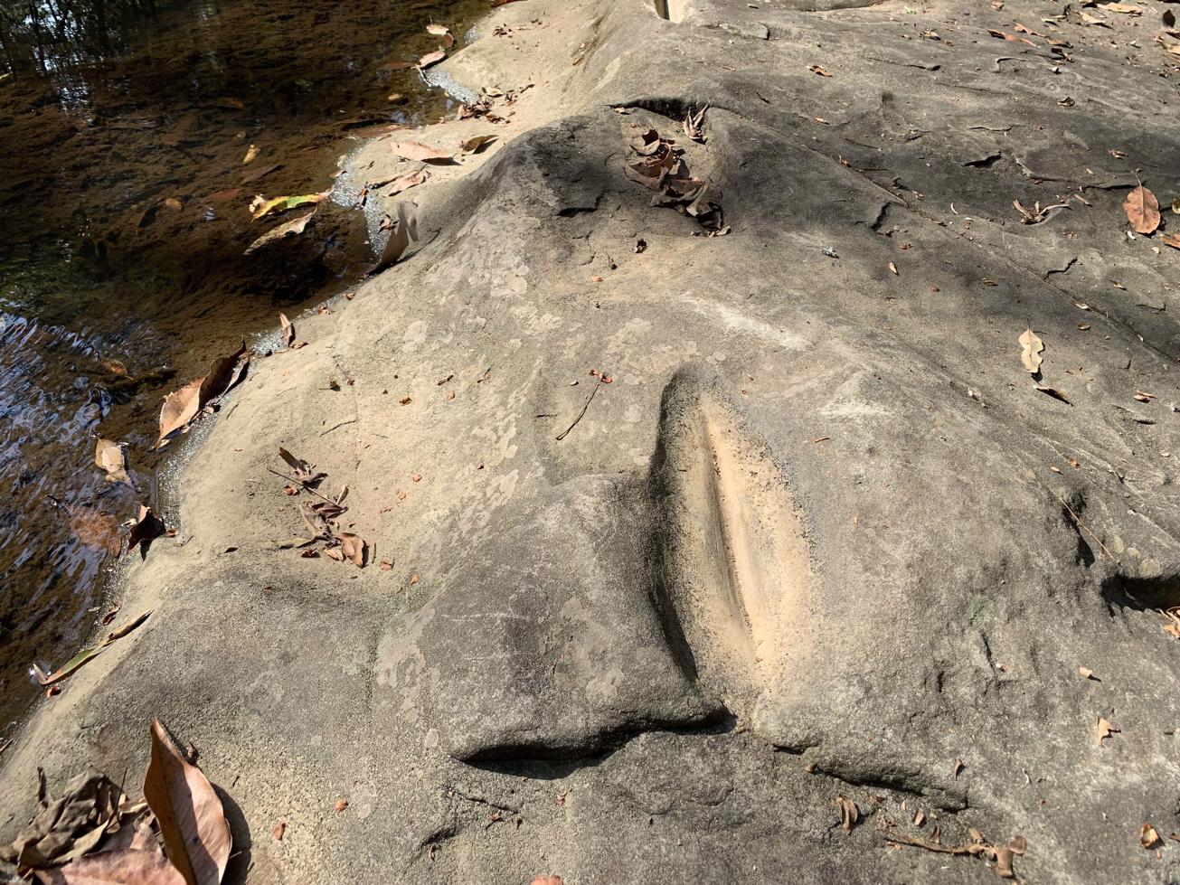
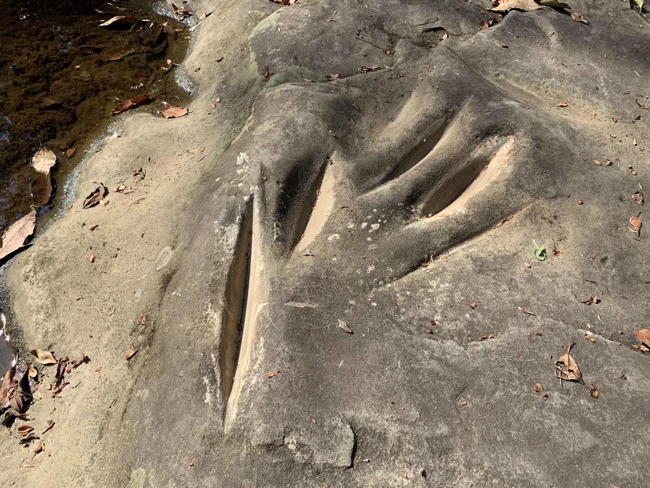
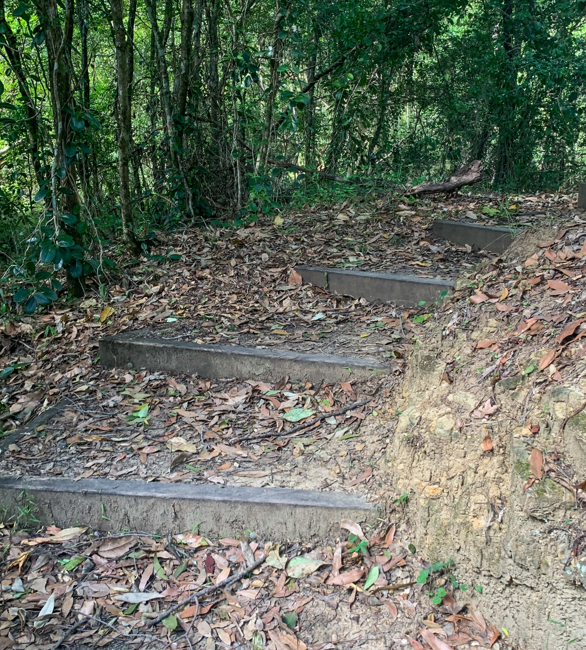
From here follow the path along a short gravel track and section of stairs to a wooden viewing platform. Here you will be able to view the grooves that are well defined and worn to the shape of the stone axes.


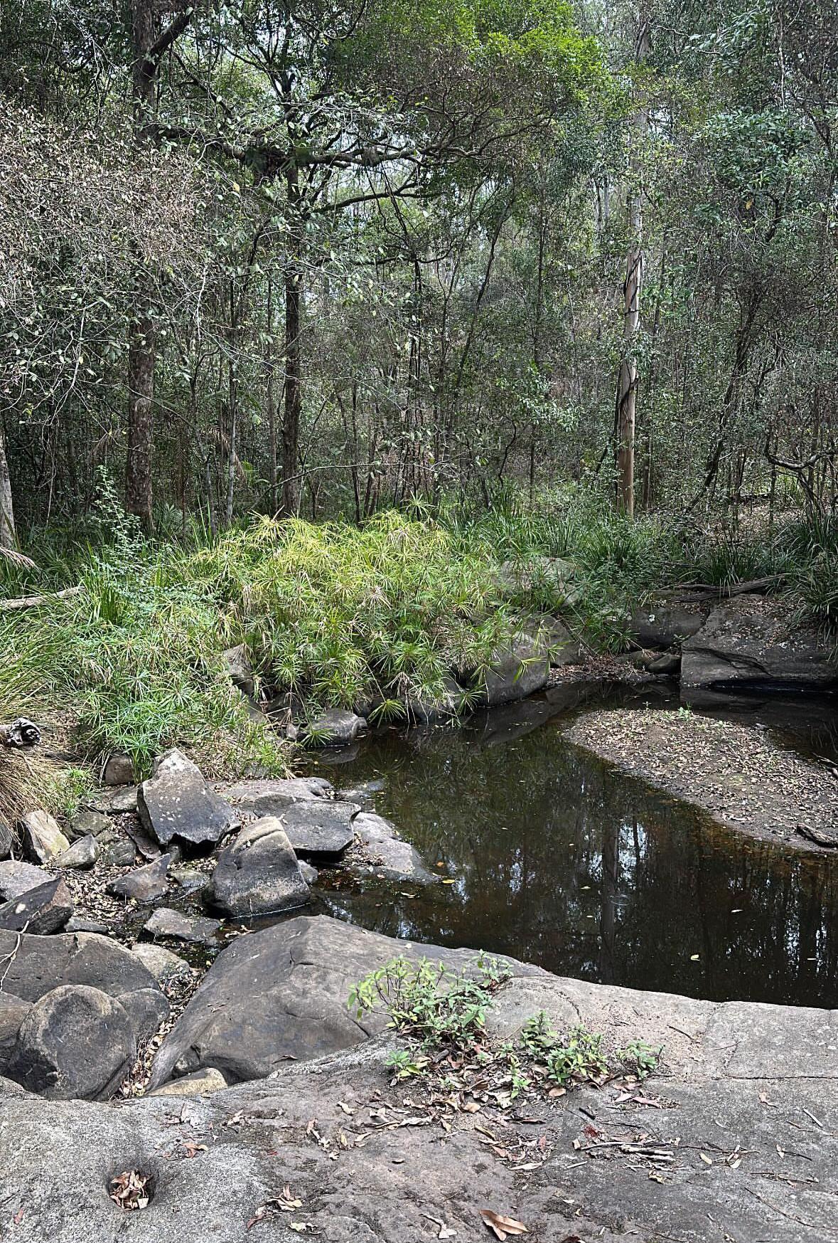
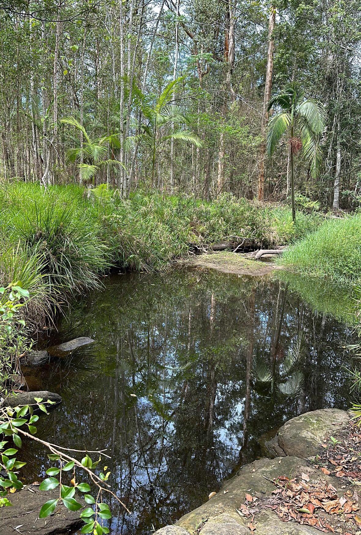
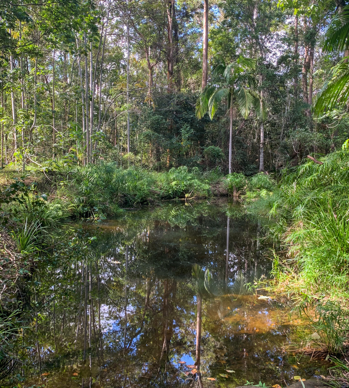
The sandstone and water flow made for a perfect place for grinding tools such as axe heads, spearheads, and cutting stones, with the harder stone used for the implement being brought in from other Glasshouse Mountain locations. As you explore this pretty little creek, have a look around – you are likely to see more grooves and evidence of past life.

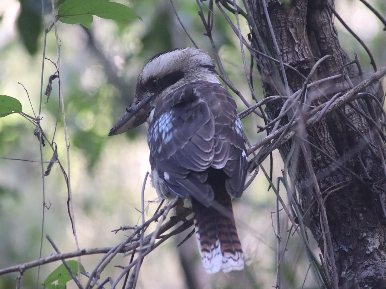
As you walk through the forest, keep an eye out for the nesting boxes in the trees for birds and the goannas roaming about.

AFTERWARDS
There is another First Nations cultural site not far away - Beerwah State Forest Bora Ring. An ancient meeting site used for gatherings, dancing and ceremonies. The bora ring (or Durn) is well maintained and easy to access, suitable for all agers and abilities (accessed via Moffat Road, east off of Steve Irwin Way.) The Mount Beerwah Picnic Area provides a great view of the local area and has more information about local First Nations heritage.

The Rocky Creek Scout Campsite is open to the public and a good base to stay while discovering the Glass House Mountains area.

HOW TO GET THERE
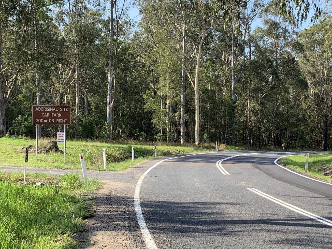
To the starting point: On Steve Irwin Way, turn off into Landsborough (Railway Street, Maleny St) and at the roundabout turn left into Gympie Street South. Approximately 1.5 km down this road (heading south) it turns into Old Gympie Road. There you will see a brown sign indicating the aboriginal site 100 metres ahead, just around the corner. Park the car here. If you miss the entry to the small car park, you can park in front of the Rocky Creek Scout campsite that is just beyond. It is only a short walk to the creek.

To the end point: This is the same as your starting point.

glossary button
Glossary
  • Icon showing this activity is suitable for wheelchairsSuitable for wheelchairs
  • Icon showing this activity is suitable for walkingSuitable for walking
  • Icon showing this activity is suitable for recreational cyclingSuitable for recreational cycling
  • Icon showing this activity is suitable for mountain bikingSuitable for mountain biking
  • Icon showing this activity is suitable for horse ridingSuitable for horse riding
  • Icon showing this activity is suitable for kayakingSuitable for kayaking
  • Icon showing this activity has drinking water availableDrinking water available
  • Icon showing this activity does not have drinking water availableNo drinking water available
  • Icon showing this activity has a barbeque on siteBarbeque on site
  • Icon showing this activity has a picnic table on sitePicnic table on site
  • Icon showing this activity has toilets on siteToilets on site
  • Icon showing fires are permitted at this activityFires permitted
  • Icon showing fires are prohibited at this activityFires prohibited
  • Icon showing camping is permitted at this activityCamping permitted
  • Icon showing camping is prohibited at this activityCamping prohibited
  • Suitable for walking Suitable for walking black lines Suitable for walking
  • No drinking water available No drinking water available No drinking water available
  • Fires prohibited Fires prohibited Fires prohibited
  • Camping prohibited Camping prohibited Camping prohibited
Write a review

Be the first to review this trail.

hazard icon

IN AN EMERGENCY DIAL '000'.

Always Adventure Safely!

  • Always follow any local signage, it contains key information and conditions can change at any time.
  • Use the trails with consideration for your abilities, be prepared for the adventure ahead:
    • Be aware of the weather conditions, found here: http://www.bom.gov.au/qld/.
    • Always wear appropriate clothing, focus on good footwear.
    • Always bring more water than you think you will need.
    • Be Sun Safe!
    • Always let someone know where you are going that isn’t going with you.
  • Just getting started try this site for good useful information: https://www.trailhiking.com.au/hike-safety/
  • Sunshine Coast Council does it’s best to maintain current information but things can change so always be aware that a trail may not be as listed in this guide, and report and issues via our feedback link.

Qld Parks and Wildlife Service

National Parks, Conservation Parks and some State Forests are managed by Queensland Parks and Wildlife Service. Contact details are: https://www.des.qld.gov.au/contactus/

For current information on trail conditions and alerts go to https://parks.des.qld.gov.au/park-alerts/#sunshinecoast

If you think something on this web site needs to change please let us know via: adventure@sunshinecoast.qld.gov.au

Nearby Trails

Trail Image for Road Cycle Route: Bellthorpe Circuit
Difficult

Road Cycle Route: Bellthorpe Circuit

Bald Knob
walking icon cycling icon
Trail type
difficulty icon
Skill Level

78.4km

Length
direction icon
Circuit
Trail Image for Skippy Park: Landsborough Criterium
Easy

Skippy Park: Landsborough Criterium

Landsborough
walking icon cycling icon mountain biking icon
Trail type
difficulty icon
Skill Level

1.3km

Length
direction icon
Circuit
Trail Image for Pioneer Park to Landsborough Township
null

Pioneer Park to Landsborough Township

Landsborough
walking icon cycling icon
Trail type
difficulty icon
Skill Level

1.3km

Length
direction icon
One-way
Trail Image for Dularcha National Park: Tunnel Track
Intermediate

Dularcha National Park: Tunnel Track

Landsborough
walking icon mountain biking icon horse riding icon
Trail type
difficulty icon
Skill Level

3.4km

Length
direction icon
One-way
Trail Image for Ewen Maddock Dam Main Track
Intermediate

Ewen Maddock Dam Main Track

Glenview
walking icon mountain biking icon horse riding icon
Trail type
difficulty icon
Skill Level

9.0km

Length
direction icon
One-way

Share this trail

This action requires a login.
To continue, click on Login/Signup below.

Photo uploaded successfully, thank you.

Feedback / Suggest an Adventure

If you have any feedback on the site or any of the trails, please drop us a short email.

Have we missed something? Do you have an adventure to suggest? Fill in the suggestion form to let us know about it.