facebook
Image showing that the PDF download is in progress... PDF download in progress

Please wait...

Image showing a pink decorative paint splat
Image showing a green decorative paint splat
upload photo button
reviews buttonReviews view map buttonMap
view 3d map button3D Map
directions take me there buttonDirections
Save
PDF
Gpx File

Currimundi South Arm Loop

Currimundi South Arm Loop
Aroona
walking icon walking icon black cycling icon cycling icon black
Trail type
difficulty icon
Skill Level
4.2km
Length
direction icon direction icon black
Circuit

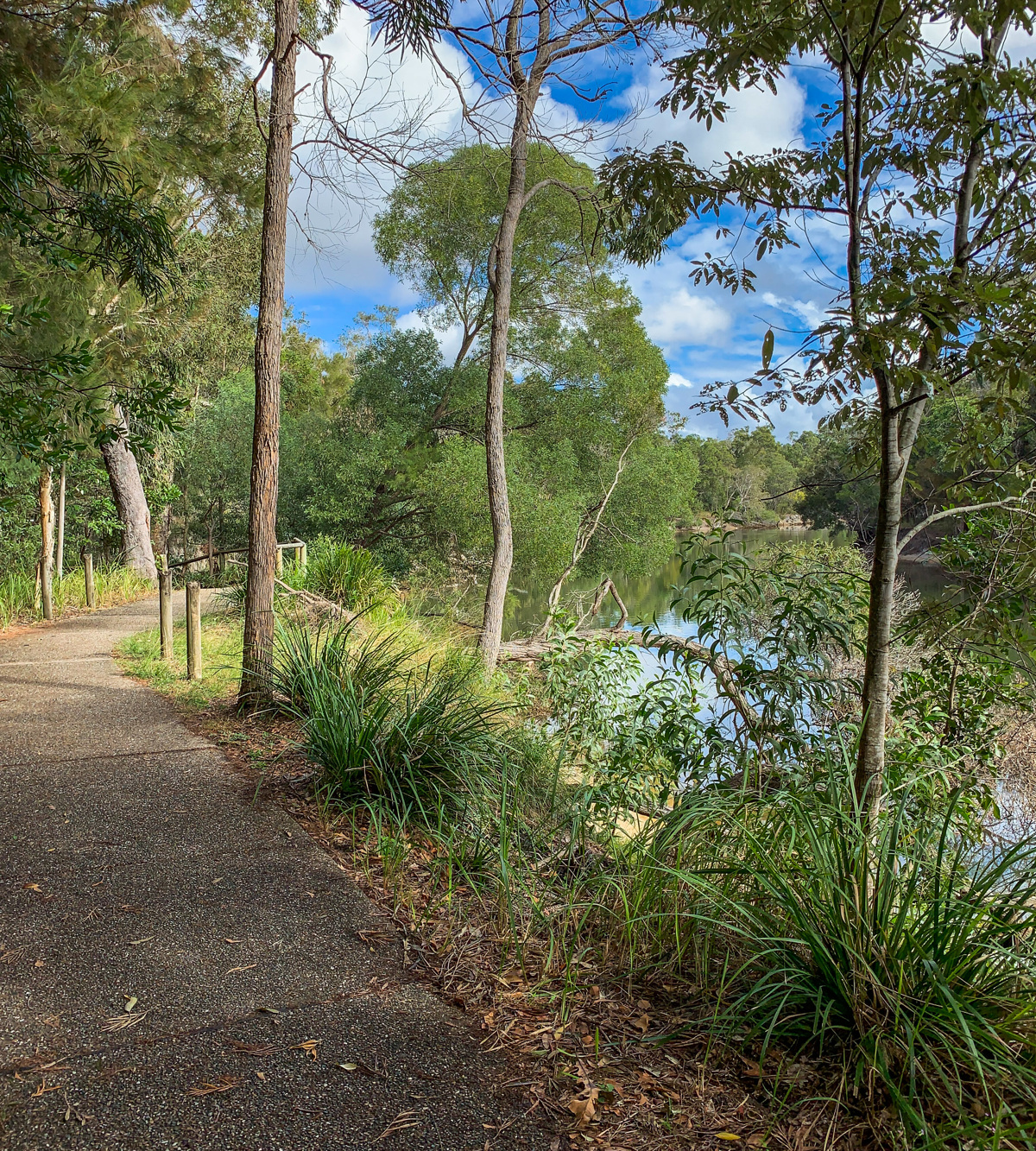
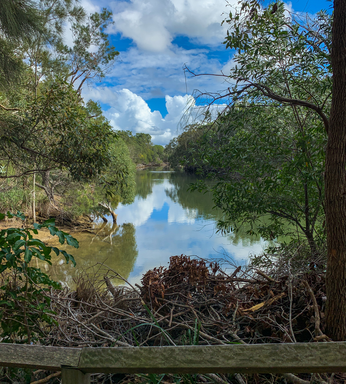
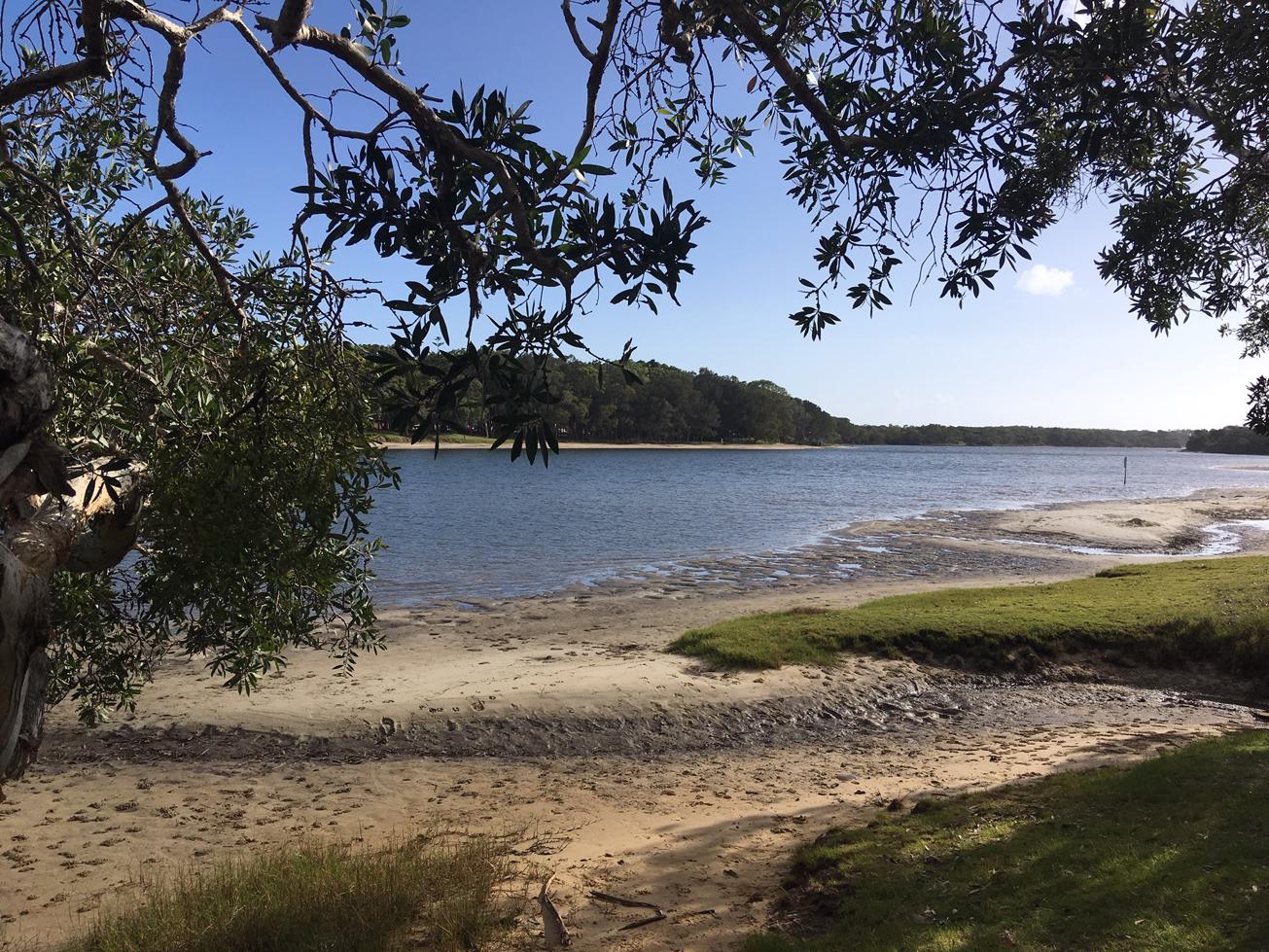
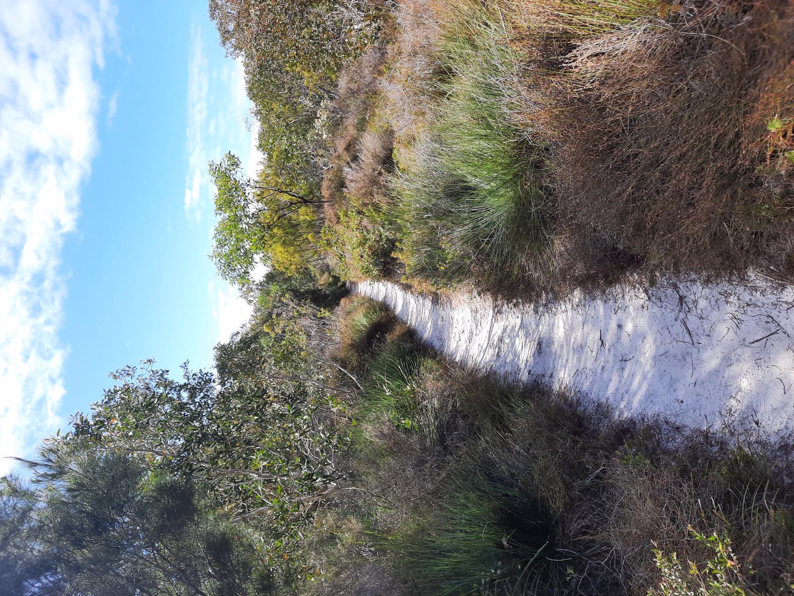
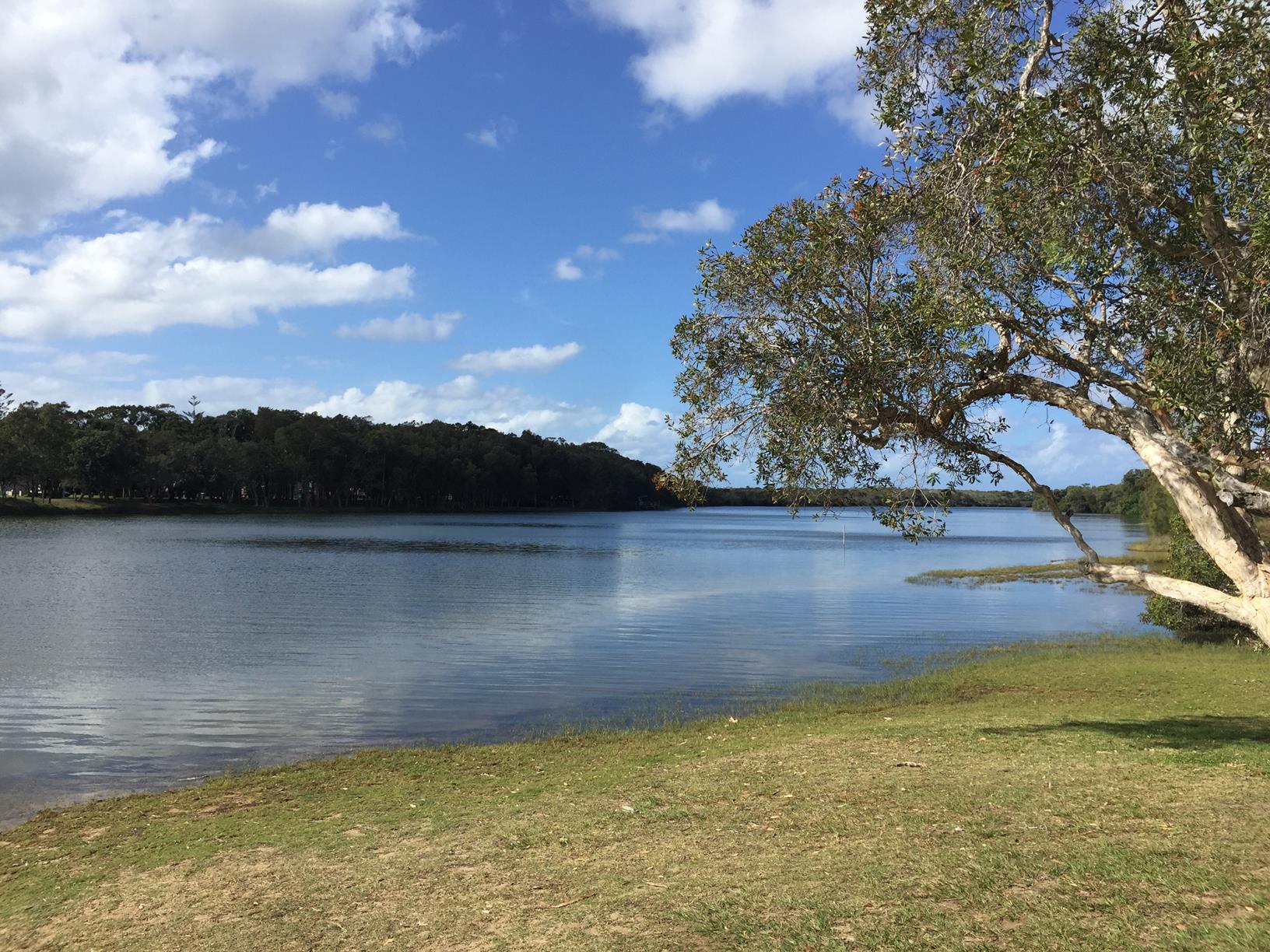
A great 3.8 km circuit that takes you to one of the back arms of the Currimundi lake.

SUITABILITY
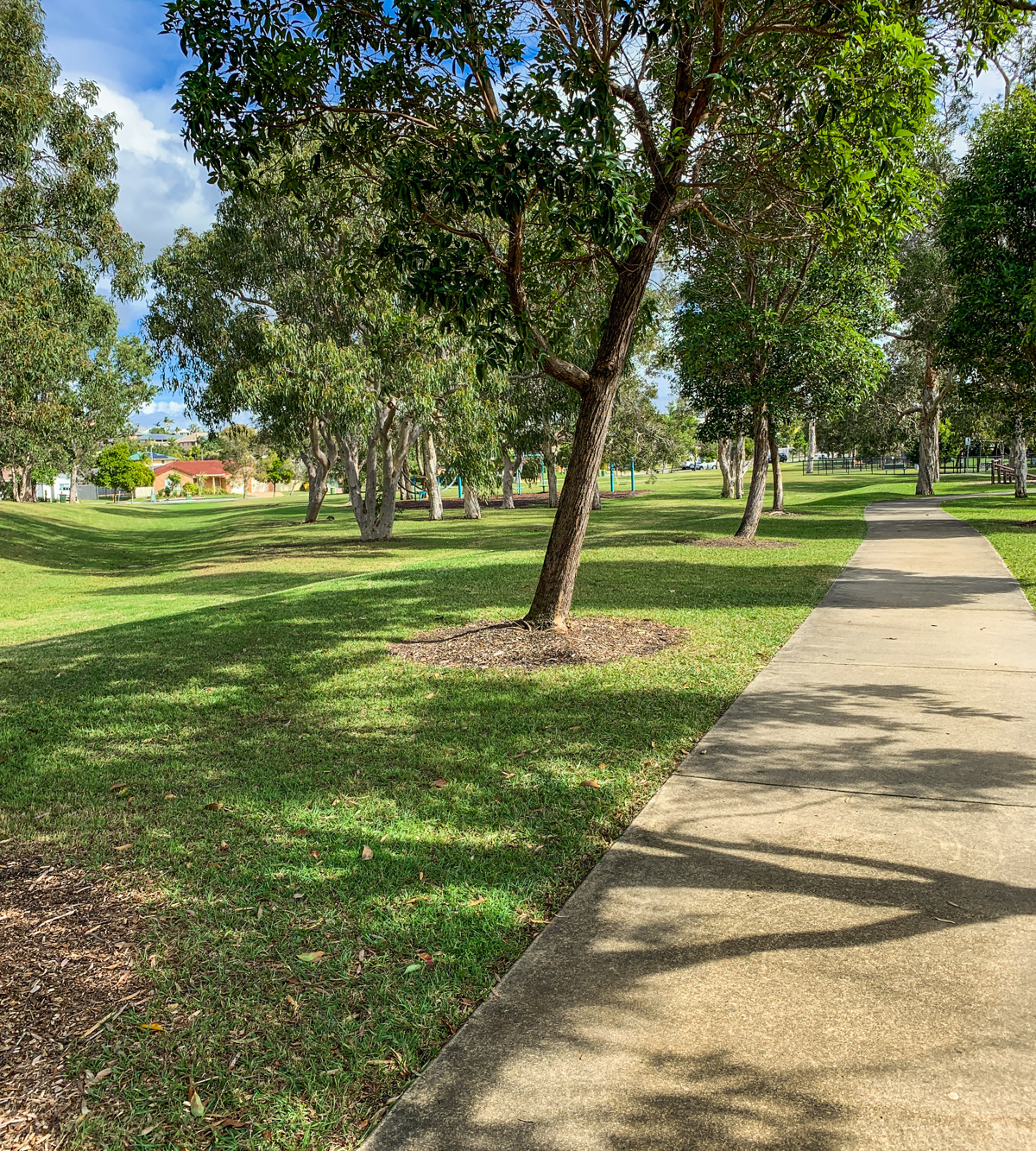
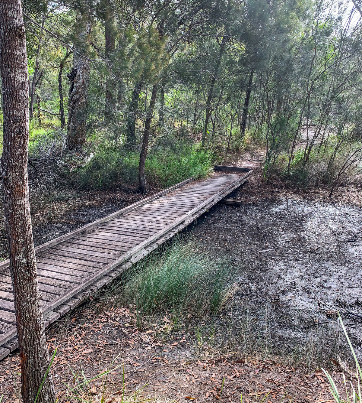
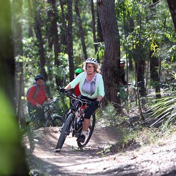
Suitable for a ride with the kids, though the track along the water may not suitable for bikes or prams. The footpath runs parallel with the track. Some of the walk is on neighbourhood roads without pathways, but plenty of wide grassed areas

HIGHLIGHTS
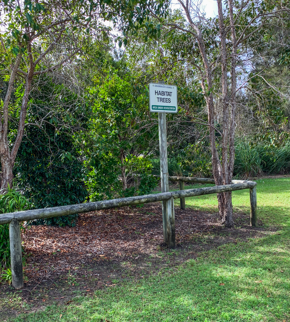
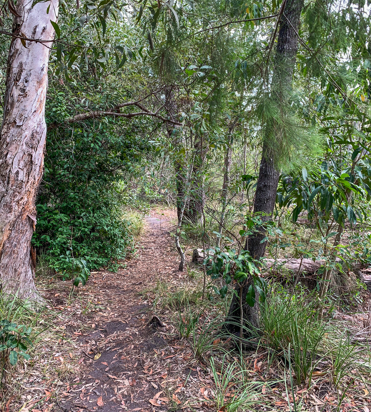
The main highlight of this experience is the bush track along Currimundi Lake where the more adventurous kids can ride in the dirt. A great place for a rest break, a spot to go fishing or to just sit on one of the many benches and enjoy the lake environment. There are also multiple parks along the route for the kids to stop and have a play.

The walk is dog friendly, on a leash, however the fenced Dog Park area is safe place to let Fido have a run.

The great thing about this the walk is you can extend the river section all the way to the river mouth by continuing east along the riverside pathway to the end and crossing Nicklin Way.


TAKE CARE
Mosquitoes can be a problem, so be prepared with insect repellent.

AFTERWARDS
When you are finished, play in a local park, or wander up to the Currimundi Marketplace for coffee or maybe lunch.

HOW TO GET THERE
To the starting point: Beginning at Ridgehaven Park on Kalana Road (off Nicklin Way) The park is near the roundabout. Plenty of on street parking in front of the park.

To the end point: This is a circular route with the end point being the same as your starting point.

glossary button
Glossary
  • Icon showing this activity is suitable for wheelchairsSuitable for wheelchairs
  • Icon showing this activity is suitable for walkingSuitable for walking
  • Icon showing this activity is suitable for recreational cyclingSuitable for recreational cycling
  • Icon showing this activity is suitable for mountain bikingSuitable for mountain biking
  • Icon showing this activity is suitable for horse ridingSuitable for horse riding
  • Icon showing this activity is suitable for kayakingSuitable for kayaking
  • Icon showing this activity has drinking water availableDrinking water available
  • Icon showing this activity does not have drinking water availableNo drinking water available
  • Icon showing this activity has a barbeque on siteBarbeque on site
  • Icon showing this activity has a picnic table on sitePicnic table on site
  • Icon showing this activity has toilets on siteToilets on site
  • Icon showing fires are permitted at this activityFires permitted
  • Icon showing fires are prohibited at this activityFires prohibited
  • Icon showing camping is permitted at this activityCamping permitted
  • Icon showing camping is prohibited at this activityCamping prohibited
  • Suitable for walking Suitable for walking black lines Suitable for walking
  • Suitable for recreational cycling Suitable for recreational cycling Suitable for recreational cycling
  • Drinking water available Drinking water available Drinking water available
  • Picnic table on site Picnic table on site Picnic table on site
  • Fires prohibited Fires prohibited Fires prohibited
  • Camping prohibited Camping prohibited Camping prohibited
Write a review

Be the first to review this trail.

hazard icon

IN AN EMERGENCY DIAL '000'.

Always Adventure Safely!

  • Always follow any local signage, it contains key information and conditions can change at any time.
  • Use the trails with consideration for your abilities, be prepared for the adventure ahead:
    • Be aware of the weather conditions, found here: http://www.bom.gov.au/qld/.
    • Always wear appropriate clothing, focus on good footwear.
    • Always bring more water than you think you will need.
    • Be Sun Safe!
    • Always let someone know where you are going that isn’t going with you.
  • Just getting started try this site for good useful information: https://www.trailhiking.com.au/hike-safety/
  • Sunshine Coast Council does it’s best to maintain current information but things can change so always be aware that a trail may not be as listed in this guide, and report and issues via our feedback link.

Sunshine Coast Council

For any issues with this experience please contact:

Sunshine Coast Council via 07 5475 7272 or via e-mail: adventure@sunshinecoast.qld.gov.au

Nearby Trails

Trail Image for Currimundi Lake: Full Paddle
Intermediate

Currimundi Lake: Full Paddle

Birtinya
canoeing icon
Trail type
difficulty icon
Skill Level

5.6km

Length
direction icon
One-way
Trail Image for Road Cycle Route: Pt. Cartwright to Moffat Beach
Difficult

Road Cycle Route: Pt. Cartwright to Moffat Beach

Aroona
walking icon cycling icon
Trail type
difficulty icon
Skill Level

30.6km

Length
direction icon
One-way
Trail Image for Currimundi Lake: ‘Loop the Lake’
Easy

Currimundi Lake: ‘Loop the Lake’

Currimundi
walking icon cycling icon
Trail type
difficulty icon
Skill Level

4.3km

Length
direction icon
One-way
Trail Image for Currimundi Lake: Short Paddle
Easy

Currimundi Lake: Short Paddle

Currimundi
canoeing icon
Trail type
difficulty icon
Skill Level

2.7km

Length
direction icon
Circuit
Trail Image for Sugar Bag Mountain Bike Trails: Beginners Loop
Easy

Sugar Bag Mountain Bike Trails: Beginners Loop

Caloundra West
mountain biking icon
Trail type
difficulty icon
Skill Level

6.4km

Length
direction icon
Circuit

Share this trail

This action requires a login.
To continue, click on Login/Signup below.

Photo uploaded successfully, thank you.

Feedback / Suggest an Adventure

If you have any feedback on the site or any of the trails, please drop us a short email.

Have we missed something? Do you have an adventure to suggest? Fill in the suggestion form to let us know about it.