facebook
Image showing that the PDF download is in progress... PDF download in progress

Please wait...

Image showing a pink decorative paint splat
Image showing a green decorative paint splat
upload photo button
reviews buttonReviews view map buttonMap
view 3d map button3D Map
directions take me there buttonDirections
Save
PDF
Gpx File

Mooloolah Town and Pond Walk

Mooloolah Town and Pond Walk
Mooloolah Valley
walking icon walking icon black mountain biking icon mountain biking icon black
Trail type
difficulty icon
Skill Level
1.5km
One-way Length
direction icon direction icon black
One-way

Take a relaxing stroll through the beautiful township of Mooloolah, past playgrounds and out to the residential ponds.

SUITABILITY
Suitable for all age groups although the ponds have sections with grass only – difficult for prams and small wheels.

HIGHLIGHTS
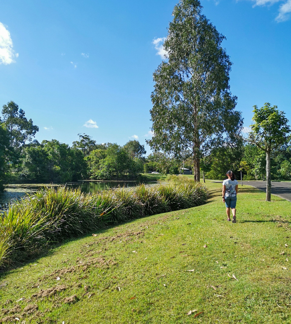
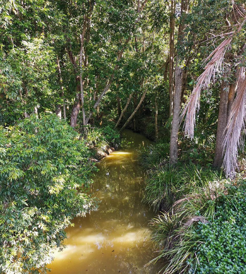
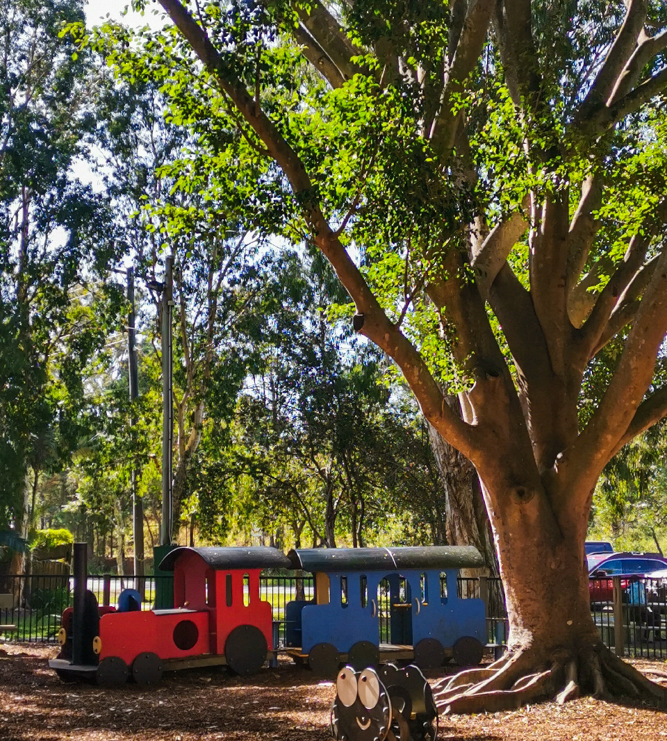
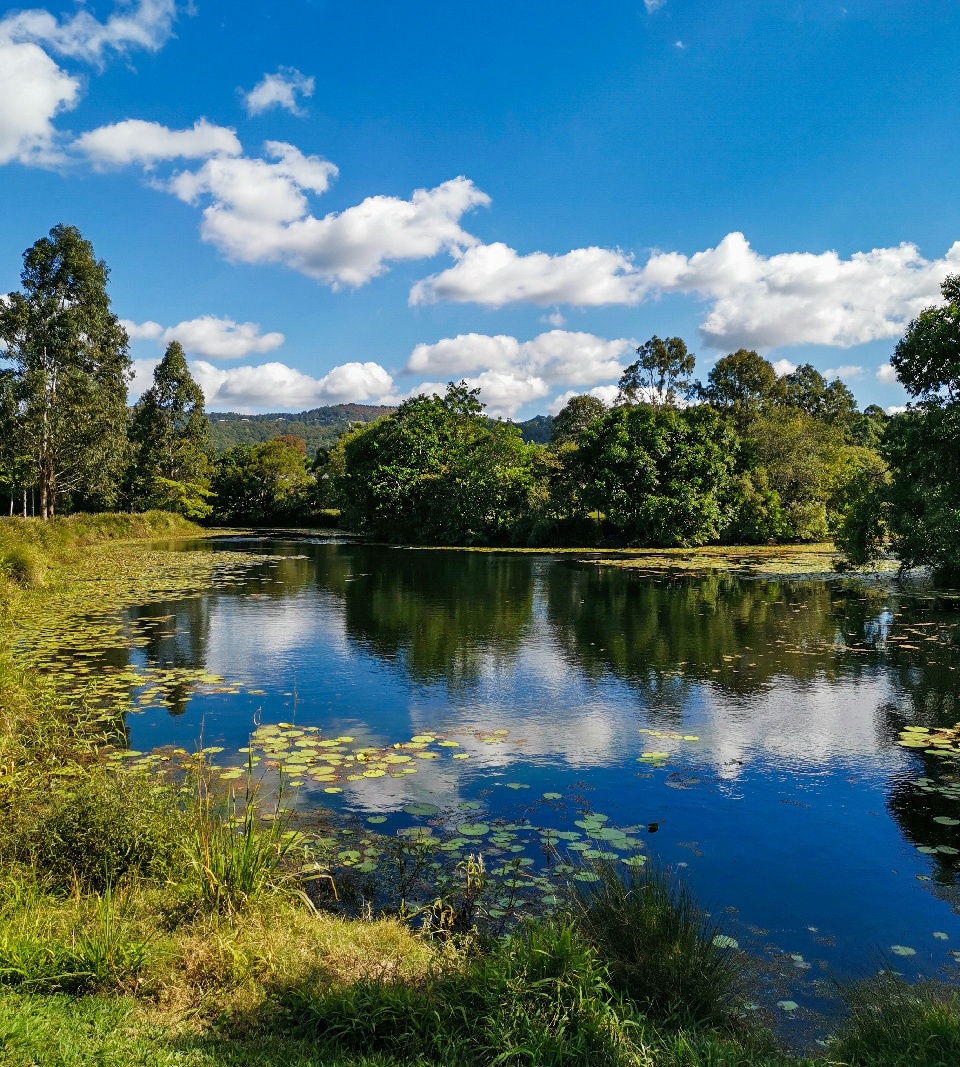
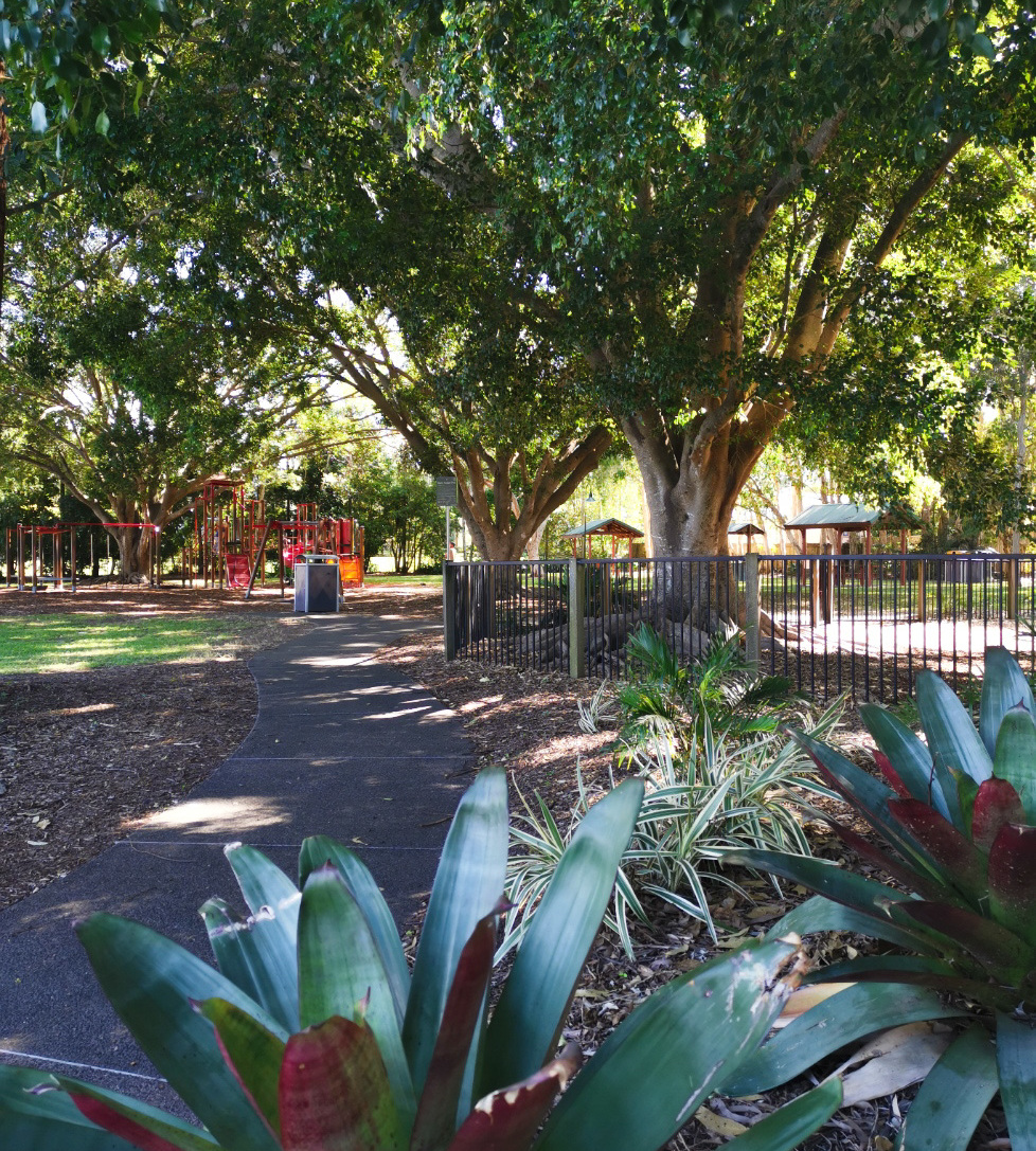
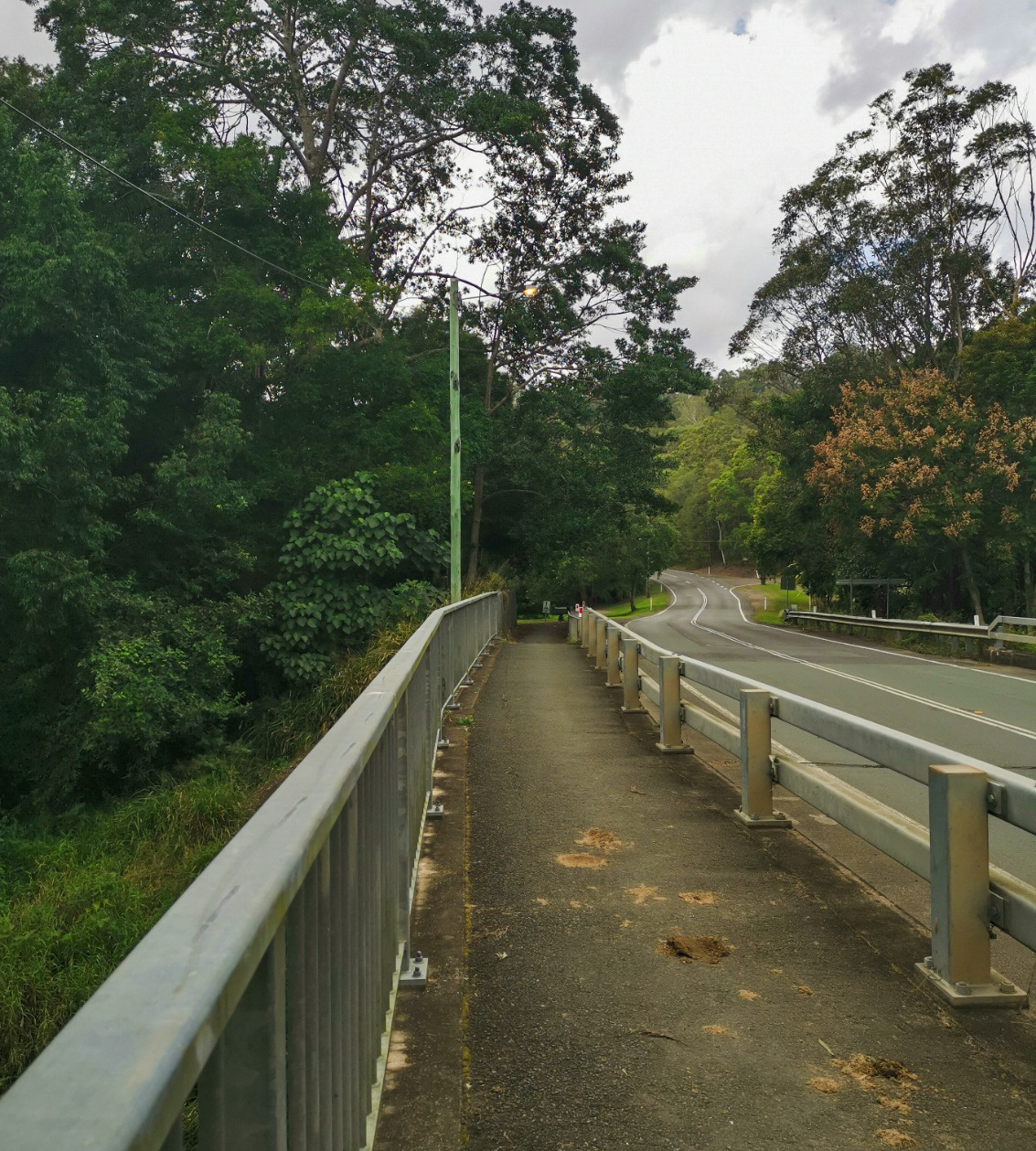
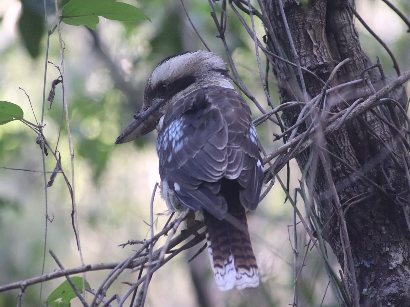
Mooloolah township is a beautiful country village with plenty of cafes, eateries, and park areas to enjoy on a leisurely outing. This short walk takes you westward past the playground shaded by impressive Fig trees, towards King Road. A left-hand turn onto the right hand side of the road will take you down a footpath towards the ponds. You’ll cross the Mooloolah River footbridge, pass the local primary school and see the path leading you into the tranquillity of the ponds nestled in the residential area of Brand Place. Beautiful water birds and other wildlife can be seen enjoying the lily pad covered water. Small bridges span the pond so the views can be enjoyed on either side. It’s an ideal location to sit and relax and enjoy nature.

AFTERWARDS
Head back the way you came and grab a bite to eat in town. The locals are truly welcoming and the service in all the food outlets is superb.
If you have children, they will love spending time in Martin Rungert Park. Besides the generous, fully fenced playground, there are BBQs, toilets, and picnic areas to utilise.

HOW TO GET THERE
The starting point: Park along Bray Road near the town center and head west to King Road.
The end point: Walk back to your starting point.

glossary button
Glossary
  • Icon showing this activity is suitable for wheelchairsSuitable for wheelchairs
  • Icon showing this activity is suitable for walkingSuitable for walking
  • Icon showing this activity is suitable for recreational cyclingSuitable for recreational cycling
  • Icon showing this activity is suitable for mountain bikingSuitable for mountain biking
  • Icon showing this activity is suitable for horse ridingSuitable for horse riding
  • Icon showing this activity is suitable for kayakingSuitable for kayaking
  • Icon showing this activity has drinking water availableDrinking water available
  • Icon showing this activity does not have drinking water availableNo drinking water available
  • Icon showing this activity has a barbeque on siteBarbeque on site
  • Icon showing this activity has a picnic table on sitePicnic table on site
  • Icon showing this activity has toilets on siteToilets on site
  • Icon showing fires are permitted at this activityFires permitted
  • Icon showing fires are prohibited at this activityFires prohibited
  • Icon showing camping is permitted at this activityCamping permitted
  • Icon showing camping is prohibited at this activityCamping prohibited
  • Suitable for walking Suitable for walking black lines Suitable for walking
  • Suitable for mountain biking Suitable for mountain biking Suitable for mountain biking
  • Drinking water available Drinking water available Drinking water available
  • barbeque on site barbeque on site Barbeque on site
  • Picnic table on site Picnic table on site Picnic table on site
  • toilets on site toilets on site Toilets on site
  • Fires prohibited Fires prohibited Fires prohibited
  • Camping prohibited Camping prohibited Camping prohibited
Write a review

Be the first to review this trail.

hazard icon

IN AN EMERGENCY DIAL '000'.

Always Adventure Safely!

  • Always follow any local signage, it contains key information and conditions can change at any time.
  • Use the trails with consideration for your abilities, be prepared for the adventure ahead:
    • Be aware of the weather conditions, found here: http://www.bom.gov.au/qld/.
    • Always wear appropriate clothing, focus on good footwear.
    • Always bring more water than you think you will need.
    • Be Sun Safe!
    • Always let someone know where you are going that isn’t going with you.
  • Just getting started try this site for good useful information: https://www.trailhiking.com.au/hike-safety/
  • Sunshine Coast Council does it’s best to maintain current information but things can change so always be aware that a trail may not be as listed in this guide, and report and issues via our feedback link.

Sunshine Coast Council

For any issues with this experience please contact:

Sunshine Coast Council via 07 5475 7272 or via e-mail: adventure@sunshinecoast.qld.gov.au

Nearby Trails

Trail Image for Mooloolah Valley Cycle Circuit
null

Mooloolah Valley Cycle Circuit

Mooloolah Valley
walking icon mountain biking icon
Trail type
difficulty icon
Skill Level

15.4km

Length
direction icon
Circuit
Trail Image for Dularcha National Park: Tunnel Track
Intermediate

Dularcha National Park: Tunnel Track

Landsborough
walking icon mountain biking icon horse riding icon
Trail type
difficulty icon
Skill Level

3.4km

Length
direction icon
One-way
Trail Image for Ewen Maddock Dam Main Track
Intermediate

Ewen Maddock Dam Main Track

Glenview
walking icon mountain biking icon horse riding icon
Trail type
difficulty icon
Skill Level

9.0km

Length
direction icon
One-way
Trail Image for Road Cycle Route: Bellthorpe Circuit
Difficult

Road Cycle Route: Bellthorpe Circuit

Bald Knob
walking icon cycling icon
Trail type
difficulty icon
Skill Level

78.4km

Length
direction icon
Circuit
Trail Image for Ewen Maddock Dam: Paddle
Easy

Ewen Maddock Dam: Paddle

Landsborough
canoeing icon
Trail type
difficulty icon
Skill Level

6.4km

Length
direction icon
Circuit

Share this trail

This action requires a login.
To continue, click on Login/Signup below.

Photo uploaded successfully, thank you.

Feedback / Suggest an Adventure

If you have any feedback on the site or any of the trails, please drop us a short email.

Have we missed something? Do you have an adventure to suggest? Fill in the suggestion form to let us know about it.