facebook
Image showing that the PDF download is in progress... PDF download in progress

Please wait...

Image showing a pink decorative paint splat
Image showing a green decorative paint splat
upload photo button
reviews buttonReviews view map buttonMap
view 3d map button3D Map
directions take me there buttonDirections
Save
PDF
Gpx File

Marcus Beach to Castaways Beach Trail

Marcus Beach to Castaways Beach Trail
walking icon walking icon black
Trail type
difficulty icon
Skill Level
3.2km
Length
direction icon direction icon black
Circuit

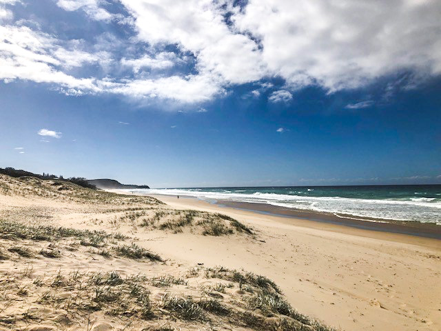
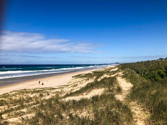
A meandering coastal pathway taking in local bushland and secluded beach accesses.

SUITABILITY
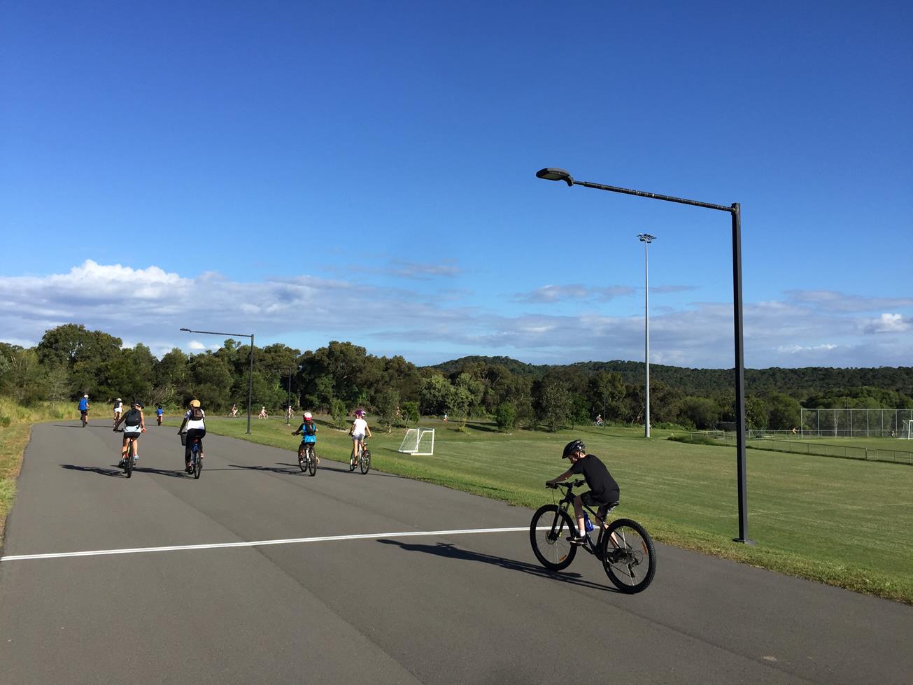
This walk is suitable for families and all ages. The track includes formed pathways and a section of beach sand.

HIGHLIGHTS
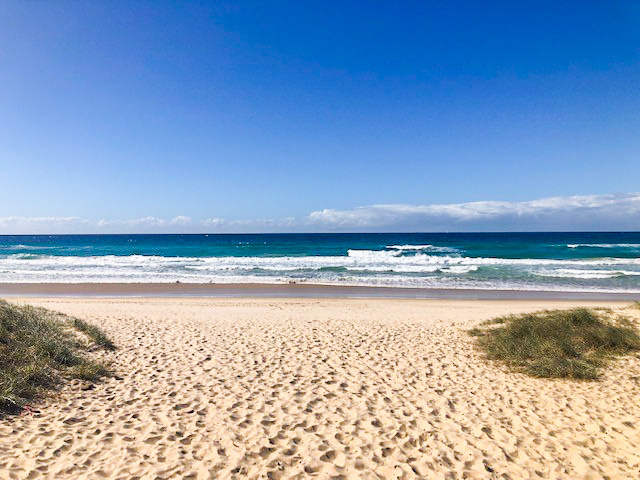
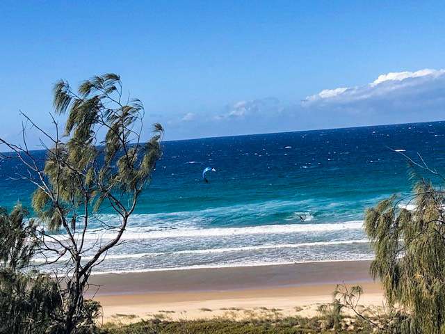
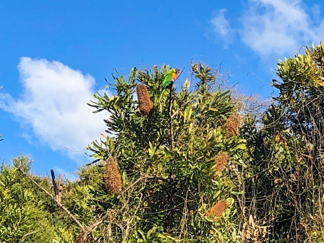
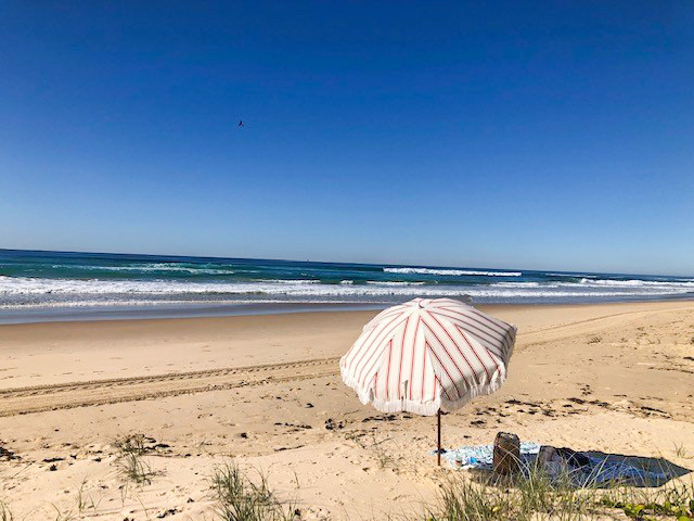
The trail begins at Tasman Tresser Park where there is a dedicated car park and direct beach access. The start begins along the sandy dunes of Marcus Beach before edging into the bushland and joining the coastal pathway. Once underway the track crosses several timber bridges over creeks and passes a number of secluded beach access points, a perfect selection for those who have packed swimmers! For those looking to bring scooters or bikes for the kids, the beach section can be substituted for the roadside running parallel. The path incorporates a healthy sand dune system and a protected swale including rainforest plants such as Port Jackson Fig and Cheese Trees. The ground cover includes a number of plants including a Coastal Wattle and Twining Guinea Flower. The turnaround point is Castaways Beach at access path 41. There is also a car park located at this point for those waiting on a pick up or the trail can be flipped to utilise this as the starting point. This space also features picnic tables and toilet facilities.

The trail is approximately 45 minutes’ walk one way.

AFTERWARDS
Return via the way you came or cool off with a swim at one of the beach access points.

HOW TO GET THERE
To Start: Via David Low Way, turn onto Mealeuca St, Tasman Trespasser Park is on the left.
To End: The end point is the start point

glossary button
Glossary
  • Icon showing this activity is suitable for wheelchairsSuitable for wheelchairs
  • Icon showing this activity is suitable for walkingSuitable for walking
  • Icon showing this activity is suitable for recreational cyclingSuitable for recreational cycling
  • Icon showing this activity is suitable for mountain bikingSuitable for mountain biking
  • Icon showing this activity is suitable for horse ridingSuitable for horse riding
  • Icon showing this activity is suitable for kayakingSuitable for kayaking
  • Icon showing this activity has drinking water availableDrinking water available
  • Icon showing this activity does not have drinking water availableNo drinking water available
  • Icon showing this activity has a barbeque on siteBarbeque on site
  • Icon showing this activity has a picnic table on sitePicnic table on site
  • Icon showing this activity has toilets on siteToilets on site
  • Icon showing fires are permitted at this activityFires permitted
  • Icon showing fires are prohibited at this activityFires prohibited
  • Icon showing camping is permitted at this activityCamping permitted
  • Icon showing camping is prohibited at this activityCamping prohibited
  • Suitable for walking Suitable for walking black lines Suitable for walking
  • No drinking water available No drinking water available No drinking water available
  • Fires prohibited Fires prohibited Fires prohibited
  • Camping prohibited Camping prohibited Camping prohibited
Write a review

Be the first to review this trail.

hazard icon

IN AN EMERGENCY DIAL '000'.

Always Adventure Safely!

  • Always follow any local signage, it contains key information and conditions can change at any time.
  • Use the trails with consideration for your abilities, be prepared for the adventure ahead:
    • Be aware of the weather conditions, found here: http://www.bom.gov.au/qld/.
    • Always wear appropriate clothing, focus on good footwear.
    • Always bring more water than you think you will need.
    • Be Sun Safe!
    • Always let someone know where you are going that isn’t going with you.
  • Just getting started try this site for good useful information: https://www.trailhiking.com.au/hike-safety/
  • Sunshine Coast Council does it’s best to maintain current information but things can change so always be aware that a trail may not be as listed in this guide, and report and issues via our feedback link.

Noosa Council

For any issues with the trail please call: 07 5329 6500

If you think something on the web site needs to change please let us know via: adventure@sunshinecoast.qld.au

Nearby Trails

Trail Image for Road Cycle Route: SCC Big Loop
Difficult

Road Cycle Route: SCC Big Loop

Alexandra Headland
walking icon cycling icon
Trail type
difficulty icon
Skill Level

180.6km

Length
direction icon
Circuit
Trail Image for Castaways Beach to Sunrise Beach Trail
Easy

Castaways Beach to Sunrise Beach Trail

walking icon mountain biking icon
Trail type
difficulty icon
Skill Level

2.6km

Length
direction icon
Circuit
Trail Image for Peregian Beach: National Park Fringe Walk
Easy

Peregian Beach: National Park Fringe Walk

walking icon
Trail type
difficulty icon
Skill Level

3.5km

Length
direction icon
Circuit
Trail Image for Peregian Beach to Peregian Beach North
Easy

Peregian Beach to Peregian Beach North

walking icon
Trail type
difficulty icon
Skill Level

2.0km

Length
direction icon
Circuit
Trail Image for Girraween Criterium Circuit
Easy

Girraween Criterium Circuit

NOOSA HEADS
walking icon cycling icon
Trail type
difficulty icon
Skill Level

1.1km

Length
direction icon
Circuit

Share this trail

This action requires a login.
To continue, click on Login/Signup below.

Photo uploaded successfully, thank you.

Feedback / Suggest an Adventure

If you have any feedback on the site or any of the trails, please drop us a short email.

Have we missed something? Do you have an adventure to suggest? Fill in the suggestion form to let us know about it.