facebook
Image showing that the PDF download is in progress... PDF download in progress

Please wait...

Image showing a pink decorative paint splat
Image showing a green decorative paint splat
upload photo button
reviews buttonReviews view map buttonMap
view 3d map button3D Map
directions take me there buttonDirections
Save
PDF
Gpx File

Coolum Beach to Stumers Creek

Coolum Beach to Stumers Creek
Coolum Beach
walking icon walking icon black
Trail type
difficulty icon
Skill Level
2.6km
Length
direction icon direction icon black
Circuit

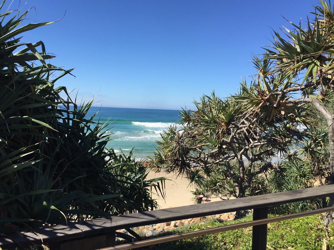
A coastal walk that starts in the heart of Coolum and ends at Stumers Creek and dog beach.

SUITABILITY
Suitable for walkers and is an easy grade.

HIGHLIGHTS
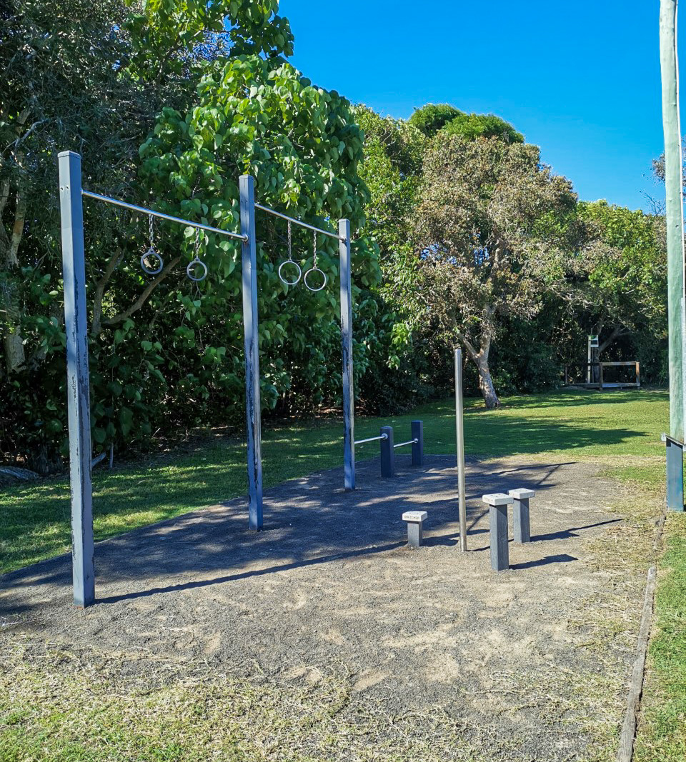
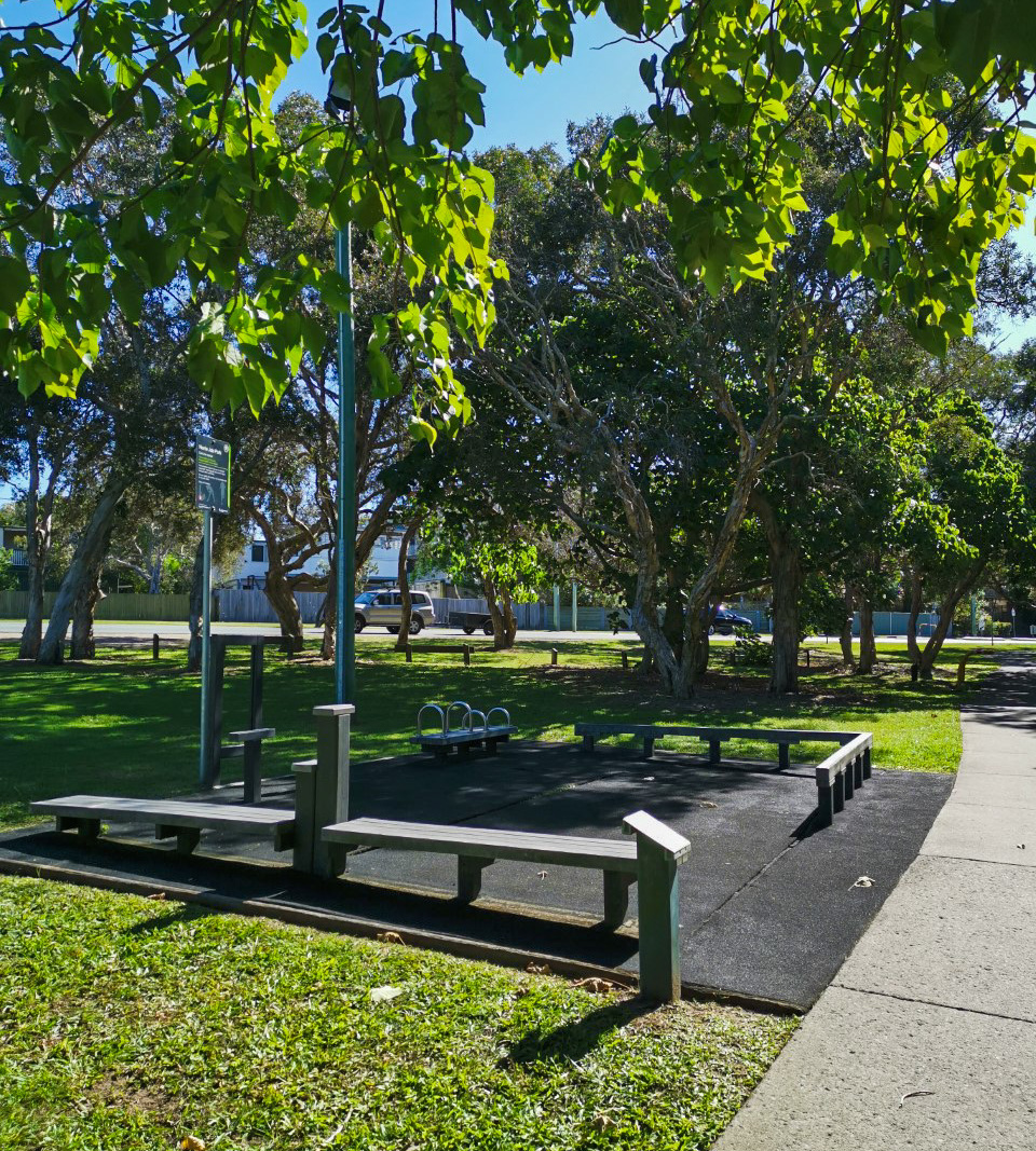
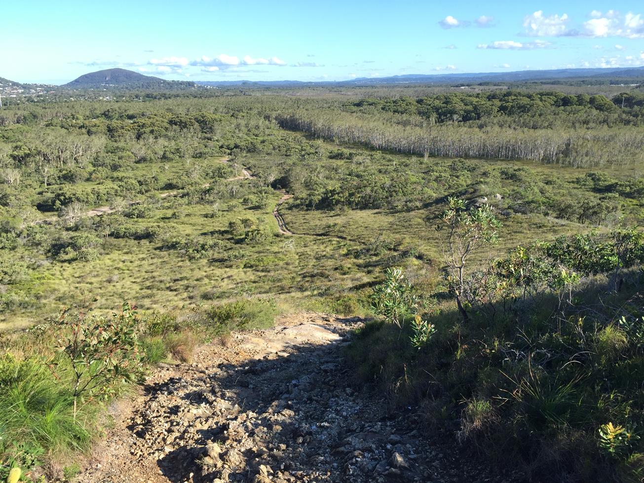
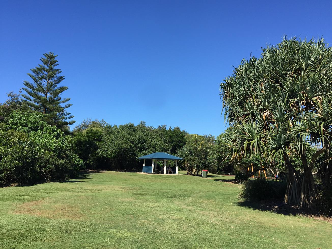
This is an easy 2.5 kilometre walk with the option to walk through bushland or along the beach. Walk along David Low Highway, past the caravan pack and you will find the large cement footpath that goes through Norrie Job Park and joins up with Stumers Creek Rd. Those keen to do the trail as a fitness session can make use of the fitness trails course with exercise equipment strategically placed within the park
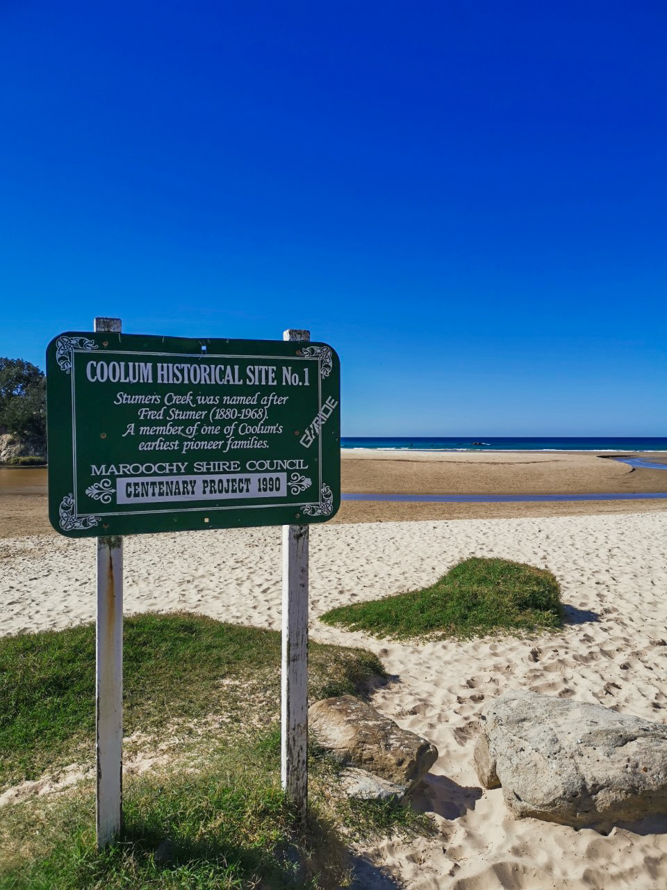
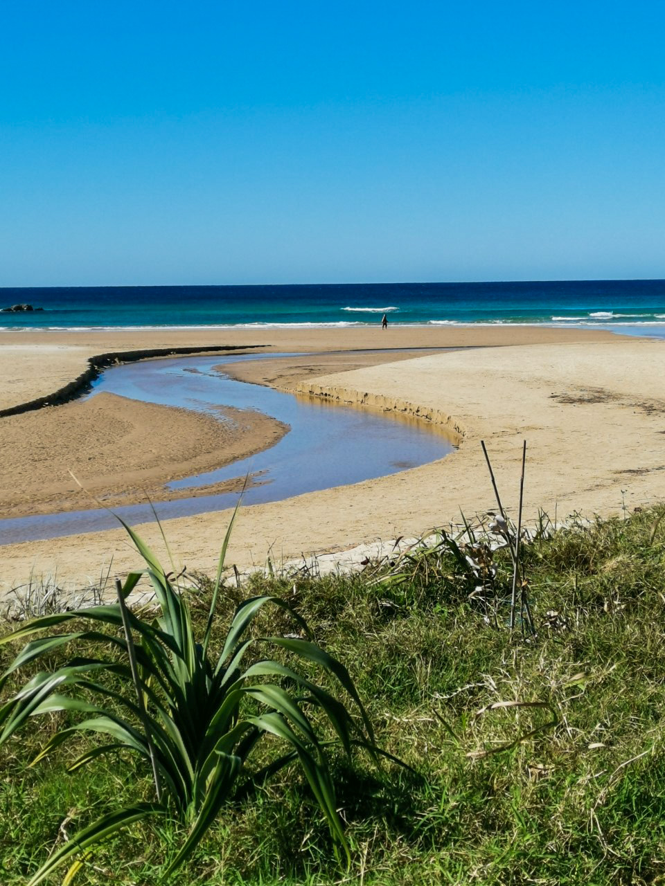
As you walk north through the bushland you will see coastal banksias and occasionally black cockatoos. At the end of the road is Stumers Creek where dogs can be unleashed and at the mouth of the creek, you’ll see pre-ice age coffee coloured rocks, formed when layered vegetation became trapped in the sand.
Stumers Creek, named after historical local man Fred Stumer and one of Coolum’s earliest pioneer families, is also where skydivers come into land. Spend an hour or two just watching them parachute in for a delicate landing on the beach.


AFTERWARDS
You can retrace your steps to Coolum Surf Life Saving Club and continue south on the wide boardwalk that leads to Point Perry where there are great ocean views up the coast to the Noosa Headland and the sheltered beach, First Bay, to the south. Point Perry is a great place for watching surfers and whales, particularly on their return voyage in August, September and October.

Afterwards you can enjoy an ice cream, coffee or drink at the Coolum Beach shops, or pop into the Surf Life Saving Club where visitors are welcome.

HOW TO GET THERE
To the starting point: Start at the Coolum Surf Life Saving Club, which is at Coolum on David Low Way and the T junction of Beach Road. Mostly there are street parks available.

To the end point: The end point is the same as the starting point.

Alternatively you can start at the end of Stumers Creek Road, where there are carparks and walk to Coolum Surf Club and back. You also have the option of doing one or both directions on the beach.

glossary button
Glossary
  • Icon showing this activity is suitable for wheelchairsSuitable for wheelchairs
  • Icon showing this activity is suitable for walkingSuitable for walking
  • Icon showing this activity is suitable for recreational cyclingSuitable for recreational cycling
  • Icon showing this activity is suitable for mountain bikingSuitable for mountain biking
  • Icon showing this activity is suitable for horse ridingSuitable for horse riding
  • Icon showing this activity is suitable for kayakingSuitable for kayaking
  • Icon showing this activity has drinking water availableDrinking water available
  • Icon showing this activity does not have drinking water availableNo drinking water available
  • Icon showing this activity has a barbeque on siteBarbeque on site
  • Icon showing this activity has a picnic table on sitePicnic table on site
  • Icon showing this activity has toilets on siteToilets on site
  • Icon showing fires are permitted at this activityFires permitted
  • Icon showing fires are prohibited at this activityFires prohibited
  • Icon showing camping is permitted at this activityCamping permitted
  • Icon showing camping is prohibited at this activityCamping prohibited
  • Suitable for walking Suitable for walking black lines Suitable for walking
  • Drinking water available Drinking water available Drinking water available
  • barbeque on site barbeque on site Barbeque on site
  • Picnic table on site Picnic table on site Picnic table on site
  • toilets on site toilets on site Toilets on site
  • Fires prohibited Fires prohibited Fires prohibited
  • Camping prohibited Camping prohibited Camping prohibited
Write a review

Be the first to review this trail.

hazard icon

IN AN EMERGENCY DIAL '000'.

Always Adventure Safely!

  • Always follow any local signage, it contains key information and conditions can change at any time.
  • Use the trails with consideration for your abilities, be prepared for the adventure ahead:
    • Be aware of the weather conditions, found here: http://www.bom.gov.au/qld/.
    • Always wear appropriate clothing, focus on good footwear.
    • Always bring more water than you think you will need.
    • Be Sun Safe!
    • Always let someone know where you are going that isn’t going with you.
  • Just getting started try this site for good useful information: https://www.trailhiking.com.au/hike-safety/
  • Sunshine Coast Council does it’s best to maintain current information but things can change so always be aware that a trail may not be as listed in this guide, and report and issues via our feedback link.

Sunshine Coast Council

For any issues with this experience please contact:

Sunshine Coast Council via 07 5475 7272 or via e-mail: adventure@sunshinecoast.qld.gov.au

Nearby Trails

Trail Image for Coolum to Emu Mountain
Difficult

Coolum to Emu Mountain

Coolum Beach
walking icon
Trail type
difficulty icon
Skill Level

4.4km

Length
direction icon
One-way
Trail Image for Stumers Creek Beach Loop
Intermediate

Stumers Creek Beach Loop

Coolum Beach
walking icon
Trail type
difficulty icon
Skill Level

1.3km

Length
direction icon
Circuit
Trail Image for Road Cycle Route: Twin Waters Loop
Difficult

Road Cycle Route: Twin Waters Loop

Bli Bli
walking icon cycling icon
Trail type
difficulty icon
Skill Level

73.8km

Length
direction icon
Circuit
Trail Image for Road Cycle Route: SCC Big Loop
Difficult

Road Cycle Route: SCC Big Loop

Alexandra Headland
walking icon cycling icon
Trail type
difficulty icon
Skill Level

180.6km

Length
direction icon
Circuit
Trail Image for Coastal Pathway: Coolum to Point Perry
Easy

Coastal Pathway: Coolum to Point Perry

Coolum Beach
walking icon cycling icon
Trail type
difficulty icon
Skill Level

1.2km

Length
direction icon
One-way

Share this trail

This action requires a login.
To continue, click on Login/Signup below.

Photo uploaded successfully, thank you.

Feedback / Suggest an Adventure

If you have any feedback on the site or any of the trails, please drop us a short email.

Have we missed something? Do you have an adventure to suggest? Fill in the suggestion form to let us know about it.