facebook
Image showing that the PDF download is in progress... PDF download in progress

Please wait...

Image showing a pink decorative paint splat
Image showing a green decorative paint splat
upload photo button
reviews buttonReviews view map buttonMap
view 3d map button3D Map
directions take me there buttonDirections
Save
PDF
Gpx File

Lake Weyba: Foreshore Walk

Lake Weyba: Foreshore Walk
NOOSAVILLE
walking icon walking icon black horse riding icon horse riding icon black
Trail type
difficulty icon
Skill Level
3.3km
One-way Length
direction icon direction icon black
One-way

A great way to extend your walk along the esplanade foreshore, if you are open to some fun and water.

SUITABILITY
Suitable for walkers, horses and mountain bikers up for a challenge – you are likely to get wet feet!.
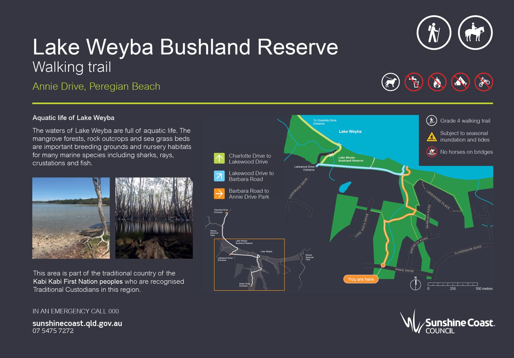
Sections of the trail are classed at the national grading system as Grade 4. Meaning experience needed!
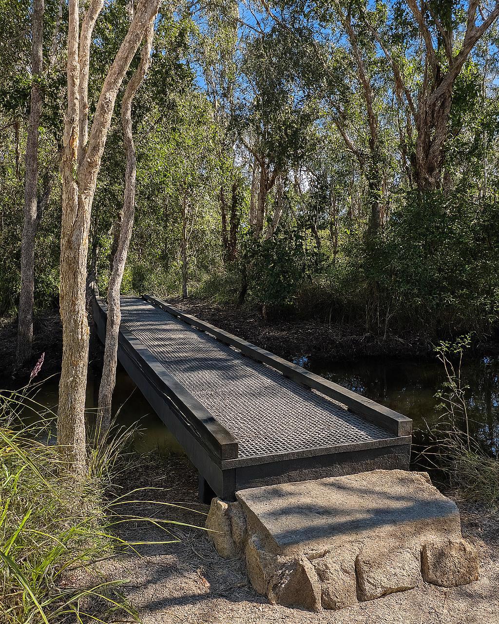
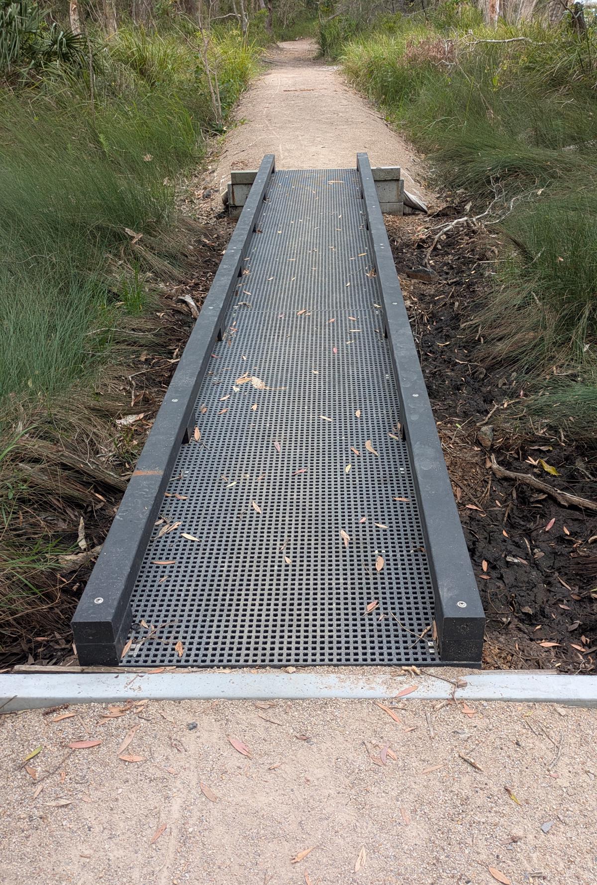
The track is subject to seasonal inundation and tides. Bridges are pedestrian only and dogs must be on a leash.

HIGHLIGHTS
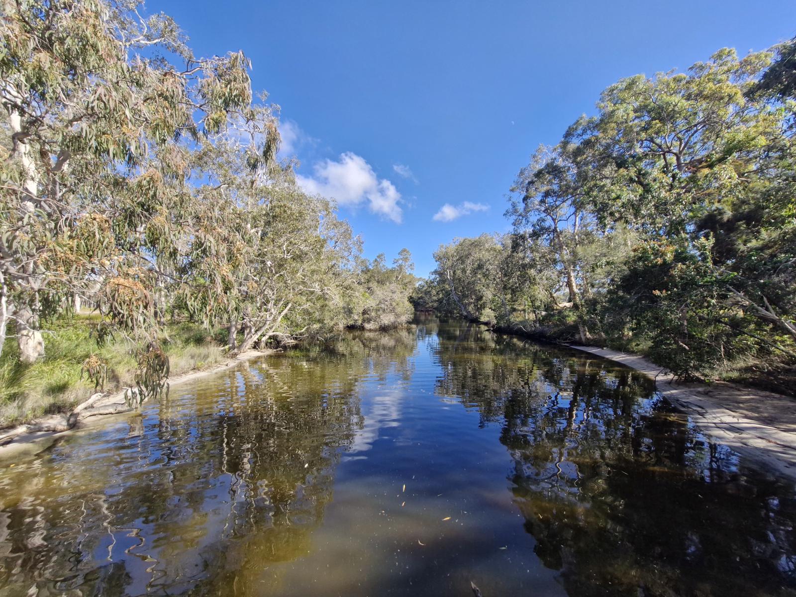
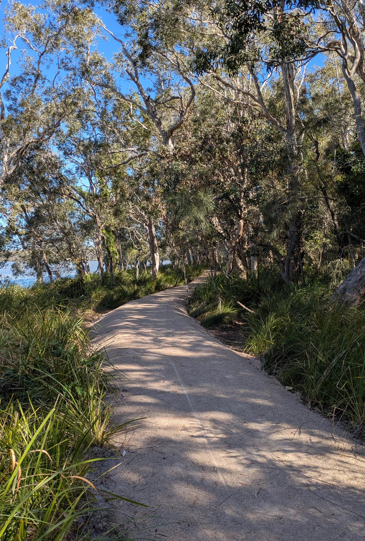
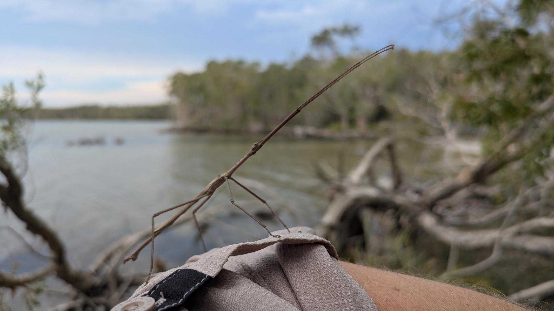
This trail starts from the foreshore at Lake Weyba Drive and meanders along the lakeside, and sometimes in it. Bring bug spray and be prepared to wade around a bit, but also to enjoy a spectacular setting, any time of day!

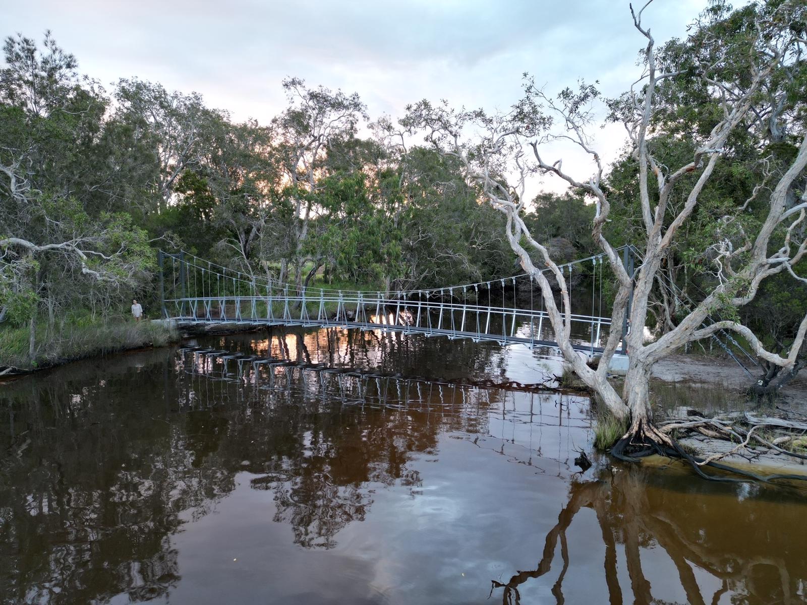
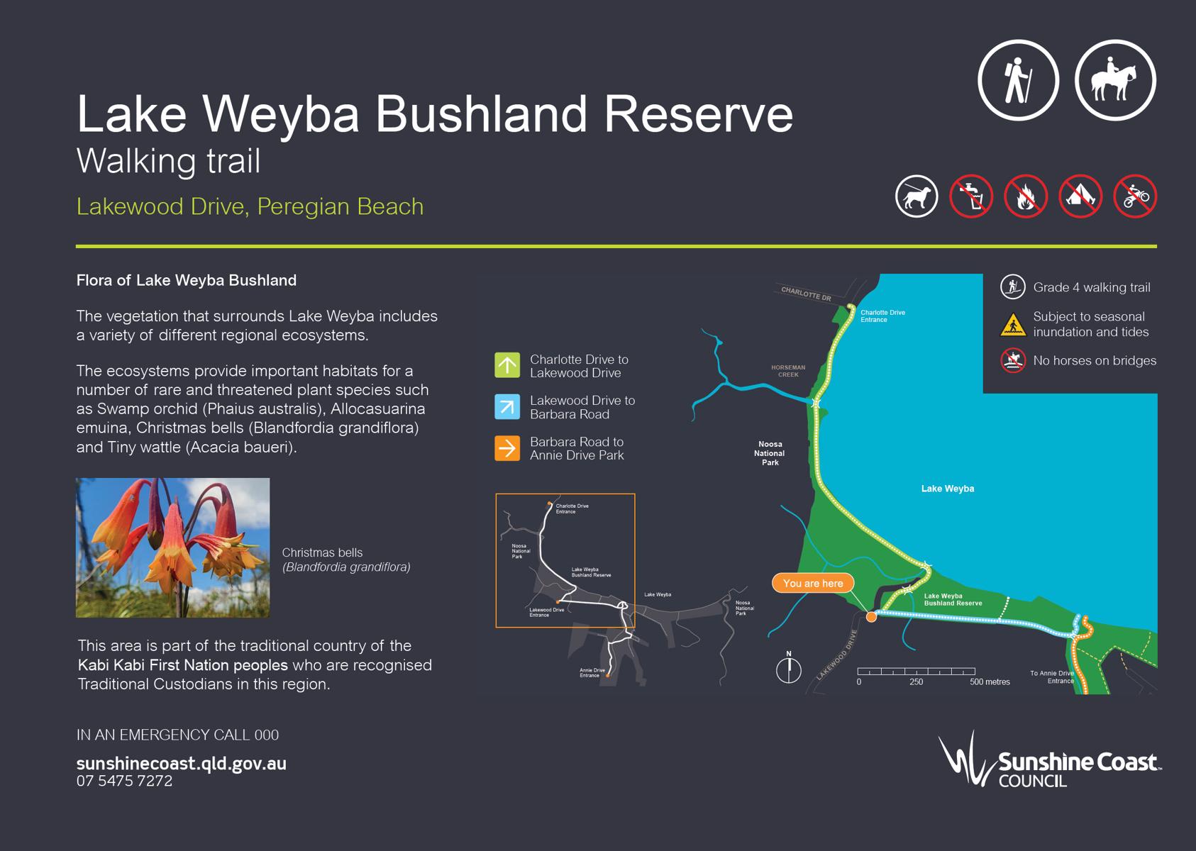
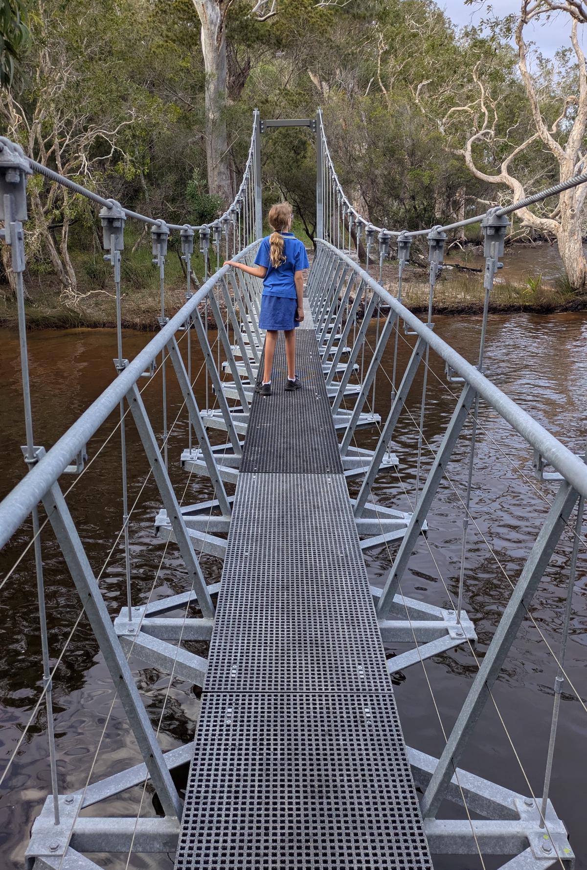
Along the trail you will see the stunning Horsmans Creek. Here you will walk across the 24 meter long suspension bridge. Take a moment on the bridge to soak up the beautiful natural views of the creek and Lake Weyba.

It’s hard to believe you are just kilometres away from the tourist crowds of Noosa.

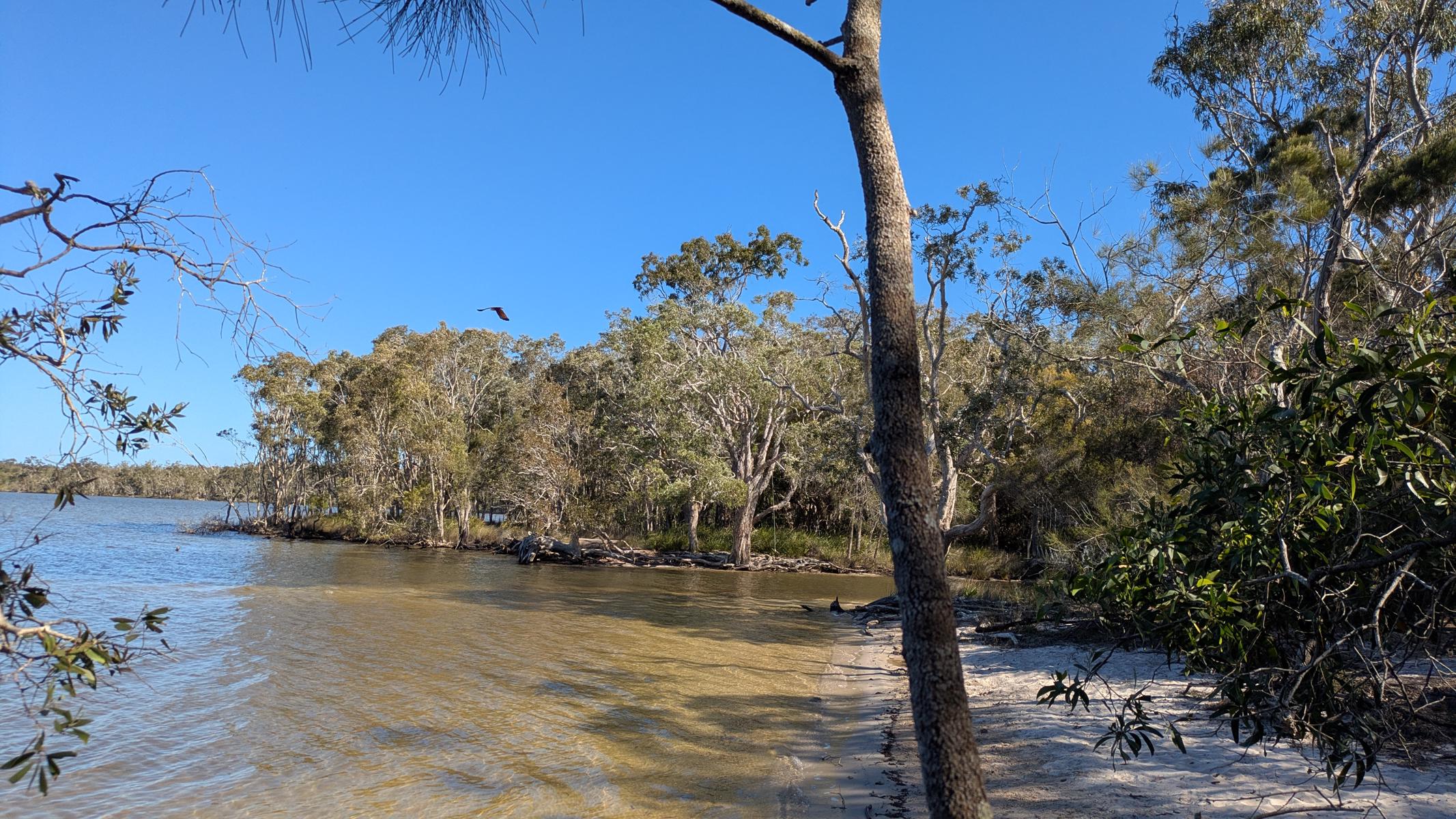
Lake Weyba is part of the Noosa Biosphere Reserve, and covers approximately 150,000 hectares of freshwater, estuarine and terrestrial environments. The lake has several tributaries including Weyba, Keyser, Eenie Hosman and Murdering Creeks.

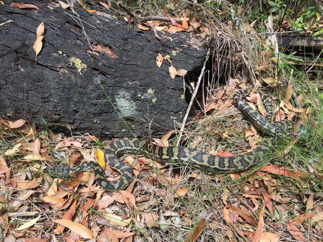
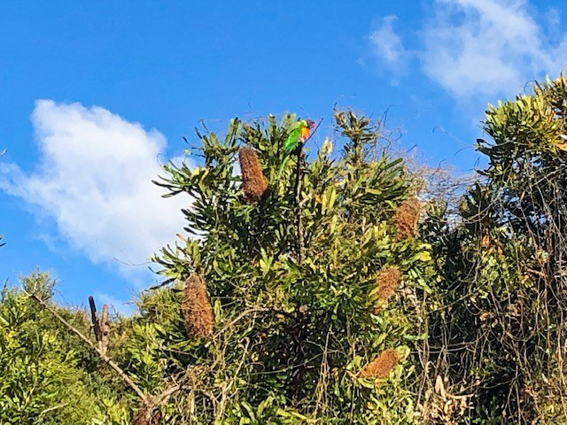
The waters of Lake Weyba are full of aquatic life. The mangrove forests, rock outcrops and sea grass beds are important breeding grounds and nursery habitats for many marine species including sharks, rays, crustations and fish. The ecosystems provide important habitats for a number of rare and threatened plant species.


AFTERWARDS
While in this area you can follow other trails that lead away from the lake through coastal bushland and saltpans. Or you might simply prefer to call it a day and head home to dry off!

HOW TO GET THERE
Head to the suburb of Weyba Downs via the Eumarella Road exit. Follow Eumarella Road to the end where it meets Lake Weyba Drive. Here you will see the lake. Start your walk along the foreshore heading south. There is a trail head sign and parking on the lake at the end of Charlotte Drive.

Note this is not a loop trail. The end point is the same as the starting point.

Alternatively the trail can be accessed from the end of Charlotte Drive, Lakewood Drive or Annie Drive Park.

glossary button
Glossary
  • Icon showing this activity is suitable for wheelchairsSuitable for wheelchairs
  • Icon showing this activity is suitable for walkingSuitable for walking
  • Icon showing this activity is suitable for recreational cyclingSuitable for recreational cycling
  • Icon showing this activity is suitable for mountain bikingSuitable for mountain biking
  • Icon showing this activity is suitable for horse ridingSuitable for horse riding
  • Icon showing this activity is suitable for kayakingSuitable for kayaking
  • Icon showing this activity has drinking water availableDrinking water available
  • Icon showing this activity does not have drinking water availableNo drinking water available
  • Icon showing this activity has a barbeque on siteBarbeque on site
  • Icon showing this activity has a picnic table on sitePicnic table on site
  • Icon showing this activity has toilets on siteToilets on site
  • Icon showing fires are permitted at this activityFires permitted
  • Icon showing fires are prohibited at this activityFires prohibited
  • Icon showing camping is permitted at this activityCamping permitted
  • Icon showing camping is prohibited at this activityCamping prohibited
  • Suitable for walking Suitable for walking black lines Suitable for walking
  • Suitable for horse riding Suitable for horse riding Suitable for horse riding
  • No drinking water available No drinking water available No drinking water available
  • Fires prohibited Fires prohibited Fires prohibited
  • Camping prohibited Camping prohibited Camping prohibited
Write a review

Be the first to review this trail.

hazard icon

IN AN EMERGENCY DIAL '000'.

Always Adventure Safely!

  • Always follow any local signage, it contains key information and conditions can change at any time.
  • Use the trails with consideration for your abilities, be prepared for the adventure ahead:
    • Be aware of the weather conditions, found here: http://www.bom.gov.au/qld/.
    • Always wear appropriate clothing, focus on good footwear.
    • Always bring more water than you think you will need.
    • Be Sun Safe!
    • Always let someone know where you are going that isn’t going with you.
  • Just getting started try this site for good useful information: https://www.trailhiking.com.au/hike-safety/
  • Sunshine Coast Council does it’s best to maintain current information but things can change so always be aware that a trail may not be as listed in this guide, and report and issues via our feedback link.

Sunshine Coast Council

For any issues with this experience please contact:

Sunshine Coast Council via 07 5475 7272 or via e-mail: adventure@sunshinecoast.qld.gov.au

Nearby Trails

Trail Image for Hoffman Drive
Easy

Hoffman Drive

NOOSAVILLE
walking icon cycling icon mountain biking icon
Trail type
difficulty icon
Skill Level

0.7km

Length
direction icon
One-way
Trail Image for Fellowship Drive
Intermediate

Fellowship Drive

DOONAN
walking icon cycling icon mountain biking icon
Trail type
difficulty icon
Skill Level

2.0km

Length
direction icon
Circuit
Trail Image for Road Cycle Route: Twin Waters Loop
Difficult

Road Cycle Route: Twin Waters Loop

Bli Bli
walking icon cycling icon
Trail type
difficulty icon
Skill Level

73.8km

Length
direction icon
Circuit
Trail Image for Peregian Beach: National Park Fringe Walk
Easy

Peregian Beach: National Park Fringe Walk

walking icon
Trail type
difficulty icon
Skill Level

3.5km

Length
direction icon
Circuit
Trail Image for Road Cycle Route: SCC Big Loop
Difficult

Road Cycle Route: SCC Big Loop

Alexandra Headland
walking icon cycling icon
Trail type
difficulty icon
Skill Level

180.6km

Length
direction icon
Circuit

Share this trail

This action requires a login.
To continue, click on Login/Signup below.

Photo uploaded successfully, thank you.

Feedback / Suggest an Adventure

If you have any feedback on the site or any of the trails, please drop us a short email.

Have we missed something? Do you have an adventure to suggest? Fill in the suggestion form to let us know about it.