facebook
Image showing that the PDF download is in progress... PDF download in progress

Please wait...

Image showing a pink decorative paint splat
Image showing a green decorative paint splat
Trail Image upload photo button

NOTE: This adventure is in Sunshine Coast Hinterland Great Walk for current Queensland Parks and Wildlife Service parks information, maps and essential park alerts click here

reviews buttonReviews view map buttonMap
view 3d map button3D Map
directions take me there buttonDirections
Save
PDF
Gpx File

Sunshine Coast Hinterland Great Walk: Baroon Lookout

Sunshine Coast Hinterland Great Walk: Baroon Lookout
Montville
walking icon walking icon black
Trail type
difficulty icon
Skill Level
2.5km
One-way Length
direction icon direction icon black
One-way

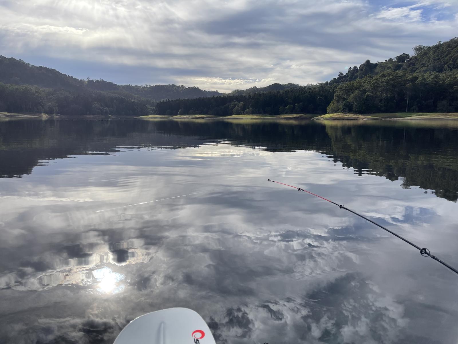
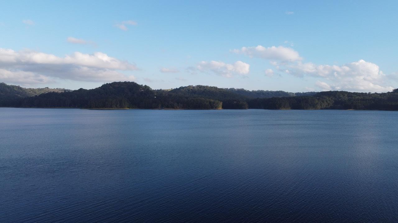
Enjoy spectacular views over Baroon Dam, Obi Obi Creek and gorge and the magnificent treescape of this area.

SUITABILITY
Suitable for walkers, a little elevation.

HIGHLIGHTS
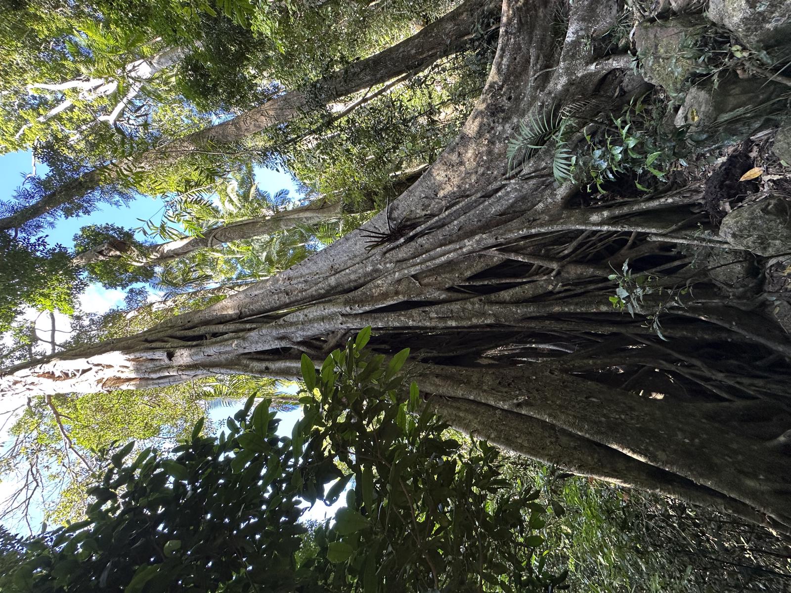
This interesting and famous 5.4km return walk is the start section of 58 km Sunshine Coast Hinterland Great Walk.and also the 1st part of the much longer option in to the impressive Kondalilla falls, for those feeling very energetic. (Google: Kondalilla topographic map.)

From Baroon Pocket carpark on Narrows Road step through the ‘great walks’ wooden archway, perhaps after an obligatory selfie, then meander on a surfaced rain-forested path for the first part. Eventually the trail narrows and steepens and climbs over 100m to the lookout. Narrows lookout is about half way to Baroon lookout for a shorter side trip and views of the Narrows Gorge.

At the Baroon Lookout there are great views over Baroon Pocket Dam and wall, the Obi Obi Creek and gorge and the dense forest. These views are well worth the walk.

AFTERWARDS
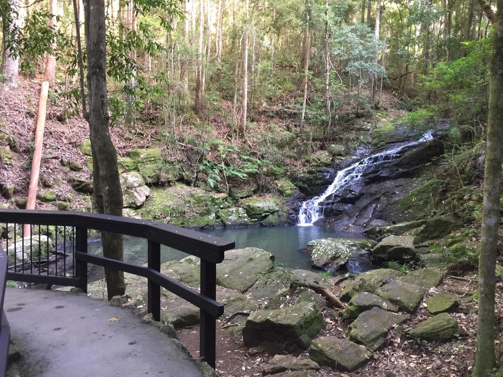
The track continues from the lookout. It is about 4 kms to the Flat Rock Swimming hole (approx. 12 kms return in total from the carpack) and further destinations beyond that. Great to walk and explore at some point.

When your return to the carpark, drop down to the right hand end to the northern recreation area which is a day use area open from 5.30 am to 5.30 pm 7 days a week. There you can have a closer look at the Dam wall and enjoy a picnic.

On the left hand end of the Narrows Road is the Secrets on the Lake, a wonderful café and boutique accommodation.

The bustling tourist town of Montville has many options for refreshments after.

HOW TO GET THERE
To the starting point: From Montville’s main street take Western Avenue for about 3 km and then turn left into Narrows Road. Follow this road almost to the end. The Baroon Pocket Dam Carpark is on your right.

To the end point: This is a there and back route, unless you are wanting to do a longer walk through to Kondilla Falls (12 km away) with a car shuttle plan.

glossary button
Glossary
  • Icon showing this activity is suitable for wheelchairsSuitable for wheelchairs
  • Icon showing this activity is suitable for walkingSuitable for walking
  • Icon showing this activity is suitable for recreational cyclingSuitable for recreational cycling
  • Icon showing this activity is suitable for mountain bikingSuitable for mountain biking
  • Icon showing this activity is suitable for horse ridingSuitable for horse riding
  • Icon showing this activity is suitable for kayakingSuitable for kayaking
  • Icon showing this activity has drinking water availableDrinking water available
  • Icon showing this activity does not have drinking water availableNo drinking water available
  • Icon showing this activity has a barbeque on siteBarbeque on site
  • Icon showing this activity has a picnic table on sitePicnic table on site
  • Icon showing this activity has toilets on siteToilets on site
  • Icon showing fires are permitted at this activityFires permitted
  • Icon showing fires are prohibited at this activityFires prohibited
  • Icon showing camping is permitted at this activityCamping permitted
  • Icon showing camping is prohibited at this activityCamping prohibited
  • Suitable for walking Suitable for walking black lines Suitable for walking
  • No drinking water available No drinking water available No drinking water available
  • barbeque on site barbeque on site Barbeque on site
  • Picnic table on site Picnic table on site Picnic table on site
  • toilets on site toilets on site Toilets on site
  • Fires prohibited Fires prohibited Fires prohibited
  • Camping prohibited Camping prohibited Camping prohibited
Write a review

Be the first to review this trail.

hazard icon

IN AN EMERGENCY DIAL '000'.

Always Adventure Safely!

  • Always follow any local signage, it contains key information and conditions can change at any time.
  • Use the trails with consideration for your abilities, be prepared for the adventure ahead:
    • Be aware of the weather conditions, found here: http://www.bom.gov.au/qld/.
    • Always wear appropriate clothing, focus on good footwear.
    • Always bring more water than you think you will need.
    • Be Sun Safe!
    • Always let someone know where you are going that isn’t going with you.
  • Just getting started try this site for good useful information: https://www.trailhiking.com.au/hike-safety/
  • Sunshine Coast Council does it’s best to maintain current information but things can change so always be aware that a trail may not be as listed in this guide, and report and issues via our feedback link.

Qld Parks and Wildlife Service

National Parks, Conservation Parks and some State Forests are managed by Queensland Parks and Wildlife Service. Contact details are: https://www.des.qld.gov.au/contactus/

For current information on trail conditions and alerts go to https://parks.des.qld.gov.au/park-alerts/#sunshinecoast

If you think something on this web site needs to change please let us know via: adventure@sunshinecoast.qld.gov.au

Nearby Trails

Trail Image for Sunshine Coast Hinterland Great Walk: Baroon Section
Difficult

Sunshine Coast Hinterland Great Walk: Baroon Section

Montville
walking icon
Trail type
difficulty icon
Skill Level

11.9km

Length
direction icon
One-way
Trail Image for Baroon Pocket Dam: Lake Paddle
Easy

Baroon Pocket Dam: Lake Paddle

North Maleny
canoeing icon
Trail type
difficulty icon
Skill Level

8.8km

Length
direction icon
Circuit
Trail Image for Baroon Pocket Dam: Martin Williams Walk
Intermediate

Baroon Pocket Dam: Martin Williams Walk

North Maleny
walking icon
Trail type
difficulty icon
Skill Level

2.2km

Length
direction icon
Circuit
Trail Image for Kondalilla National Park: Kondalilla Rock Pools
Intermediate

Kondalilla National Park: Kondalilla Rock Pools

Montville
walking icon
Trail type
difficulty icon
Skill Level

2.7km

Length
direction icon
Circuit
Trail Image for Road Cycle Route: Hinterland Loop
Difficult

Road Cycle Route: Hinterland Loop

Balmoral Ridge
walking icon cycling icon
Trail type
difficulty icon
Skill Level

95.8km

Length
direction icon
Circuit

Share this trail

This action requires a login.
To continue, click on Login/Signup below.

Photo uploaded successfully, thank you.

Feedback / Suggest an Adventure

If you have any feedback on the site or any of the trails, please drop us a short email.

Have we missed something? Do you have an adventure to suggest? Fill in the suggestion form to let us know about it.