facebook
Image showing that the PDF download is in progress... PDF download in progress

Please wait...

Image showing a pink decorative paint splat
Image showing a green decorative paint splat
Trail Image upload photo button

NOTE: This adventure is in Tewantin National Park for current Queensland Parks and Wildlife Service parks information, maps and essential park alerts click here

reviews buttonReviews view map buttonMap
view 3d map button3D Map
directions take me there buttonDirections
Save
PDF
Gpx File

Tewantin National Park: Palm Grove Circuit

Tewantin National Park: Palm Grove Circuit
TEWANTIN
walking icon walking icon black
Trail type
difficulty icon
Skill Level
1.1km
Length
direction icon direction icon black
Circuit

While there are many trails in this area catering for recreational adventurers, this trail is the only exclusive walking trail on offer.

SUITABILITY
The trails in this area have been primarily developed for mountain bikers. This short one is the exceptions – it’s for walkers. Please watch out for Mountain bikes at this location as they can come past at speed on the trails.

HIGHLIGHTS
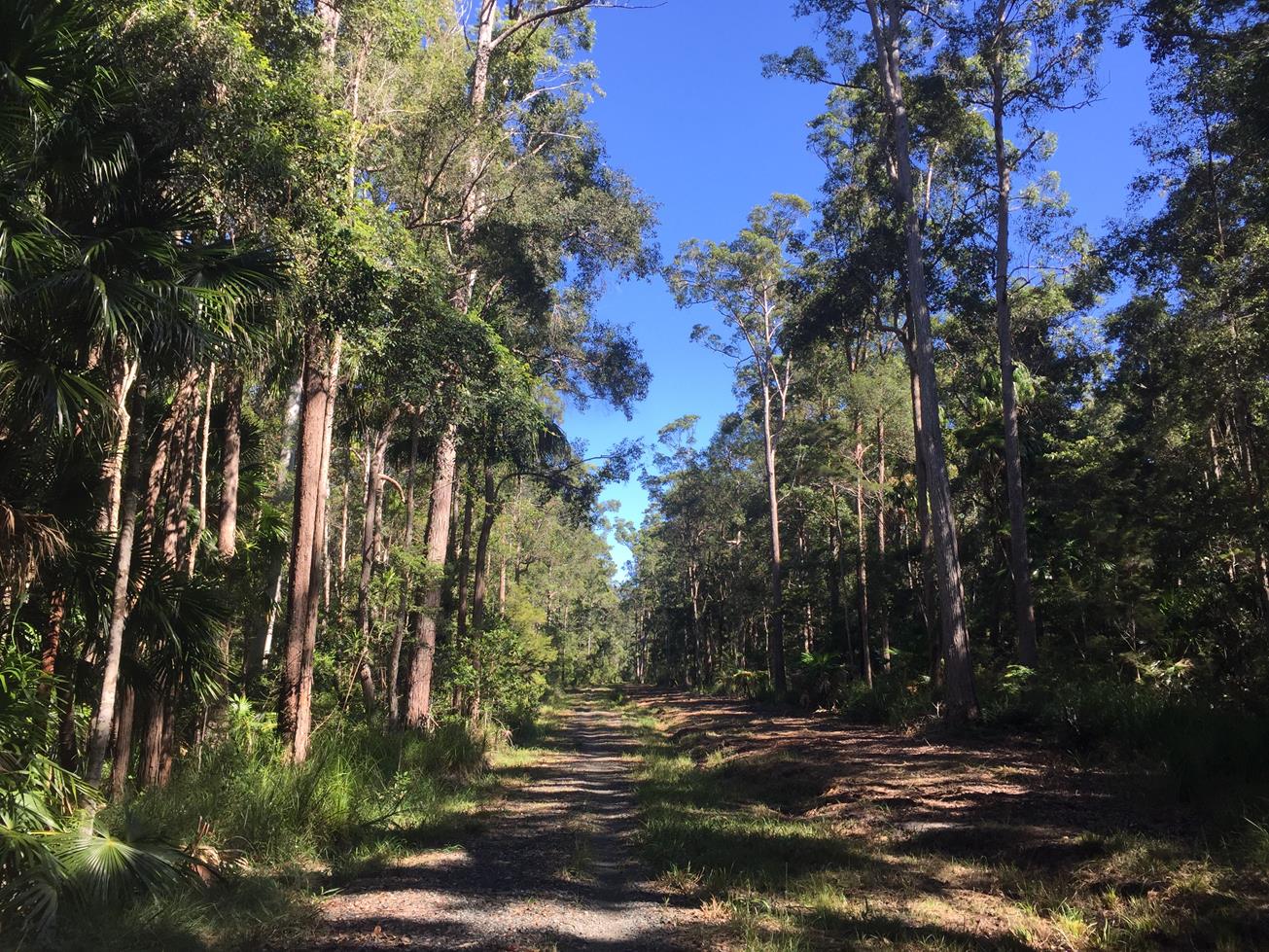
This is the only NO bikes bit of track in the Wooroi Day Use area of Tewantin National Park. It is rare to see another soul on this short and easy stroll amongst the towering palms.
However, be warned, the beginning and end of this track is shared with mountain bike riders so be on the lookout for bike riders as it can get busy.

Still, in the forest, you can enjoy a walk through cabbage tree and piccabeen palms along Wooroi Creek. Keep your eye out for white-breasted sea eagles, shiny black cockatoos, or even koalas that reside within this protected habitat.

AFTERWARDS
When you are finished this short circuit do the Hovea (Trail 1) circuit. It’s a flat and wide shared Management Track that walkers, recreational cyclists, mountain bikers and even horseriders can use (for parts of it).

Note: Some of the wider management tracks in this area can be enjoyed by walkers and joggers, these typically are the easier routes. As the signage says: walkers and runners beware! Mountain-bike trails are narrow and rough in places. Bike riders may approach at speed from either direction. If you choose to walk or run on mountain-bike trails you do so at your own risk. If you want do to other walks in this area, you a best to avoid the difficult trails.

For more secluded walks see our options for Tewantin National Park on the other side of Cooroy Noosa Road.

In the carpark at Wooroi Day use there is a large pleasant picnic area surrounded by bloodwood trees and coastal she-oaks with tables and taps but no toilets. Nearest toilets are at the Tinbeerwah Rural Fire Station at the top of the range. (Corner of Sunrise Road and Gyndier Drive.

HOW TO GET THERE
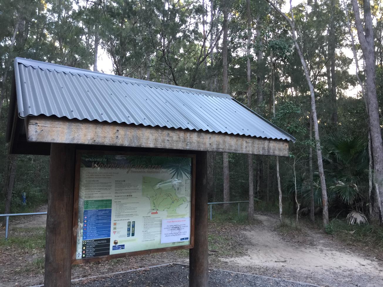
To the starting point: From Tewantin or Noosaville head to the Cooroy Noosa Road. Just passed Beckman’s Road there is a bus shelter. Turn left immediately into the Wooroi Day Use Area, drive along about 100 metres till you get to the picnic area where there are plenty of parks available. There is an information board map of the many trails here catering for all different abilities and terrains.

To the end point: Back in the car park where you started.

glossary button
Glossary
  • Icon showing this activity is suitable for wheelchairsSuitable for wheelchairs
  • Icon showing this activity is suitable for walkingSuitable for walking
  • Icon showing this activity is suitable for recreational cyclingSuitable for recreational cycling
  • Icon showing this activity is suitable for mountain bikingSuitable for mountain biking
  • Icon showing this activity is suitable for horse ridingSuitable for horse riding
  • Icon showing this activity is suitable for kayakingSuitable for kayaking
  • Icon showing this activity has drinking water availableDrinking water available
  • Icon showing this activity does not have drinking water availableNo drinking water available
  • Icon showing this activity has a barbeque on siteBarbeque on site
  • Icon showing this activity has a picnic table on sitePicnic table on site
  • Icon showing this activity has toilets on siteToilets on site
  • Icon showing fires are permitted at this activityFires permitted
  • Icon showing fires are prohibited at this activityFires prohibited
  • Icon showing camping is permitted at this activityCamping permitted
  • Icon showing camping is prohibited at this activityCamping prohibited
  • Suitable for walking Suitable for walking black lines Suitable for walking
  • Drinking water available Drinking water available Drinking water available
  • Picnic table on site Picnic table on site Picnic table on site
  • Fires prohibited Fires prohibited Fires prohibited
  • Camping prohibited Camping prohibited Camping prohibited
Write a review

Be the first to review this trail.

hazard icon

IN AN EMERGENCY DIAL '000'.

Always Adventure Safely!

  • Always follow any local signage, it contains key information and conditions can change at any time.
  • Use the trails with consideration for your abilities, be prepared for the adventure ahead:
    • Be aware of the weather conditions, found here: http://www.bom.gov.au/qld/.
    • Always wear appropriate clothing, focus on good footwear.
    • Always bring more water than you think you will need.
    • Be Sun Safe!
    • Always let someone know where you are going that isn’t going with you.
  • Just getting started try this site for good useful information: https://www.trailhiking.com.au/hike-safety/
  • Sunshine Coast Council does it’s best to maintain current information but things can change so always be aware that a trail may not be as listed in this guide, and report and issues via our feedback link.

Qld Parks and Wildlife Service

National Parks, Conservation Parks and some State Forests are managed by Queensland Parks and Wildlife Service. Contact details are: https://www.des.qld.gov.au/contactus/

For current information on trail conditions and alerts go to https://parks.des.qld.gov.au/park-alerts/#sunshinecoast

If you think something on this web site needs to change please let us know via: adventure@sunshinecoast.qld.gov.au

Nearby Trails

Trail Image for Tewantin National Park: Wooroi Introduction Loop
Intermediate

Tewantin National Park: Wooroi Introduction Loop

TINBEERWAH
mountain biking icon
Trail type
difficulty icon
Skill Level

11.5km

Length
direction icon
Circuit
Trail Image for Tewantin National Park: Hovea Circuit
Easy

Tewantin National Park: Hovea Circuit

TEWANTIN
mountain biking icon
Trail type
difficulty icon
Skill Level

1.5km

Length
direction icon
Circuit
Trail Image for Road Cycle Route: SCC Big Loop
Difficult

Road Cycle Route: SCC Big Loop

Alexandra Headland
walking icon cycling icon
Trail type
difficulty icon
Skill Level

180.6km

Length
direction icon
Circuit
Trail Image for Heritage Park Walk
Easy

Heritage Park Walk

TEWANTIN
walking icon cycling icon
Trail type
difficulty icon
Skill Level

2.2km

Length
direction icon
Circuit
Trail Image for Tewantin Sports Grounds Circuit
Intermediate

Tewantin Sports Grounds Circuit

TEWANTIN
walking icon
Trail type
difficulty icon
Skill Level

2.4km

Length
direction icon
One-way

Share this trail

This action requires a login.
To continue, click on Login/Signup below.

Photo uploaded successfully, thank you.

Feedback / Suggest an Adventure

If you have any feedback on the site or any of the trails, please drop us a short email.

Have we missed something? Do you have an adventure to suggest? Fill in the suggestion form to let us know about it.