facebook
Image showing that the PDF download is in progress... PDF download in progress

Please wait...

Image showing a pink decorative paint splat
Image showing a green decorative paint splat
upload photo button

NOTE: This adventure is in Great Sandy National Park for current Queensland Parks and Wildlife Service parks information, maps and essential park alerts click here

reviews buttonReviews view map buttonMap
view 3d map button3D Map
directions take me there buttonDirections
Save
PDF
Gpx File

Lake Cootharaba: Elanda Point to Kinaba

Lake Cootharaba: Elanda Point to Kinaba
COMO
canoe icon canoe icon black
Trail type
difficulty icon
Skill Level
4.8km
One-way Length
direction icon direction icon black
One-way

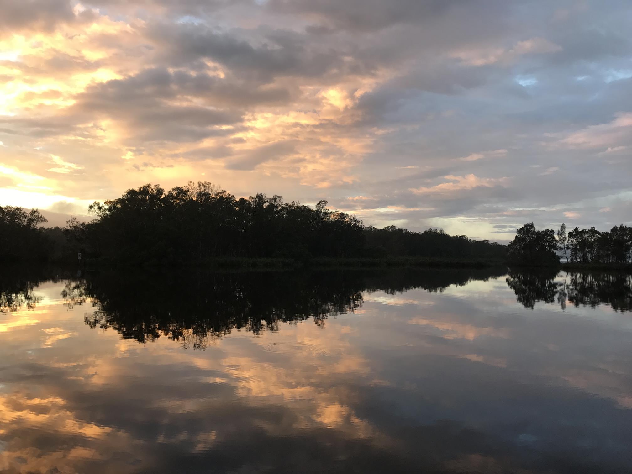
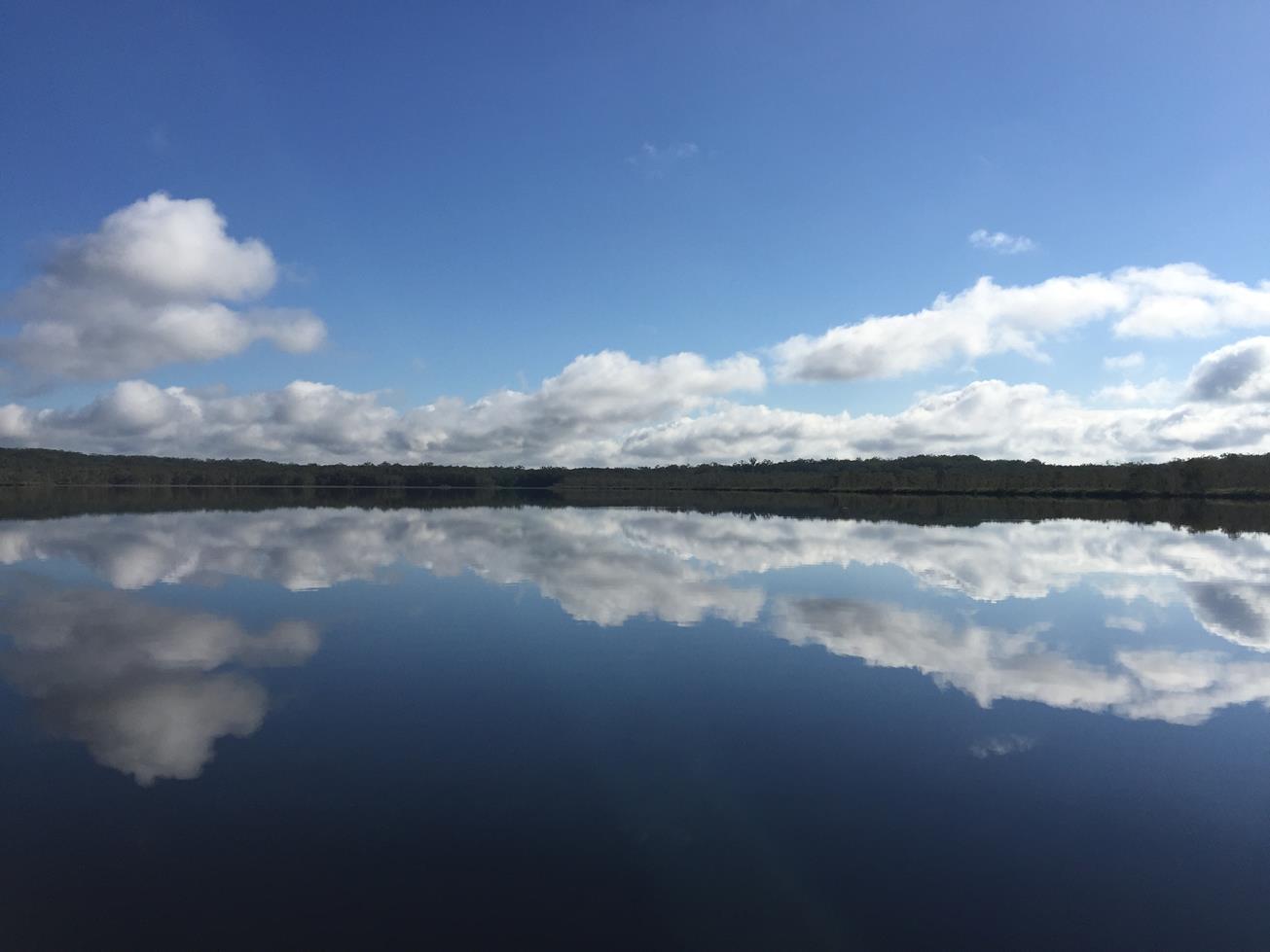
A peaceful kayak across Lake Cootharaba to Kinaba Information Centre/Kinaba Island seeing beautiful paper-bark lined banks and clear water.

SUITABLILITY
Suitable for intermediate level kayakers. If a windy day the lake can get quite choppy. NOTE: times given here are ONE WAY ONLY.

HIGHLIGHTS
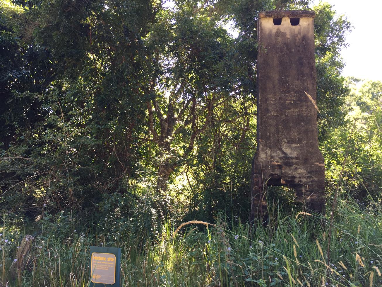
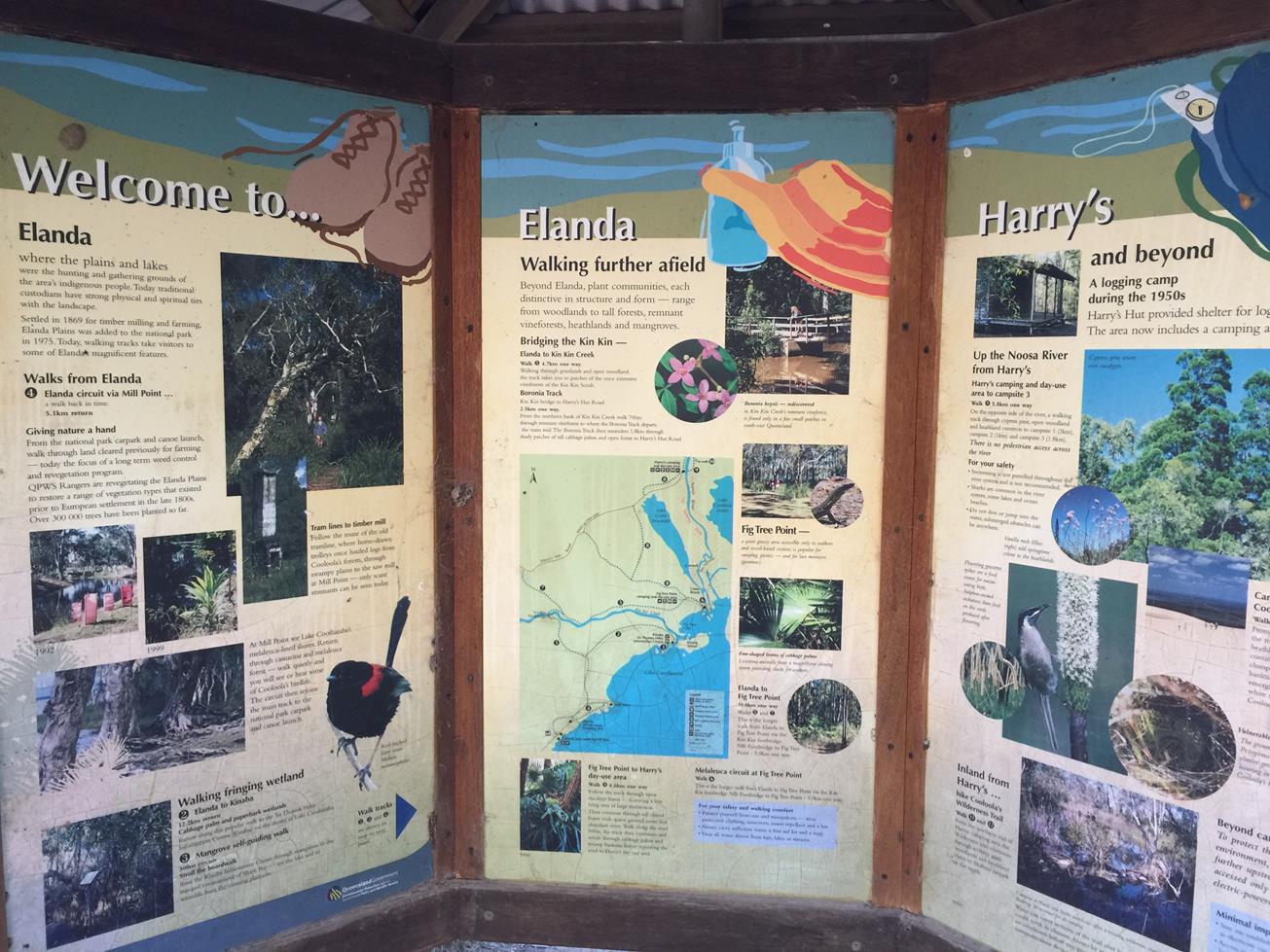
Gateway to the much lauded Everglades, this open water 10km return route is a great paddle in its own right. And it’s the launch pad into the twisting upper reaches of the Everglades. After the first few km paddling pull ashore at Mill Point for a look at the interpretive plaques. Next paddle 2km NE to a triangle channel marker, from where you can see the timber Kinaba Information Center building on the water. It’s a great stop, with a short boardwalk trail, toilets and large interpretive displays.

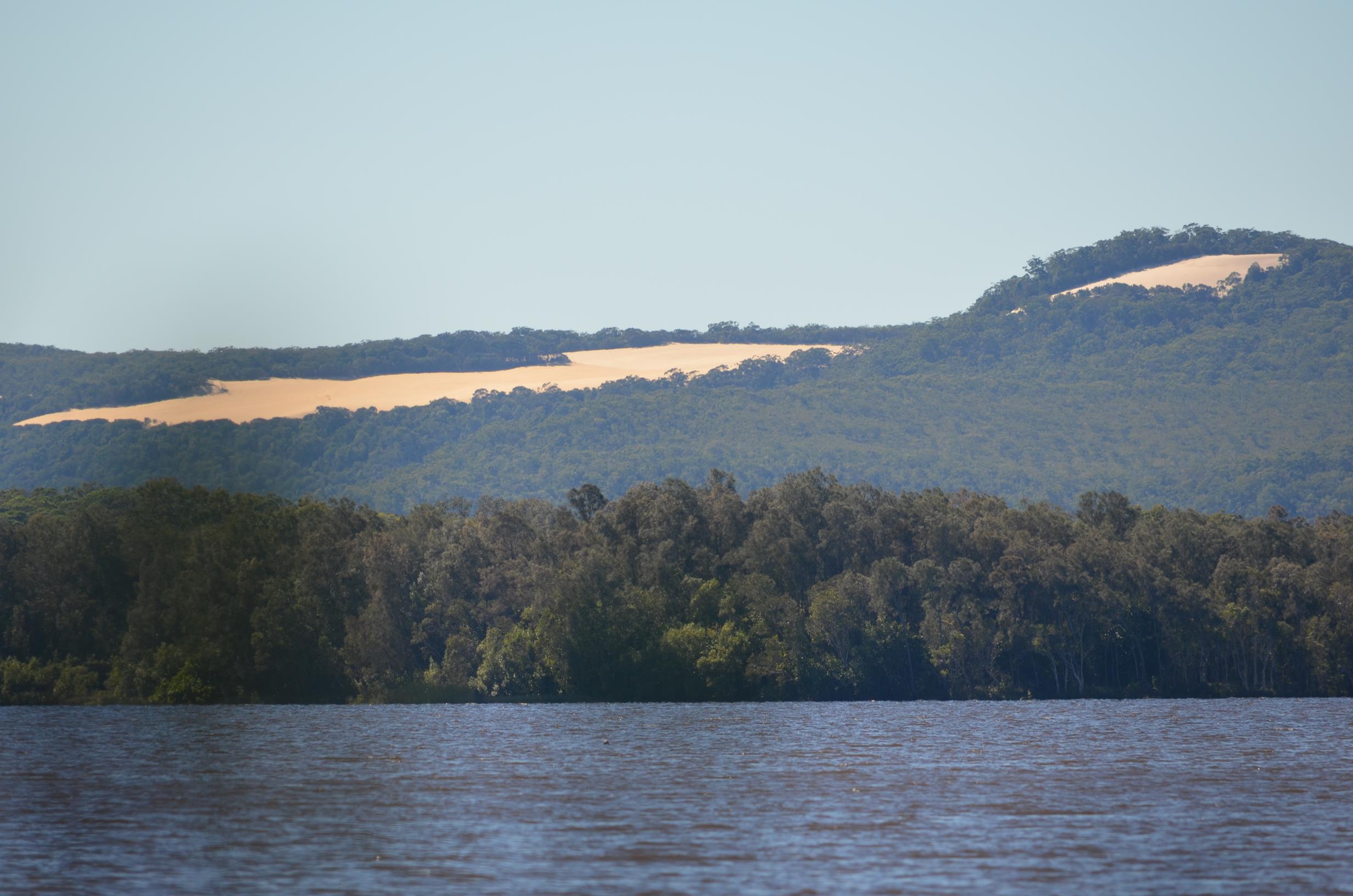
Lake Cootharaba, the largest of this river system, is fringed with forest and has glimpses of the Cooloola Sandblow to the north. Although mostly shallow it can get very rough if windy, especially onshore. Check the forecast and conditions on the day. If it looks dicey, do the Kinaba walk instead.

AFTERWARDS
Habitat Noosa at Elanda Point is a newly updated establishment offering everything from glamping, camping, boat hire to coffee/cake, ice creams and finer lunch dining. There is also a craft brewery and bar on site offering interesting craft beers (Pacific Ales/XPA’s) and delicious cocktails. Sit back and relax and look out over large trees towards the lake. On weekends they sometimes bring in a free kids rock climbing course.

You can hire canoes and kayaks from Habitat.

Down the road is the famous Apollonian Vale Hotel relocated from Gympie (and its old mining glory days). If you wanted to drive further afield there is plenty to see in the nearby townships of Pomona, Cooran and Kin Kin.

HOW TO GET THERE
To the starting point: Drive to Habitat Noosa, entrance is via a dirt road off Lake Flat Road, Elanda Point/Boreen Point. Heading towards Boreen Point on Louis Bazzo Drive, continue past Boreen Point township (on your right) onto Lake Flat Road and follow the signs. There is a large launch area in front of Habitat Noosa.

To the end point: The end point is the same as the starting point.

glossary button
Glossary
  • Icon showing this activity is suitable for wheelchairsSuitable for wheelchairs
  • Icon showing this activity is suitable for walkingSuitable for walking
  • Icon showing this activity is suitable for recreational cyclingSuitable for recreational cycling
  • Icon showing this activity is suitable for mountain bikingSuitable for mountain biking
  • Icon showing this activity is suitable for horse ridingSuitable for horse riding
  • Icon showing this activity is suitable for kayakingSuitable for kayaking
  • Icon showing this activity has drinking water availableDrinking water available
  • Icon showing this activity does not have drinking water availableNo drinking water available
  • Icon showing this activity has a barbeque on siteBarbeque on site
  • Icon showing this activity has a picnic table on sitePicnic table on site
  • Icon showing this activity has toilets on siteToilets on site
  • Icon showing fires are permitted at this activityFires permitted
  • Icon showing fires are prohibited at this activityFires prohibited
  • Icon showing camping is permitted at this activityCamping permitted
  • Icon showing camping is prohibited at this activityCamping prohibited
  • suitable for kayaking suitable for kayaking Suitable for kayaking
  • No drinking water available No drinking water available No drinking water available
  • Picnic table on site Picnic table on site Picnic table on site
  • toilets on site toilets on site Toilets on site
  • Fires prohibited Fires prohibited Fires prohibited
  • Camping permitted Camping permitted Camping permitted
Write a review

Review Date: 25/05/2019

Be sure to hit the water before the 10am surface breeze does. Mill Point is an interesting stop along the way and it’s just north of Elanda Point. Kayaks can be launched a few hundred metres before the entrance to Habitat Noosa. This public launch ramp also has a pretty white sandy beach. If you are in a group that’s too big for your kayak, there is a delightful walking track inland to Kinaba Island where you can meet up. Always be mindful of the wind speed and direction when timing your return trip.

Reviewed By: Regi

hazard icon

IN AN EMERGENCY DIAL '000'.

Always Adventure Safely!

  • Always follow any local signage, it contains key information and conditions can change at any time.
  • Use the trails with consideration for your abilities, be prepared for the adventure ahead:
    • Be aware of the weather conditions, found here: http://www.bom.gov.au/qld/.
    • Always wear appropriate clothing, focus on good footwear.
    • Always bring more water than you think you will need.
    • Be Sun Safe!
    • Always let someone know where you are going that isn’t going with you.
  • Just getting started try this site for good useful information: https://www.trailhiking.com.au/hike-safety/
  • Sunshine Coast Council does it’s best to maintain current information but things can change so always be aware that a trail may not be as listed in this guide, and report and issues via our feedback link.

Qld Parks and Wildlife Service

National Parks, Conservation Parks and some State Forests are managed by Queensland Parks and Wildlife Service. Contact details are: https://www.des.qld.gov.au/contactus/

For current information on trail conditions and alerts go to https://parks.des.qld.gov.au/park-alerts/#sunshinecoast

If you think something on this web site needs to change please let us know via: adventure@sunshinecoast.qld.gov.au

Nearby Trails

Trail Image for Lake Cootharaba: Kinaba kayak, KinKin Creek, Lake Como
Intermediate

Lake Cootharaba: Kinaba kayak, KinKin Creek, Lake Como

COMO
canoeing icon
Trail type
difficulty icon
Skill Level

8.9km

Length
direction icon
Circuit
Trail Image for Mill Point, Elanda Point Walk
Intermediate

Mill Point, Elanda Point Walk

COMO
walking icon
Trail type
difficulty icon
Skill Level

2.3km

Length
direction icon
One-way
Trail Image for Elanda Point, Mill Point: various walks
Easy

Elanda Point, Mill Point: various walks

COMO
walking icon
Trail type
difficulty icon
Skill Level

1.9km

Length
direction icon
Circuit
Trail Image for Noosa Banks paddle to Nth shore resort
Intermediate

Noosa Banks paddle to Nth shore resort

COOROIBAH
canoeing icon
Trail type
difficulty icon
Skill Level

4.3km

Length
direction icon
One-way
Trail Image for Tewantin National Park: Mt Tinbeerwah Eastern Waterfall
Difficult

Tewantin National Park: Mt Tinbeerwah Eastern Waterfall

COOROIBAH
walking icon
Trail type
difficulty icon
Skill Level

2.1km

Length
direction icon
One-way

Share this trail

This action requires a login.
To continue, click on Login/Signup below.

Photo uploaded successfully, thank you.

Feedback / Suggest an Adventure

If you have any feedback on the site or any of the trails, please drop us a short email.

Have we missed something? Do you have an adventure to suggest? Fill in the suggestion form to let us know about it.