facebook
Image showing that the PDF download is in progress... PDF download in progress

Please wait...

Image showing a pink decorative paint splat
Image showing a green decorative paint splat
upload photo button

NOTE: This adventure is in Tuchekoi National Park for current Queensland Parks and Wildlife Service parks information, maps and essential park alerts click here

reviews buttonReviews view map buttonMap
view 3d map button3D Map
directions take me there buttonDirections
Save
PDF
Gpx File

Tuchekoi National Park: Mount Cooroora

Tuchekoi National Park: Mount Cooroora
POMONA
walking icon walking icon black
Trail type
difficulty icon
Skill Level
1.2km
One-way Length
direction icon direction icon black
One-way

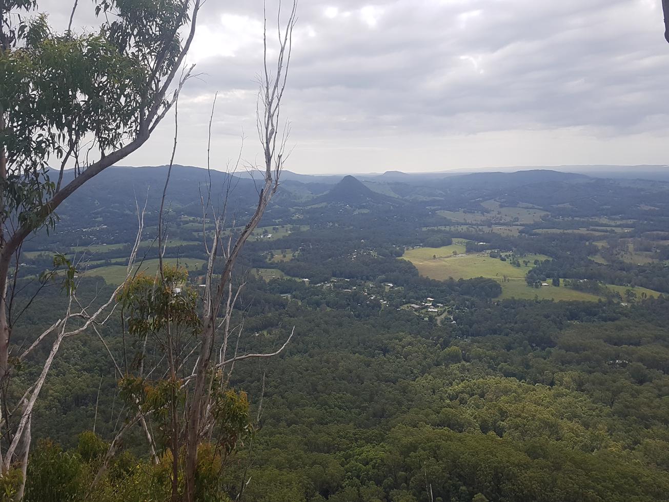
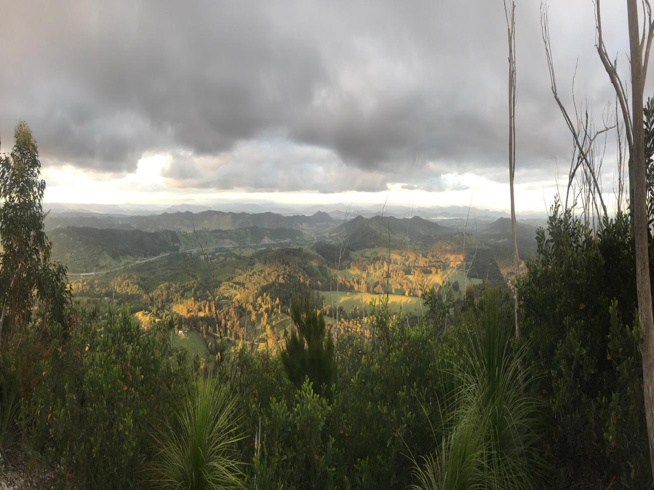
Scale the highest volcanic peak on the northern end of the Sunshine Coast for stunning 360 degree views.

SUITABILITY
Suitable for experienced walkers only – steep in places, strenuous and some exposure.

HIGHLIGHTS
A local’s favourite and for very good reasons, and views. A stone’s throw from the quaint village of Pomona in the Sunshine Coast hinterland stands the proud pinnacle of Mount Cooroora. The site of the annual ‘king of the mountain race’ this track takes your breath away, literally. But the expansive vista and calorie burn make it well worthwhile.

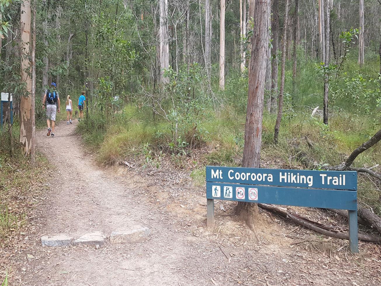
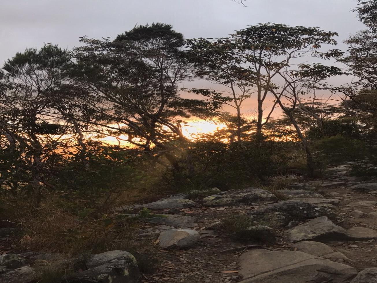
Take the worn track up through a wooded section, before a short decent and creek bridge crossing. There are chiselled rock steps as well as concrete and metal ones in places. You definitely need to watch your footing and look out for the odd handhold and resting seat! Some sections are steep in places but there are chains to help you pull yourself up.

You will be exhilarated when you get to the summit. Hard to believe the record for running up and back is 22.43 minutes.

AFTERWARDS
Enjoy a well earned refreshment back in Pomona, where there are coffee shops, a pub, supermarket, antique shops and the heritage listed Majestic Theatre.

HOW TO GET THERE
To the starting point: On the coast side of Cooroy, take Elm Street North (runs parallel to the train lines). This road becomes the Old Bruce Highway. Stay on this road for about 3 km then follow the signs to Pomona.

When you get to Pomona take Hill Street and follow it round into Reserve Street, cross over the railway tracks, go through the roundabout and take the first right into School Street. Continue on this road and when you turn the corner turn left into Mountain Street. This takes you all the way to the Mt Cooroora car park and beyond. Park in the car park beside the park. The trail starts opposite.

To the end point: It’s a there and back route, or rather and up and down one.

glossary button
Glossary
  • Icon showing this activity is suitable for wheelchairsSuitable for wheelchairs
  • Icon showing this activity is suitable for walkingSuitable for walking
  • Icon showing this activity is suitable for recreational cyclingSuitable for recreational cycling
  • Icon showing this activity is suitable for mountain bikingSuitable for mountain biking
  • Icon showing this activity is suitable for horse ridingSuitable for horse riding
  • Icon showing this activity is suitable for kayakingSuitable for kayaking
  • Icon showing this activity has drinking water availableDrinking water available
  • Icon showing this activity does not have drinking water availableNo drinking water available
  • Icon showing this activity has a barbeque on siteBarbeque on site
  • Icon showing this activity has a picnic table on sitePicnic table on site
  • Icon showing this activity has toilets on siteToilets on site
  • Icon showing fires are permitted at this activityFires permitted
  • Icon showing fires are prohibited at this activityFires prohibited
  • Icon showing camping is permitted at this activityCamping permitted
  • Icon showing camping is prohibited at this activityCamping prohibited
  • Suitable for walking Suitable for walking black lines Suitable for walking
  • Drinking water available Drinking water available Drinking water available
  • Picnic table on site Picnic table on site Picnic table on site
  • toilets on site toilets on site Toilets on site
  • Fires prohibited Fires prohibited Fires prohibited
  • Camping prohibited Camping prohibited Camping prohibited
Write a review

Review Date: 29/05/2019

My children, husband and I climbed this mountain on Mother's Day after using this website to find where the walk started. The Adventure Sunshine Coast site contains very accurate directions to locate the trail start. This trail is, at the website suggests not just for the average person. A level of fitness is required to complete it as some sections are steep and it will most definitely get the heart pumping. While both my children aged 8 and 10 were able to complete it, we as a family are regular hikers. I would not recommend it for children under this age (unless quite experienced) as some rock scrabbling and climbing is required and their height would make it a lot more challenging to complete these sections independently. In the steeper sections there is a combination of metal stairs and/or chains to assist you. All the recent rain has caused some of this track to become a bit more rutted out in sections but generally it is very good. Make sure you have both hands free to help you with the climb. Overall, this a very rewarding, albeit slightly more challenging climb with beautiful views from the top.

Reviewed By: Melinda

Review Date: 20/11/2018

My friends and I tackled the mountain in the dark (with headlamps!) to catch a beautiful sunrise. The climb definitely gets the heart pumping, and there were times that I had to use my hands to pull myself upwards on rocks and the chain. Once at the top you are rewarded with viewpoints at different locations, giving you essentially a 360 degree view surrounding the mountain. Very beautiful.

Reviewed By: Bronwyn

Review Date: 19/11/2018

I climbed this with a couple of friends to catch the sunrise up the top. Mid-November we left Eumundi at 3:30am which timed pretty much perfectly with being able to see first light as you climb, and then watching the sunrise from the horizon up the top. Head torches are essential if you're climbing in the dark, as you need both hands to pull you up through some of the tricky bits. And be prepared for the heart rate to be peaking on the way up! Very rewarding climb.

Reviewed By: Jade

Review Date: 02/11/2018

Quite a steep and strenuous hike that will be sure to test your fitness. Allow a couple of hours to complete it, however the hinterland views from the top are well worth the effort. There are some sections that require basic climbing skills and has some metal stairs and chain rope to help you through some of the sticky sections. After the climb, head into the quaint town of Pamona for a coffee and lunch, if you're lucky there might be a weekend market on.

Reviewed By: Adam

hazard icon

IN AN EMERGENCY DIAL '000'.

Always Adventure Safely!

  • Always follow any local signage, it contains key information and conditions can change at any time.
  • Use the trails with consideration for your abilities, be prepared for the adventure ahead:
    • Be aware of the weather conditions, found here: http://www.bom.gov.au/qld/.
    • Always wear appropriate clothing, focus on good footwear.
    • Always bring more water than you think you will need.
    • Be Sun Safe!
    • Always let someone know where you are going that isn’t going with you.
  • Just getting started try this site for good useful information: https://www.trailhiking.com.au/hike-safety/
  • Sunshine Coast Council does it’s best to maintain current information but things can change so always be aware that a trail may not be as listed in this guide, and report and issues via our feedback link.

Qld Parks and Wildlife Service

National Parks, Conservation Parks and some State Forests are managed by Queensland Parks and Wildlife Service. Contact details are: https://www.des.qld.gov.au/contactus/

For current information on trail conditions and alerts go to https://parks.des.qld.gov.au/park-alerts/#sunshinecoast

If you think something on this web site needs to change please let us know via: adventure@sunshinecoast.qld.gov.au

Nearby Trails

Trail Image for Tuchekoi National Park: Pomona side trail
Intermediate

Tuchekoi National Park: Pomona side trail

POMONA
walking icon mountain biking icon horse riding icon
Trail type
difficulty icon
Skill Level

5.2km

Length
direction icon
One-way
Trail Image for Tuchekoi National Park: Cooran side trail
Intermediate

Tuchekoi National Park: Cooran side trail

COORAN
walking icon cycling icon mountain biking icon horse riding icon
Trail type
difficulty icon
Skill Level

5.0km

Length
direction icon
Circuit
Trail Image for Road Cycle Route: SCC Big Loop
Difficult

Road Cycle Route: SCC Big Loop

Alexandra Headland
walking icon cycling icon
Trail type
difficulty icon
Skill Level

180.6km

Length
direction icon
Circuit
Trail Image for Tewantin National Park: Lake MacDonald North.
Intermediate

Tewantin National Park: Lake MacDonald North.

LAKE MACDONALD
walking icon mountain biking icon
Trail type
difficulty icon
Skill Level

6.6km

Length
direction icon
Circuit
Trail Image for Lake MacDonald: Canoe/Kayak
Easy

Lake MacDonald: Canoe/Kayak

LAKE MACDONALD
canoeing icon
Trail type
difficulty icon
Skill Level

4.9km

Length
direction icon
Circuit

Share this trail

This action requires a login.
To continue, click on Login/Signup below.

Photo uploaded successfully, thank you.

Feedback / Suggest an Adventure

If you have any feedback on the site or any of the trails, please drop us a short email.

Have we missed something? Do you have an adventure to suggest? Fill in the suggestion form to let us know about it.