facebook
Image showing that the PDF download is in progress... PDF download in progress

Please wait...

Image showing a pink decorative paint splat
Image showing a green decorative paint splat
upload photo button
reviews buttonReviews view map buttonMap
view 3d map button3D Map
directions take me there buttonDirections
Save
PDF
Gpx File

Cilento Park: Falls Walk

Cilento Park: Falls Walk
Nambour
walking icon walking icon black
Trail type
difficulty icon
Skill Level
0.9km
Length
direction icon direction icon black
Circuit

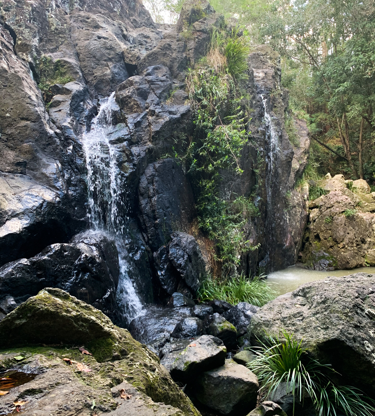
Tropical rainforest and secluded waterfall in the centre of Nambour

SUITABILITY
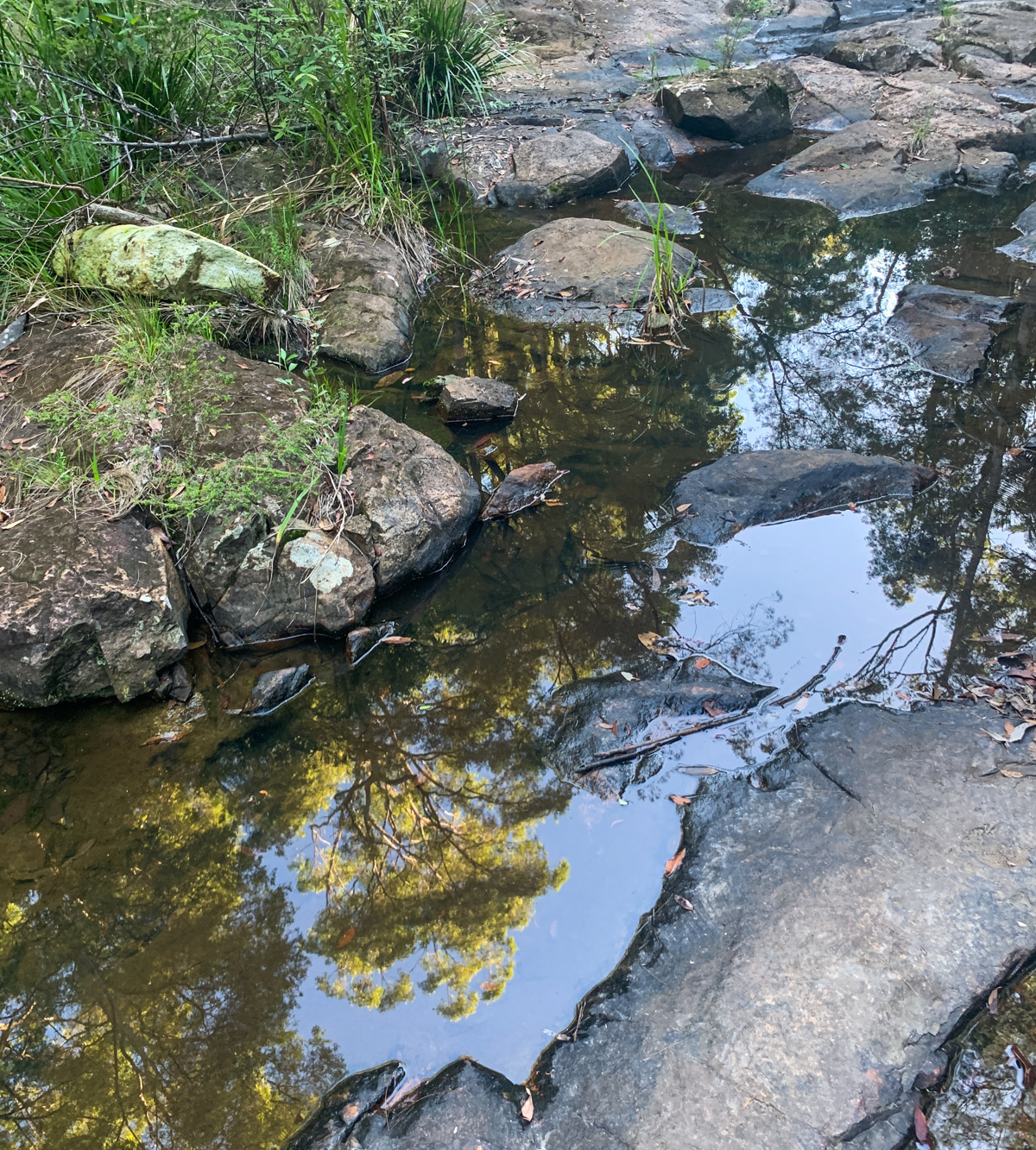
This is a pathway suitable for walkers, however, it can be slippery and involves crossing a small section of rocks to complete the loop. Children should be accompanied by an adult, as the falls are not cordoned off.

HIGHLIGHTS
The short bush walk to the waterfall can be found at the Cilento Bushland Conservation Reserve.

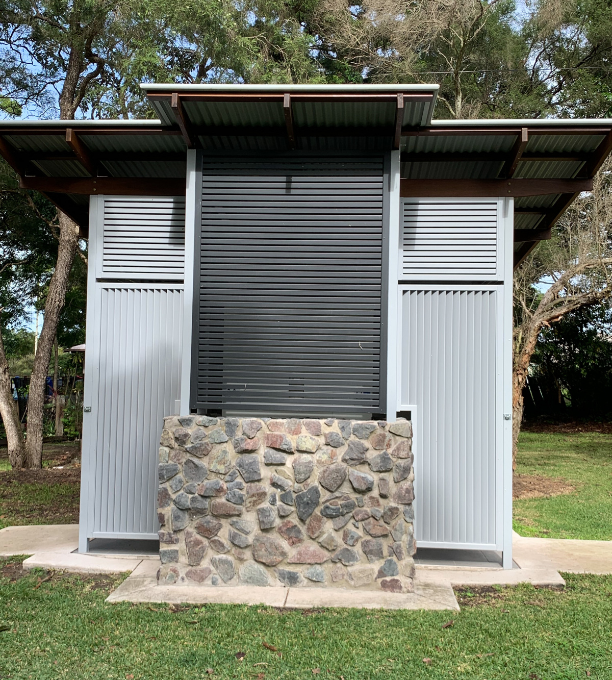
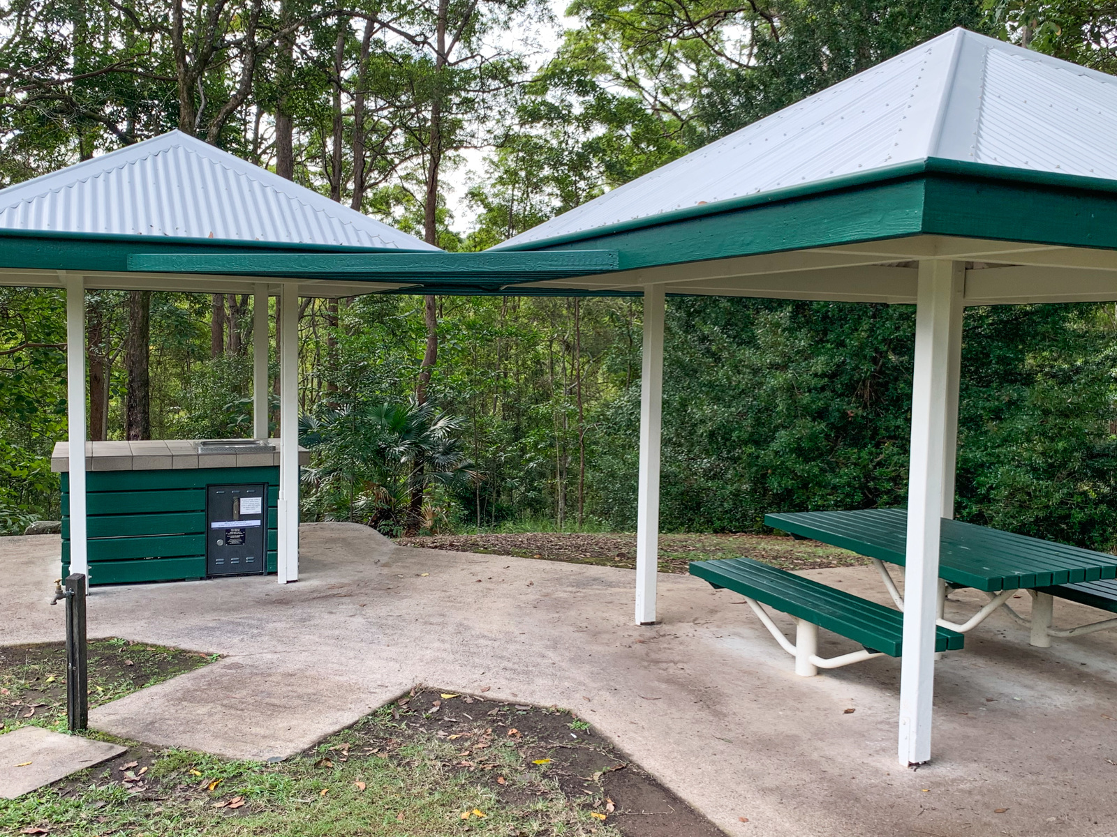
Upon arrival you will be greeted by a large open parkland, picnic tables, BBQ facilities, play equipment for the kids and amenities.
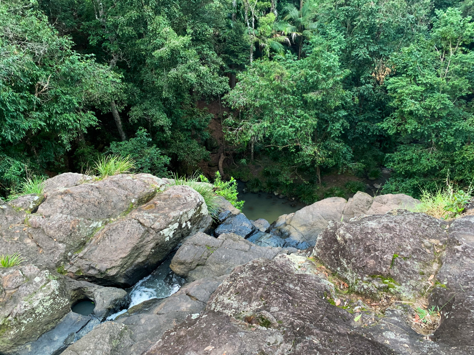
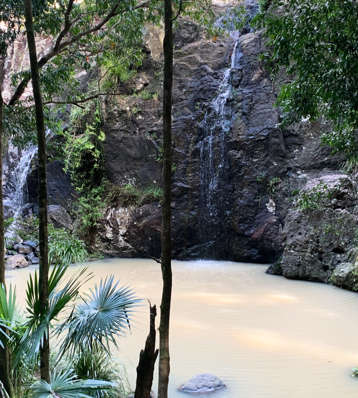
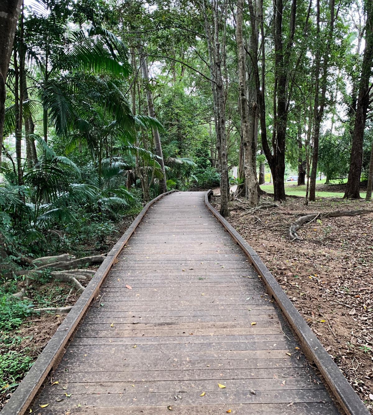
The entrance to the trail can be found behind the picnic tables, which guides you on a short bush track to the bottom of the waterfall. Walking through the tropical rainforest you can hear the birds chirping and the relaxing sounds of water falling. Be careful as you approach the falls, as the waterfall is not fenced off and can be very slippery. This gorgeous view is a popular location for local photographers and swimmers on a hot summer day!

As you commence your walk back to the reserve, the bush track inclines with sections of graded steps. As you get close to the finish, you will need to cross a section of rocks. Be careful as the rocks are slippery, and you need to do a small jump to continue the loop back to the reserve.
Be careful if there has been significant rainfall, as sections of the track may be flooded.


AFTERWARDS
Spend some time soaking up the tranquil nature of the reserve, let the kids play in the park, enjoy a family picnic or BBQ in the shelters provided. Forgot to bring lunch? No problem. Head into town and explore a thriving regional hub and unique cafes.

Visiting a loved one in the nearby hospital, grab a coffee and take a short walk to the reserve.

HOW TO GET THERE

The short circuit bushwalk to the waterfall can be found at The Cilento Bushland Conservation Reserve in Waterfall Road, Nambour, off Mapleton Road, across from the Nambour Hospital.

On-street parking is available at the end of the road (no dedicated car park).

glossary button
Glossary
  • Icon showing this activity is suitable for wheelchairsSuitable for wheelchairs
  • Icon showing this activity is suitable for walkingSuitable for walking
  • Icon showing this activity is suitable for recreational cyclingSuitable for recreational cycling
  • Icon showing this activity is suitable for mountain bikingSuitable for mountain biking
  • Icon showing this activity is suitable for horse ridingSuitable for horse riding
  • Icon showing this activity is suitable for kayakingSuitable for kayaking
  • Icon showing this activity has drinking water availableDrinking water available
  • Icon showing this activity does not have drinking water availableNo drinking water available
  • Icon showing this activity has a barbeque on siteBarbeque on site
  • Icon showing this activity has a picnic table on sitePicnic table on site
  • Icon showing this activity has toilets on siteToilets on site
  • Icon showing fires are permitted at this activityFires permitted
  • Icon showing fires are prohibited at this activityFires prohibited
  • Icon showing camping is permitted at this activityCamping permitted
  • Icon showing camping is prohibited at this activityCamping prohibited
  • Suitable for walking Suitable for walking black lines Suitable for walking
  • No drinking water available No drinking water available No drinking water available
  • barbeque on site barbeque on site Barbeque on site
  • Picnic table on site Picnic table on site Picnic table on site
  • toilets on site toilets on site Toilets on site
  • Fires prohibited Fires prohibited Fires prohibited
  • Camping prohibited Camping prohibited Camping prohibited
Write a review

Review Date: 07/04/2019

Arriving mid-morning on a cracking Sunday, I expected it to be busier, but the kids and I only passed one person on the walk and we had the playground to ourselves. It was such a peaceful place with a lot of bird song, and even though I live 10 minutes away, I would never have found this place without the #adventuresunshinecoast website. The path was in mostly good condition, but after the recent rain, the section down by the waterhole was a little mushy. Most of the path is wide and although a bit steep, it's still easy to navigate, but the steps and tree roots by the creek will keep you on your toes, especially if you're with children. My four year old son walked the entire circuit barefoot, and I wore my 2 year old twins in my double carrier, which made the rock hop over the creek a little exciting! There were a few mosquitos down by the water as to be expected at this time of year, so we didn't linger there, but I could definitely see myself jumping in the waterhole on a hot summer day.

Reviewed By: Jasmin

hazard icon

IN AN EMERGENCY DIAL '000'.

Always Adventure Safely!

  • Always follow any local signage, it contains key information and conditions can change at any time.
  • Use the trails with consideration for your abilities, be prepared for the adventure ahead:
    • Be aware of the weather conditions, found here: http://www.bom.gov.au/qld/.
    • Always wear appropriate clothing, focus on good footwear.
    • Always bring more water than you think you will need.
    • Be Sun Safe!
    • Always let someone know where you are going that isn’t going with you.
  • Just getting started try this site for good useful information: https://www.trailhiking.com.au/hike-safety/
  • Sunshine Coast Council does it’s best to maintain current information but things can change so always be aware that a trail may not be as listed in this guide, and report and issues via our feedback link.

Sunshine Coast Council

For any issues with this experience please contact:

Sunshine Coast Council via 07 5475 7272 or via e-mail: adventure@sunshinecoast.qld.gov.au

Nearby Trails

Trail Image for Gary Evans Walkway
Easy

Gary Evans Walkway

Nambour
walking icon cycling icon
Trail type
difficulty icon
Skill Level

1.5km

Length
direction icon
One-way
Trail Image for Nambour Heritage Soundtrail
Easy

Nambour Heritage Soundtrail

Nambour
walking icon
Trail type
difficulty icon
Skill Level

2.3km

Length
direction icon
Circuit
Trail Image for Koala Park Recreation Loop
Intermediate

Koala Park Recreation Loop

Nambour
walking icon
Trail type
difficulty icon
Skill Level

1.2km

Length
direction icon
Circuit
Trail Image for Parklands Conservation Park - Rocky Creek Circuit
Difficult

Parklands Conservation Park - Rocky Creek Circuit

Parklands
walking icon mountain biking icon horse riding icon
Trail type
difficulty icon
Skill Level

6.0km

Length
direction icon
Circuit
Trail Image for Road Cycle Route: Twin Waters Loop
Difficult

Road Cycle Route: Twin Waters Loop

Bli Bli
walking icon cycling icon
Trail type
difficulty icon
Skill Level

73.8km

Length
direction icon
Circuit

Share this trail

This action requires a login.
To continue, click on Login/Signup below.

Photo uploaded successfully, thank you.

Feedback / Suggest an Adventure

If you have any feedback on the site or any of the trails, please drop us a short email.

Have we missed something? Do you have an adventure to suggest? Fill in the suggestion form to let us know about it.