facebook
Image showing that the PDF download is in progress... PDF download in progress

Please wait...

Image showing a pink decorative paint splat
Image showing a green decorative paint splat
upload photo button
reviews buttonReviews view map buttonMap
view 3d map button3D Map
directions take me there buttonDirections
Save
PDF
Gpx File

Maroochy Waters Three Parks Loop

Maroochy Waters Three Parks Loop
Maroochydore
walking icon walking icon black mountain biking icon mountain biking icon black
Trail type
difficulty icon
Skill Level
3.7km
Length
direction icon direction icon black
Circuit

An easy neighborhood walk along the pathways of Maroochy Waters - this circuit loops you past three scenic park areas and the Maroochy Waters canal.

SUITABILITY
Suitable for adults and older children as the last 200m of the loop is on grassed footpaths and not suitable for bikes or scooters.

HIGHLIGHTS
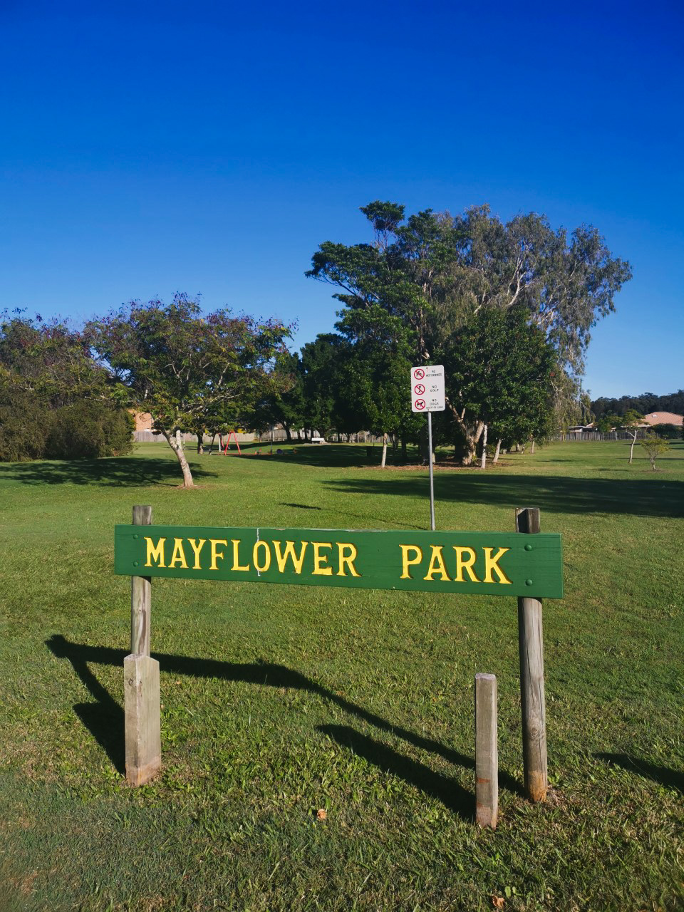
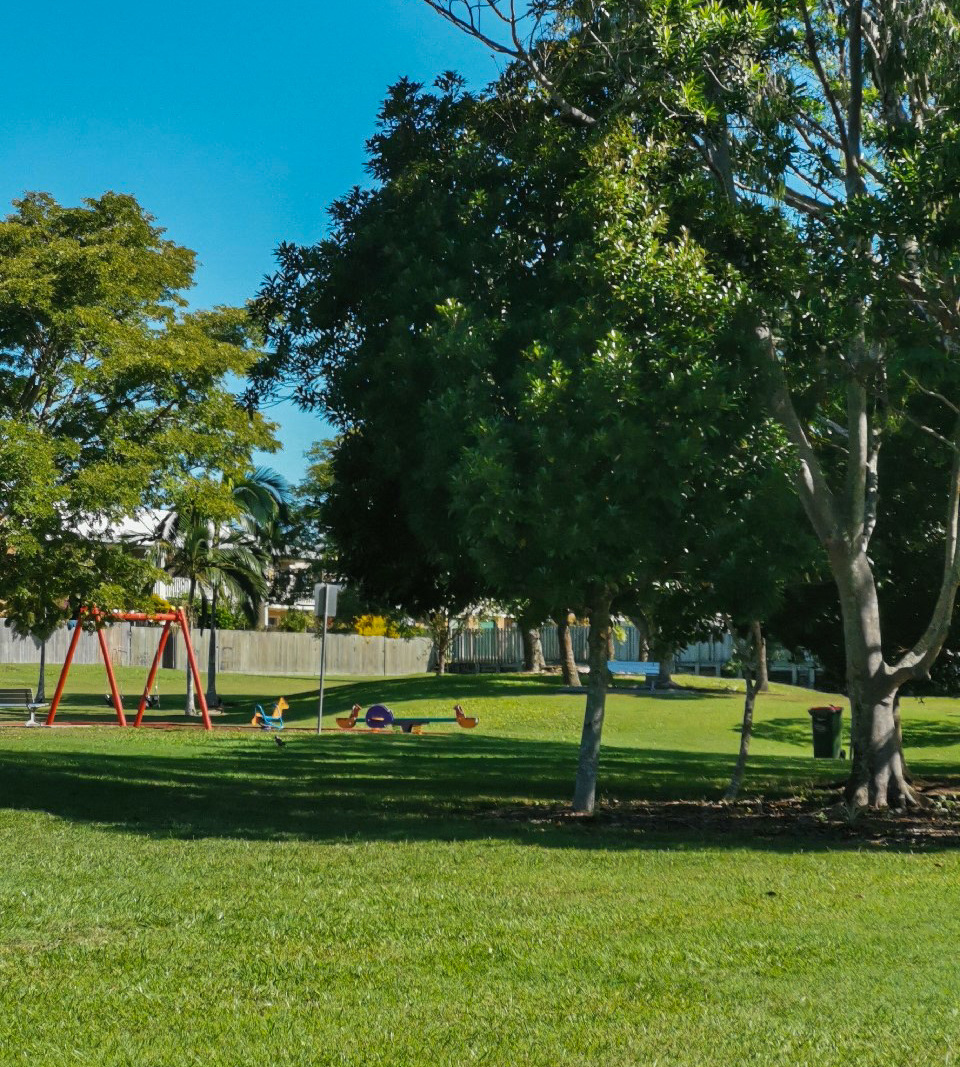
Your starting point at Mayflower Park is a quiet, large-sized park, great for a game of football, and has an excellent playground for the kids. Walk through this park to the far western corner and take the exit onto the footpath on Maroochy Waters Drive. Only 20 meters away is the second little tranquil park with a paved walkway that loops you around and back onto the footpath. Continue north and wind your way past some truly marvelous front gardens until you reach the third park opposite the canals.

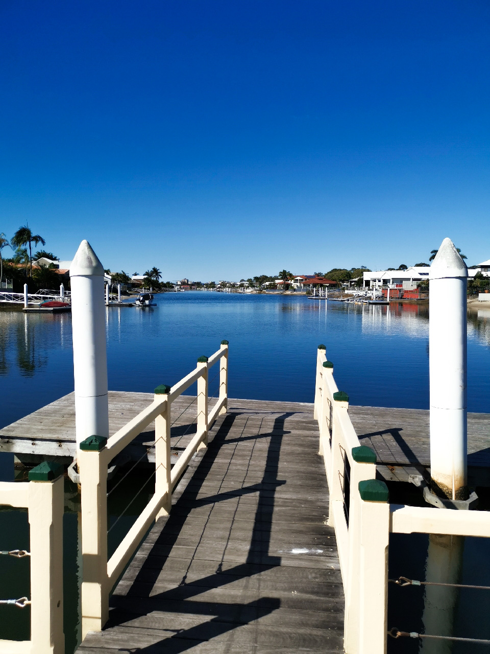
Rest awhile on the canal jetty and watch the mullet jumping from the water before departing for the last section of the loop. Continue towards Traders Place and stay on the footpath that leads onto the shared bike/pedestrian path. Although you are beside the motorway, the opportunity for a good run or cycle on this section is achievable as the path is wide and relatively straight. The local shops and tavern at Traders Place offer refreshment opportunities. Turn left off the footpath and head down Arwen Street and the side entry into Mayflower Park to complete the loop. This last section is grassed footpath.

AFTERWARDS
Enjoy a picnic in Mayflower Park or head back to Maroochydore for a dip in the ocean.

HOW TO GET THERE
To the starting point: there are roads leading off Main Road that lead to Tepequar Drive. Parking is available on Tepequar Drive opposite the park.
To the end point: same as start

glossary button
Glossary
  • Icon showing this activity is suitable for wheelchairsSuitable for wheelchairs
  • Icon showing this activity is suitable for walkingSuitable for walking
  • Icon showing this activity is suitable for recreational cyclingSuitable for recreational cycling
  • Icon showing this activity is suitable for mountain bikingSuitable for mountain biking
  • Icon showing this activity is suitable for horse ridingSuitable for horse riding
  • Icon showing this activity is suitable for kayakingSuitable for kayaking
  • Icon showing this activity has drinking water availableDrinking water available
  • Icon showing this activity does not have drinking water availableNo drinking water available
  • Icon showing this activity has a barbeque on siteBarbeque on site
  • Icon showing this activity has a picnic table on sitePicnic table on site
  • Icon showing this activity has toilets on siteToilets on site
  • Icon showing fires are permitted at this activityFires permitted
  • Icon showing fires are prohibited at this activityFires prohibited
  • Icon showing camping is permitted at this activityCamping permitted
  • Icon showing camping is prohibited at this activityCamping prohibited
  • Suitable for walking Suitable for walking black lines Suitable for walking
  • Suitable for mountain biking Suitable for mountain biking Suitable for mountain biking
  • No drinking water available No drinking water available No drinking water available
  • Fires prohibited Fires prohibited Fires prohibited
  • Camping prohibited Camping prohibited Camping prohibited
Write a review

Be the first to review this trail.

hazard icon

IN AN EMERGENCY DIAL '000'.

Always Adventure Safely!

  • Always follow any local signage, it contains key information and conditions can change at any time.
  • Use the trails with consideration for your abilities, be prepared for the adventure ahead:
    • Be aware of the weather conditions, found here: http://www.bom.gov.au/qld/.
    • Always wear appropriate clothing, focus on good footwear.
    • Always bring more water than you think you will need.
    • Be Sun Safe!
    • Always let someone know where you are going that isn’t going with you.
  • Just getting started try this site for good useful information: https://www.trailhiking.com.au/hike-safety/
  • Sunshine Coast Council does it’s best to maintain current information but things can change so always be aware that a trail may not be as listed in this guide, and report and issues via our feedback link.

Sunshine Coast Council

For any issues with this experience please contact:

Sunshine Coast Council via 07 5475 7272 or via e-mail: adventure@sunshinecoast.qld.gov.au

Nearby Trails

Trail Image for Maroochy Waters Canal to Chambers Island Paddle
Easy

Maroochy Waters Canal to Chambers Island Paddle

Maroochydore
canoeing icon
Trail type
difficulty icon
Skill Level

2.7km

Length
direction icon
One-way
Trail Image for Road Cycle Route: SCC Big Loop
Difficult

Road Cycle Route: SCC Big Loop

Alexandra Headland
walking icon cycling icon
Trail type
difficulty icon
Skill Level

180.6km

Length
direction icon
Circuit
Trail Image for Road Cycle Route: Mooloolaba to Coolum
Difficult

Road Cycle Route: Mooloolaba to Coolum

Alexandra Headland
walking icon cycling icon
Trail type
difficulty icon
Skill Level

51.6km

Length
direction icon
One-way
Trail Image for Road Cycle Route: Mooloolaba to Mudjimba
Difficult

Road Cycle Route: Mooloolaba to Mudjimba

Alexandra Headland
walking icon cycling icon
Trail type
difficulty icon
Skill Level

31.4km

Length
direction icon
One-way
Trail Image for Maroochy River to Bli Bli Circuit
Easy

Maroochy River to Bli Bli Circuit

Bli Bli
walking icon mountain biking icon
Trail type
difficulty icon
Skill Level

12.3km

Length
direction icon
Circuit

Share this trail

This action requires a login.
To continue, click on Login/Signup below.

Photo uploaded successfully, thank you.

Feedback / Suggest an Adventure

If you have any feedback on the site or any of the trails, please drop us a short email.

Have we missed something? Do you have an adventure to suggest? Fill in the suggestion form to let us know about it.