facebook
Image showing that the PDF download is in progress... PDF download in progress

Please wait...

Image showing a pink decorative paint splat
Image showing a green decorative paint splat
upload photo button
reviews buttonReviews view map buttonMap
view 3d map button3D Map
directions take me there buttonDirections
Save
PDF
Gpx File

Tewantin: Cranks Creek Trail

Tewantin: Cranks Creek Trail
walking icon walking icon black cycling icon cycling icon black
Trail type
difficulty icon
Skill Level
2.4km
Length
direction icon direction icon black
Circuit

A leisurely walk traversing the local creek and bushland.

SUITABILITY
This walk is suitable for families and all ages, as well as recreational cyclists.
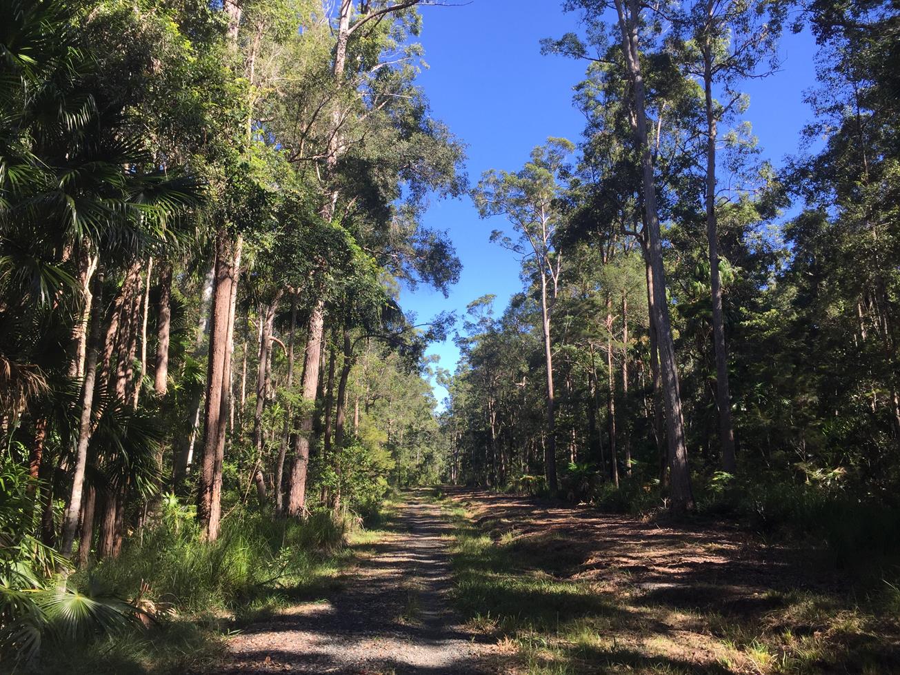
HIGHLIGHTS
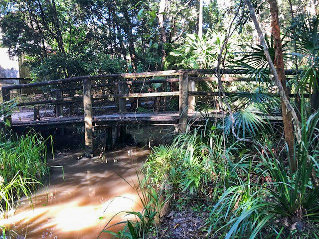
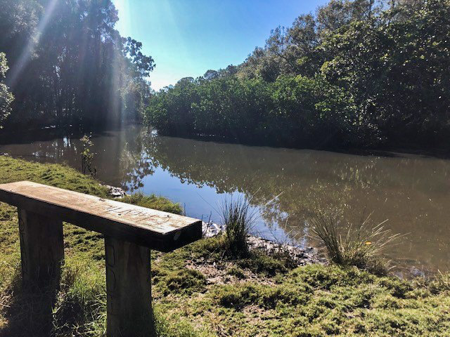
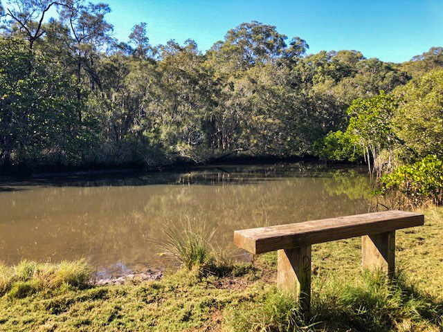
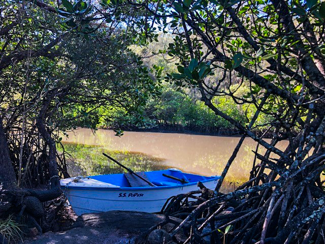
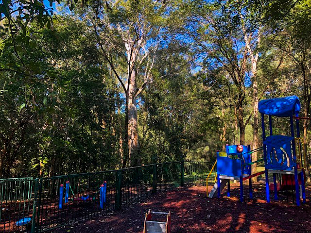
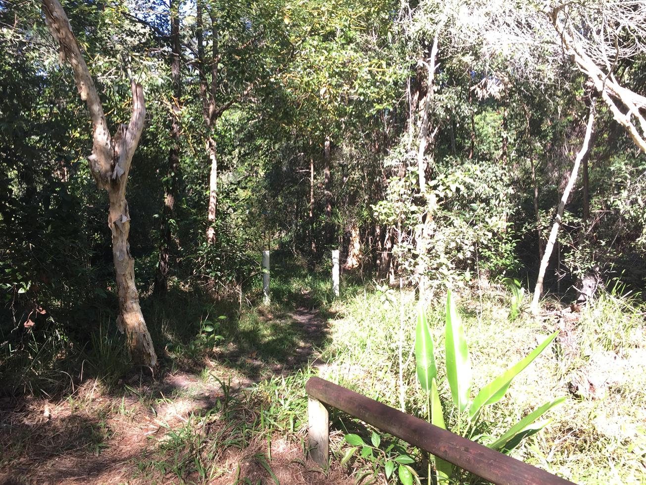
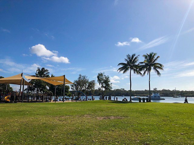
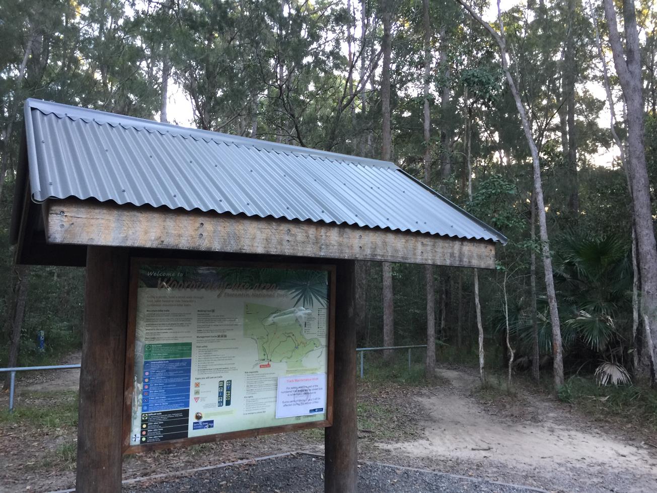
Beginning at the Nichols Ct roundabout, there are a number of off-street parking options. The track begins under the forest canopy and initially takes walkers through the bush along a formed path. A short distance in the path passes a modern playground set amongst the trees. This area also features some green space and picnic tables, perfect for a quick refreshment break or lunch. The trail continues alongside the creek along a winding formed track and small bridges and occasionally short grass and gravel sections. A number of bird species reside in the overhead Scribbly Gum Eucalyptus trees including corellas, galahs, sulphur crested cockatoos and owls. If you are not able to see them you will certainly hear them! The turnaround point is Jacaranda Park which offers a large green space to rest and set up a halfway picnic.

AFTERWARDS
Return via the same route or for the more adventurous, take one of the many side-tracks on offer. The nearby town of Tewantin offers delightful country town hospitality including cafes, bakeries, and parks.

HOW TO GET THERE
To Start: Via Eumundi Noosa Rd, turn onto Beckmans Rd, then right onto St Andrews Drive. Turn right onto Outlook Drive and park at the Nichols Ct roundabout.
To End: The end point is the start point


glossary button
Glossary
  • Icon showing this activity is suitable for wheelchairsSuitable for wheelchairs
  • Icon showing this activity is suitable for walkingSuitable for walking
  • Icon showing this activity is suitable for recreational cyclingSuitable for recreational cycling
  • Icon showing this activity is suitable for mountain bikingSuitable for mountain biking
  • Icon showing this activity is suitable for horse ridingSuitable for horse riding
  • Icon showing this activity is suitable for kayakingSuitable for kayaking
  • Icon showing this activity has drinking water availableDrinking water available
  • Icon showing this activity does not have drinking water availableNo drinking water available
  • Icon showing this activity has a barbeque on siteBarbeque on site
  • Icon showing this activity has a picnic table on sitePicnic table on site
  • Icon showing this activity has toilets on siteToilets on site
  • Icon showing fires are permitted at this activityFires permitted
  • Icon showing fires are prohibited at this activityFires prohibited
  • Icon showing camping is permitted at this activityCamping permitted
  • Icon showing camping is prohibited at this activityCamping prohibited
  • Suitable for walking Suitable for walking black lines Suitable for walking
  • Suitable for recreational cycling Suitable for recreational cycling Suitable for recreational cycling
  • No drinking water available No drinking water available No drinking water available
  • Picnic table on site Picnic table on site Picnic table on site
  • Fires prohibited Fires prohibited Fires prohibited
  • Camping prohibited Camping prohibited Camping prohibited
Write a review

Be the first to review this trail.

hazard icon

IN AN EMERGENCY DIAL '000'.

Always Adventure Safely!

  • Always follow any local signage, it contains key information and conditions can change at any time.
  • Use the trails with consideration for your abilities, be prepared for the adventure ahead:
    • Be aware of the weather conditions, found here: http://www.bom.gov.au/qld/.
    • Always wear appropriate clothing, focus on good footwear.
    • Always bring more water than you think you will need.
    • Be Sun Safe!
    • Always let someone know where you are going that isn’t going with you.
  • Just getting started try this site for good useful information: https://www.trailhiking.com.au/hike-safety/
  • Sunshine Coast Council does it’s best to maintain current information but things can change so always be aware that a trail may not be as listed in this guide, and report and issues via our feedback link.

Noosa Council

For any issues with the trail please call: 07 5329 6500

If you think something on the web site needs to change please let us know via: adventure@sunshinecoast.qld.au

Nearby Trails

Trail Image for Road Cycle Route: SCC Big Loop
Difficult

Road Cycle Route: SCC Big Loop

Alexandra Headland
walking icon cycling icon
Trail type
difficulty icon
Skill Level

180.6km

Length
direction icon
Circuit
Trail Image for Tewantin Sports Grounds Circuit
Intermediate

Tewantin Sports Grounds Circuit

TEWANTIN
walking icon
Trail type
difficulty icon
Skill Level

2.4km

Length
direction icon
One-way
Trail Image for Noosa Marina to Gympie Terrace
Easy

Noosa Marina to Gympie Terrace

walking icon
Trail type
difficulty icon
Skill Level

2.5km

Length
direction icon
Circuit
Trail Image for Tewantin National Park: Wooroi Introduction Loop
Intermediate

Tewantin National Park: Wooroi Introduction Loop

TINBEERWAH
mountain biking icon
Trail type
difficulty icon
Skill Level

11.5km

Length
direction icon
Circuit
Trail Image for Tewantin National Park: Hovea Circuit
Easy

Tewantin National Park: Hovea Circuit

TEWANTIN
mountain biking icon
Trail type
difficulty icon
Skill Level

1.5km

Length
direction icon
Circuit

Share this trail

This action requires a login.
To continue, click on Login/Signup below.

Photo uploaded successfully, thank you.

Feedback / Suggest an Adventure

If you have any feedback on the site or any of the trails, please drop us a short email.

Have we missed something? Do you have an adventure to suggest? Fill in the suggestion form to let us know about it.