facebook
Image showing that the PDF download is in progress... PDF download in progress

Please wait...

Image showing a pink decorative paint splat
Image showing a green decorative paint splat
upload photo button
reviews buttonReviews view map buttonMap
view 3d map button3D Map
directions take me there buttonDirections
Save
PDF
Gpx File

Pioneer Park Explore

Pioneer Park Explore
Gheerulla
walking icon walking icon black
Trail type
difficulty icon
Skill Level
0.3km
Length
direction icon direction icon black
Circuit

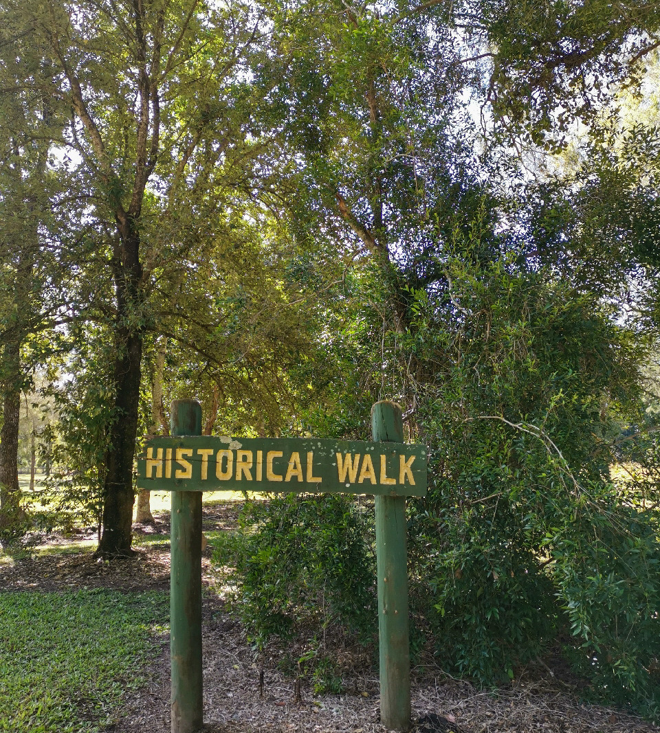
A small trail that highlights the timber logging history of Gheerulla.

SUITABILITY
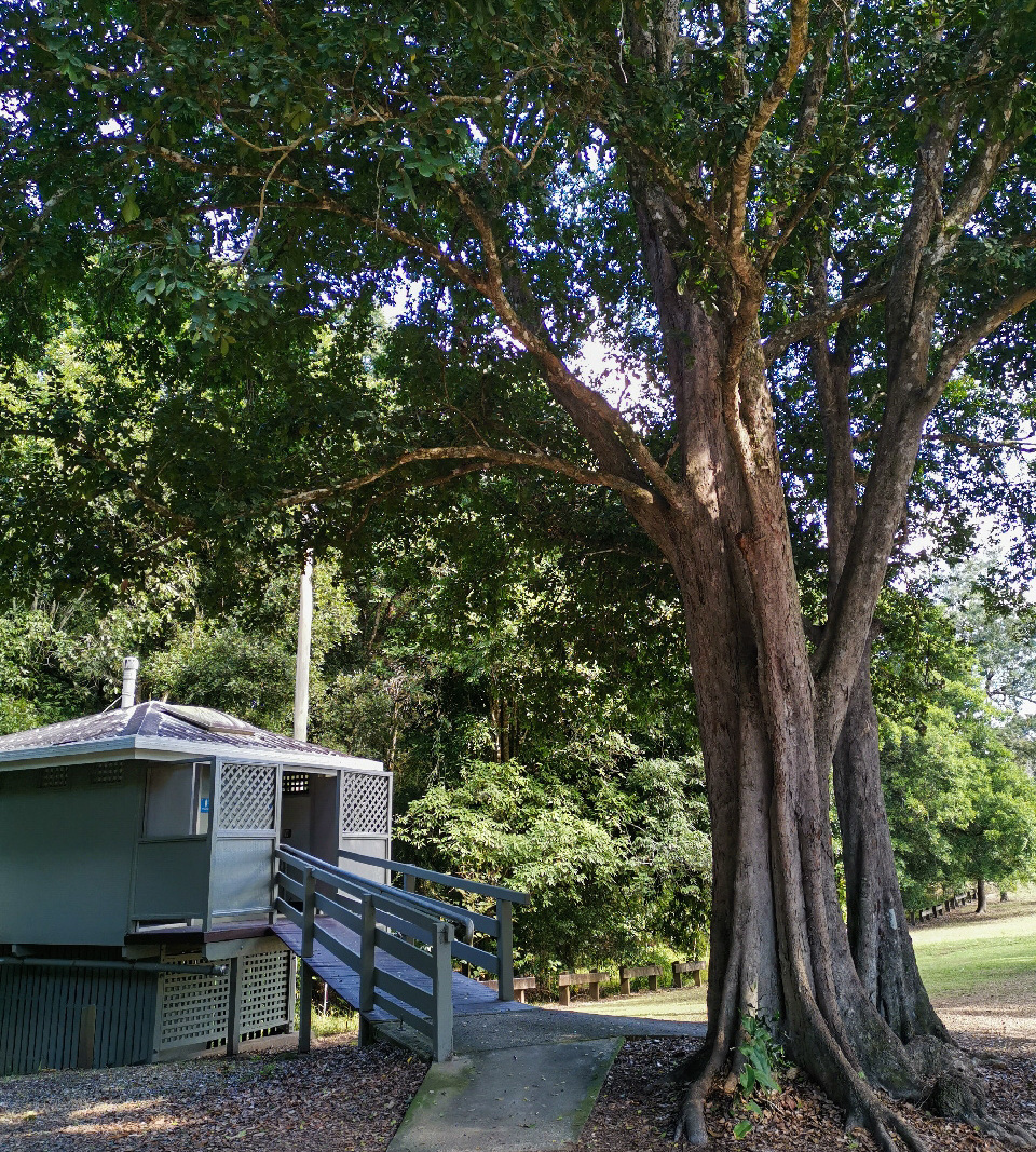
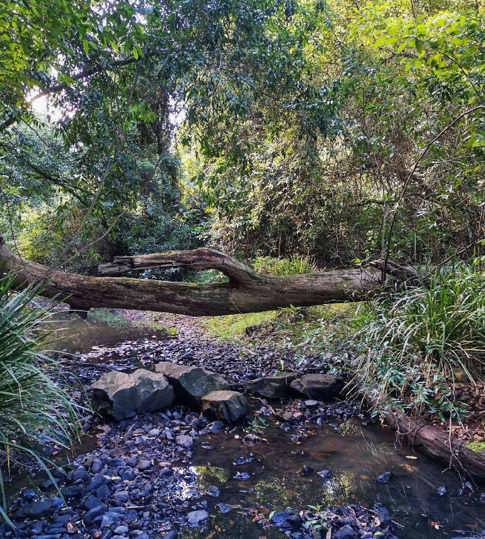
Suitable for all age groups and abilities. The amenities and historical walk are both wheelchair accessible but the path to the creek is not suitable.

HIGHLIGHTS
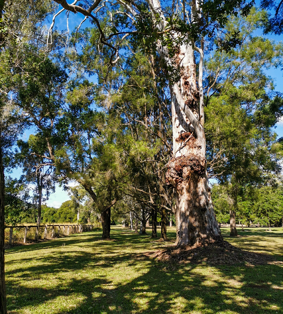
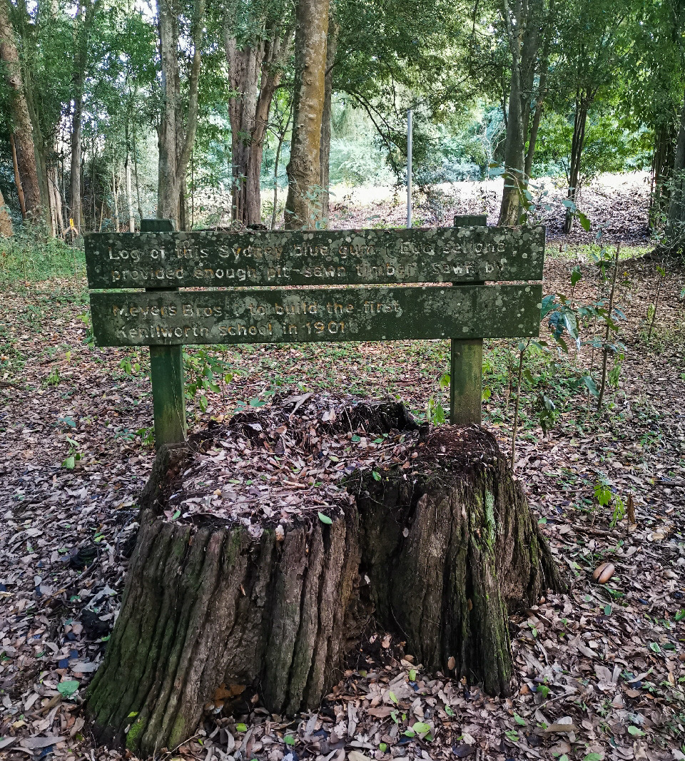
Tucked just off the Eumundi Kenilworth Road, this little park has some interesting historical features that are worth the stop. Old, tree stumps down near the creek are ghostly reminders of the logging history of the area and in the park, shaded by an avenue of trees, is a short historical walk that acknowledges some of the pioneering timber cutters and selectors who worked in the industry and used the timber to build the first school in Kenilworth.

AFTERWARDS
Head into Kenilworth and sample some of the local cheese or a famous donut from the bakery. This quaint, hinterland town is worth taking a stroll around too as there are many gift shops and cafes to spend some time in.

HOW TO GET THERE
To the starting point: Take the Bruce Highway and turn off onto the Eumundi Kenilworth Road. Follow the signs to Gheerulla. Pioneer Park rest area is clearly marked on the left-hand side of the road.
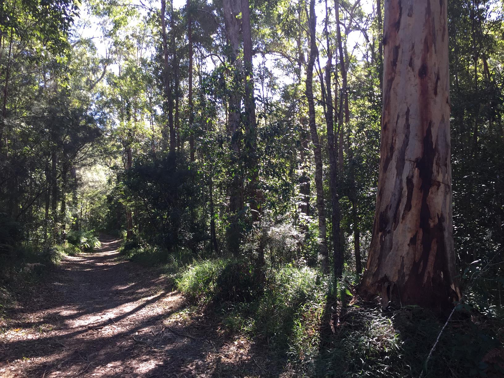
The Historical Walk is signposted. The creek walk is accessed just behind the amenities block.

To the end point: The end point is the same as the starting point.

glossary button
Glossary
  • Icon showing this activity is suitable for wheelchairsSuitable for wheelchairs
  • Icon showing this activity is suitable for walkingSuitable for walking
  • Icon showing this activity is suitable for recreational cyclingSuitable for recreational cycling
  • Icon showing this activity is suitable for mountain bikingSuitable for mountain biking
  • Icon showing this activity is suitable for horse ridingSuitable for horse riding
  • Icon showing this activity is suitable for kayakingSuitable for kayaking
  • Icon showing this activity has drinking water availableDrinking water available
  • Icon showing this activity does not have drinking water availableNo drinking water available
  • Icon showing this activity has a barbeque on siteBarbeque on site
  • Icon showing this activity has a picnic table on sitePicnic table on site
  • Icon showing this activity has toilets on siteToilets on site
  • Icon showing fires are permitted at this activityFires permitted
  • Icon showing fires are prohibited at this activityFires prohibited
  • Icon showing camping is permitted at this activityCamping permitted
  • Icon showing camping is prohibited at this activityCamping prohibited
  • Suitable for walking Suitable for walking black lines Suitable for walking
  • No drinking water available No drinking water available No drinking water available
  • Picnic table on site Picnic table on site Picnic table on site
  • toilets on site toilets on site Toilets on site
  • Fires prohibited Fires prohibited Fires prohibited
  • Camping prohibited Camping prohibited Camping prohibited
Write a review

Be the first to review this trail.

hazard icon

IN AN EMERGENCY DIAL '000'.

Always Adventure Safely!

  • Always follow any local signage, it contains key information and conditions can change at any time.
  • Use the trails with consideration for your abilities, be prepared for the adventure ahead:
    • Be aware of the weather conditions, found here: http://www.bom.gov.au/qld/.
    • Always wear appropriate clothing, focus on good footwear.
    • Always bring more water than you think you will need.
    • Be Sun Safe!
    • Always let someone know where you are going that isn’t going with you.
  • Just getting started try this site for good useful information: https://www.trailhiking.com.au/hike-safety/
  • Sunshine Coast Council does it’s best to maintain current information but things can change so always be aware that a trail may not be as listed in this guide, and report and issues via our feedback link.

Noosa Council

For any issues with the trail please call: 07 5329 6500

If you think something on the web site needs to change please let us know via: adventure@sunshinecoast.qld.au

Nearby Trails

Trail Image for Road Cycle Route: SCC Big Loop
Difficult

Road Cycle Route: SCC Big Loop

Alexandra Headland
walking icon cycling icon
Trail type
difficulty icon
Skill Level

180.6km

Length
direction icon
Circuit
Trail Image for Mapleton National Park: Gheerulla Short Loop
Intermediate

Mapleton National Park: Gheerulla Short Loop

Gheerulla
walking icon
Trail type
difficulty icon
Skill Level

2.3km

Length
direction icon
Circuit
Trail Image for Mapleton National Park: Gheerulla Full Loop Hike
Difficult

Mapleton National Park: Gheerulla Full Loop Hike

Gheerulla
walking icon
Trail type
difficulty icon
Skill Level

24.1km

Length
direction icon
Circuit
Trail Image for Road Cycle Route: Hinterland Loop
Difficult

Road Cycle Route: Hinterland Loop

Balmoral Ridge
walking icon cycling icon
Trail type
difficulty icon
Skill Level

95.8km

Length
direction icon
Circuit
Trail Image for Kenilworth Township Explore
Easy

Kenilworth Township Explore

Kenilworth
walking icon
Trail type
difficulty icon
Skill Level

1.6km

Length
direction icon
Circuit

Share this trail

This action requires a login.
To continue, click on Login/Signup below.

Photo uploaded successfully, thank you.

Feedback / Suggest an Adventure

If you have any feedback on the site or any of the trails, please drop us a short email.

Have we missed something? Do you have an adventure to suggest? Fill in the suggestion form to let us know about it.