facebook
Image showing that the PDF download is in progress... PDF download in progress

Please wait...

Image showing a pink decorative paint splat
Image showing a green decorative paint splat
upload photo button
reviews buttonReviews view map buttonMap
view 3d map button3D Map
directions take me there buttonDirections
Save
PDF
Gpx File

Ninderry Bushland Conservation Reserve: Mount Ninderry Summit Walk

Ninderry Bushland Conservation Reserve: Mount Ninderry Summit Walk
Ninderry
walking icon walking icon black
Trail type
difficulty icon
Skill Level
1.7km
One-way Length
direction icon direction icon black
One-way

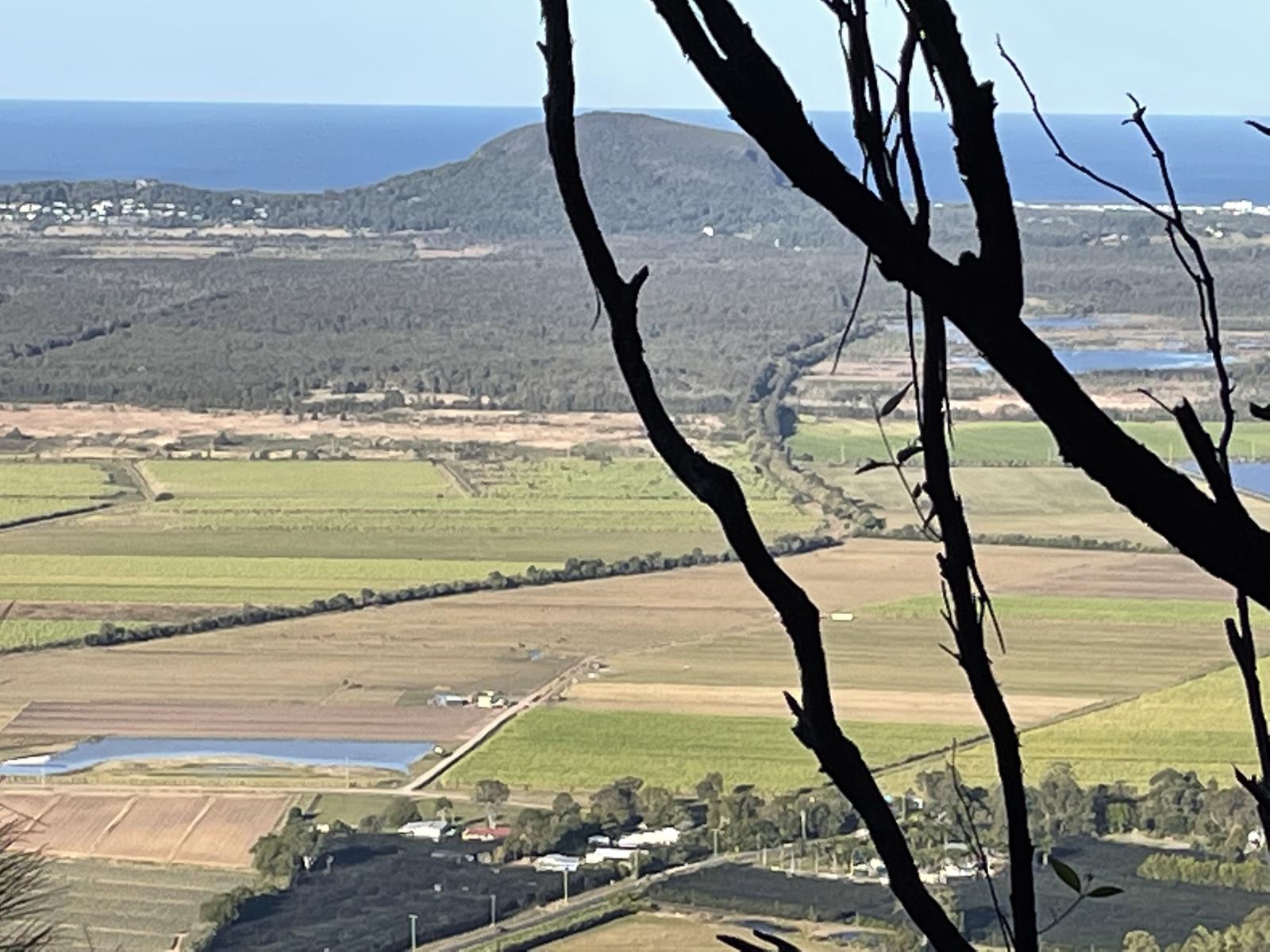
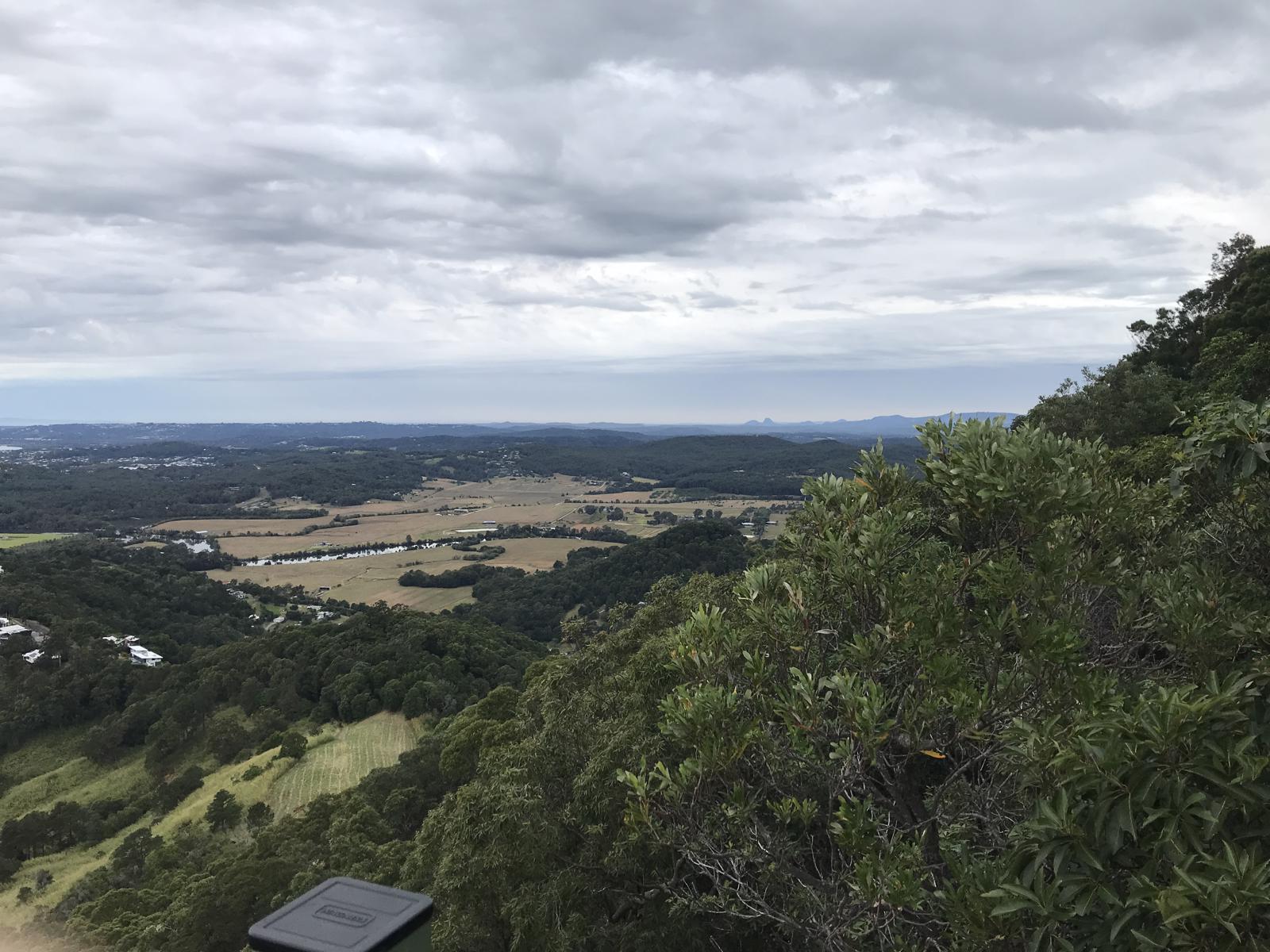
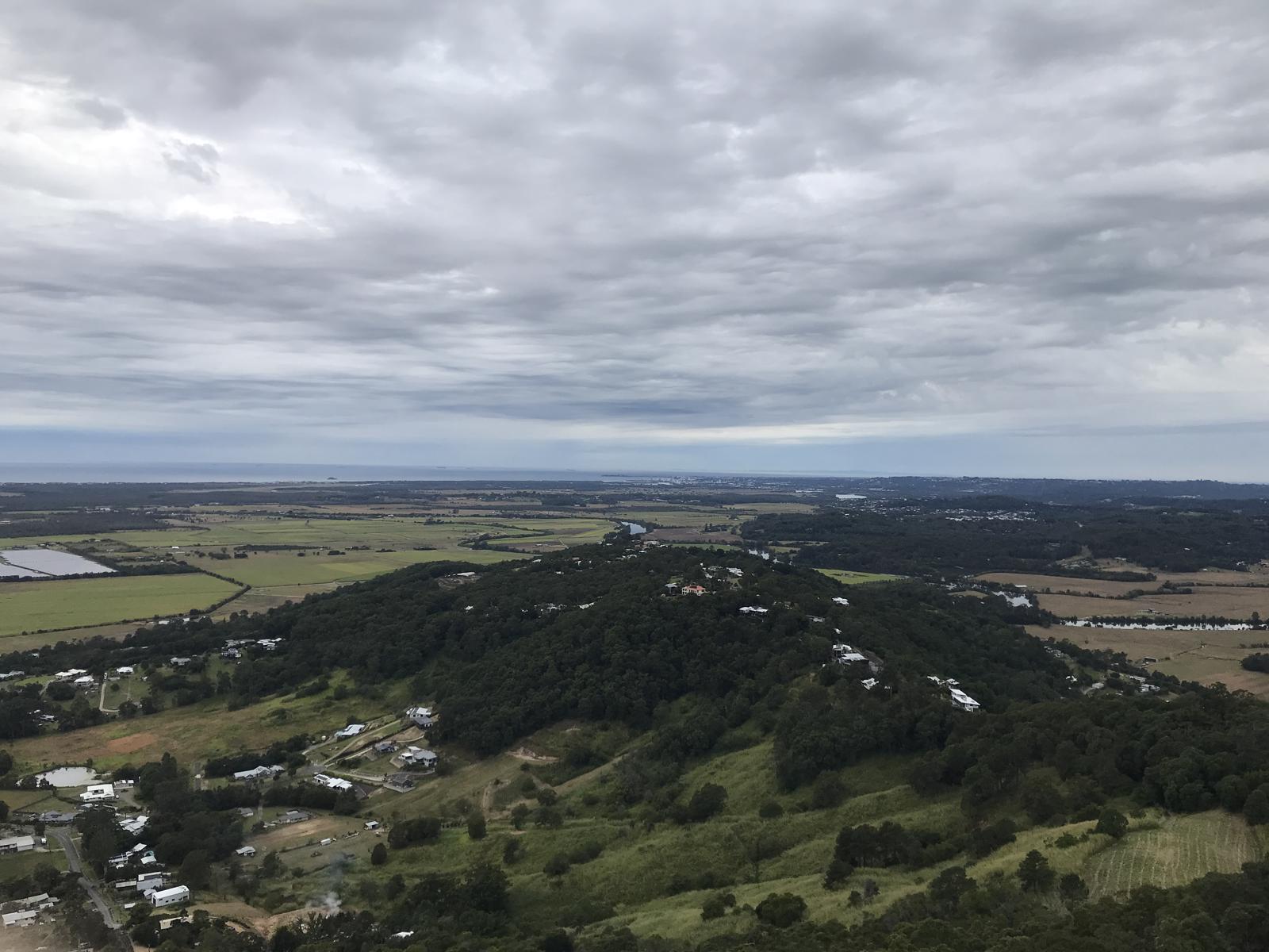
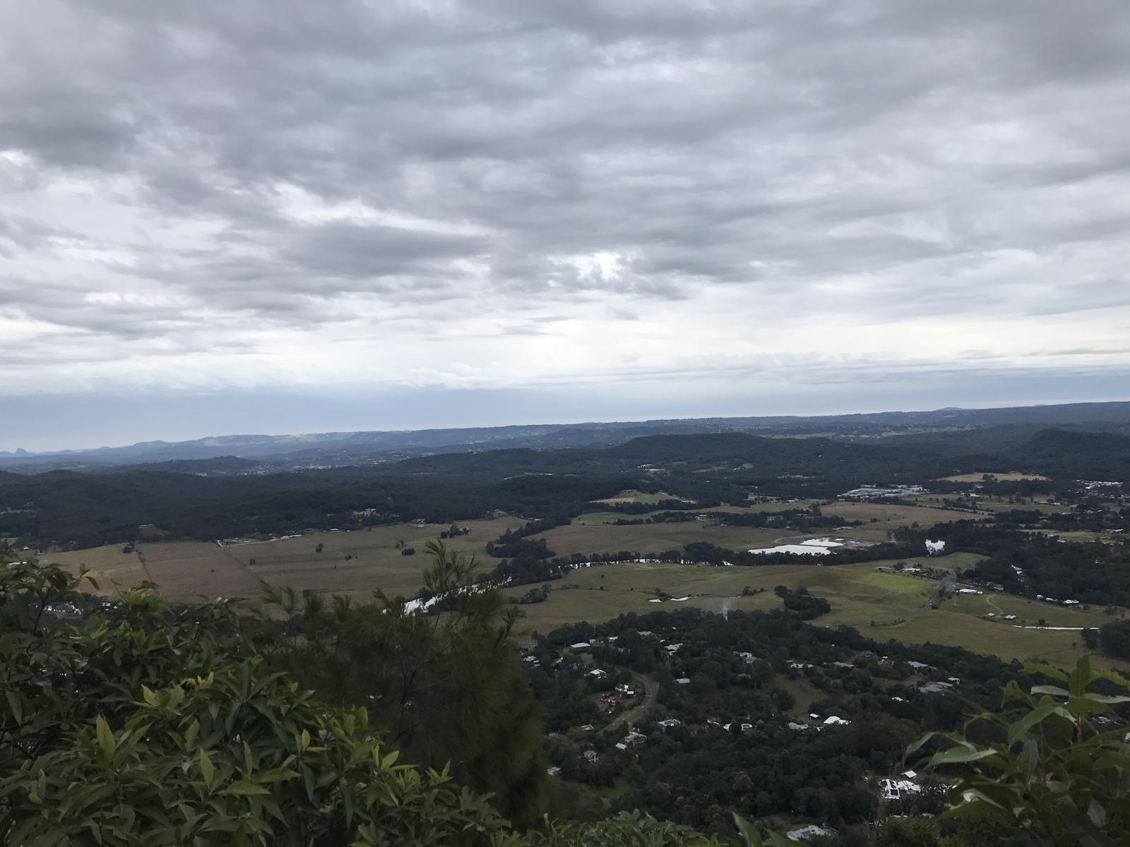
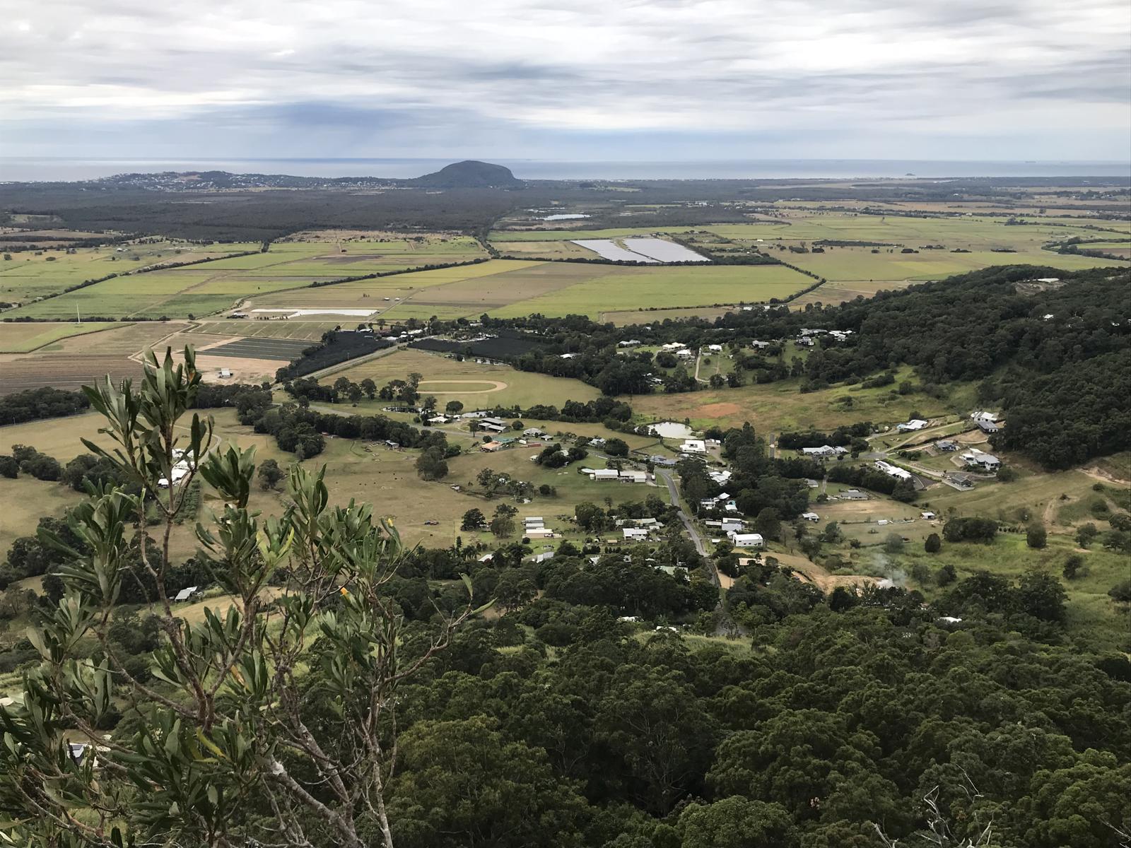
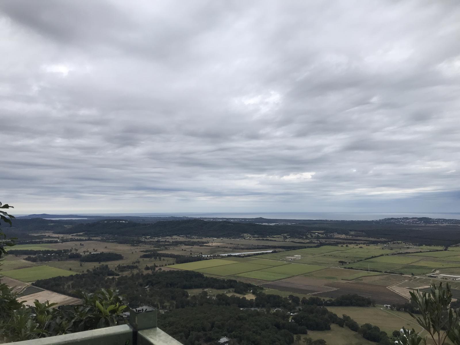
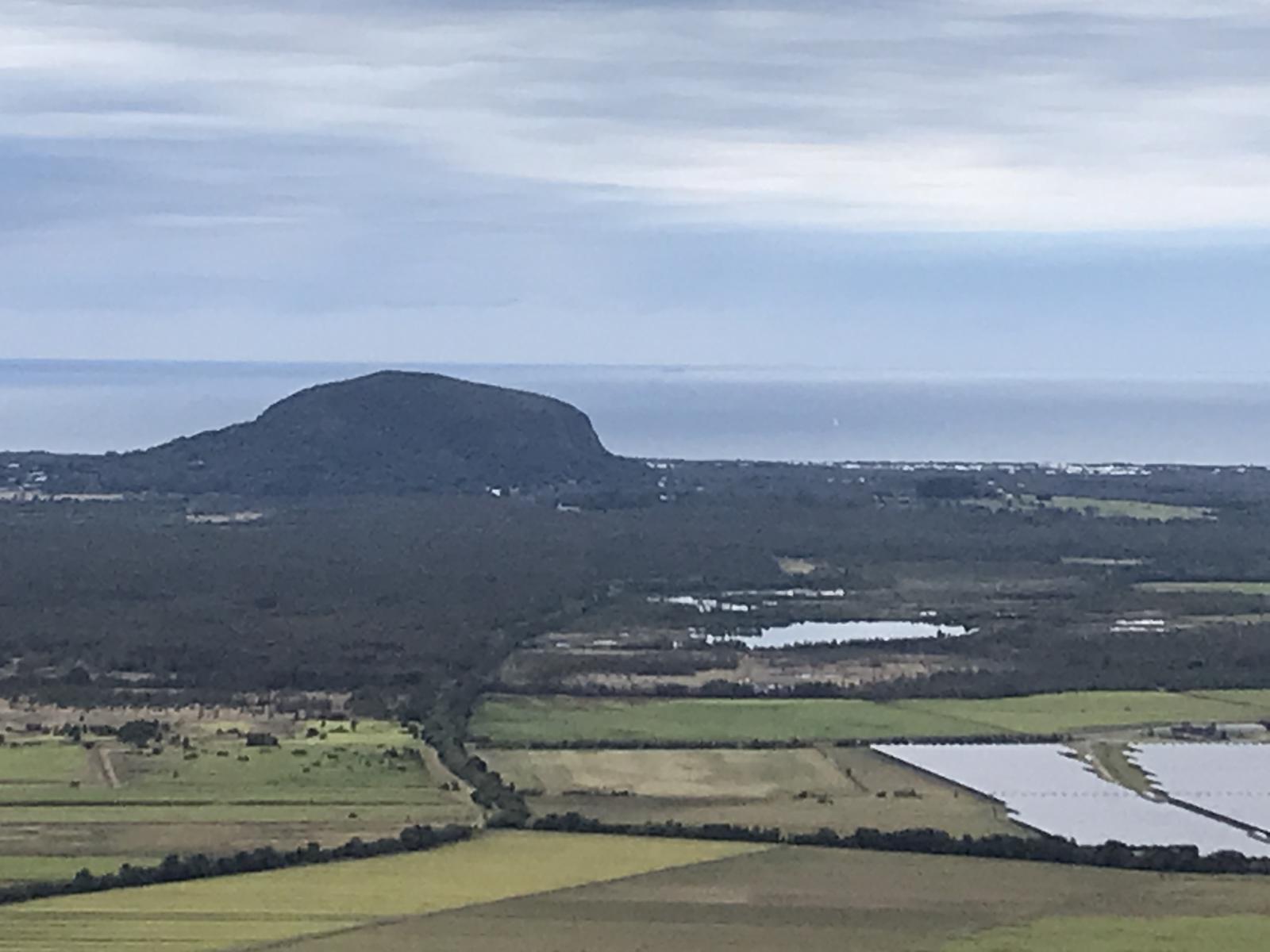
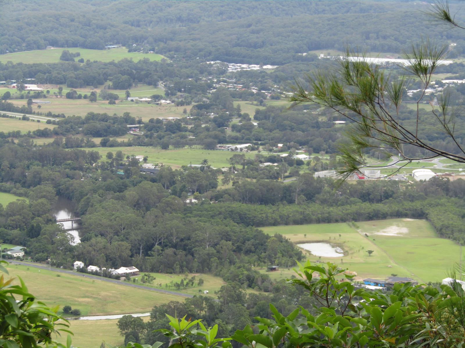
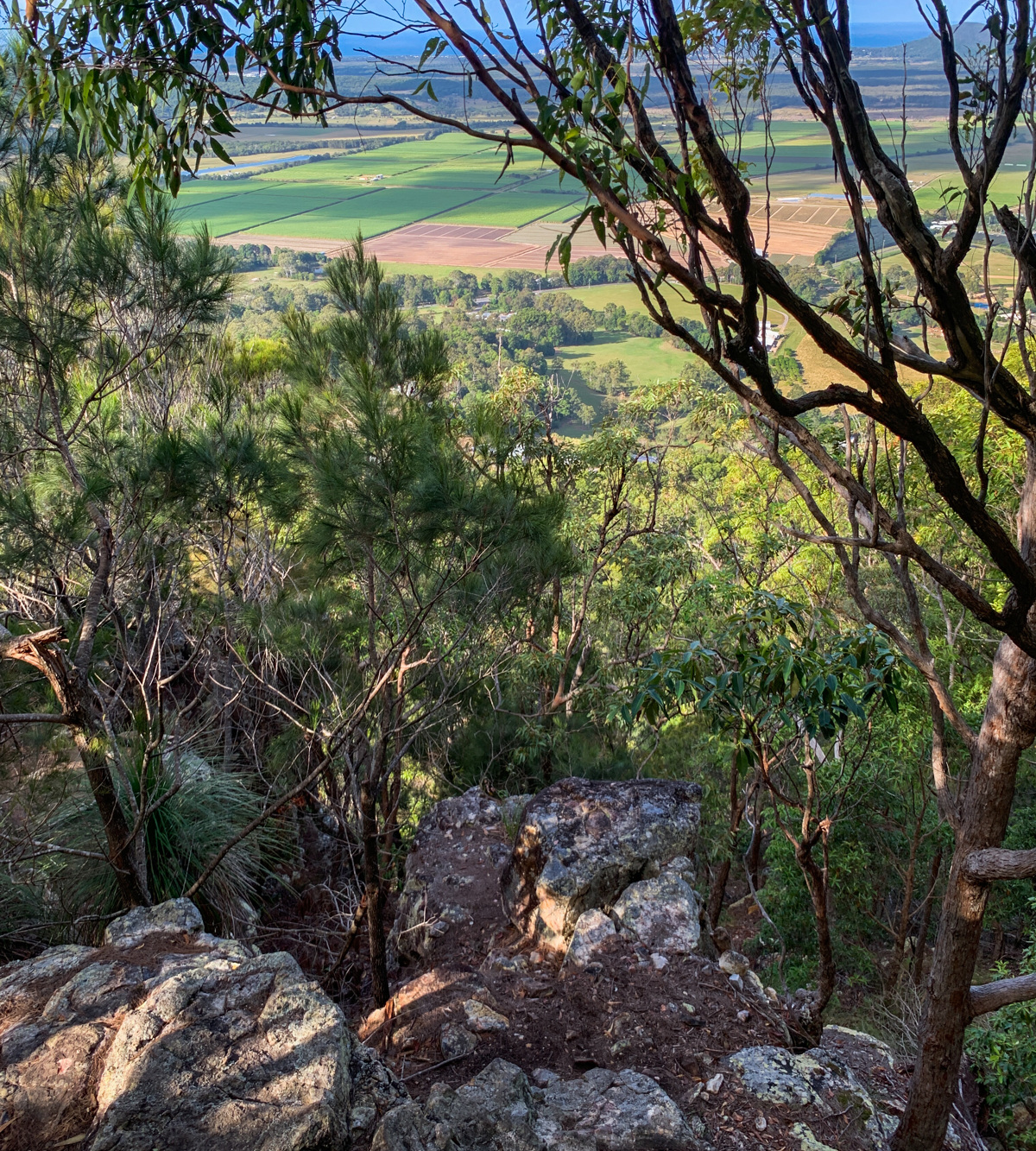
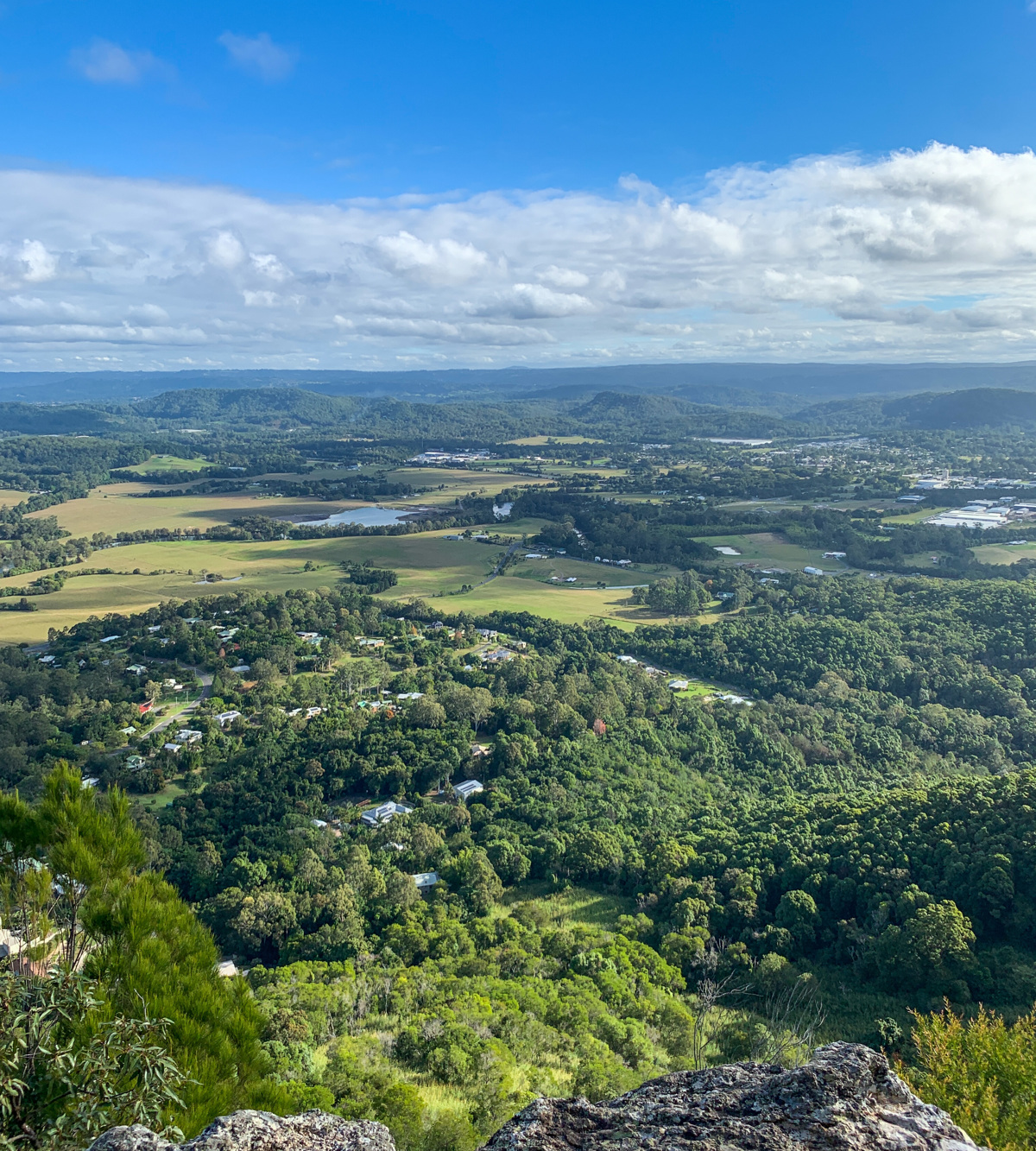
Get your heart pumping on this short walk up Mount Ninderry and enjoy fabulous views of canefields, the Maroochy River and other district views.

SUITABILITY
Suitable for walkers of intermediate fitness levels.
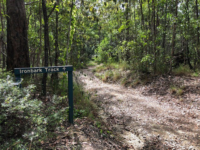
HIGHLIGHTS
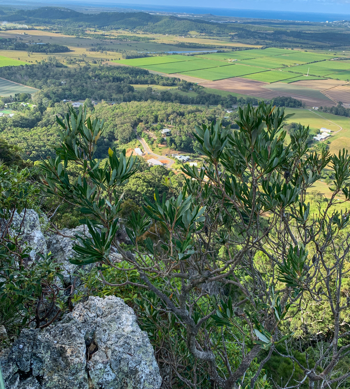
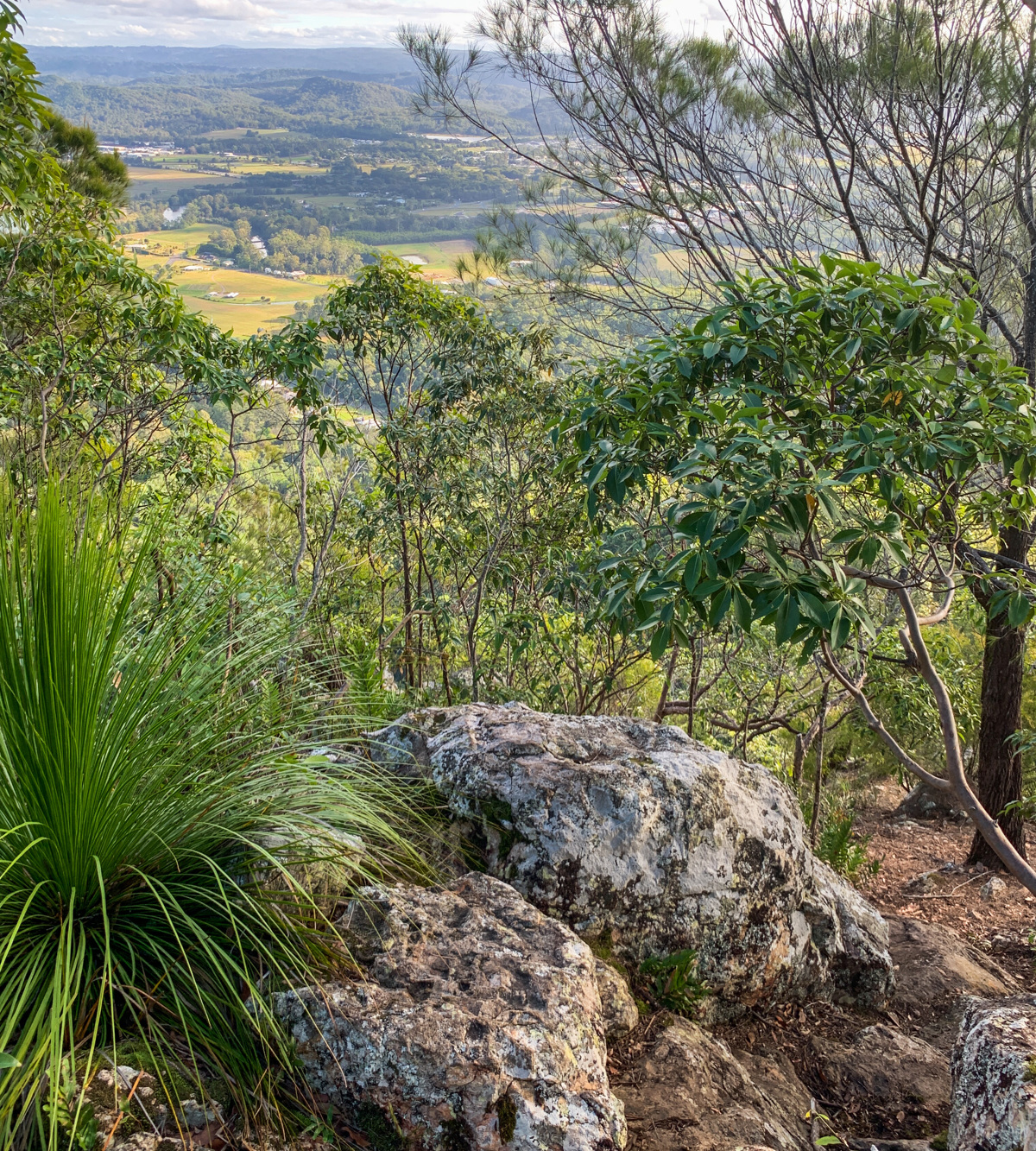
The Mt Ninderry Bushland Conservation Reserve covers approx. 150 hectares, while its peak, Mt Ninderry, is 304 meters above sea level. On this summit trail you ascend just over 130 metres because – good news – the carpark start is high up on a ridge.

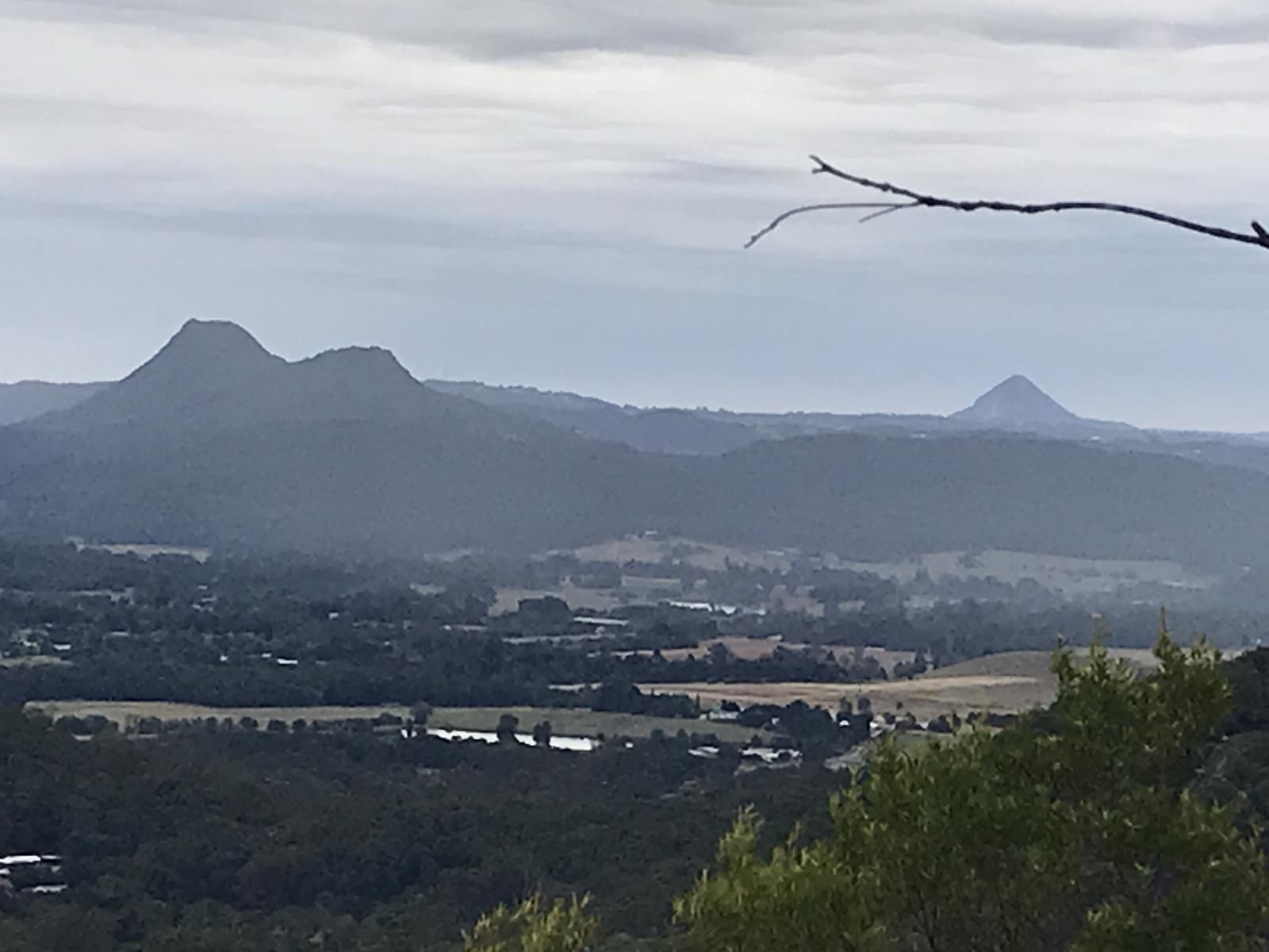
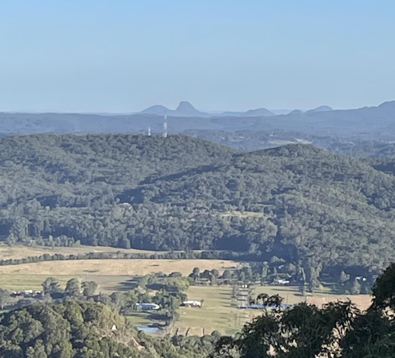
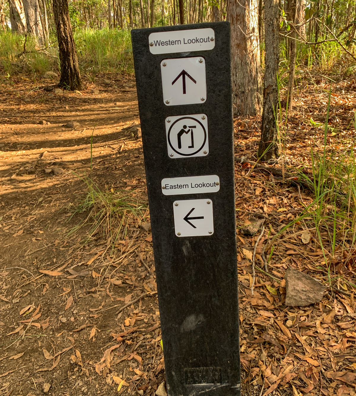
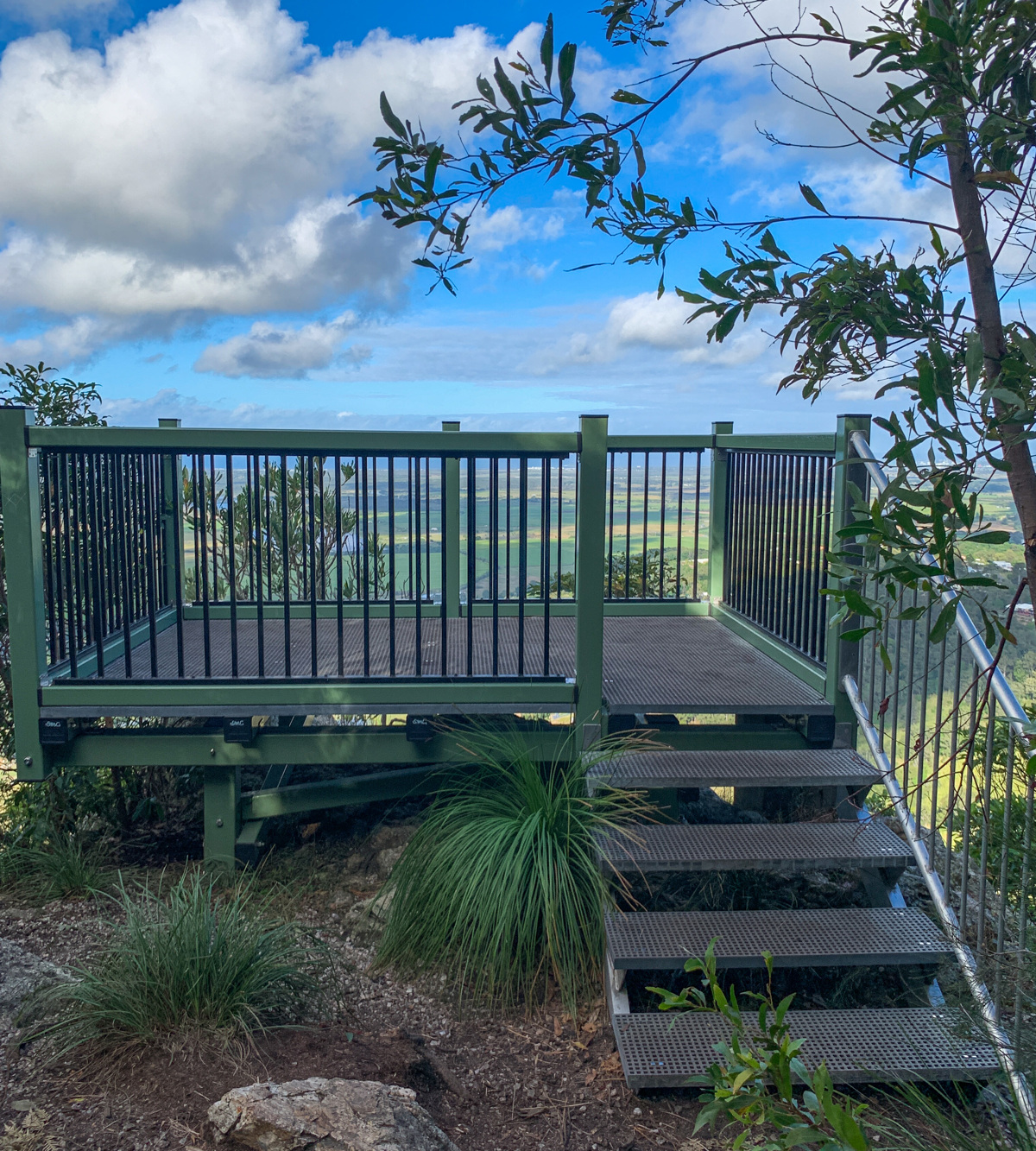
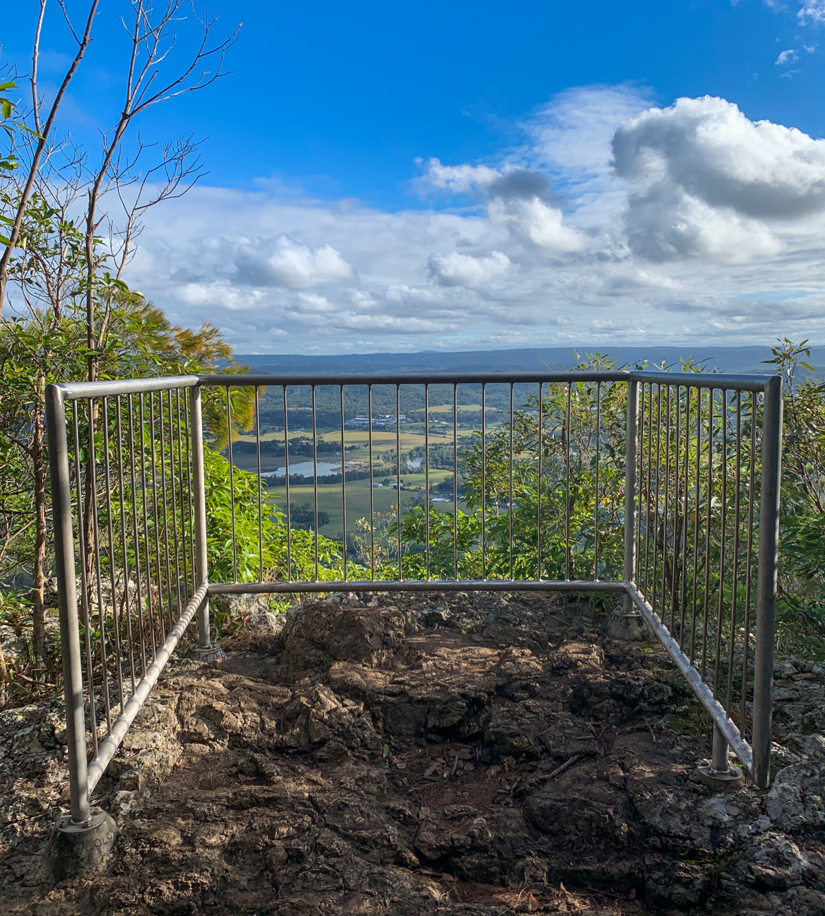
From the car park follow the rolling fire road to a steep single track with a lot of calf-burning steps, and occasional tantalising views, before it finally opens out up onto the prominent bluff as a reward for your efforts. It’s a great compliment to Mt Coolum’s summit, visible to the east, which you can see from one of two lookouts at the summit. Get up early and climb the trail as the day is breaking and watch the sun rise!

AFTERWARDS
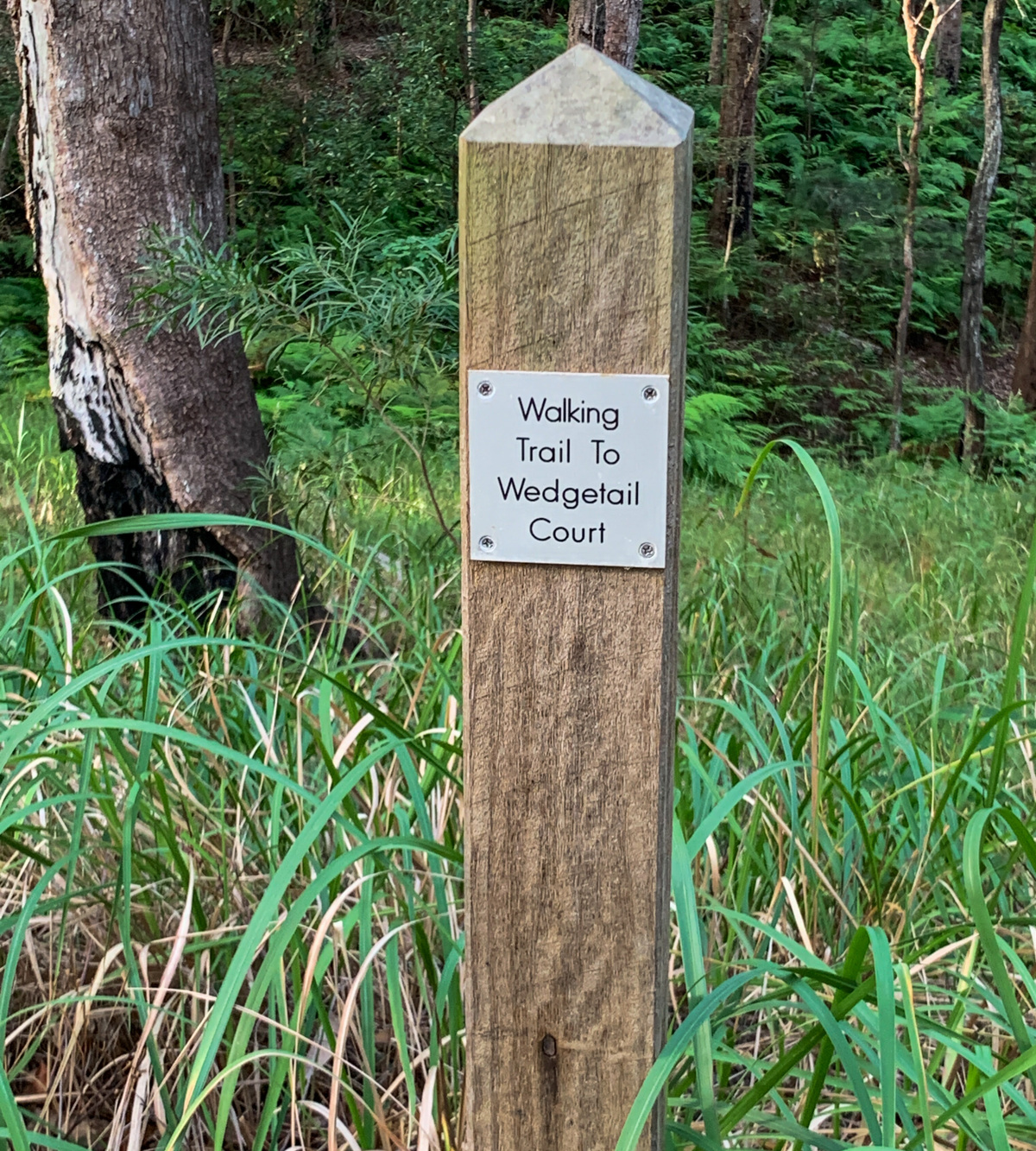
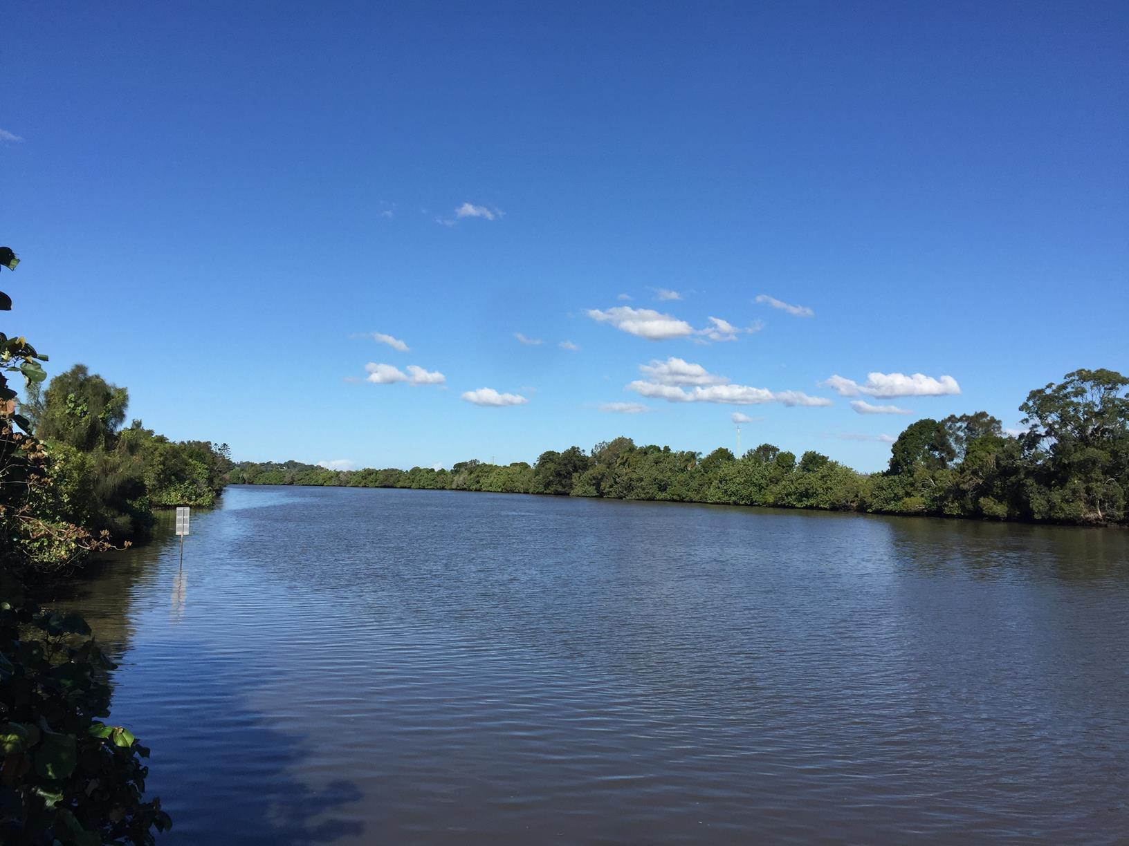
While you are here why not do the Walking Trail to Wedgetail Court - located just behind the car park at the top. And just south of the Maroochy River is Dunethin Rock, which offers much closer views over the river. Yandina township is the closest for conveniences and attractions including the ginger and macadamia factories, the famous Thai Spirit House restaurant, wonderful organic cafes and a delightful country pub. Here on a Saturday morning – why not check out the local markets!

HOW TO GET THERE
To the starting point: Travelling on the M1 take the Yandina Coolum exit towards the coast. After you cross the Maroochy River turn left into Collins Road.

Travelling on the Sunshine Coast Motorway take the Yandina Coolum exit towards Yandina and turn right into Collins Road just before the river (close to Yandina).

Follow Collins Road to the end and at the T-junction with Ninderry Road turn right and follow it to about 500 metres before the end where the road forks. Take the right-hand road to Mount Ninderry car park.

Additionally, heading north along Nambour Connection Road, travel through the Yandina town (changes to Farrell Street), before turning right into Ninderry Road.

To the end point: This is an up-and-back route. Go for it!


glossary button
Glossary
  • Icon showing this activity is suitable for wheelchairsSuitable for wheelchairs
  • Icon showing this activity is suitable for walkingSuitable for walking
  • Icon showing this activity is suitable for recreational cyclingSuitable for recreational cycling
  • Icon showing this activity is suitable for mountain bikingSuitable for mountain biking
  • Icon showing this activity is suitable for horse ridingSuitable for horse riding
  • Icon showing this activity is suitable for kayakingSuitable for kayaking
  • Icon showing this activity has drinking water availableDrinking water available
  • Icon showing this activity does not have drinking water availableNo drinking water available
  • Icon showing this activity has a barbeque on siteBarbeque on site
  • Icon showing this activity has a picnic table on sitePicnic table on site
  • Icon showing this activity has toilets on siteToilets on site
  • Icon showing fires are permitted at this activityFires permitted
  • Icon showing fires are prohibited at this activityFires prohibited
  • Icon showing camping is permitted at this activityCamping permitted
  • Icon showing camping is prohibited at this activityCamping prohibited
  • Suitable for walking Suitable for walking black lines Suitable for walking
  • No drinking water available No drinking water available No drinking water available
  • Picnic table on site Picnic table on site Picnic table on site
  • Fires prohibited Fires prohibited Fires prohibited
  • Camping prohibited Camping prohibited Camping prohibited
Write a review

Review Date: 28/05/2019

It was fabulous to take 3 and 5 year old up Mt Ninderry. Plenty of places to stop. Wide paths in sections. Twisted trees to climb over. No complaints from the kids. Beautiful view with morning tea at the top.

Reviewed By: Kj

Review Date: 28/05/2019

Verdant views west to Mt Coolum, south over Maroochy River and Dunethin Rock to Buderim, Maroochydore and Mooloolaba, and east to the ranges, if you do a loop around the top. On a sunny day, it's glorious. And for now you still have a chance of having Ninderry to yourself, unlike Coolum, Ngungun and even Cooroora. The track has had steps installed, and the lookout platform is fairly recent, so this is set to become more popular.

Reviewed By: Dan

Review Date: 16/05/2019

Perfect starter for the day. My little family and i (with dogs) thoroughly enjoyed this scenic climb before a delicous in breakfast in Coolum.

Reviewed By: B

Review Date: 28/11/2018

Nice easy walk with good views at the end. Easy grade and usually very quiet. Does not take long. Definitely check it out if you are in that area.

Reviewed By: Mickey

Review Date: 14/11/2018

This is great walk if you're looking to avoid the crowds. The views from the top are spectacular!

Reviewed By: Michael

Review Date: 13/11/2018

Directions and outline description is good. The thing that it doesn't say is that there is just one picnic table which is at the base - near the car park. Signs on the top of the mountain can be confusing, as it indicates a shelter - which is all the way at the bottom, not near the lookout. Just an observation (it was raining the day I was there). Lovely easy walk though.

Reviewed By: Elspeth

Review Date: 11/11/2018

This is one of my all-time favourite hikes on the Coast, I prefer to hike up Mount Ninderry over Mount Coolum. It’s challenging at times, due to the loose gravel track. However, there are steps along the way. It is a really nice hike up to the summit, with great views of Mount Coolum on the East side and the Hinterland on the West. It’s not as busy as some of the other Mountain hikes on the Coast, but definitely one worth completing. If you have a dog, you can also bring your pooch along for the adventure!

Reviewed By: Brooke

Review Date: 02/11/2018

The perfect mountain for the intermediate hiker, whilst it still provides a physical challenge, it's not to difficult and does not require any climbing. There are 2 alternate paths, however i'd recommend sticking to the left side on the way up as the other side is quite steep. At the top you'll have great hinterland and coastal views, perfect for a sunrise hike. You can also marvel at the sheer size of Councils solar farm which is the first of its kind for any Council in Australia, offsetting 100% of its energy use.

Reviewed By: Adam

Review Date: 02/10/2018

I love this walk and do it regularly with my dog (on a lead!). Gets the heart pumping, and you are rewarded with plenty of lookout vantage points on different sides of Mt Ninderry.

Reviewed By: Bronwyn

hazard icon

IN AN EMERGENCY DIAL '000'.

Always Adventure Safely!

  • Always follow any local signage, it contains key information and conditions can change at any time.
  • Use the trails with consideration for your abilities, be prepared for the adventure ahead:
    • Be aware of the weather conditions, found here: http://www.bom.gov.au/qld/.
    • Always wear appropriate clothing, focus on good footwear.
    • Always bring more water than you think you will need.
    • Be Sun Safe!
    • Always let someone know where you are going that isn’t going with you.
  • Just getting started try this site for good useful information: https://www.trailhiking.com.au/hike-safety/
  • Sunshine Coast Council does it’s best to maintain current information but things can change so always be aware that a trail may not be as listed in this guide, and report and issues via our feedback link.

Sunshine Coast Council

For any issues with this experience please contact:

Sunshine Coast Council via 07 5475 7272 or via e-mail: adventure@sunshinecoast.qld.gov.au

Nearby Trails

Trail Image for Ninderry Bushland Conservation Reserve: Walk to Wedgetail Court
Intermediate

Ninderry Bushland Conservation Reserve: Walk to Wedgetail Court

Ninderry
walking icon
Trail type
difficulty icon
Skill Level

0.8km

Length
direction icon
One-way
Trail Image for Maroochy River Canoe Trail: George Best Park to River Junction Paddle
Intermediate

Maroochy River Canoe Trail: George Best Park to River Junction Paddle

Ninderry
canoeing icon
Trail type
difficulty icon
Skill Level

4.3km

Length
direction icon
One-way
Trail Image for Maroochy River Canoe Trail: Ashtons Wharf to Lift Bridge
Intermediate

Maroochy River Canoe Trail: Ashtons Wharf to Lift Bridge

Maroochy River
canoeing icon
Trail type
difficulty icon
Skill Level

3.3km

Length
direction icon
One-way
Trail Image for Road Cycle Route: Twin Waters Loop
Difficult

Road Cycle Route: Twin Waters Loop

Bli Bli
walking icon cycling icon
Trail type
difficulty icon
Skill Level

73.8km

Length
direction icon
Circuit
Trail Image for Eumundi Conservation Park: Ironbark Trail
Easy

Eumundi Conservation Park: Ironbark Trail

Verrierdale
walking icon mountain biking icon horse riding icon
Trail type
difficulty icon
Skill Level

5.5km

Length
direction icon
One-way

Share this trail

This action requires a login.
To continue, click on Login/Signup below.

Photo uploaded successfully, thank you.

Feedback / Suggest an Adventure

If you have any feedback on the site or any of the trails, please drop us a short email.

Have we missed something? Do you have an adventure to suggest? Fill in the suggestion form to let us know about it.