facebook
Image showing that the PDF download is in progress... PDF download in progress

Please wait...

Image showing a pink decorative paint splat
Image showing a green decorative paint splat
upload photo button
reviews buttonReviews view map buttonMap
view 3d map button3D Map
directions take me there buttonDirections
Save
PDF
Gpx File

Wappa Dam and Falls

Wappa Dam and Falls
Kiamba
walking icon walking icon black
Trail type
difficulty icon
Skill Level
1.1km
One-way Length
direction icon direction icon black
One-way

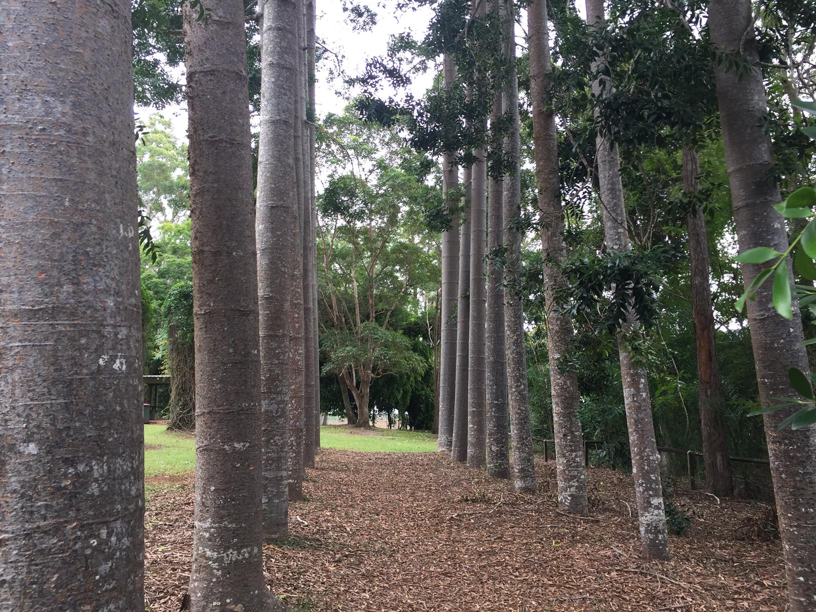
An incredibly beautiful open parkland and a short walk to the falls.

SUITABILITY
The parkland is suitable for the whole family. Heading to the falls - just take care in and around the falls - supervision is a must!

HIGHLIGHTS
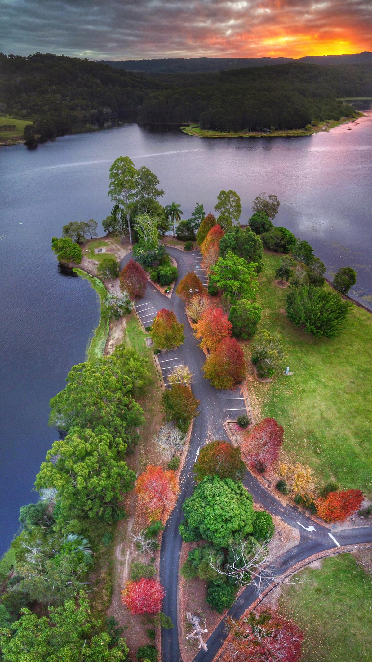
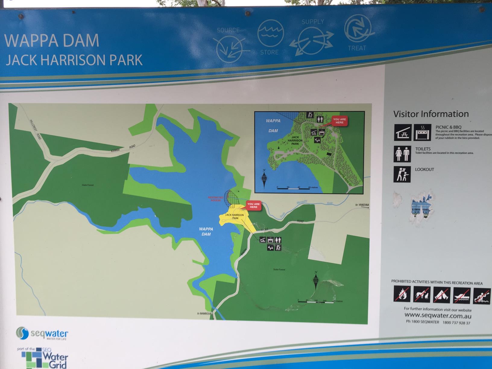
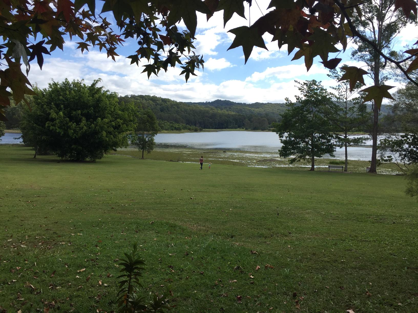
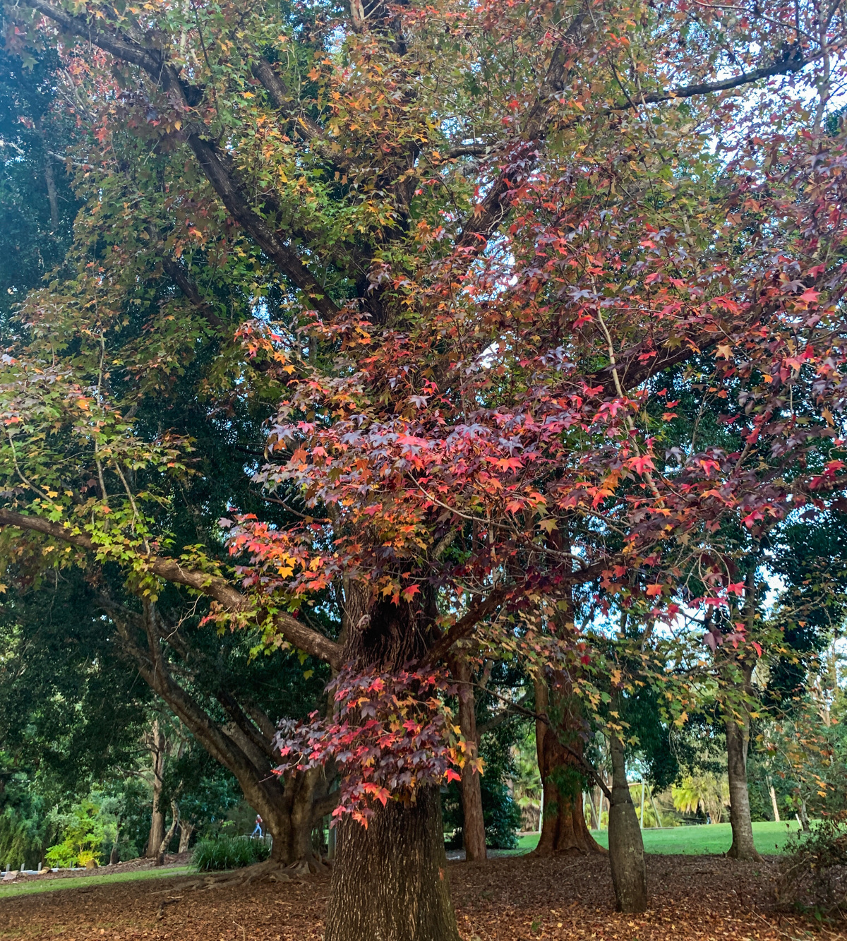
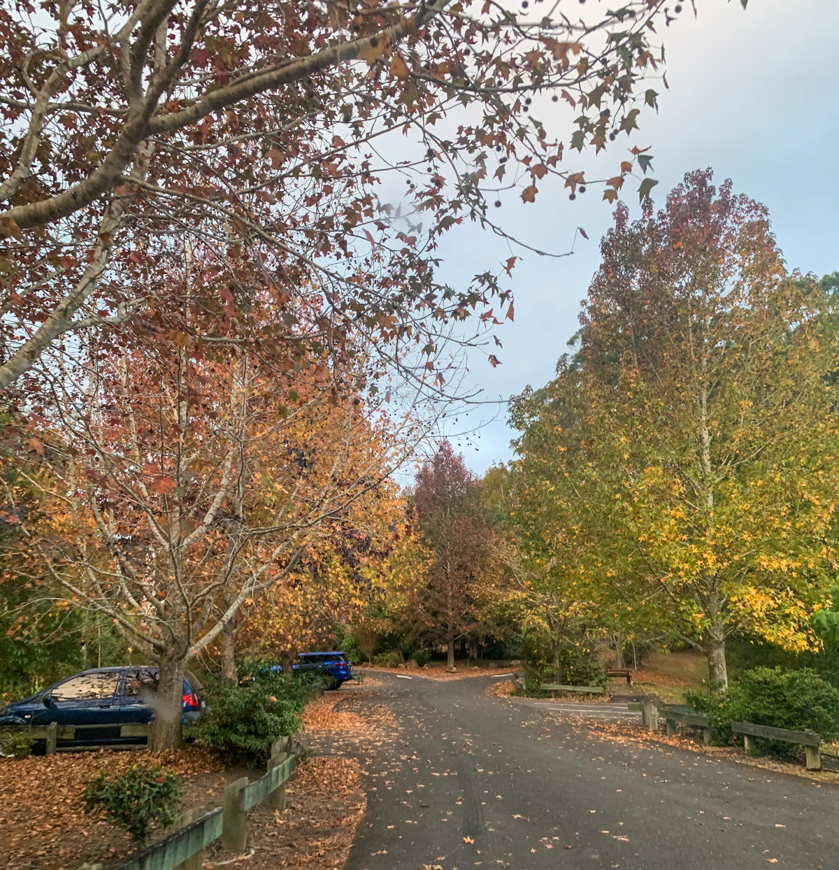
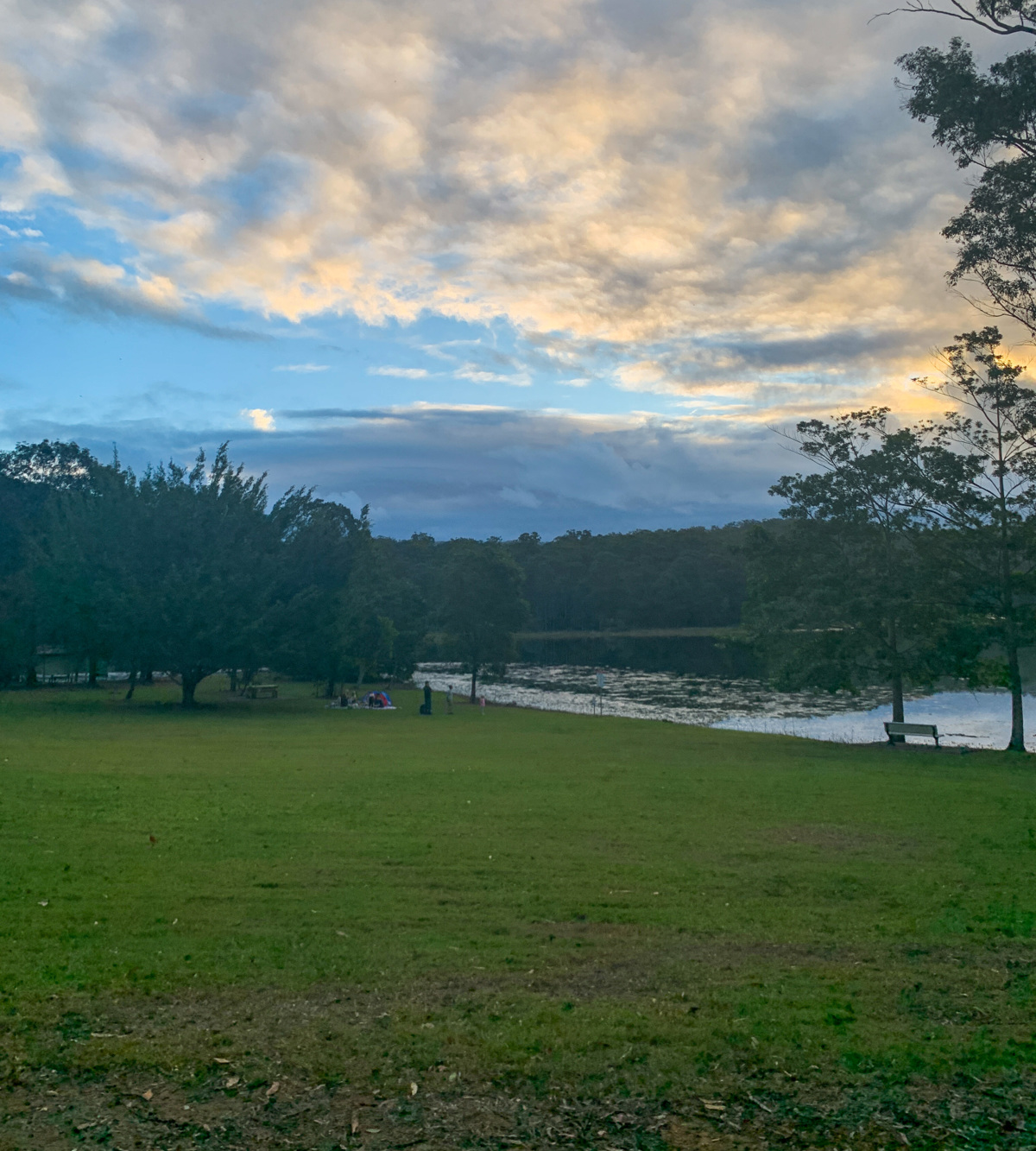
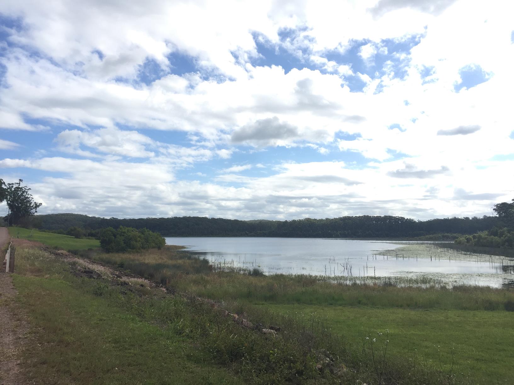
On the banks of Wappa Dam is the incredibly pretty Jack Harrison Park (also known as Wappa Park). The park is filled with endless green open space, picnic tables, playground, amenities, large parking areas and lawns which stretch right down to the dam – perfect for lounging and soaking up the sun.

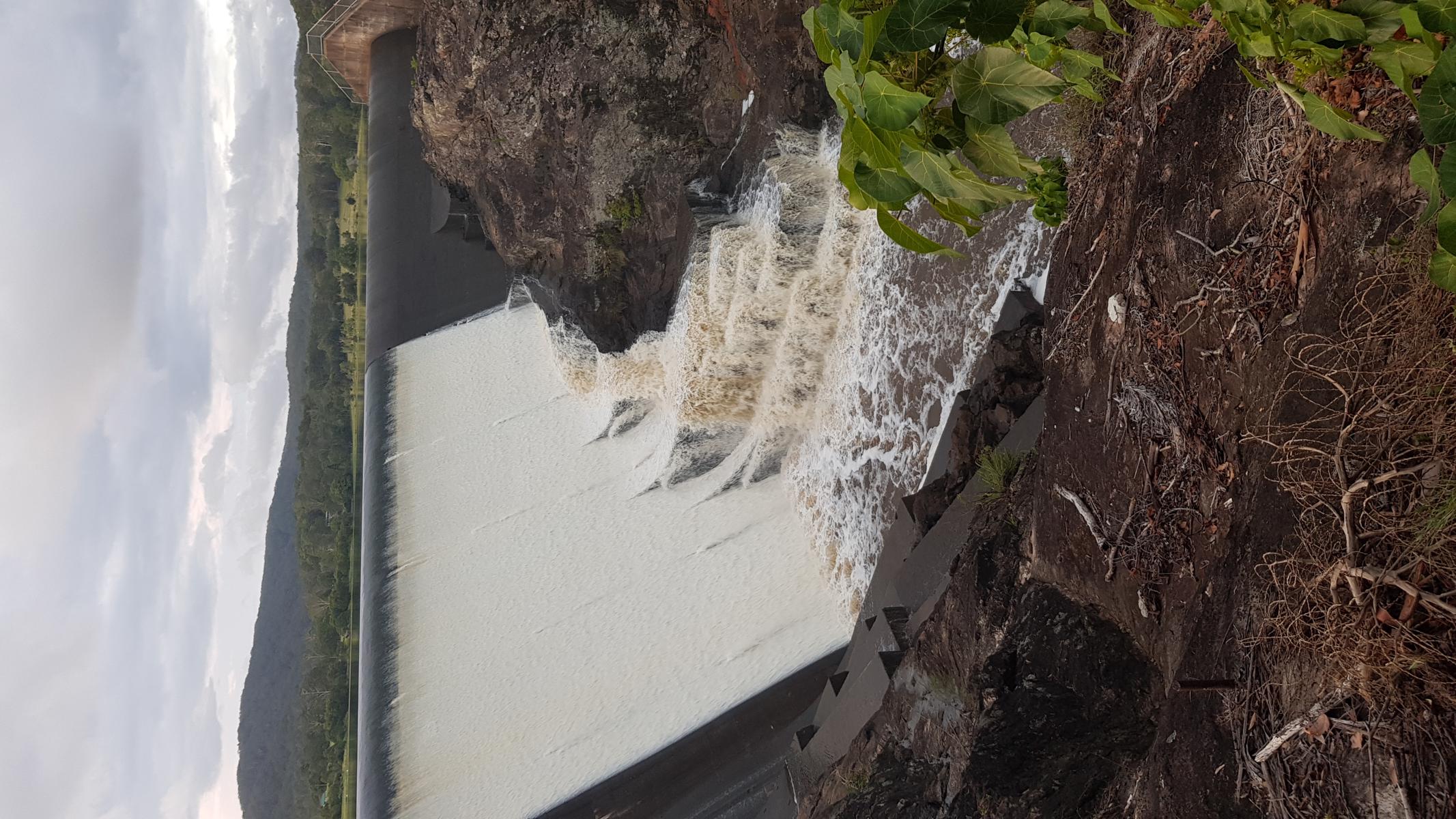
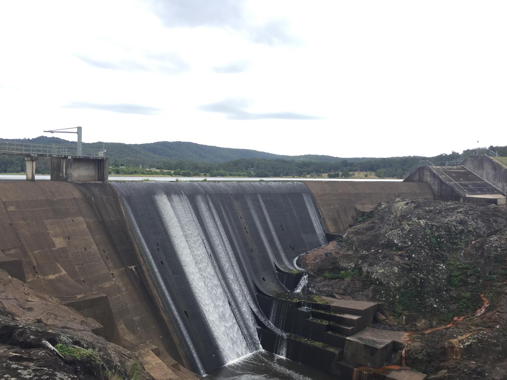
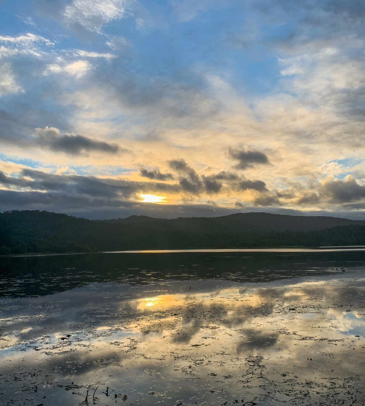
In Autumn, the park is filled with red maple leaves, and after some heavy rain, Wappa Dam will quickly become one of your favorite places to visit to watch water go over the spillway. (just remember no swimming). Gates to the park close at 5:30pm.

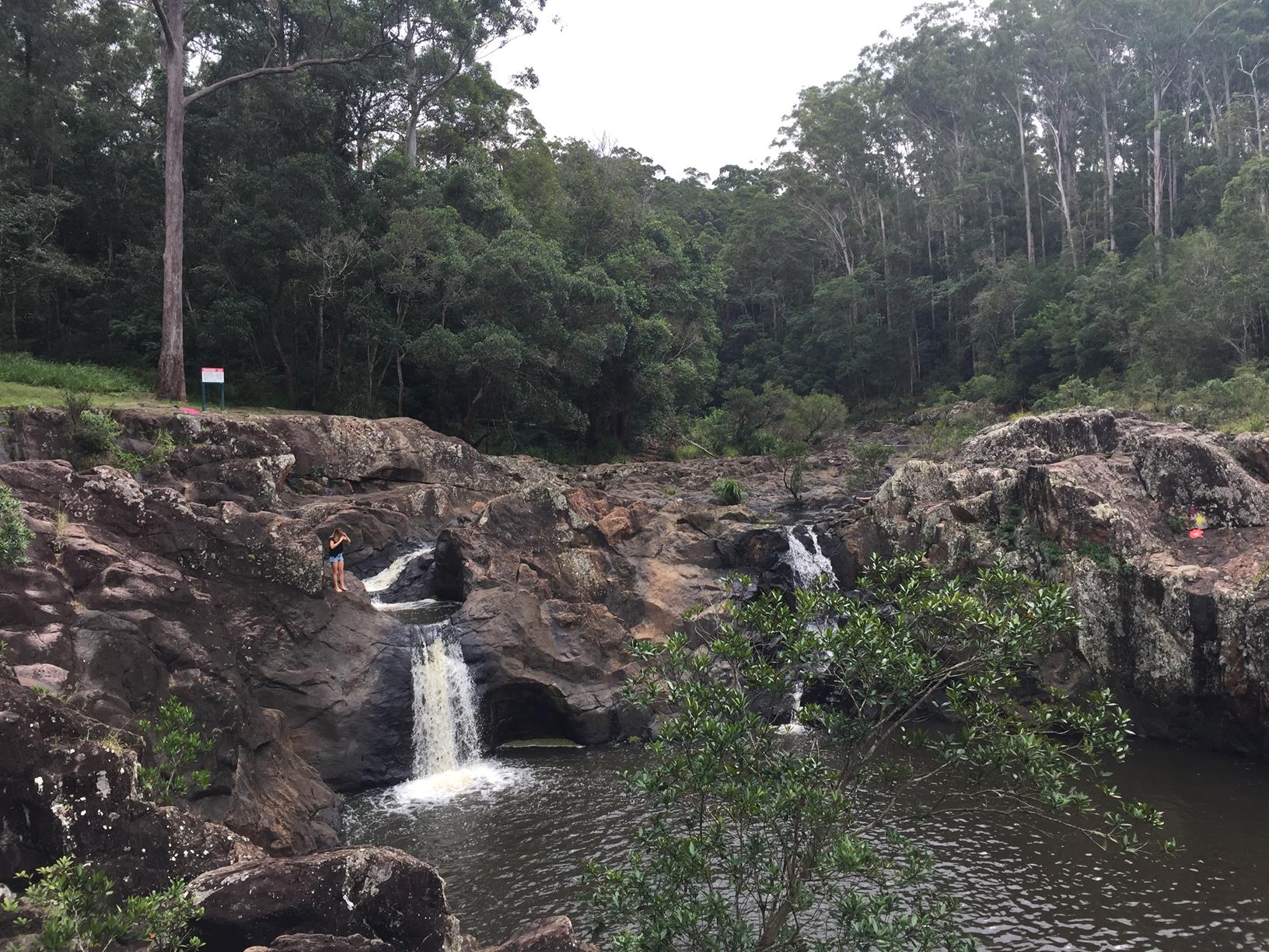
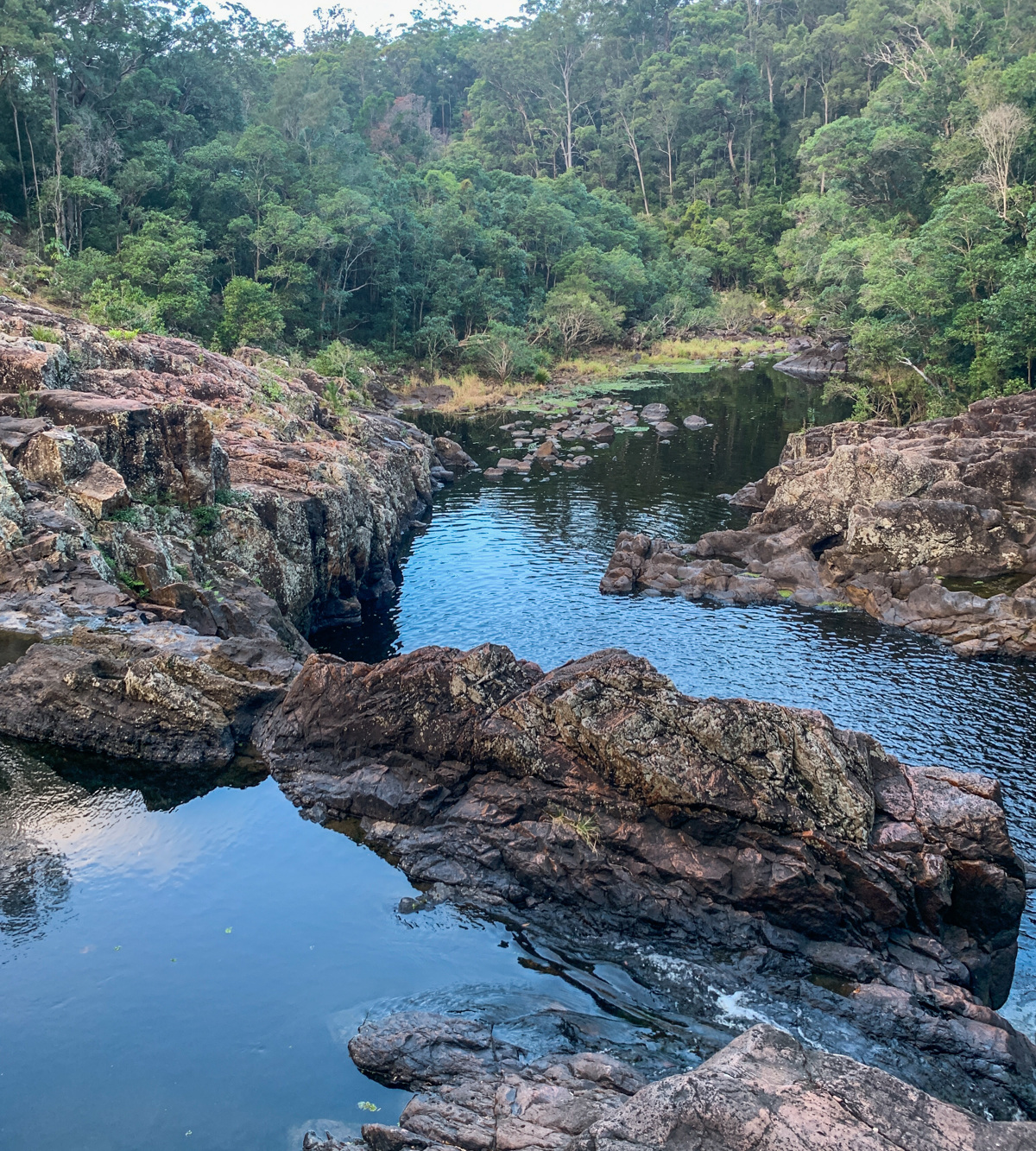
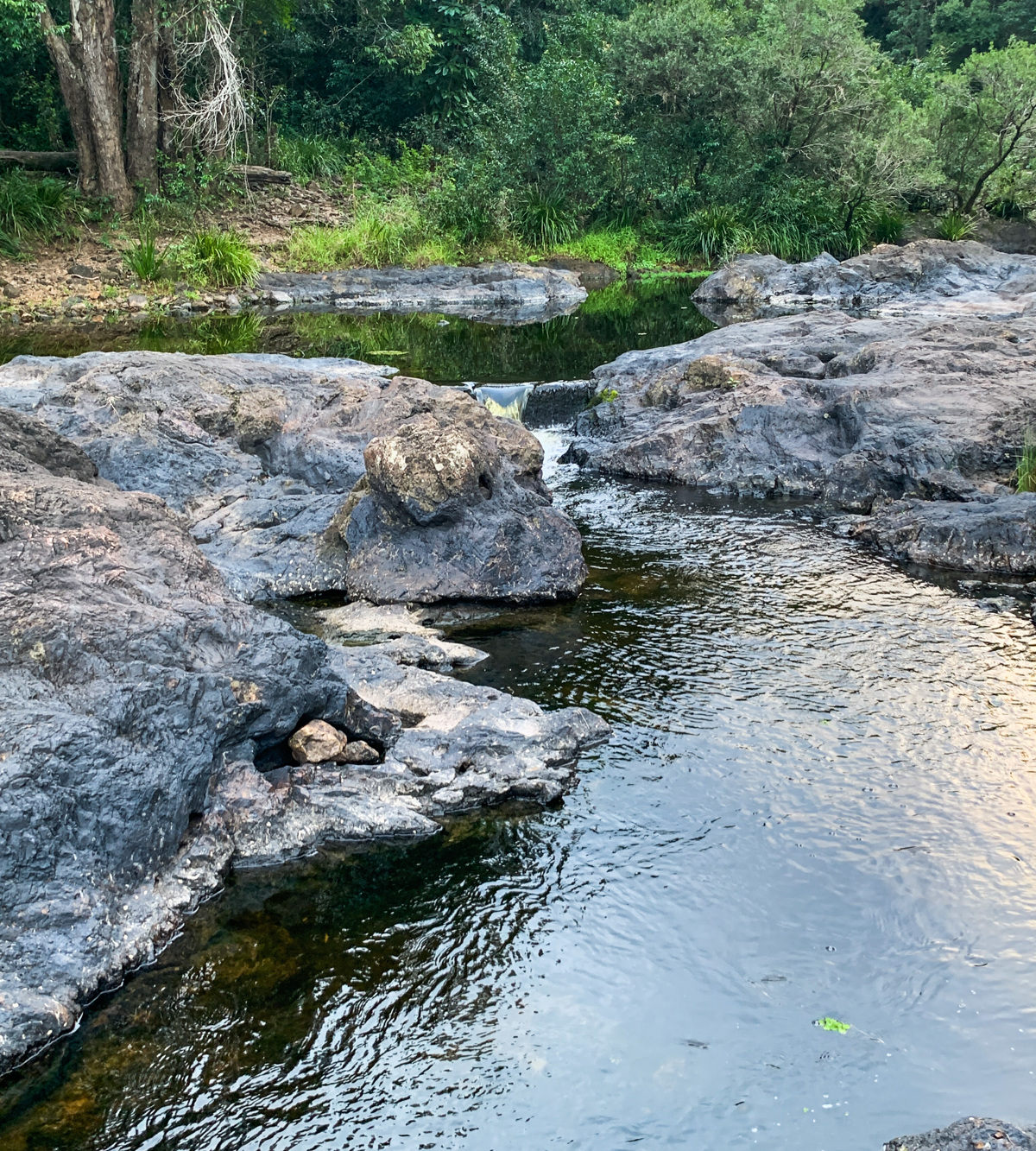
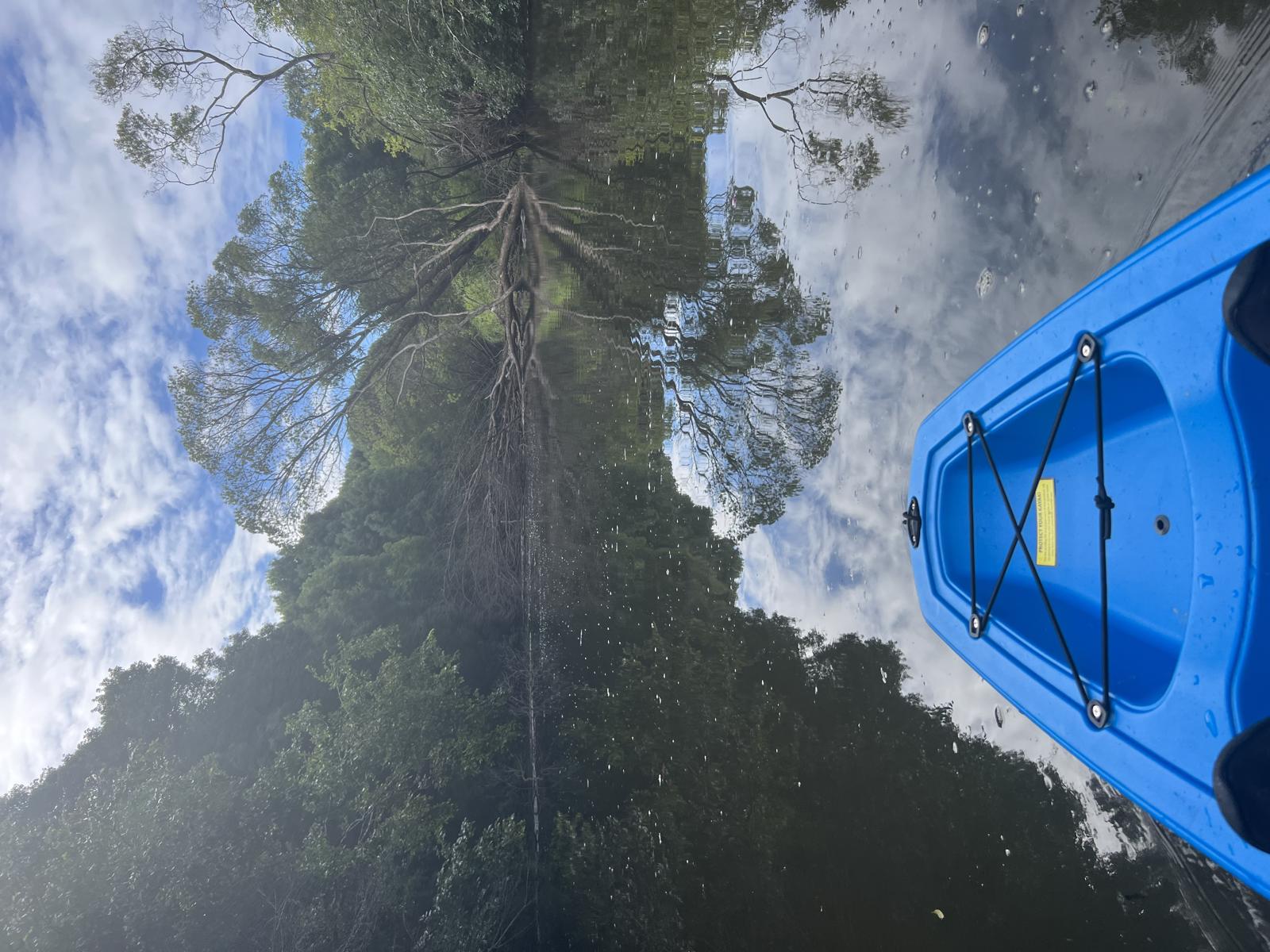
From the park, follow a short walk through the bush to Wappa Falls. Whilst this is a popular swimming hole, we urge caution and swimming is not recommended as the rocks can be slippery and the currents unpredictable.

Alternatively, you can park at the falls (limited), which is only a very short walk from the car park.

AFTERWARDS
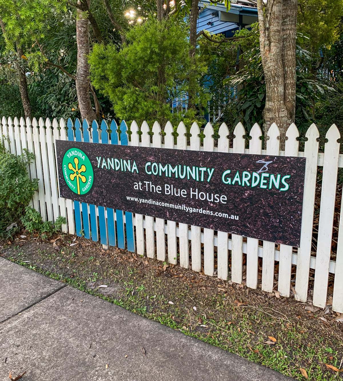
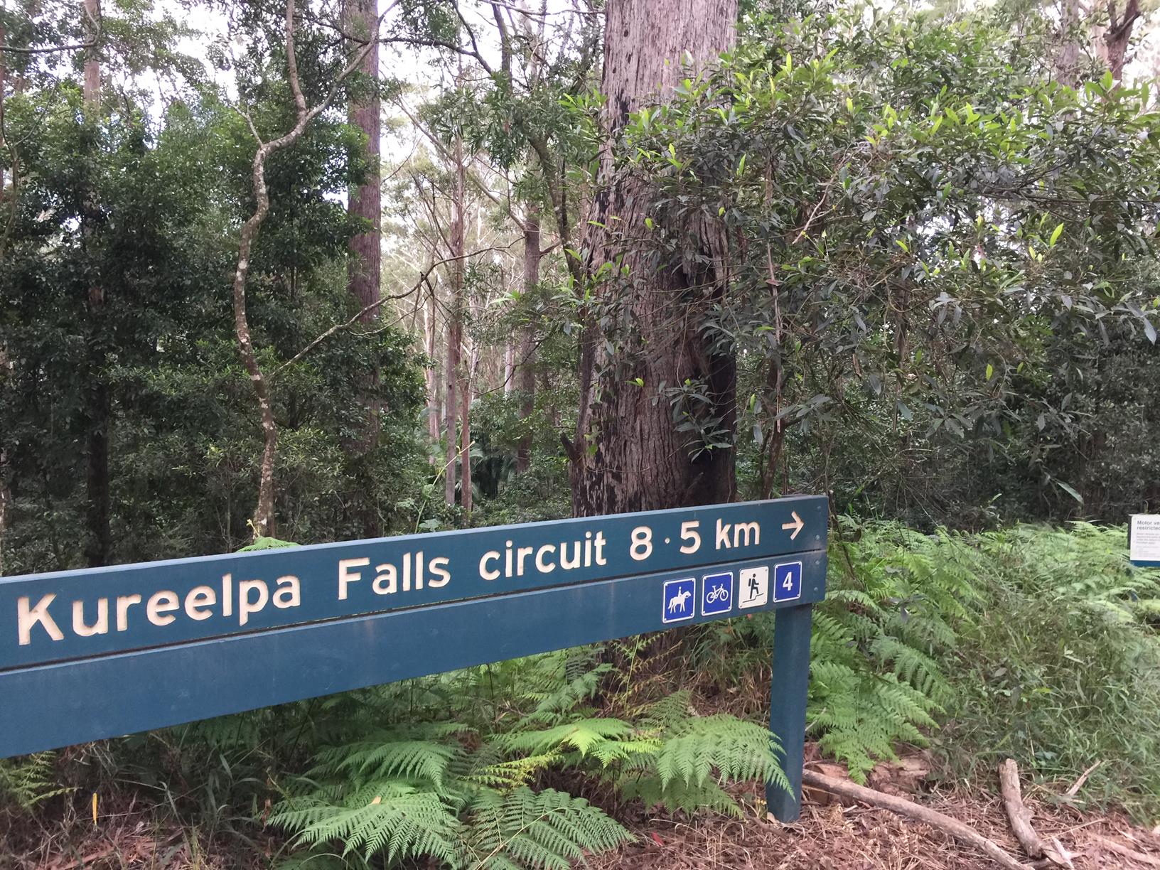
Cooloolabin Dam is close by with walks to explore (and is often quieter than Wappa Falls.) The closest town for coffee and snacks is Yandina where there is casual and fine dining on offer.

HOW TO GET THERE
To the starting point: Take the Yandina exit off the M1 and head west through the roundabout. At the next roundabout turn left into Fleming Street. At a 4-way intersection turn left into Farrell Street. Follow this road over the South Maroochy River and take the third turnoff on your right into Wappa Falls Road. The falls are approximately 5 km along this road. The walk starts in Wappa Park.

To the end point: The end point is the same as the starting point.

glossary button
Glossary
  • Icon showing this activity is suitable for wheelchairsSuitable for wheelchairs
  • Icon showing this activity is suitable for walkingSuitable for walking
  • Icon showing this activity is suitable for recreational cyclingSuitable for recreational cycling
  • Icon showing this activity is suitable for mountain bikingSuitable for mountain biking
  • Icon showing this activity is suitable for horse ridingSuitable for horse riding
  • Icon showing this activity is suitable for kayakingSuitable for kayaking
  • Icon showing this activity has drinking water availableDrinking water available
  • Icon showing this activity does not have drinking water availableNo drinking water available
  • Icon showing this activity has a barbeque on siteBarbeque on site
  • Icon showing this activity has a picnic table on sitePicnic table on site
  • Icon showing this activity has toilets on siteToilets on site
  • Icon showing fires are permitted at this activityFires permitted
  • Icon showing fires are prohibited at this activityFires prohibited
  • Icon showing camping is permitted at this activityCamping permitted
  • Icon showing camping is prohibited at this activityCamping prohibited
  • Suitable for walking Suitable for walking black lines Suitable for walking
  • Drinking water available Drinking water available Drinking water available
  • barbeque on site barbeque on site Barbeque on site
  • Picnic table on site Picnic table on site Picnic table on site
  • toilets on site toilets on site Toilets on site
  • Fires prohibited Fires prohibited Fires prohibited
  • Camping prohibited Camping prohibited Camping prohibited
Write a review

Review Date: 30/09/2020

Summer is almost upon us! Pack a picnic for an adventurous family day trip to Wappa Falls and Jack Harrison Park on Wappa Dam. With picnicking, BBQ facilities, toilets (with disabled access), children’s playground, walking and bird-watching at Jack Harrison Park and wild water swimming at the Falls, there is heaps to keep everybody in the family happy and busy. Please note NO dogs. For more information and photos, please follow the following link: https://www.weekendnotes.com/day-tripping-wappa-falls-jack-harrison-park/

Reviewed By: Elaine

hazard icon

IN AN EMERGENCY DIAL '000'.

Always Adventure Safely!

  • Always follow any local signage, it contains key information and conditions can change at any time.
  • Use the trails with consideration for your abilities, be prepared for the adventure ahead:
    • Be aware of the weather conditions, found here: http://www.bom.gov.au/qld/.
    • Always wear appropriate clothing, focus on good footwear.
    • Always bring more water than you think you will need.
    • Be Sun Safe!
    • Always let someone know where you are going that isn’t going with you.
  • Just getting started try this site for good useful information: https://www.trailhiking.com.au/hike-safety/
  • Sunshine Coast Council does it’s best to maintain current information but things can change so always be aware that a trail may not be as listed in this guide, and report and issues via our feedback link.

SEQ Water

For any issues with the trail please contact:

SEQ Water via 07 3035 5500 or communications@seqwater.com.au

If you think something on the web site needs to change please let us know via: adventure@sunshinecoast.qld.gov.au

Nearby Trails

Trail Image for Road Cycle Route: Twin Waters Loop
Difficult

Road Cycle Route: Twin Waters Loop

Bli Bli
walking icon cycling icon
Trail type
difficulty icon
Skill Level

73.8km

Length
direction icon
Circuit
Trail Image for A Journey through Yandina
Easy

A Journey through Yandina

Yandina
walking icon
Trail type
difficulty icon
Skill Level

2.0km

Length
direction icon
Circuit
Trail Image for Mapleton National Park: Kureelpa Falls Circuit
Difficult

Mapleton National Park: Kureelpa Falls Circuit

Mapelton
walking icon mountain biking icon horse riding icon
Trail type
difficulty icon
Skill Level

8.7km

Length
direction icon
Circuit
Trail Image for Maroochy River Canoe Trail: George Best Park to River Junction Paddle
Intermediate

Maroochy River Canoe Trail: George Best Park to River Junction Paddle

Ninderry
canoeing icon
Trail type
difficulty icon
Skill Level

4.3km

Length
direction icon
One-way
Trail Image for Cooloolabin Dam: Day Use Short Walk
Intermediate

Cooloolabin Dam: Day Use Short Walk

Cooloolabin
walking icon horse riding icon
Trail type
difficulty icon
Skill Level

3.1km

Length
direction icon
Circuit

Share this trail

This action requires a login.
To continue, click on Login/Signup below.

Photo uploaded successfully, thank you.

Feedback / Suggest an Adventure

If you have any feedback on the site or any of the trails, please drop us a short email.

Have we missed something? Do you have an adventure to suggest? Fill in the suggestion form to let us know about it.