facebook
Image showing that the PDF download is in progress... PDF download in progress

Please wait...

Image showing a pink decorative paint splat
Image showing a green decorative paint splat
upload photo button
reviews buttonReviews view map buttonMap
view 3d map button3D Map
directions take me there buttonDirections
Save
PDF
Gpx File

Old Woman Island Paddle

Old Woman Island Paddle
canoe icon canoe icon black
Trail type
difficulty icon
Skill Level
2.6km
One-way Length
direction icon direction icon black
One-way

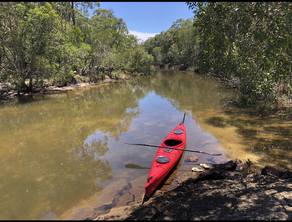
A sea adventure where you can paddle on open water out to Old Woman Island and back.

SUITABLILITY
This paddle is suitable for medium to experienced paddlers only, preferably with sea kayaking experience. Only do on calm days and with a seaworthy craft. Total distance is around 4km return.

HIGHLIGHTS
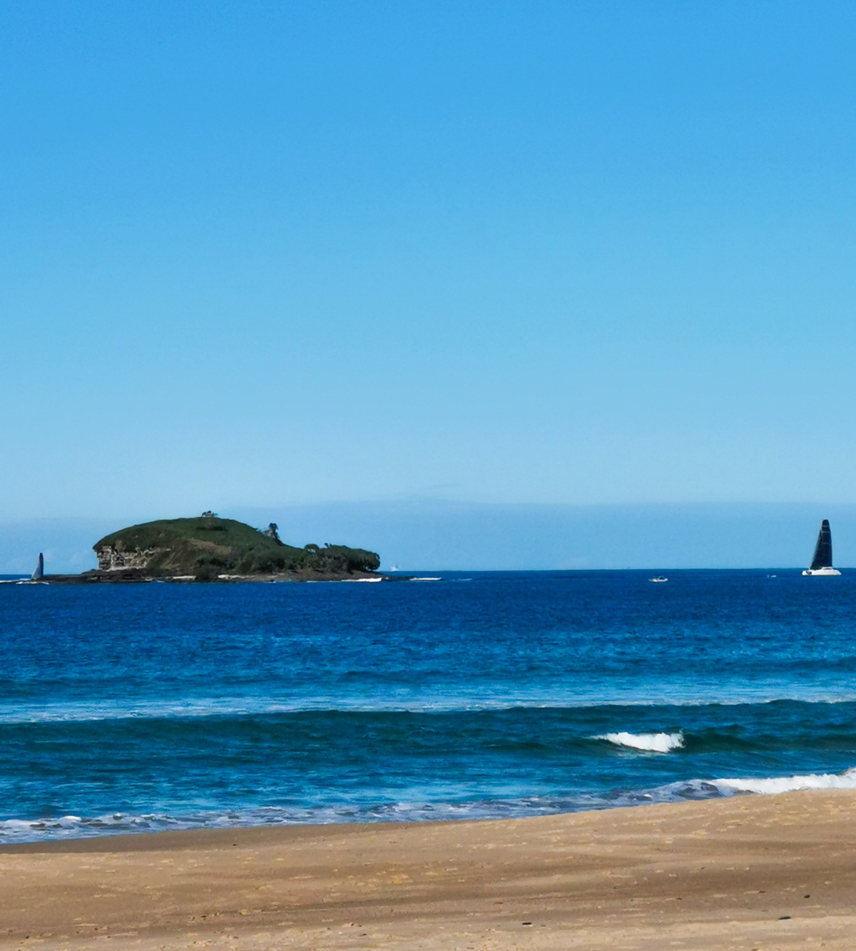
This is an out and back open water sea kayak, once there you can circumnavigate Old Woman Island.

Look for the channel just north of the beach access and once out on the open water look for sea turtles. This can be a very rewarding kayak trip with views up and down the coast on the return journey including views to Mt Coolum, Marcoola and Maroochydore. Landing on the Island is not permitted but you can fish, snorkel and spearfish when out there.

At the island you may be lucky and see terns, cormorants, egrets, tattlers, and ospreys. In the right season there are wedge-tailed shearwaters nesting in burrows.

Old Woman Island is actually Mudjimba Island, of which the nearby beach is also named after. The name Old Woman Island is from an Aboriginal legend about two women who lived on the island.

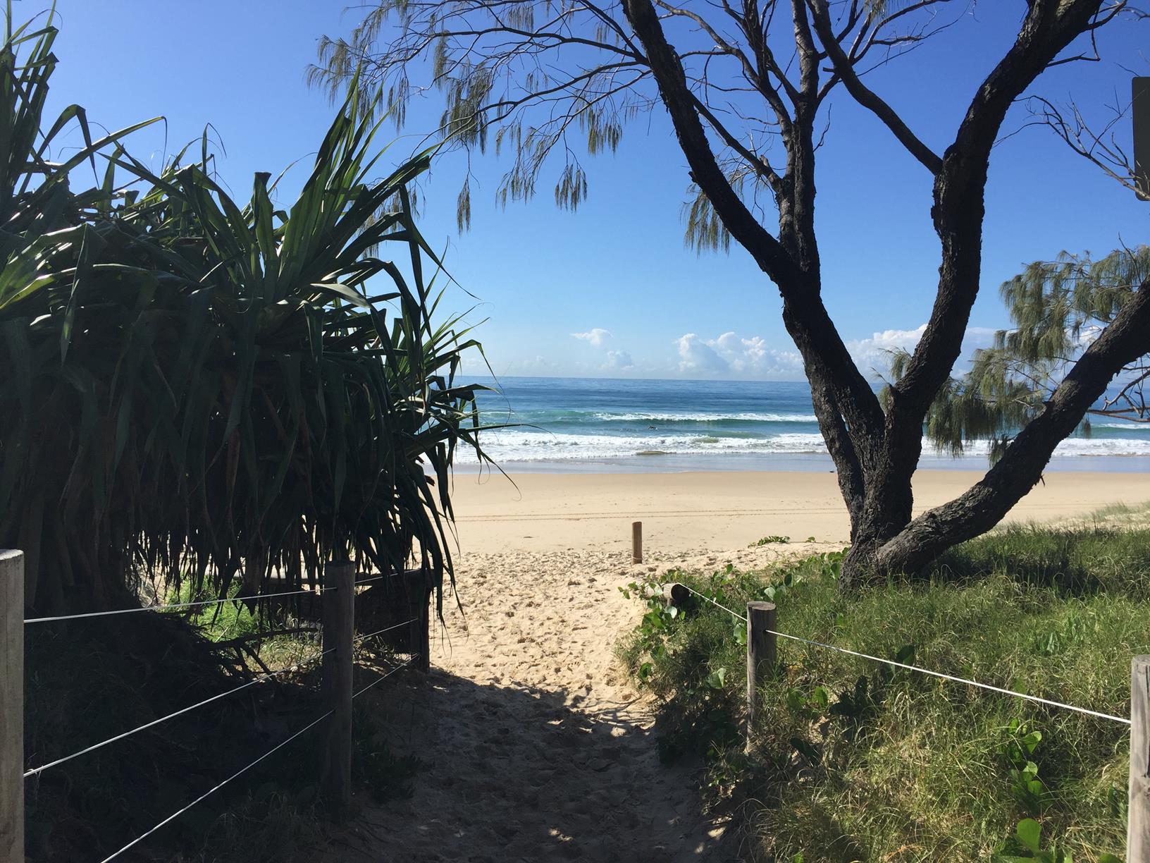
Back at Mudjimba Beach there are amenities, cafés and a variety of accommodation options.

AFTERWARDS
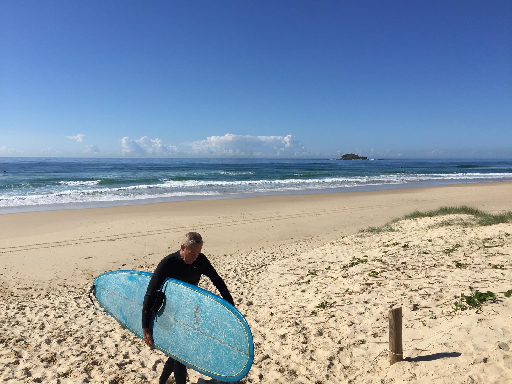
Enjoy the serenity of Mudjimba Beach with a spot of surfing, beach fishing. There are playgrounds for the kids and a choice of cafes. Further afield you can enjoy the Aqua Parks at Twin Waters, Bli Bli or Coolum. Nearby is Mt Coolum, a strenuous return hike of approximately 1 hour (return) to the summit where you will be rewarded with whole of Sunshine Coast views.

HOW TO GET THERE
To the starting point: The starting point for this is Mudjimba Beach directly opposite the island. Drive to Mudjimba Esplanade where you will can access the beach near Power Memorial Park or Beach View Lookout. Be mindful of getting out over the surf break.

To the end point: The end point is the same as the starting point.

glossary button
Glossary
  • Icon showing this activity is suitable for wheelchairsSuitable for wheelchairs
  • Icon showing this activity is suitable for walkingSuitable for walking
  • Icon showing this activity is suitable for recreational cyclingSuitable for recreational cycling
  • Icon showing this activity is suitable for mountain bikingSuitable for mountain biking
  • Icon showing this activity is suitable for horse ridingSuitable for horse riding
  • Icon showing this activity is suitable for kayakingSuitable for kayaking
  • Icon showing this activity has drinking water availableDrinking water available
  • Icon showing this activity does not have drinking water availableNo drinking water available
  • Icon showing this activity has a barbeque on siteBarbeque on site
  • Icon showing this activity has a picnic table on sitePicnic table on site
  • Icon showing this activity has toilets on siteToilets on site
  • Icon showing fires are permitted at this activityFires permitted
  • Icon showing fires are prohibited at this activityFires prohibited
  • Icon showing camping is permitted at this activityCamping permitted
  • Icon showing camping is prohibited at this activityCamping prohibited
  • suitable for kayaking suitable for kayaking Suitable for kayaking
  • Drinking water available Drinking water available Drinking water available
  • barbeque on site barbeque on site Barbeque on site
  • Picnic table on site Picnic table on site Picnic table on site
  • toilets on site toilets on site Toilets on site
  • Fires prohibited Fires prohibited Fires prohibited
  • Camping permitted Camping permitted Camping permitted
Write a review

Review Date: 28/11/2018

15 min paddle each way on a kayak or SUP. If the conditions are good you can land on the island and explore. Check the swell and wind forecast before heading out.

Reviewed By: Mickey

Review Date: 28/11/2018

15 min paddle each way on a kayak or SUP. You can land at the island and check out the old stone house ruins if the conditions are good. Make sure you check the wind and swell conditions.

Reviewed By: Mickey

hazard icon

IN AN EMERGENCY DIAL '000'.

Always Adventure Safely!

  • Always follow any local signage, it contains key information and conditions can change at any time.
  • Use the trails with consideration for your abilities, be prepared for the adventure ahead:
    • Be aware of the weather conditions, found here: http://www.bom.gov.au/qld/.
    • Always wear appropriate clothing, focus on good footwear.
    • Always bring more water than you think you will need.
    • Be Sun Safe!
    • Always let someone know where you are going that isn’t going with you.
  • Just getting started try this site for good useful information: https://www.trailhiking.com.au/hike-safety/
  • Sunshine Coast Council does it’s best to maintain current information but things can change so always be aware that a trail may not be as listed in this guide, and report and issues via our feedback link.

Sunshine Coast Council

For any issues with this experience please contact:

Sunshine Coast Council via 07 5475 7272 or via e-mail: adventure@sunshinecoast.qld.gov.au

Nearby Trails

Trail Image for Coastal Pathway: Mudjimba to Marcoola
Easy

Coastal Pathway: Mudjimba to Marcoola

Marcoola
walking icon mountain biking icon
Trail type
difficulty icon
Skill Level

4.2km

Length
direction icon
One-way
Trail Image for Road Cycle Route: Twin Waters Loop
Difficult

Road Cycle Route: Twin Waters Loop

Bli Bli
walking icon cycling icon
Trail type
difficulty icon
Skill Level

73.8km

Length
direction icon
Circuit
Trail Image for Road Cycle Route: SCC Big Loop
Difficult

Road Cycle Route: SCC Big Loop

Alexandra Headland
walking icon cycling icon
Trail type
difficulty icon
Skill Level

180.6km

Length
direction icon
Circuit
Trail Image for Bill Kear Waterway Paddle
null

Bill Kear Waterway Paddle

Mudjimba
canoeing icon
Trail type
difficulty icon
Skill Level

2.1km

Length
direction icon
One-way
Trail Image for Maroochy River Conservation Park walk
Easy

Maroochy River Conservation Park walk

Mudjimba
walking icon
Trail type
difficulty icon
Skill Level

3.1km

Length
direction icon
One-way

Share this trail

This action requires a login.
To continue, click on Login/Signup below.

Photo uploaded successfully, thank you.

Feedback / Suggest an Adventure

If you have any feedback on the site or any of the trails, please drop us a short email.

Have we missed something? Do you have an adventure to suggest? Fill in the suggestion form to let us know about it.