facebook
Image showing that the PDF download is in progress... PDF download in progress

Please wait...

Image showing a pink decorative paint splat
Image showing a green decorative paint splat
reviews buttonReviews view map buttonMap
view 3d map button3D Map
directions take me there buttonDirections
Save
PDF
Gpx File

Road Cycle Route: Buderim Local Loop

Road Cycle Route: Buderim Local Loop
Buderim
walking icon walking icon black cycling icon cycling icon black
Trail type
difficulty icon
Skill Level
37.4km
One-way Length
direction icon direction icon black
One-way

An on-road ride mostly flat route meandering from Buderim through the beautiful countryside around Eudlo.

SUITABILITY
Suitable for confident road cyclists. Some road speeds are >60km/hr and have narrow or no shoulders.

HIGHLIGHTS
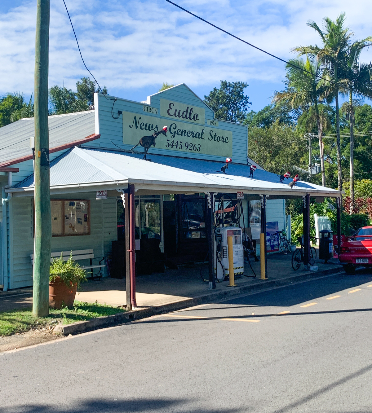
Escape the city in minutes on this peaceful road ride. Travel inland through Chevallum and historic timber town Eudlo, or detour through Palmwoods for a coffee. A great ride through farmland and countryside.

AFTERWARDS
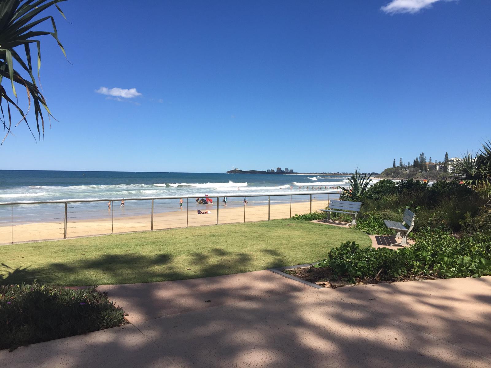
Grab a coffee and some lunch at the local cafe. Or continue your ride to Mooloolaba for a swim and a cool-off!

HOW TO GET THERE
Start and finish at the Goshawk Blvd Shopping Centre, Buderim.

IMPORTANT: On-road cyclists should always ride with caution and be aware that conditions can change at any time. Cyclists using rural roads may encounter heavy vehicles and should be aware that roads can be narrow and undulating with varying shoulder widths. Notify someone of your intended route and be prepared with water, food and sun protection.

glossary button
Glossary
  • Icon showing this activity is suitable for wheelchairsSuitable for wheelchairs
  • Icon showing this activity is suitable for walkingSuitable for walking
  • Icon showing this activity is suitable for recreational cyclingSuitable for recreational cycling
  • Icon showing this activity is suitable for mountain bikingSuitable for mountain biking
  • Icon showing this activity is suitable for horse ridingSuitable for horse riding
  • Icon showing this activity is suitable for kayakingSuitable for kayaking
  • Icon showing this activity has drinking water availableDrinking water available
  • Icon showing this activity does not have drinking water availableNo drinking water available
  • Icon showing this activity has a barbeque on siteBarbeque on site
  • Icon showing this activity has a picnic table on sitePicnic table on site
  • Icon showing this activity has toilets on siteToilets on site
  • Icon showing fires are permitted at this activityFires permitted
  • Icon showing fires are prohibited at this activityFires prohibited
  • Icon showing camping is permitted at this activityCamping permitted
  • Icon showing camping is prohibited at this activityCamping prohibited
  • Suitable for walking Suitable for walking black lines Suitable for walking
  • Suitable for recreational cycling Suitable for recreational cycling Suitable for recreational cycling
  • No drinking water available No drinking water available No drinking water available
  • Fires prohibited Fires prohibited Fires prohibited
  • Camping prohibited Camping prohibited Camping prohibited
Write a review

Be the first to review this trail.

hazard icon

IN AN EMERGENCY DIAL '000'.

Always Adventure Safely!

  • Always follow any local signage, it contains key information and conditions can change at any time.
  • Use the trails with consideration for your abilities, be prepared for the adventure ahead:
    • Be aware of the weather conditions, found here: http://www.bom.gov.au/qld/.
    • Always wear appropriate clothing, focus on good footwear.
    • Always bring more water than you think you will need.
    • Be Sun Safe!
    • Always let someone know where you are going that isn’t going with you.
  • Just getting started try this site for good useful information: https://www.trailhiking.com.au/hike-safety/
  • Sunshine Coast Council does it’s best to maintain current information but things can change so always be aware that a trail may not be as listed in this guide, and report and issues via our feedback link.

Nearby Trails

Trail Image for Road Cycle Route: SCC Big Loop
Difficult

Road Cycle Route: SCC Big Loop

Alexandra Headland
walking icon cycling icon
Trail type
difficulty icon
Skill Level

180.6km

Length
direction icon
Circuit
Trail Image for Road Cycle Route: Maroochydore Flat Road Loop
Difficult

Road Cycle Route: Maroochydore Flat Road Loop

Alexandra Headland
walking icon cycling icon
Trail type
difficulty icon
Skill Level

38.9km

Length
direction icon
Circuit
Trail Image for Olsen Mill Park
Easy

Olsen Mill Park

Eudlo
walking icon cycling icon
Trail type
difficulty icon
Skill Level

0.5km

Length
direction icon
Circuit
Trail Image for Maroochy Regional Bushland Botanic Garden: Whipbird walk
Easy

Maroochy Regional Bushland Botanic Garden: Whipbird walk

Tanawha
walking icon
Trail type
difficulty icon
Skill Level

0.6km

Length
direction icon
Circuit
Trail Image for Buderim Tramway Trail
Easy

Buderim Tramway Trail

Forest Glen
walking icon
Trail type
difficulty icon
Skill Level

2.1km

Length
direction icon
One-way

Share this trail

This action requires a login.
To continue, click on Login/Signup below.

Photo uploaded successfully, thank you.

Feedback / Suggest an Adventure

If you have any feedback on the site or any of the trails, please drop us a short email.

Have we missed something? Do you have an adventure to suggest? Fill in the suggestion form to let us know about it.