facebook
Image showing that the PDF download is in progress... PDF download in progress

Please wait...

Image showing a pink decorative paint splat
Image showing a green decorative paint splat
upload photo button
reviews buttonReviews view map buttonMap
view 3d map button3D Map
directions take me there buttonDirections
Save
PDF
Gpx File

Coastal Pathway: Marcoola to Mt Coolum Beach

Coastal Pathway: Marcoola to Mt Coolum Beach
Marcoola
walking icon walking icon black mountain biking icon mountain biking icon black
Trail type
difficulty icon
Skill Level
1.6km
One-way Length
direction icon direction icon black
One-way

A beautiful, tree-covered short walk along Marcoola Beach. This section of the iconic Coastal Walk is a 1.4km path linking Mudjimba Beach to Mt Coolum Beach with multiple access points to the sandy beach.

SUITABLILITY
Suitable for all walkers – wheelchair accessible.

HIGHLIGHTS
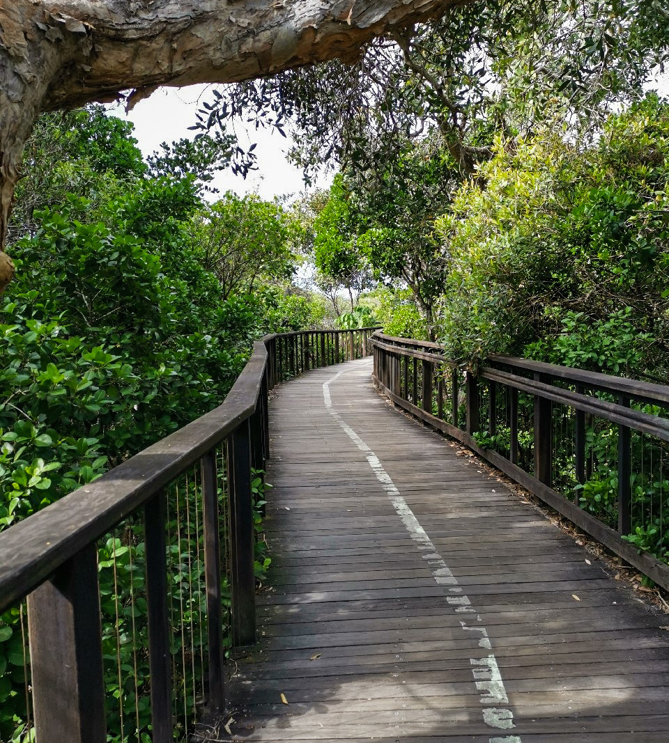
A tranquil and easy walk, this part of the greater Coastal Walk can be enjoyed even on the hottest of days as almost the entire length of the path is covered by shady trees.
Bird lovers can enjoy the sounds of the many species occupying the coastal heath and surfers can take advantage of the multiple access paths onto Marcoola Beach.
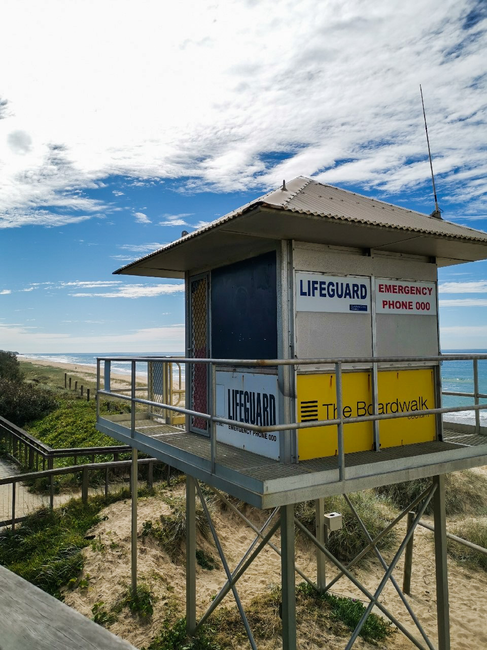
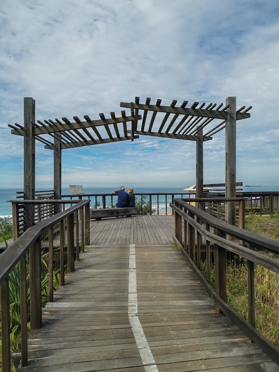
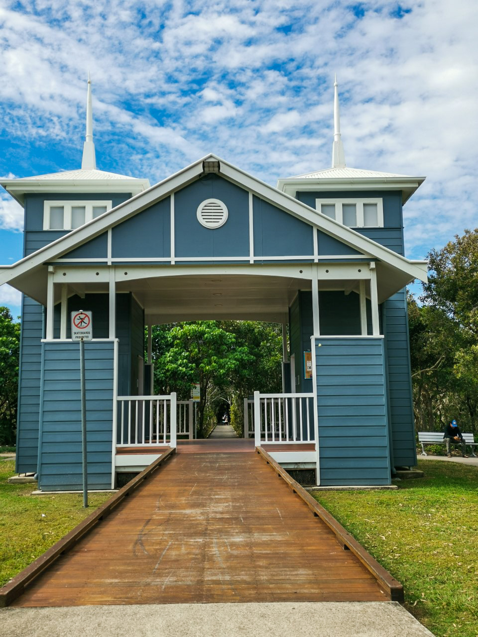
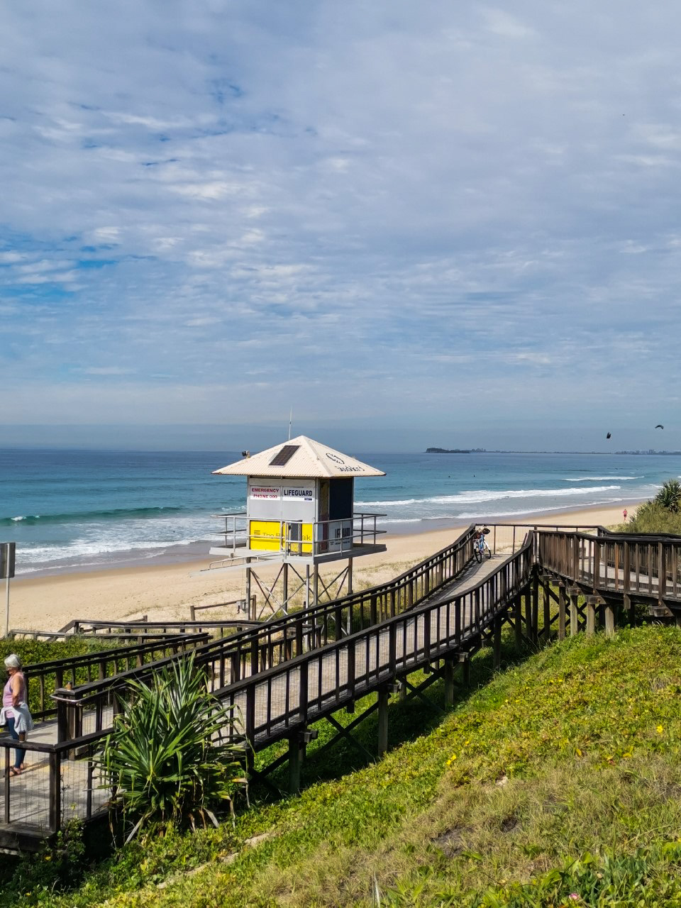
There’s an impressive boardwalk leading up to the Lifesaving tower that is worth the detour off the path. Enjoy the views of the beach, particularly a sunrise or sunset over the ocean. A backwards glance from this vantage point allows to see majestic Mt. Coolum in the distance. There are exits on the residential side of the path that lead you over the wetland zones via boardwalks to parks and amenities. Access 98 has an impressive amenity block and Access 95 – Boardrider Crescent Park, has BBQ facilities if you’d like to make a day of it. Be sure to take mosquito repellent as the lush, wet surroundings are ideal for mossies and sandflies.

AFTERWARDS
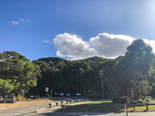
Take a stroll up Mt. Coolum and view the coastline from a higher vantage point or enjoy a coffee at one of the many boutique cafes near Mt. Coolum and Marcoola.

HOW TO GET THERE
To the starting point: Take the airport turnoff and stay on David Low Way. Turn onto North Shore Connection Road and follow it before turning right onto Petrie Avenue. Turn off Petrie Avenue and drive along Marcoola Esplanade until you see the parking area at the start of the pathway. Parking anywhere along the esplanade is usually easy except on busy weekends.
To the end point: The end point is the same as the starting point.

glossary button
Glossary
  • Icon showing this activity is suitable for wheelchairsSuitable for wheelchairs
  • Icon showing this activity is suitable for walkingSuitable for walking
  • Icon showing this activity is suitable for recreational cyclingSuitable for recreational cycling
  • Icon showing this activity is suitable for mountain bikingSuitable for mountain biking
  • Icon showing this activity is suitable for horse ridingSuitable for horse riding
  • Icon showing this activity is suitable for kayakingSuitable for kayaking
  • Icon showing this activity has drinking water availableDrinking water available
  • Icon showing this activity does not have drinking water availableNo drinking water available
  • Icon showing this activity has a barbeque on siteBarbeque on site
  • Icon showing this activity has a picnic table on sitePicnic table on site
  • Icon showing this activity has toilets on siteToilets on site
  • Icon showing fires are permitted at this activityFires permitted
  • Icon showing fires are prohibited at this activityFires prohibited
  • Icon showing camping is permitted at this activityCamping permitted
  • Icon showing camping is prohibited at this activityCamping prohibited
  • Suitable for walking Suitable for walking black lines Suitable for walking
  • Suitable for mountain biking Suitable for mountain biking Suitable for mountain biking
  • Drinking water available Drinking water available Drinking water available
  • Fires prohibited Fires prohibited Fires prohibited
  • Camping prohibited Camping prohibited Camping prohibited
Write a review

Be the first to review this trail.

hazard icon

IN AN EMERGENCY DIAL '000'.

Always Adventure Safely!

  • Always follow any local signage, it contains key information and conditions can change at any time.
  • Use the trails with consideration for your abilities, be prepared for the adventure ahead:
    • Be aware of the weather conditions, found here: http://www.bom.gov.au/qld/.
    • Always wear appropriate clothing, focus on good footwear.
    • Always bring more water than you think you will need.
    • Be Sun Safe!
    • Always let someone know where you are going that isn’t going with you.
  • Just getting started try this site for good useful information: https://www.trailhiking.com.au/hike-safety/
  • Sunshine Coast Council does it’s best to maintain current information but things can change so always be aware that a trail may not be as listed in this guide, and report and issues via our feedback link.

Sunshine Coast Council

For any issues with this experience please contact:

Sunshine Coast Council via 07 5475 7272 or via e-mail: adventure@sunshinecoast.qld.gov.au

Nearby Trails

Trail Image for Mt Coolum: Tanah St Loop
Easy

Mt Coolum: Tanah St Loop

Mount Coolum
walking icon
Trail type
difficulty icon
Skill Level

2.3km

Length
direction icon
One-way
Trail Image for Road Cycle Route: SCC Big Loop
Difficult

Road Cycle Route: SCC Big Loop

Alexandra Headland
walking icon cycling icon
Trail type
difficulty icon
Skill Level

180.6km

Length
direction icon
Circuit
Trail Image for Road Cycle Route: Twin Waters Loop
Difficult

Road Cycle Route: Twin Waters Loop

Bli Bli
walking icon cycling icon
Trail type
difficulty icon
Skill Level

73.8km

Length
direction icon
Circuit
Trail Image for Road Cycle Route: Mooloolaba to Coolum
Difficult

Road Cycle Route: Mooloolaba to Coolum

Alexandra Headland
walking icon cycling icon
Trail type
difficulty icon
Skill Level

51.6km

Length
direction icon
One-way
Trail Image for Coastal Pathway: Mudjimba to Marcoola
Easy

Coastal Pathway: Mudjimba to Marcoola

Marcoola
walking icon mountain biking icon
Trail type
difficulty icon
Skill Level

4.2km

Length
direction icon
One-way

Share this trail

This action requires a login.
To continue, click on Login/Signup below.

Photo uploaded successfully, thank you.

Feedback / Suggest an Adventure

If you have any feedback on the site or any of the trails, please drop us a short email.

Have we missed something? Do you have an adventure to suggest? Fill in the suggestion form to let us know about it.