facebook
Image showing that the PDF download is in progress... PDF download in progress

Please wait...

Image showing a pink decorative paint splat
Image showing a green decorative paint splat
upload photo button
reviews buttonReviews view map buttonMap
view 3d map button3D Map
directions take me there buttonDirections
Save
PDF
Gpx File

Mt Coolum: Tanah St Loop

Mt Coolum: Tanah St Loop
Mount Coolum
walking icon walking icon black
Trail type
difficulty icon
Skill Level
2.3km
One-way Length
direction icon direction icon black
One-way

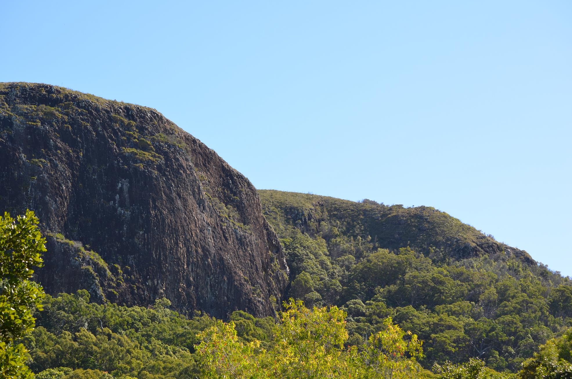
A circuit walk around the base of Mt Coolum, with many family packed features.

SUITABILITY
This walk is suitable for families and all ages.

HIGHLIGHTS
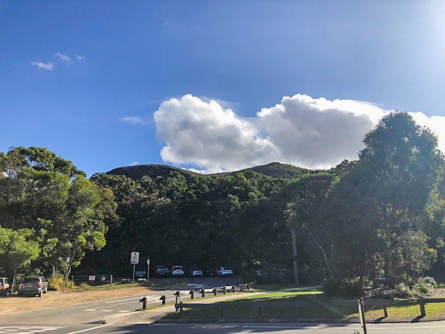
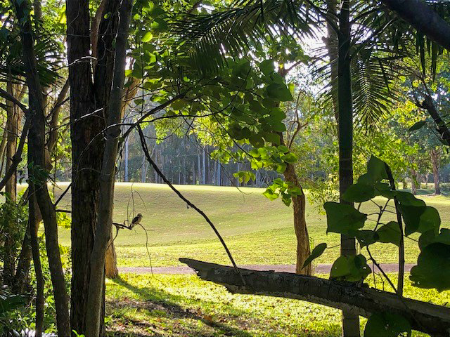
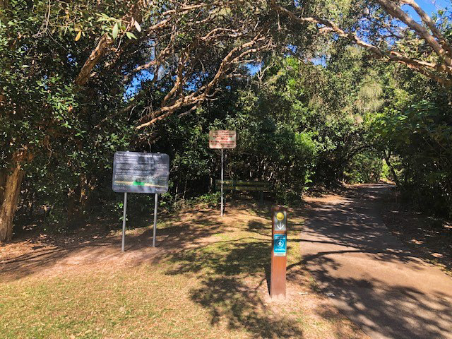
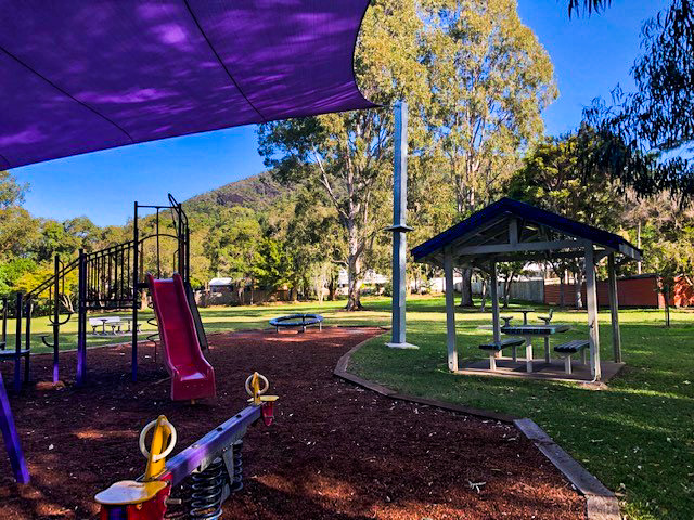
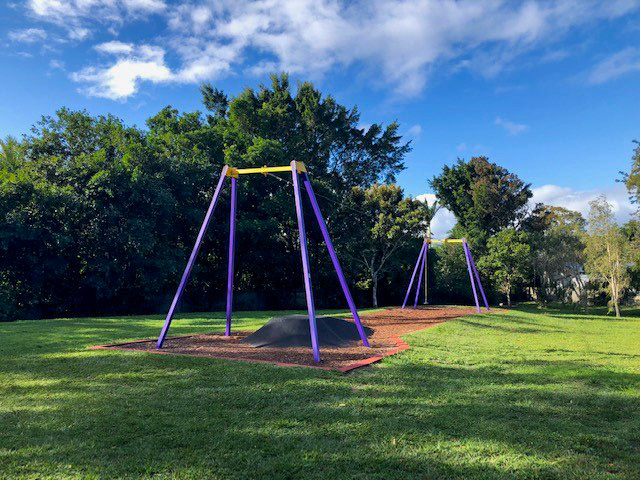
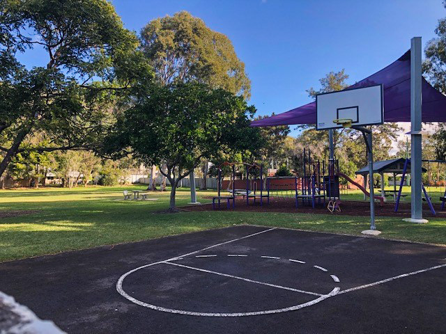
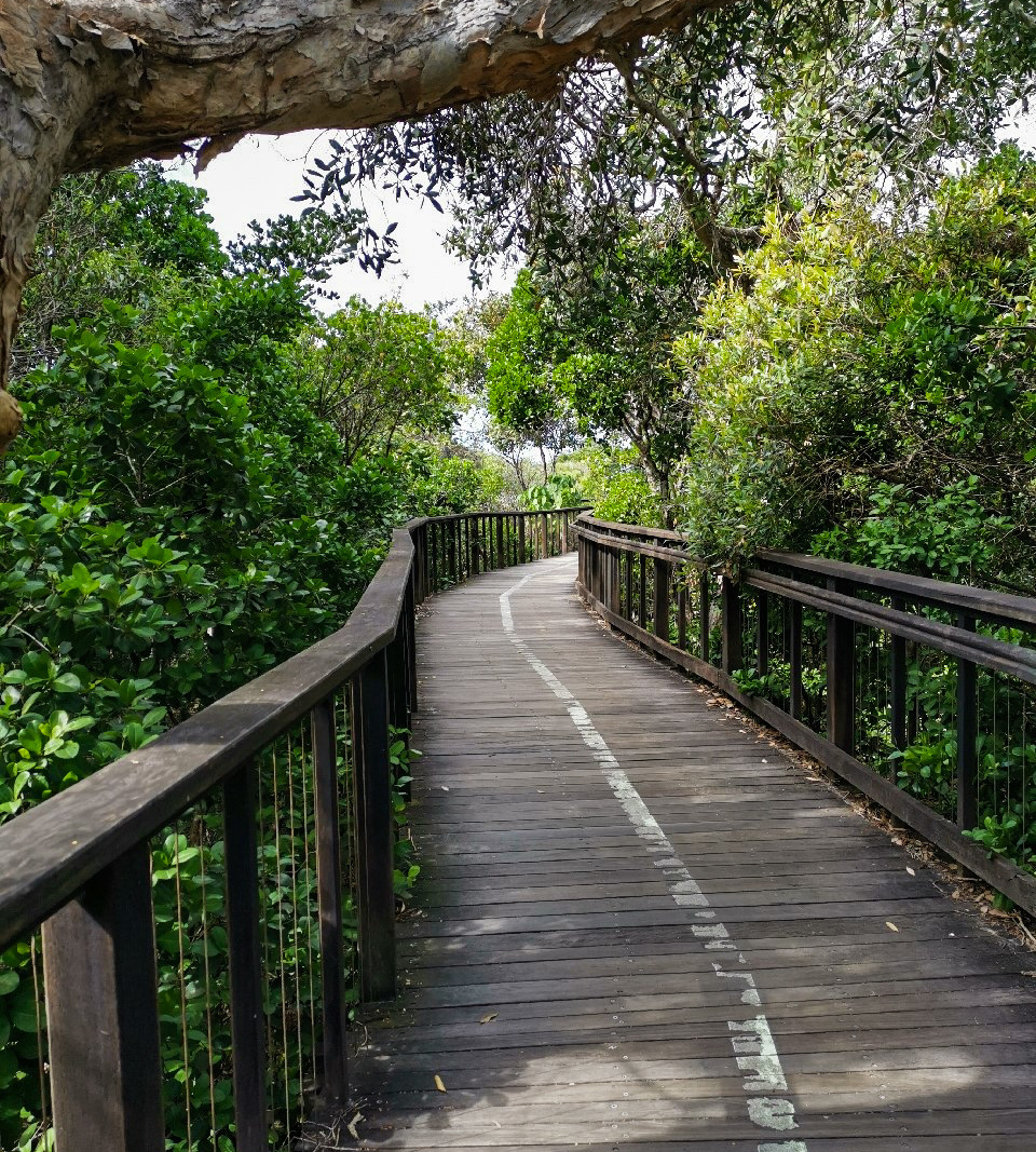
This walk commences at Beach access No 94, Tanah St in Mt Coolum at the beginning of the boardwalk to Marcoola. A wonderful place to start with a beach trip or walk along the boardwalk an option for those looking to extend their visit. Minimal car parking is available with street parking also available. Once underway the beautiful base aspect of Mt Coolum is evident and it lingers over this trail for the duration. The path tracks alongside not only the mountain but also a premier local golf course. Those wishing to peek through the trees will be unlucky not to see a plethora of local birdlife including kookaburras and rosellas or even a group of kangaroos enjoying the evening sun. The turnaround point is the Warrack St Park, a fabulous place for families to enjoy a morning or afternoon pit stop. This area features not only a playground for the younger members, but a basketball hoop and flying fox for the more adventurous. A selection of picnic tables and a BBQ round out the features available.

AFTERWARDS
A short 5 minute walk away is the newly renovated Mt Coolum shopping complex featuring cafes, restaurants and further convenience options.

HOW TO GET THERE
To Start: Via David Low Way, turn onto Tanah St East and park at the end of the street.
To End: The end point is the start point

glossary button
Glossary
  • Icon showing this activity is suitable for wheelchairsSuitable for wheelchairs
  • Icon showing this activity is suitable for walkingSuitable for walking
  • Icon showing this activity is suitable for recreational cyclingSuitable for recreational cycling
  • Icon showing this activity is suitable for mountain bikingSuitable for mountain biking
  • Icon showing this activity is suitable for horse ridingSuitable for horse riding
  • Icon showing this activity is suitable for kayakingSuitable for kayaking
  • Icon showing this activity has drinking water availableDrinking water available
  • Icon showing this activity does not have drinking water availableNo drinking water available
  • Icon showing this activity has a barbeque on siteBarbeque on site
  • Icon showing this activity has a picnic table on sitePicnic table on site
  • Icon showing this activity has toilets on siteToilets on site
  • Icon showing fires are permitted at this activityFires permitted
  • Icon showing fires are prohibited at this activityFires prohibited
  • Icon showing camping is permitted at this activityCamping permitted
  • Icon showing camping is prohibited at this activityCamping prohibited
  • Suitable for walking Suitable for walking black lines Suitable for walking
  • Drinking water available Drinking water available Drinking water available
  • barbeque on site barbeque on site Barbeque on site
  • Picnic table on site Picnic table on site Picnic table on site
  • Fires prohibited Fires prohibited Fires prohibited
  • Camping prohibited Camping prohibited Camping prohibited
Write a review

Be the first to review this trail.

hazard icon

IN AN EMERGENCY DIAL '000'.

Always Adventure Safely!

  • Always follow any local signage, it contains key information and conditions can change at any time.
  • Use the trails with consideration for your abilities, be prepared for the adventure ahead:
    • Be aware of the weather conditions, found here: http://www.bom.gov.au/qld/.
    • Always wear appropriate clothing, focus on good footwear.
    • Always bring more water than you think you will need.
    • Be Sun Safe!
    • Always let someone know where you are going that isn’t going with you.
  • Just getting started try this site for good useful information: https://www.trailhiking.com.au/hike-safety/
  • Sunshine Coast Council does it’s best to maintain current information but things can change so always be aware that a trail may not be as listed in this guide, and report and issues via our feedback link.

Sunshine Coast Council

For any issues with this experience please contact:

Sunshine Coast Council via 07 5475 7272 or via e-mail: adventure@sunshinecoast.qld.gov.au

Nearby Trails

Trail Image for Road Cycle Route: SCC Big Loop
Difficult

Road Cycle Route: SCC Big Loop

Alexandra Headland
walking icon cycling icon
Trail type
difficulty icon
Skill Level

180.6km

Length
direction icon
Circuit
Trail Image for Road Cycle Route: Twin Waters Loop
Difficult

Road Cycle Route: Twin Waters Loop

Bli Bli
walking icon cycling icon
Trail type
difficulty icon
Skill Level

73.8km

Length
direction icon
Circuit
Trail Image for Road Cycle Route: Mooloolaba to Coolum
Difficult

Road Cycle Route: Mooloolaba to Coolum

Alexandra Headland
walking icon cycling icon
Trail type
difficulty icon
Skill Level

51.6km

Length
direction icon
One-way
Trail Image for Coastal Pathway: Marcoola to Mt Coolum Beach
Easy

Coastal Pathway: Marcoola to Mt Coolum Beach

Marcoola
walking icon mountain biking icon
Trail type
difficulty icon
Skill Level

1.6km

Length
direction icon
One-way
Trail Image for Mt Coolum National Park: Summit Walk
Difficult

Mt Coolum National Park: Summit Walk

Mount Coolum
walking icon
Trail type
difficulty icon
Skill Level

0.9km

Length
direction icon
One-way

Share this trail

This action requires a login.
To continue, click on Login/Signup below.

Photo uploaded successfully, thank you.

Feedback / Suggest an Adventure

If you have any feedback on the site or any of the trails, please drop us a short email.

Have we missed something? Do you have an adventure to suggest? Fill in the suggestion form to let us know about it.