


If you have any feedback on the site or any of the trails, please drop us a short email.
Suggest an AdventureHave we missed something? Do you have an adventure to suggest? Fill in the suggestion form to let us know about it.

 PDF download in progress
Please wait...


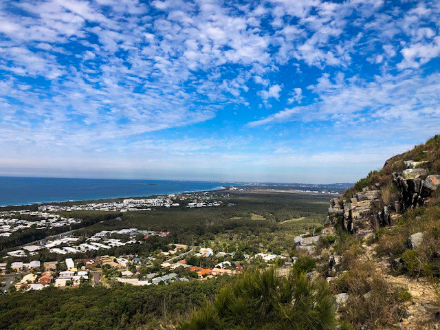
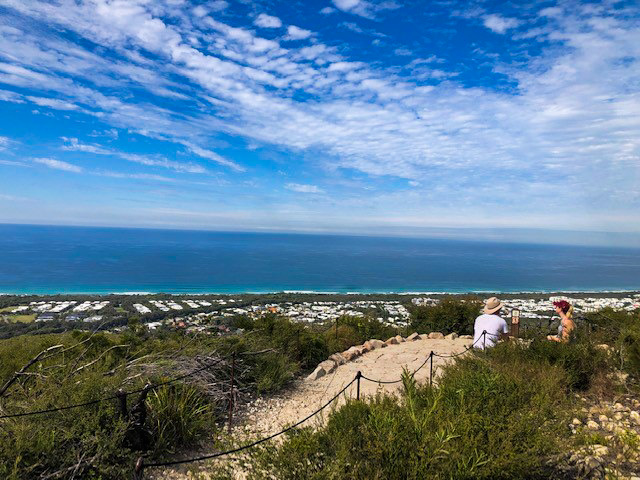
One of the best vantage points on the coast to see the coastline in both directions and the canefields and other developments of the hinterland.
SUITABILITY
Suitable for experienced walkers, take your time – there is no rush. Please note Mt Coolum has no toilet facilities.
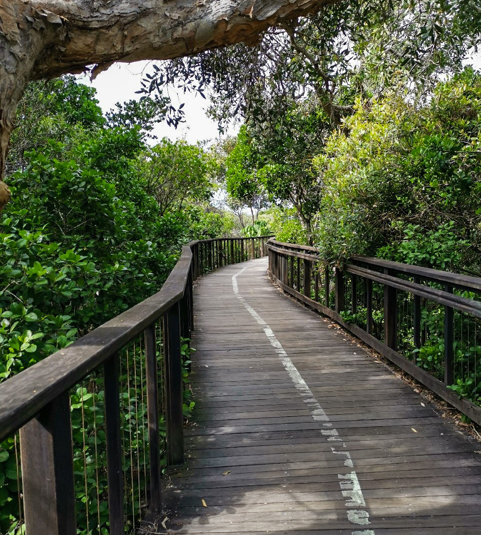
HIGHLIGHTS
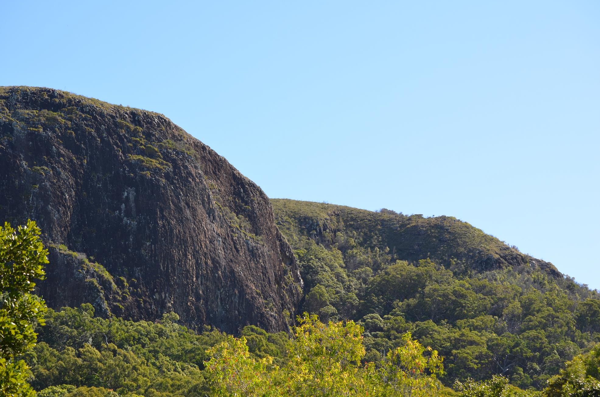
Did you know Mt Coolum is actually a large rock? Beneath the earth’s surface about 25-26 million years ago a large dome shaped chamber of molten magma intruded into sandstone and then cooled forming rhyolite rock. Erosion has since removed the soft outside revealing the hard, erosion proof rhyolite we know called Mt Coolum.
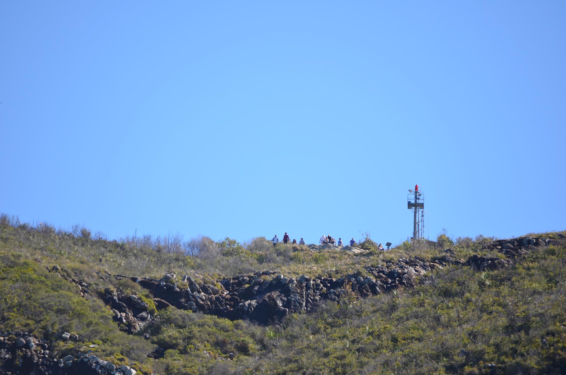
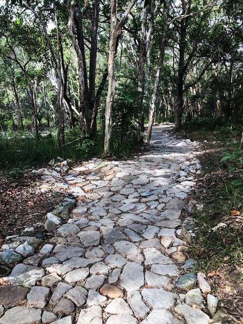
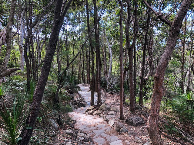
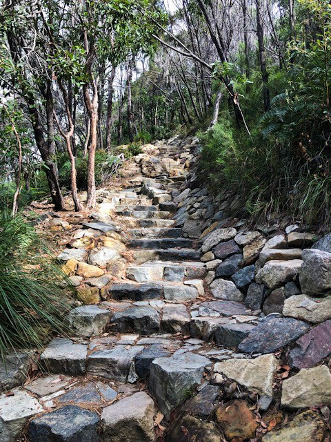
This iconic ascent of an ancient volcano core (laccolith) for great views of the coastline is an awesome option, in good weather, for the view, and for safety (slippery enough as it is). Stairs aside, steep rocky sections and exposed vantages mean children MUST be closely supervised. It also can be busy!
That said it is a fabulous family adventure. Fascinating geological features abound and glimpses of wildlife such as resident rare and endangered falcons can be more common than you might expect. And of course a feeling of accomplishment from climbing over 200m!
From the top you can easily spot Old Woman Island off the coast of Mudjimba, the Sunshine Coast Airport and runways, solar farms on the west side, and distant Glass House Mountains! You’ve got to do it.
AFTERWARDS
If you missed the juice mobile at the car park, Mt Coolum Shopping strip is a mere 300m away. The newly renovated centre has a plethora of food, drinks and convenience options.
HOW TO GET THERE
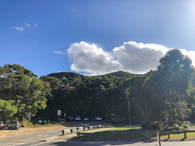
To the starting point: The walk starts in the car park just on the right at the start of Jarnahill Drive off Tanah Street West, south of Coolum.
If you are on the southern end of the coast, head north on the Sunshine Coast Motorway take the exit to Sunshine Coast Airport, bypass the airport and continue on David Low Way to the coast. Head north, past the airport and bush, through a roundabout till you come to Tanah Street West. Turn left here and take the first left into Jarnahill Drive.
From the northern end of the coast, head to Coolum either via the David Low Coast Road – keep driving through Coolum – and after 4 km turn right into Tanah Street West and left into Jarnahill Drive. Alternatively, take the Coolum exit off the Sunshine Coast Motorway, turn right at the first roundabout and head right along South Coolum Road, follow this as it leads into Toolga and Tanah Street West till you get to Jarnahill Drive on your right.
To the end point: The end point is the same as the starting point.
Review Date: 11/05/2019
Reviewed By: Anna
Review Date: 18/04/2019
Reviewed By: Jasmine
Review Date: 30/11/2018
Reviewed By: Christopher
Review Date: 30/11/2018
Reviewed By: Fiona
Review Date: 28/11/2018
Reviewed By: Georgia
Review Date: 26/11/2018
Reviewed By: Carissa
Review Date: 26/11/2018
Reviewed By: Emily
Review Date: 06/11/2018
Reviewed By: Wendy
Review Date: 02/11/2018
Reviewed By: Adam
IN AN EMERGENCY DIAL '000'.
Always Adventure Safely!
Qld Parks and Wildlife Service
National Parks, Conservation Parks and some State Forests are managed by Queensland Parks and Wildlife Service. Contact details are: https://www.des.qld.gov.au/contactus/
For current information on trail conditions and alerts go to https://parks.des.qld.gov.au/park-alerts/#sunshinecoast
If you think something on this web site needs to change please let us know via: adventure@sunshinecoast.qld.gov.au
This action requires a login.
To continue, click on Login/Signup below.
 loading...
Photo uploaded successfully, thank you.
If you have any feedback on the site or any of the trails, please drop us a short email.
Suggest an AdventureHave we missed something? Do you have an adventure to suggest? Fill in the suggestion form to let us know about it.