facebook
Image showing that the PDF download is in progress... PDF download in progress

Please wait...

Image showing a pink decorative paint splat
Image showing a green decorative paint splat
upload photo button
reviews buttonReviews view map buttonMap
view 3d map button3D Map
directions take me there buttonDirections
Save
PDF
Gpx File

Woombye Town Walk

Woombye Town Walk
Woombye
walking icon walking icon black cycling icon cycling icon black
Trail type
difficulty icon
Skill Level
4.1km
Length
direction icon direction icon black
Circuit

Discover the hidden gem of the hinterland

SUITABILITY
This walk is suitable for all agers.

HIGHLIGHTS
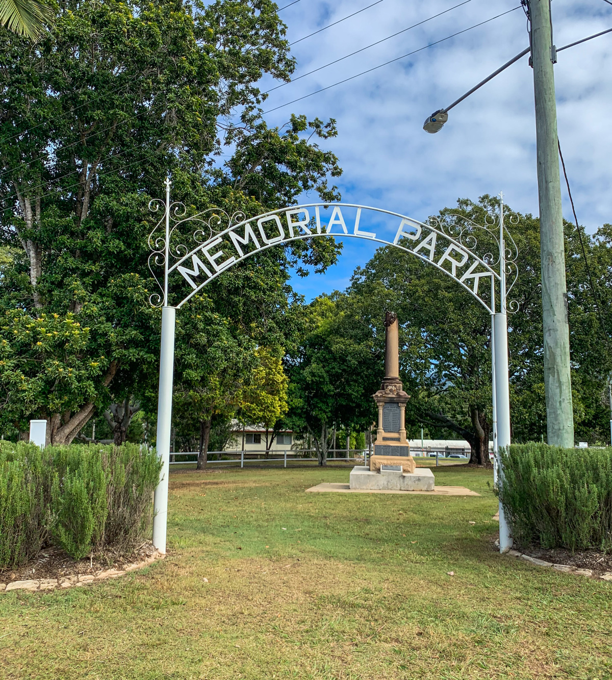
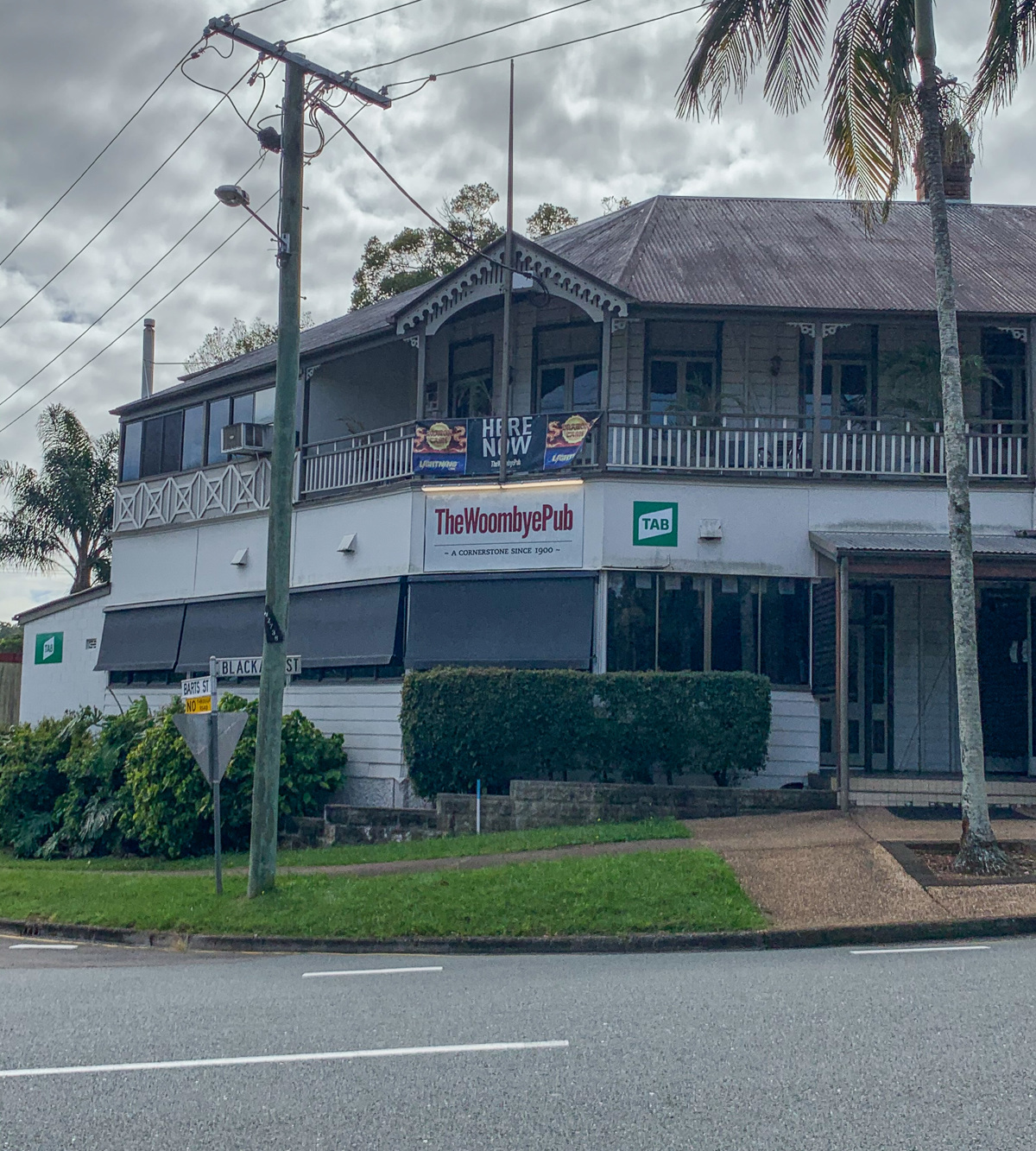
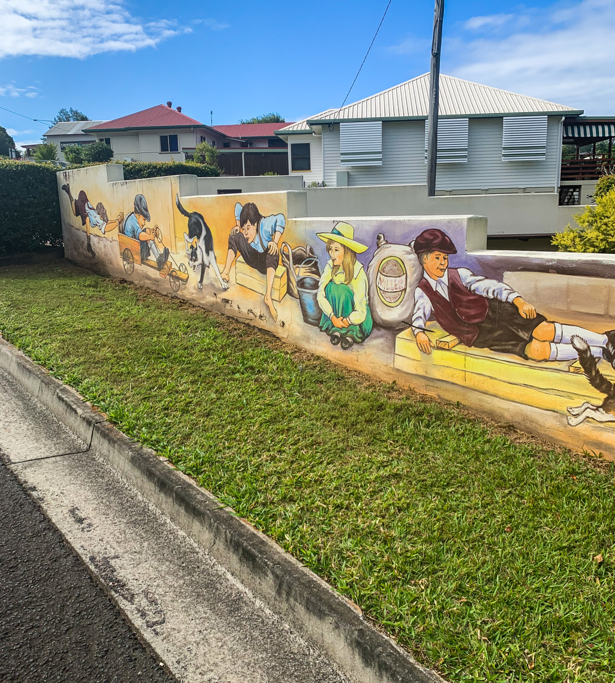
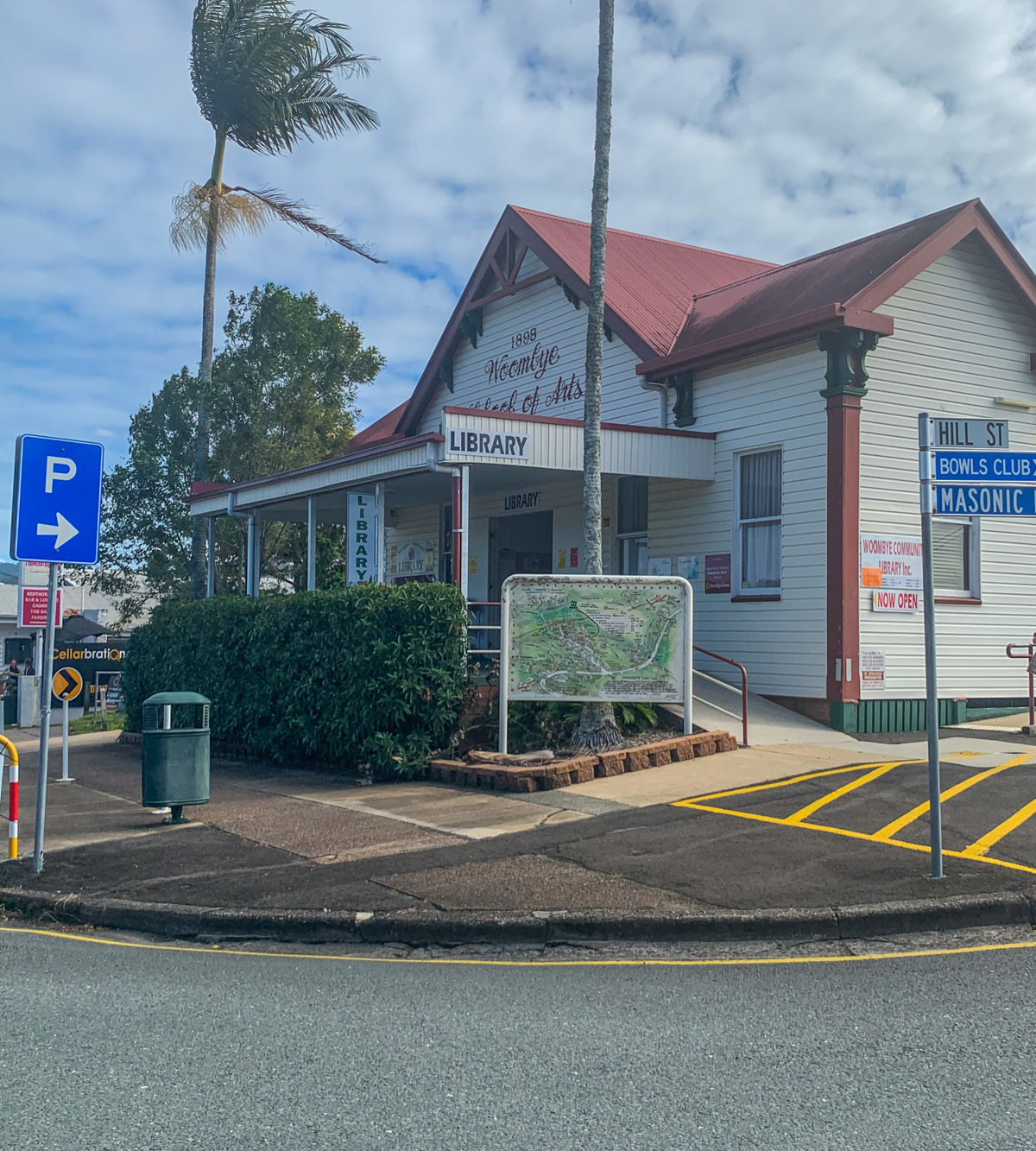
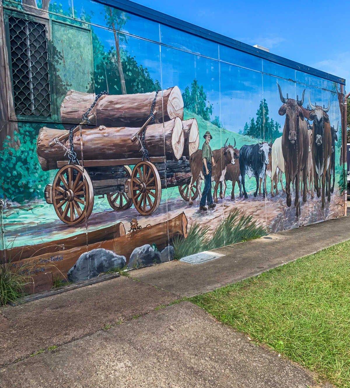
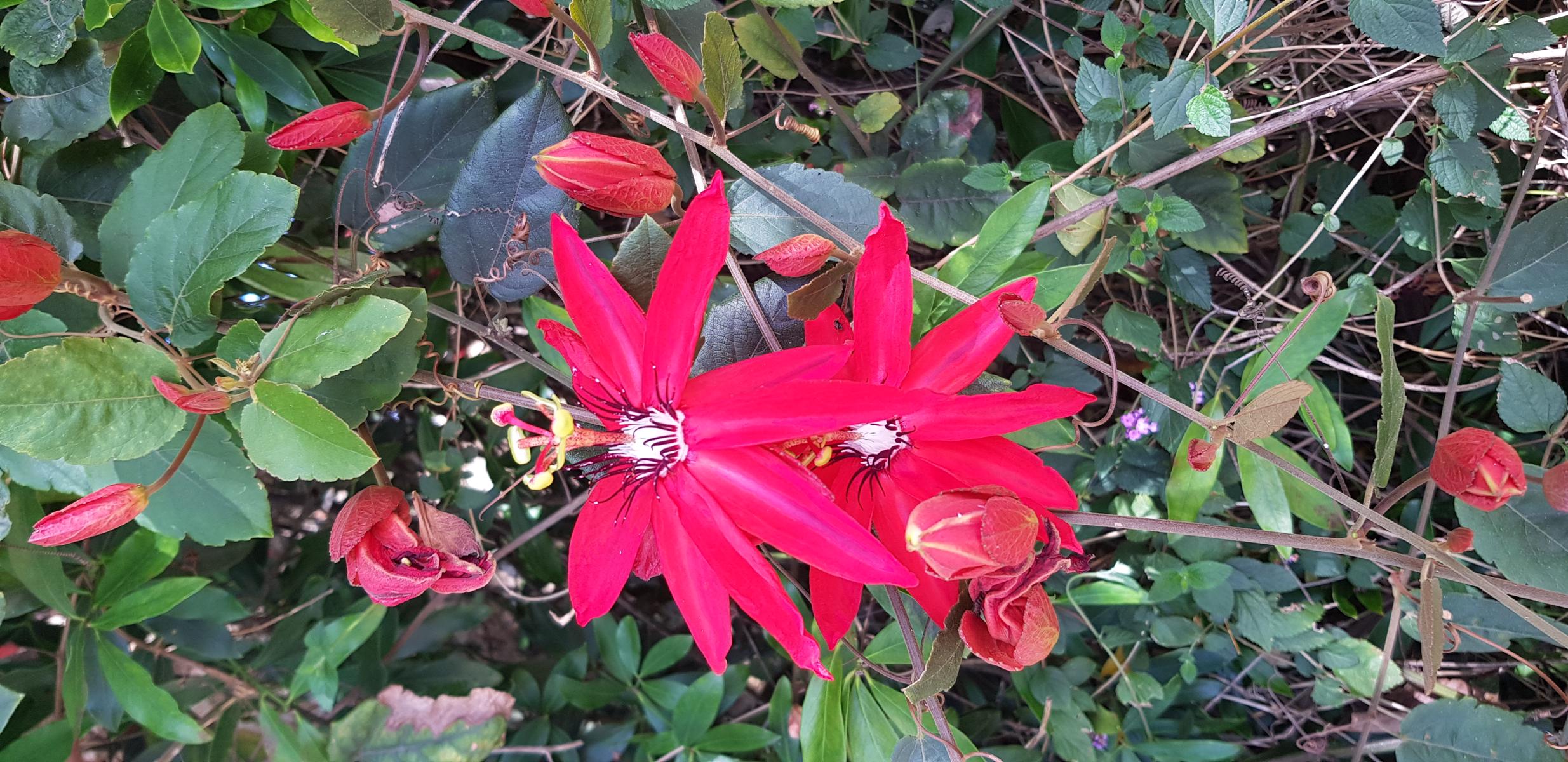
Woombye is a rural township in the eastern foothills of the Blackall Range, established in the early 1870s as ‘Cobb’s Camp’. Cobb’s Camp was established by Cobb & Co, which ran a coach service between Brisbane and the Gympie goldfields in late 1867. The walk will take you right through the centre of town, before taking you on a journey through the residential township as you journey through the town, the history of the ‘Cobbs Camp’ is still very much present, with several buildings, including the town amenities a mural backdrop and reminder of the town's early beginnings. The main street is picture perfect with its sweeping mountain views and quaint old shops, yet behind this sleepy façade is every convenience you could possibly need. There is plenty of iconic buildings, from the local pub who celebrated its 100th anniversary in 2000, the beautiful School of Arts (including a library) and the War Memorial located in the centre of town. Keep an eye out for charming old properties and beautifully restored homes. If you're taking the family on the journey, there are plenty of local parks to enjoy along the way.

AFTERWARDS
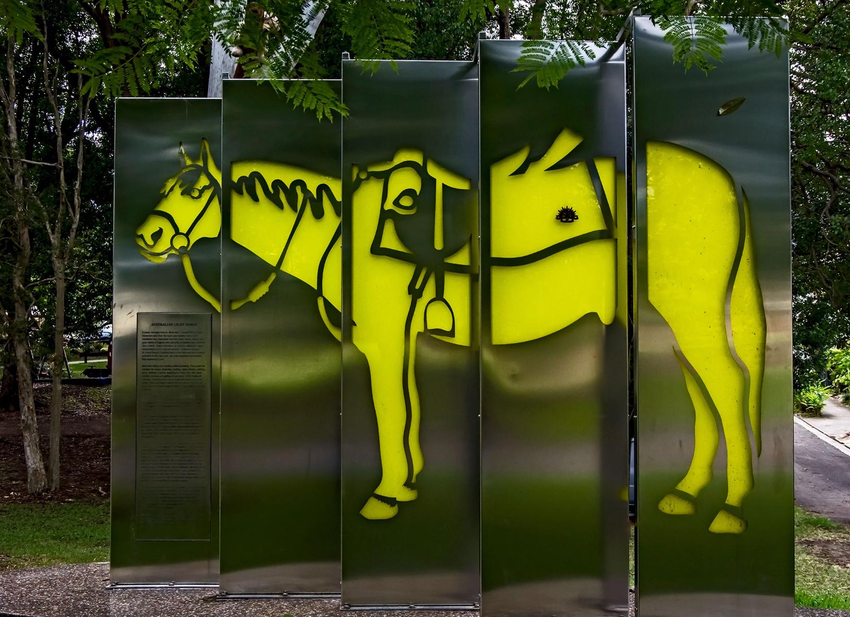
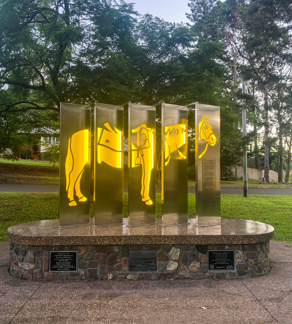
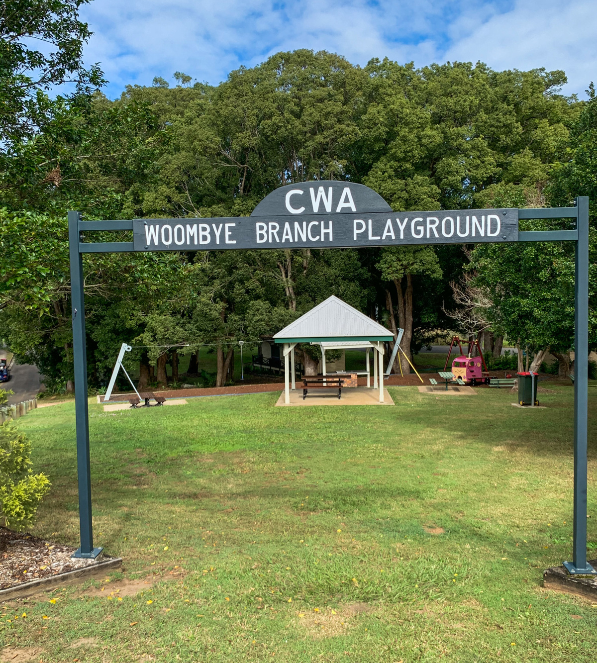
Spend some time getting to know the locals by enjoying a coffee or meal at one of the local establishments. For families, spend some time enjoying the facilities of CWA Park, home of the Light Horse Regiment Woombye Memorial Troop or visiting the War Memorial. Woombye is also close to major attractions including the Big Pineapple and Wildlife HQ.

HOW TO GET THERE
To the starting point: The township of Woombye is located off the Bruce Highway, west of Maroochydore. Take the Nambour Connection Road exit off the Bruce Highway, and travel east for approximately 5 minutes before you see the sign to Woombye. Turn left into Blackall Street, the main street of Woombye. The walk begins on the corner of Hill Street, opposite the Woombye School of Arts. There is plenty of parking available.
To the end point: The end point is the same as the starting point.

glossary button
Glossary
  • Icon showing this activity is suitable for wheelchairsSuitable for wheelchairs
  • Icon showing this activity is suitable for walkingSuitable for walking
  • Icon showing this activity is suitable for recreational cyclingSuitable for recreational cycling
  • Icon showing this activity is suitable for mountain bikingSuitable for mountain biking
  • Icon showing this activity is suitable for horse ridingSuitable for horse riding
  • Icon showing this activity is suitable for kayakingSuitable for kayaking
  • Icon showing this activity has drinking water availableDrinking water available
  • Icon showing this activity does not have drinking water availableNo drinking water available
  • Icon showing this activity has a barbeque on siteBarbeque on site
  • Icon showing this activity has a picnic table on sitePicnic table on site
  • Icon showing this activity has toilets on siteToilets on site
  • Icon showing fires are permitted at this activityFires permitted
  • Icon showing fires are prohibited at this activityFires prohibited
  • Icon showing camping is permitted at this activityCamping permitted
  • Icon showing camping is prohibited at this activityCamping prohibited
  • Suitable for walking Suitable for walking black lines Suitable for walking
  • Suitable for recreational cycling Suitable for recreational cycling Suitable for recreational cycling
  • Drinking water available Drinking water available Drinking water available
  • barbeque on site barbeque on site Barbeque on site
  • Picnic table on site Picnic table on site Picnic table on site
  • toilets on site toilets on site Toilets on site
  • Fires prohibited Fires prohibited Fires prohibited
  • Camping prohibited Camping prohibited Camping prohibited
Write a review

Be the first to review this trail.

hazard icon

IN AN EMERGENCY DIAL '000'.

Always Adventure Safely!

  • Always follow any local signage, it contains key information and conditions can change at any time.
  • Use the trails with consideration for your abilities, be prepared for the adventure ahead:
    • Be aware of the weather conditions, found here: http://www.bom.gov.au/qld/.
    • Always wear appropriate clothing, focus on good footwear.
    • Always bring more water than you think you will need.
    • Be Sun Safe!
    • Always let someone know where you are going that isn’t going with you.
  • Just getting started try this site for good useful information: https://www.trailhiking.com.au/hike-safety/
  • Sunshine Coast Council does it’s best to maintain current information but things can change so always be aware that a trail may not be as listed in this guide, and report and issues via our feedback link.

Sunshine Coast Council

For any issues with this experience please contact:

Sunshine Coast Council via 07 5475 7272 or via e-mail: adventure@sunshinecoast.qld.gov.au

Nearby Trails

Trail Image for Woombye to Palmwoods Town Centres
Easy

Woombye to Palmwoods Town Centres

Palmwoods
walking icon cycling icon
Trail type
difficulty icon
Skill Level

5.3km

Length
direction icon
One-way
Trail Image for Road Cycle Route: SCC Big Loop
Difficult

Road Cycle Route: SCC Big Loop

Alexandra Headland
walking icon cycling icon
Trail type
difficulty icon
Skill Level

180.6km

Length
direction icon
Circuit
Trail Image for Kolora Park & Bushland Conservation Reserve
Easy

Kolora Park & Bushland Conservation Reserve

Palmwoods
walking icon
Trail type
difficulty icon
Skill Level

0.5km

Length
direction icon
Circuit
Trail Image for Palmwoods Town Walk
Easy

Palmwoods Town Walk

Palmwoods
walking icon cycling icon
Trail type
difficulty icon
Skill Level

2.0km

Length
direction icon
One-way
Trail Image for Federation Park Circuit
Easy

Federation Park Circuit

Palmwoods
walking icon cycling icon
Trail type
difficulty icon
Skill Level

0.8km

Length
direction icon
Circuit

Share this trail

This action requires a login.
To continue, click on Login/Signup below.

Photo uploaded successfully, thank you.

Feedback / Suggest an Adventure

If you have any feedback on the site or any of the trails, please drop us a short email.

Have we missed something? Do you have an adventure to suggest? Fill in the suggestion form to let us know about it.